GIS ObjectLand Download
Downloading GIS ObjectLand 2.6.7
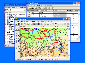
GIS ObjectLand is a universal Geographic Information System for Windows.
Key features:
- creation of vector-raster maps with arbitrary structure of layers and feature types;
- creation of themes. Theme is a user presentation of a map;
- control of displaying features depending on the chosen scale;
- spatial data input and editing by assigning feature coordinates and also by interactive drawing with mouse or digitizer;
- sewing of separate pages of an imported map into one unified continuous map;
- copying, merging, and moving maps, layers, and feature types between different geoinformation databases;
- creation of tables of arbitrary structure;
- creation of queries. Query is a user presentation of table built by setting search and sorting conditions, joining tables, calculations and using reference tables;
- copying, merging, and moving tables and queries between different geoinformation databases;
- setting arbitrary links between spatial and table information;
- getting information about the feature selected on the map;
- searching for features on the map by linked records;
- creation of filters. Filter is conditions of feature visualization depending on spatial properties of features and linked table data;
- creation of layouts. Layout is an output form combining spatial, table information and presentation elements;
- import and export of table and spatial information for widespread data formats;
- support of style libraries containing fonts, map symbols, line styles, hatches and fill styles;
- style editors for displaying styles;
- setting for users the access permissions to components;
- multiuser data editing;
- using and editing tables of external database (via ODBC) as linked tables;
- providing automation COM interfaces for user applications.
To start download, click the following link:
Report Link Error |
Back to GIS ObjectLand Details page