WeatherStudio Screenshot
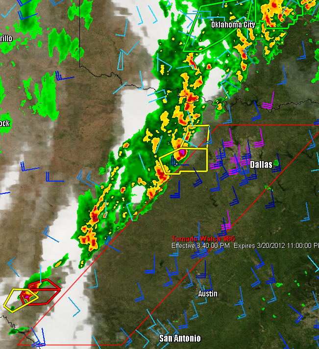
WeatherStudio combines a vast array of live weather data, products, maps, and charts into a single map that the user can pan and zoom. GFS/NDFD/NAM/RUC Model Data, Placefiles, Radar Loops, Satellite, Storm Reports, Hurricane Paths, Surface Observations, Watches/Warnings, Buoys, Shapefiles, GPS support, FTP Uploading, etc. Made for Storm Chasers, Mariners, Meteorologists, yet simple enough for home users. Partial List of Available Weather Data (about only thirty percent of all layers/data):
* Radar/Satellite
o National Radar
o National Satellite (Infrared, Visible, and Water Vapor)
o GOES East/West Satellite (Infrared, Visible, and Water Vapor)
o Individual Radars (Press R to show, press M to measure distances from them)
All of the following can be show in either the latest scan or animated loop:
+ Base Reflectivity
+ Composite Reflectivity
+ Long-Range 248-nmi Reflectivity
+ Storm Relative Velocity
+ Base Velocity
+ One-Hour Precip Totals
+ Storm Total Precip Totals
o National Radar Loop / National Radar Archive Loop (goes back to 1996)
o IR/Visible Satellite Loop / Archive Loop (goes back to 2007)
o Water Vapor Loop / Archive Loop (goes back to March 2009)
o National Echo Tops/One Hour Rainfall/Storm Total Rainfall Loop
* Severe Weather
o Storm Reports (Tornado, Hail, Wind)
+ Recent Reports
+ Archived Reports
Back to WeatherStudio Details page