Free Downloads: Apr File Format Gis
 Shareware
Total Gis Converter is an affordable converter of Gis files. It converts AEP, GRD, ADF, E00, FLT, Apr, SHP, DXF, BT, TOC, RT1, DEM, DLG, ECW, IMG, DGF, GML, SID, MIF, TAB, WOR, DNG, DDF, BIL, TIF, JPEG, TTKPS, TTKGP, TTKLS, LFT, PFT, and TFT files. The target formats are TIFF, PNG, JPEG, BMP. The program can scale your Gis files to optimize their size. Besides, it...
Category: Multimedia & Design / Graphics Viewers
Publisher: Softplicity, License: Shareware, Price: USD $99.90, File Size: 7.6 MB
Platform: Windows
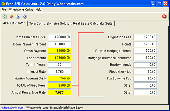
Apr Calculator 32, 1.0 is a user-friendly financial calculator which uses the Actuarial Method of calculating Annual Percentage Rates for mortgage loans as explained in Appendix J of 12 CFR Ch. II, Pt. 226, the portion of the United States Code of Federal
Category: Business & Finance / Calculators
Publisher: wheatworks.com, License: Freeware, Price: USD $0.00, File Size: 425.0 KB
Platform: Windows, Mac, 2K
AvisMap Gis Engine is the basic development platform for AvisMap Gis suites, which is a new generation component Gis development platform for Gis application developers. AvisMap Gis Engine 5 provides powerful Gis functions through Active X controls based on Microsoft COM component technique standards. It allows users to rapidly develop professional...
Category: Multimedia & Design / Multimedia App's
Publisher: AvisMap GIS Technologies, License: Freeware, Price: USD $0.00, File Size: 60.5 MB
Platform: Windows
DIVA-GIS is a GIS for plant biodiversity analysis.
DIVA-Gis is a Gis for plant biodiversity analysis. The project will modernize the architecture for better collaboration and extensibility based on Eclipse RCP.
DIVA-Gis can be used to map and analyze biological distribution data, such as can be provided by natural history collections and genetic resources collections. Typically, the distribution data would refer to...
Category: Business & Finance / Business Finance
Publisher: International Potato Center (CIP), License: Freeware, Price: USD $0.00, File Size: 122.4 MB
Platform: Windows
This Free Mortgage Apr Calculator for Windows allows you to quickly calculate Annual Perecentage Rates. Free Apr Calculator is a financial calculator designed for Windows 2000, XP and Vista systems. It offers integrated help, provides automatic hints, and offers Wheatworks' integrated Upgrade Center for easy, free, online updates.
Category: Business & Finance / Business Finance
Publisher: Wheatworks Software, LLC, License: Freeware, Price: USD $0.00, File Size: 771.0 KB
Platform: Windows
DIVA-Gis is a free computer program for mapping and geographic data analysis (a geographic information system (Gis). With DIVA-Gis you can make maps of the world, or of a very small area, using, for example, state boundaries, rivers, a satellite image, and the locations of sites where an animal species was observed.
Category: Business & Finance / Applications
Publisher: diva-gis, License: Freeware, Price: USD $0.00, File Size: 3.8 MB
Platform: Windows
Answer a few quick questions & use this software to find a low apr credit card.
Answer a few quick questions & use this software to find a low Apr credit card. Get a lower rate on your purchases. 100% free of spyware & adware. Download it now!
Category: Business & Finance / Business Finance
Publisher: AgentD LLC, License: Freeware, Price: USD $0.00, File Size: 1.8 MB
Platform: Windows
The CANVAS 9 Gis Mapping Edition adds native support for Geographic Information System (Gis) data to Canvas. You can take measurements in geographic coordinates, import industry standard SHAPE and GeoTIFF files into unlimited numbers of automatically aligned overlapping layers and choose among the following options: 2,104 Coordinate Reference Systems 67 Operation Methods (like...
Category: Multimedia & Design / Multimedia App's
Publisher: ACD Systems, License: Shareware, Price: USD $549.99, File Size: 51.9 MB
Platform: Mac, PPC
The Quantum GIS Tethys repository contains a lot of software from OSGeo projects.
The Quantum Gis Tethys repository contains a lot of software from OSGeo projects. Quantum Gis Tethys and all dependencies are included, along with Python, GRASS, GDAL, etc. This is most suitable for people who want to be able to update dependencies from the Quantum Gis Tethys repository easily. The installer is able to install from internet or just download all needed...
Category: Multimedia & Design / Graphics Viewers
Publisher: QGIS Development Team, License: Freeware, Price: USD $0.00, File Size: 369.0 KB
Platform: Windows
Shareware
AvisMap Gis Engine is a comprehensive SDK for the development of custom Gis applications and solutions. This SDK provides several ActiveX (OCX) controls which support Visual Basic, VB.NET, C#, Visual C++ and other ActiveX compatible programming languages, with Microsoft Visual Studio versions 6, 2003, 2005, and Express. Supports .NET via COM. While the SDK is excellent for desktop...
Category: Software Development / Components & Libraries
Publisher: AvisMap GIS Technologies, License: Shareware, Price: USD $1199.00, File Size: 57.8 MB
Platform: Windows
AvisMap Gis Engine is the basic development platform for AvisMap Gis suites, which is a new generation component Gis development platform for Gis application developers.AvisMap Gis Engine Sample Projects is a bundle of sample of different projects that you can see how they work.
Category: Software Development / Misc. Programming
Publisher: AvisMap GIS Technologies, License: Shareware, Price: USD $0.00, File Size: 30.9 MB
Platform: Windows
Free Mortgage Apr Calculator is a free calculator that lets us know the exact amount of a mortgage Apr (annual percentage rate). We can use this utility to compare the various offers that we may receive from banks or other financial institutions. This calculator can help us know which loan suits our financial situation better.
The program features a simple UI that is...
Category: Business & Finance / Calculators
Publisher: Wheatworks Software, License: Freeware, Price: USD $0.00, File Size: 0
Platform: Windows
Commercial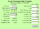
The MoneyToys Apr Calculator for web sites gives your visitors an easy-to-use calculator which calculates annual percentage rates (Apr) for mortgage loans. Easily installed with a few lines of HTML, this Apr Calculator can be configured to match your site's colors and design. MoneyToys(tm) financial calculators for websites give webmasters a simple way to add value to...
Category: Web Authoring / JavaScript
Publisher: Wheatworks Software, LLC, License: Commercial, Price: USD $39.95, File Size: 18.5 KB
Platform: Windows, Linux, Java, Unix, Not Applicable
So that you can identify the Mapping & Gis product that best suits your needs, use this simple Product Comparison. There are four main product types that you can use to create a GPS data collection and maintenance system, or mobile Gis solution. Use the links below to select a product group, and compare the features of each product within that group.
Category: Internet / Communications
Publisher: Trimble Navigation Limited, License: Freeware, Price: USD $0.00, File Size: 2.7 MB
Platform: Windows
Shareware
Lotus Approach Password by Thegrideon Software allows you to recover Lotus Approach file passwords
Lotus Approach Password by Thegrideon Software allows you to recover passwords which Lotus Approach files (.Apr,.apt,.dbf,.db,.vew) are protected with. Lotus Approach Password recovers passwords for Lotus Approach users and groups as well. Also recovers dBase/Foxpro (.dbf) and Paradox (.db) passwords for database created in Lotus Approach. Program works with all Lotus Approach versions.
Category: Security & Privacy / Password Managers & Generators
Publisher: Thegrideon Software, License: Shareware, Price: USD $29.95, File Size: 722.8 KB
Platform: Windows
AccuGlobe Desktop 2007,a standardized platform for delivering solutions to the global Gis community, offers even more of what you demand in a desktop Gis application. Combining user-friendly design with significantly increased functionality, AccuGlobe Desktop 2007 gives you greater freedom in analyzing spatial data. In addition to functioning as the core engine behind many...
Category: Multimedia & Design / Multimedia App's
Publisher: Digital Data Technologies, Inc., License: Freeware, Price: USD $0.00, File Size: 9.8 MB
Platform: Windows
GeoSurveillance is software that combines spatial statistical routines with some basic Geographic Information Systems (Gis) functions to carry out retrospective and prospective statistical tests for the detection of geographic clustering. In this software, the focus is primarily on the spatial statistical analysis. Consequently, full Gis functionality is not provided. Gis...
Category: Home & Education / Miscellaneous
Publisher: NCGIA, License: Freeware, Price: USD $0.00, File Size: 2.4 MB
Platform: Windows
TerraSync is designed for fast and efficient field GIS data collection.
TerraSync is designed for fast and efficient field Gis data collection.Trimble® TerraSync™ software is designed for fast and efficient field Gis data collection and maintenance.
Integrating all the ways you collect data—with a GNSS handheld computer, laser rangefinder, or centimeter-grade equipment—it's a powerful system for the collection...
Category: Utilities / Misc. Utilities
Publisher: Trimble, License: Shareware, Price: USD $7000.00, File Size: 20.6 MB
Platform: Windows
Freeware
VSceneGIS Desktop. (Gis) Analysis, Computing and Editing. Customer Project Development, Analysis, Computing and Gis editing. VSceneGIS Desktop applies the concept of Tree and Graph Topology to implement the data model in a Gis. Validation, Editing and Topological Behavior Export and import of data sources: PostgreSQL / PostGIS, Oracle, MySQL, SQLite / SpatiaLite,...
Category: Home & Education / Science
Publisher: vscenegis.com, License: Freeware, Price: USD $0.00, File Size: 118.4 MB
Platform: Windows
With MapAuthor you can create, print and save desktop maps, using data that you obtain from commercial sources or perhaps your in-hous Gis department as shapefiles (shapefiles are a very common Gis exchange Format.) You can also produce internet-based maps based on Google Maps, for use on your web site.
MapAuthor allows you to link your own data to maps, for example...
Category: Internet / Misc. Plugins
Publisher: MapAuthor.com, License: Freeware, Price: USD $0.00, File Size: 6.3 MB
Platform: Windows
The CANVAS 9 Advanced Gis Mapping Edition adds native support for Geographic Information System (Gis) data to Canvas. You can take measurements in geographic coordinates, import industry standard SHAPE and GeoTIFF files into unlimited numbers of automatically aligned overlapping layers and choose among the following options:2,104 Coordinate Reference Systems67 Operation Methods...
Category: Multimedia & Design / Multimedia App's
Publisher: ACD Systems, License: Shareware, Price: USD $999.95, File Size: 54.2 MB
Platform: Windows
With this release, ArcGIS transforms the way you use GIS.
With this release, ArcGIS transforms the way you use Gis.Be more productive with your work and take advantage of Gis everywhere: via individual local desktops, across desktops and browsers leveraging central servers, and in the cloud.ArcGIS Desktop contains two applications: ArcMap and ArcCatalog. ArcMap provides data display, query, and analysis. ArcCatalog provides data management.
Category: Business & Finance / Business Finance
Publisher: Environmental Systems Research Institute, Inc., License: Demo, Price: USD $0.00, File Size: 2.0 GB
Platform: Windows
The CANVAS 9 Advanced Gis Mapping Edition adds native support for Geographic Information System (Gis) data to Canvas. You can take measurements in geographic coordinates, import industry standard SHAPE and GeoTIFF files into unlimited numbers of automatically aligned overlapping layers and choose among the following options:·2,104 Coordinate Reference Systems·67...
Category: Multimedia & Design / Multimedia App's
Publisher: ACD Systems, License: Shareware, Price: USD $999.95, File Size: 51.9 MB
Platform: Mac, PPC
Map Suite Wpf Desktop Edition takes Gis application development for the Windows desktop to a whole new level.Using the intuitive object model, even developers inexperienced in Geographic Information Systems (Gis) can have fully functional maps working in minutes. With blazing fast rendering performance, powerful mapping features and support for the most popular data formats, Map...
Category: Internet / Misc. Plugins
Publisher: ThinkGeo, License: Shareware, Price: USD $4995.00, File Size: 69.1 MB
Platform: Windows
ArcGIS Workflow Manager (formerly Job Tracking for ArcGIS [JTX]) is an extension to ArcGIS Desktop and ArcGIS Server that lets organizations develop and enforce standard, repeatable Gis workflows across the enterprise.
Workflow Manager greatly improves the efficiency of Gis operations by organizing and automating the relationships between the activities in a Gis...
Category: Home & Education / Miscellaneous
Publisher: ESRI, License: Shareware, Price: USD $2500.00, File Size: 1.1 MB
Platform: Windows