Free Downloads: Area Measurement Gps
1888_Unit_Converter is a simple program that will help you to convert various units of measurement.
1888_Unit_Converter is a simple program that will help you to convert various units of Measurement. The program will help you save your precious time and effort in calculating and converting amounts to different units, and your results will be more accurate and reliable with this program.
In total, twelve Measurement categories are available in the program for you to...
Category: Business & Finance / Calculators
Publisher: 1888softwaredownloads.com, License: Freeware, Price: USD $0.00, File Size: 481.9 KB
Platform: Windows
 Shareware
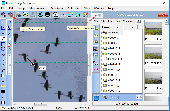
Bersoft Image Measurement (BIM) is designed as a flexible tool for acquiring, measuring and analyzing digital images. The measurements may be done by pointing and clicking or in an automated way, when doing statistical or analytical measurements. BIM can load many different types of images, including DICOM files, and also supports image acquisition from most TWAIN scanners. Angle,...
Category: Home & Education / Science
Publisher: Bersoft, License: Shareware, Price: USD $50.00, File Size: 9.7 MB
Platform: Windows
RAD is the functional limited edition of the advanced acoustic research system DSSF3.
RAD is the functional limited edition of the advanced acoustic research system DSSF3. The point that RAD differs from other systems completely is that a time change of sound can be analyzed in detail at a high temporal resolution. Using RAD, various sound qualities such as loudness, total quality, pitch and the movement of source can be analyzed by the running ACF Measurement. Broad...
Category: Audio / Utilities & Plug-Ins
Publisher: Yoshimasa Electronic Inc., License: Shareware, Price: USD $75.00, File Size: 5.7 MB
Platform: Windows
Gps Tracker Data Logger acts as the server and allows you to collect data from an unlimited number of various Gps trackers simultaneously. The obtained data is processed, uniformed and written to a log file or a database. Also, the program has a set of interfaces so other applications can get data in real time.
Gps Tracker Data Logger can convert data into other...
Category: Internet / Misc. Servers
Publisher: AGG Software, License: Shareware, Price: USD $80.83, File Size: 11.8 MB
Platform: Windows
GPS Tuner was first launched in 2003.
Gps Tuner was first launched in 2003. Success followed introduction shortly. Over the years it became a best-selling favourite Gps software among off-roaders as a reliable, versatile feature-packed application suiting the needs of outdoor enthusiasts and professional off-road users alike. After five years of continuous development of previous Gps Tuner versions Gps...
Category: Web Authoring / Web Design Utilities
Publisher: GPS Tuner Ltd., License: Freeware, Price: USD $0.00, File Size: 4.5 MB
Platform: Windows
Various sound measurement can be performed using a various functions in the realtime analyzer.
Various sound Measurement can be performed using a various functions in the realtime analyzer. The FFT analyzer with the data record and the export function, the distortion analyzer, and the phase meter enable various Measurement.There are four versions of DSSF3. We recommend Full-system Version for a wide field of Measurement. For the noise Measurement and sound...
Category: Audio / Utilities & Plug-Ins
Publisher: Yoshimasa Electronic Inc., License: Shareware, Price: USD $660.00, File Size: 3.0 MB
Platform: Windows
CloudCUBE is a tool on AutoCAD® platform conceived to exploit best the potentialities of the most advanced survey technologies (lidar, radar, bathymetric sonar) and the traditional Measurement methods (Gps, total station). CloudCUBE combines traditional 2D and 3D graphic representation techniques with a revolutionary approach to point clouds to produce effective and productive...
Category: Multimedia & Design / Image Editing
Publisher: Virtualgeo, License: Shareware, Price: USD $0.00, File Size: 120.1 MB
Platform: Windows
The Surface Area Calculator is a tool for easily calculating surface and planimetric areas, as well as volumes.
The extent and shape of the Area in question are given in terms of the coordinates of a number of points throughout the Area.
These coordinates can be specified as either latitude, longitude, and height, as Gps coordinates (geocentric...
Category: Business & Finance / Calculators
Publisher: Microsearch Corp, License: Shareware, Price: USD $134.00, File Size: 1.2 MB
Platform: Windows
The Gps Controller software is a free program designed to allow you to configure a range of Gps receivers. There are versions that run on Windows desktop computers, or Windows Mobile devices.
Before downloading the software, it recommend downloading and reading the documentation to confirm which version you need.
Category: Home & Education / Miscellaneous
Publisher: Trimble Navigation, License: Freeware, Price: USD $0.00, File Size: 30.9 MB
Platform: Windows
User friendly FREE utility to easily convert between units of measurement.
User friendly FREE utility to easily convert between units of Measurement. Includes Units for Temperature, Distance, Mass, Area, Volume, Pressure, Velocity, Acceleration, Force, Energy, Power, Fuel Consumption, Flow, Torque, Angles, Luminous Intensity, Il
Category: Business & Finance / Conversion Applications
Publisher: esbconsult.com, License: Freeware, Price: USD $0.00, File Size: 751.9 KB
Platform: Windows, Mac, 2K, 2K3, Vista, 2K8
Shareware
Java toolkit to add coordinate conversion functionality to your Java applications and applets. The toolkit offers functionality to perform map grid and datum transformations: latitude and longitude can be converted to various map grids, like Transverse Mercator (TM), Oblique Mercator, Mercator, Oblique Stereographic, Polar Stereographic, Cassini, Albers Equal Area Conal, Gauss Kruger or...
Category: Software Development / Components & Libraries
Publisher: Eye4Software B.V., License: Shareware, Price: USD $199.00, EUR179, File Size: 155.5 KB
Platform: Unknown
Calc It Converter is a fully featured measurement converter.
Calc It Converter is a fully featured Measurement converter. It's planned measurements are: * Area * Length * Mass * Capacity * Volume * Temperature * and Computer Measurements
Category: Business & Finance / Applications
Publisher: Bell Software, License: Freeware, Price: USD $0.00, File Size: 829.4 KB
Platform: Windows
GPS-CCD:is a novel computational program for the
Prediction of Calpain Cleavage Sites.
Gps-CCD:is a novel computational program for the
Prediction of Calpain Cleavage Sites.
The online service and local packages of Gps-CCD 1.0 were
implemented in JAVA/. For the online service, we tested the Gps-CCD1.0 on a variety of internet browsers, including Internet Explorer 6.0, Netscape Browser 8.1.3 and Firefox 2 under the Windows XPOperating System...
Category: Web Authoring / JavaScript
Publisher: The CUCKOO Workgroup, License: Freeware, Price: USD $0.00, File Size: 19.2 MB
Platform: Windows
APSW Instant Convertor 1.0 is a free application that enables you with the function of converting different units of Measurement from one into another in a glimpse of an eye. This efficient conversion tool supports a lot of units of Measurement, such as time, Area, length, volume, power units, bits, bytes, megabytes, celsius, feet, gallons, miles, litres, seconds, weight,...
Category: Business & Finance / Business Finance
Publisher: All Purpose Software, License: Freeware, Price: USD $0.00, File Size: 3.3 MB
Platform: Windows
ThinkVantage Gps (Global Positioning System) receives signals from the Gps satellites and determines the location of your ThinkPad. This program is easy to install and easy to manipulate.
This package installs the software (Gps driver) to enable the following devices:
- Ericsson F3507g
- Ericsson F3607gw
- Ericsson F5521gw
-...
Category: Utilities / System Utilities
Publisher: Lenovo, License: Freeware, Price: USD $0.00, File Size: 20.6 MB
Platform: Windows
Easy Unit Converter converts most frequently used length, Area, volume, temperature and weight Measurement units with a single button click. This freeware tool includes about fifty most commonly used measure units: kilometers, meters, miles, light years, yards, feet, inches, acres, hectares, feet, barrels, gallons, quarts, liters, carats, ounces, pints, pounds are just some of the...
Category: Business & Finance / Calculators
Publisher: FilesWeb.com, License: Freeware, Price: USD $0.00, File Size: 326.0 KB
Platform: Windows
The OSTN02 extension for ArcPad is a FREE tool that automatically transforms Gps data and aligns it with Ordnance Survey (OS) background map. This easy-to-use extension removes the need to manually post-process Gps data by providing’ on the fly’ transformation of WGS84 latitude and longitude into OSTN02 corrected British National Grid coordinate. Data capture using...
Category: Home & Education / Miscellaneous
Publisher: ESRI (UK) Ltd, License: Freeware, Price: USD $0.00, File Size: 8.0 MB
Platform: Windows
Although many things such as emotion and thought may be difficult to measure, some things are much easier to quantitize. Measurement Converter aids in converting one Measurement to another similar Measurement. Why people care so much about measurements and conversions still remain a mystery to one such as myself. I am convinced however that there could be a useful purpose...
Category: Home & Education / Mathematics
Publisher: mySoftwareFactory.net, License: Shareware, Price: USD $9.87, File Size: 952.3 KB
Platform: Windows

Overview Gps Simulator is software that generates a virtual Gps data Used to develop and simulation of Gps applications -Save testing and development time -No location restriction or work everywhere -No Gps device needed Feature Easy routing Selectable map(7EA Map) Support speed control Support 10EA NMEA protocol messages(GGA, GNS, GLL, RMC, VTG,...
Category: Desktop Enhancements / Shell & Desktop Managers
Publisher: NMEAsoft, License: Demo, Price: USD $150.00, File Size: 3.3 MB
Platform: Windows

Improve your golf game with a handheld Gps that gives distance to pin, club suggestions, locations of hazards and much more. Wherever in the world you play golf, the sureshotgps will allow you to obtain distances from tee to green. Experience the difference with better club selection, speedier play and statistical information per round of golf. The sureshotgps relies on Gps...
Category: Home & Education
Publisher: Absolute Software Pty Ltd, License: Shareware, Price: USD $399.00, File Size: 3.8 MB
Platform: Windows
User friendly FREE Windows Utility to easily convert between 613 units of Measurement in 21 categoriess. Includes Units for Temperature, Distance, Mass, Area, Volume, Pressure, Velocity, Acceleration, Force, Energy, Power, Fuel Consumption, Flow, Torque, Illumination, Luminous Intensity, Angles, Time, Quantities and Radioactivity. Looks best in 16-bit or better Colour. Includes...
Category: Business & Finance / Calculators
Publisher: ESB Consultancy, License: Freeware, Price: USD $0.00, File Size: 1.2 MB
Platform: Windows
ABF Value Converter is an application for Measurement units conversion. This software easily converts various Measurement values into any other possible ones. Inches to centimetres, pounds to kilograms, Fahrenheit to Celsius... and more than 5000 other conversions, grouped according to categories. ABF Value Converter also calculates the values of many mathematical functions, as...
Category: Business & Finance
Publisher: ABF software, Inc., License: Shareware, Price: USD $19.95, File Size: 970.1 KB
Platform: Windows
GPS Send Map is a Windows interface program which uses (sendmap.
Gps Send Map is a Windows interface program which uses (sendmap.exe) to load the IMG maps to the Gps.This program works well and setup is easy, although there seams to be minor issues in some windows OS.The Gps acted as usual and my maps appeared on the screen as usual. NICE.
Category: Security & Privacy / Other
Publisher: DougsBrat, License: Freeware, Price: USD $0.00, File Size: 1.5 MB
Platform: Windows
GeoBuddy is a complete geocaching solution that can display all of the geocaches in your Area, as well as your own personal Gps data, over USGS topo maps, aerial photos, your own scanned paper trail and road maps. A built-in Web browser lists all of the information about each geocache, including pictures and hints left by the cache owner, and logs by recent visitors to the geocache.
Category: Internet / Communications
Publisher: TopoGrafix, License: Shareware, Price: USD $49.95, File Size: 10.3 MB
Platform: Windows
Shareware
Photo EXIF Manager Photo EXIF Manager lets you read and edit EXIF tags of many popular cameras. Photo EXIF Manager lets you view and edit most well-known digital photo EXIF tags. The edit capability extends to the more recent Gps tags too. All tags are listed in a table and grouped into three main groups Image, Camera, and Gps. EXIF 2.3 standard tags are supported. Editing...
Category: Multimedia & Design / Digital Media Editors
Publisher: MIKLSOFT, License: Shareware, Price: USD $19.99, EUR17.99, File Size: 792.0 KB
Platform: Windows