Free Downloads: Astronomical Maps
A series of astronomical props for use with Poser software.
A series of Astronomical props for use with Poser software. They allow you to quickly add real 3D planet-style objects directly inside Poser to give your scenes some extra dimension! This product has been optimized for low system requirements in order to keep rendering times to a minimum. The "Core Edition" will provide you with the most common objects needed to add planets,...
Category: Multimedia & Design / Multimedia App's
Publisher: Cybia, License: Demo, Price: USD $12.00, File Size: 388.0 KB
Platform: Windows
VOSpec is a tool for spectra analysis and display in the astronomical community.
VOSpec is a tool for spectra analysis and display in the Astronomical community. The tool contains also general Astronomical functionality useful for any wavelength range. The most obvious initial one, coming from the definition itself of the algorithm for spectra superimposition, is the ability to change the display between different units, allowing for better qualitative...
Category: Business & Finance / Applications
Publisher: ESAC, License: Freeware, Price: USD $0.00, File Size: 8.6 MB
Platform: Windows
AIP4Win(Astronomical Image Processing for Windows) is a suite of software tools for viewing, calibrating, measuring, and enhancing digital Astronomical images. AIP4Win has been tested and runs properly under Win 98se, Win ME, Win XP, Vista, and Win 7.
Category: Home & Education / Science
Publisher: Jeff Hopkins, License: Shareware, Price: USD $99.95, File Size: 0
Platform: Windows
CyberSky is an accurate, yet easy-to-use planetarium program that provides an excellent way to learn about astronomy and explore the sky visible in the distant past, the present, and the far-off future. CyberSky can display and print attractive, highly-customizable Maps of the sky as seen from your home, your favorite vacation spot, or any other location on the Earth. The program's...
Category: Home & Education
Publisher: Stephen Michael Schimpf, License: Shareware, Price: USD $32.95, File Size: 3.3 MB
Platform: Windows
Alcyone Astronomical Tables is an application that is intended for real fans of astronomy.
Alcyone Astronomical Tables is an application that is intended for real fans of astronomy. It is designed for those who have some knowledge on this subject, preferably for experienced researchers.
If you're not a connoisseur of astronomy, you may find the program rather dull and unattractive, because it consists of precise calculations which can be made in the area of...
Category: Home & Education / Astrology & Numerology
Publisher: Alcyone Software, License: Shareware, Price: USD $24.90, File Size: 72.6 MB
Platform: Windows

FSS Google Maps Downloader is a tool that can download the Google Maps images to your PC. This is a clearly free program. There is no spyware or adware. It's absolutely safe to install and to run. The interface is very simple and self explaining. It runs low on system resources consumption and is supported on all Windows versions. It can save them to your hard disk,...
Category: Internet / Download Managers
Publisher: FreeSmartSoft, License: Freeware, Price: USD $0.00, File Size: 874.0 KB
Platform: Windows
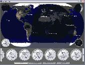
ActiveEarth is a world time clock with a gorgeous day/night merge of NASA's Visible Earth satellite images in flat Maps or a globe, with a row of user-definable clocks along the bottom. These clocks are beautiful, scalable, ticking, analog clocks that come in several styles with many custom settings. Each clock is set to a city of your choice. The program has accurate time zone data for...
Category: Business & Finance
Publisher: Norris Family Industry, License: Demo, Price: USD $24.95, File Size: 2.8 MB
Platform: Windows
SAOImage DS9 is an astronomical imaging and data visualization application.
SAOImage DS9 is an Astronomical imaging and data visualization application. DS9 supports FITS images and binary tables, multiple frame buffers, region manipulation, and many scale algorithms and colormaps. It provides for easy communication with external
Category: Home & Education / Mathematics
Publisher: hea-harvard.edu, License: Freeware, Price: USD $0.00, File Size: 13.2 MB
Platform: Windows, Mac, Vista
Diffuse maps represent the absorption of light.
Diffuse Maps represent the absorption of light. Diffuse Maps are what people call "textures". They are the color textures or photographic textures usually applied to 3d models.
ShaderMap creates displacement Maps using the light data stored inside of diffuse Maps. Evenly lit diffuse Maps generally create better quality Maps with ShaderMap.
Category: Home & Education / Miscellaneous
Publisher: Rendering Systems Inc., License: Freeware, Price: USD $0.00, File Size: 4.0 MB
Platform: Windows
NOVA Maps provides appraisers and appraisal users with complete, high-resolution location Maps (also known as “street Maps”) for forms and addenda in seconds. NOVA Maps even automatically places labels for subject properties and comparables.
For just pennies per map and with just a click of the mouse, users have access to the entire United...
Category: Home & Education / Miscellaneous
Publisher: Day One, License: Demo, Price: USD $0.00, File Size: 5.7 MB
Platform: Windows
AstroGrav is an astronomy software program that allows you to simulate how Astronomical objects move and interact under the force of gravity. It features superb interactive 3D graphics which allow you to move around within a many-body Astronomical system, while watching how it evolves with the passage of time. A wide variety of sample files are provided, including Solar System,...
Category: Home & Education
Publisher: AstroGrav Astronomy Software, License: Shareware, Price: USD $59.00, File Size: 3.5 MB
Platform: Mac
AstroGrav is an astronomy software program that allows you to simulate how Astronomical objects move and interact under the force of gravity. It features superb interactive 3D graphics which allow you to move around within a many-body Astronomical system, while watching how it evolves with the passage of time. A wide variety of sample files are provided, including Solar System,...
Category: Home & Education
Publisher: AstroGrav Astronomy Software, License: Shareware, Price: USD $59.00, File Size: 25.9 MB
Platform: Windows
 Shareware
Google Maps Terrain Downloader is a tool that can automatically download the google terrain Maps images to your PC. It can download the small tiles and save them to your hard disk. After downloading, you can view the Maps offline by its tool Maps Viewer, or you can combine the small images into one big map image. If you want to make a map of your city by yourself, it...
Category: Internet / Download Managers
Publisher: allmapsoft.com, License: Shareware, Price: USD $29.99, File Size: 305.3 MB
Platform: Windows
Shareware
Google Hybrid Maps Downloader is a tool that can automatically download the google hybrid Maps images to your PC. It can download the small tiles and save them to your hard disk. After downloading, you can view the Maps offline by its tool Maps Viewer, or you can combine the small images into one big map image. If you want to make a map of your city by yourself, it...
Category: Internet / Download Managers
Publisher: allmapsoft.com, License: Shareware, Price: USD $29.99, File Size: 30.6 MB
Platform: Windows
A PicPack for Stellaris is a free collection of astronomical images that Stellaris can display.
A PicPack for Stellaris is a free collection of Astronomical images that Stellaris can display. The images have been collected from the internet for your convenience. This is a great and very interesting program for the amateur astronomer. You will enjoy working with it.
Category: Home & Education / Astrology & Numerology
Publisher: Stellaris Software, License: Freeware, Price: USD $0.00, File Size: 1.2 MB
Platform: Windows
Powerful, easy-to-use astronomical image processing software with next-generation technology.
Powerful, easy-to-use Astronomical image processing software with next-generation technology. Version 2 adds multiple processor support for faster operation, additional deconvolution controls to correct minor tracking & guiding errors, bad pixel mapping, improved registration and enhanced DSLR RAW support for popular cameras.
Category: Home & Education / Astrology & Numerology
Publisher: CCDWare, License: Freeware, Price: USD $0.00, File Size: 2.1 MB
Platform: Windows
think! Bubble Maps is a Windows tool for creating bubble Maps and capturing your thought. Using simple mouse click, drags and typing, your thoughts get put to paper (virtual), quickly and effectively.
The key feature of think! Bubble Maps is speed which makes it an excellent tool for live capture. You can use this program during meetings, workshops, and seminars.
Category: Multimedia & Design / Multimedia App's
Publisher: Lowrie Associates Ltd, License: Shareware, Price: USD $41.90, File Size: 5.9 MB
Platform: Windows
MapComp is a powerful and free Windows Software for drawing images of linkage Maps and to compare linkage Maps and indicate common markers.
MapInspect can display, print and save images, and has no limit to the number of Maps it can compare (but only neighbouring Maps are compared). Maps can be flipped within MapINspect, an the on-screen order of...
Category: Multimedia & Design / Multimedia App's
Publisher: MapInspect, License: Freeware, Price: USD $0.00, File Size: 616.7 KB
Platform: Windows
This software development kit (SDK) provides the binaries and programming reference for the Bing Maps Silverlight Control. You can use this control to build your own web sites that use Bing Maps.
The Bing Maps Silverlight Control combines the power of Silverlight and Bing Maps to provide an enhanced mapping experience. Developers can use the Bing...
Category: Utilities / Misc. Utilities
Publisher: Microsoft, License: Freeware, Price: USD $0.00, File Size: 3.8 MB
Platform: Windows
SensAct -SENSORS CONVERSION Maps AND ACTUATORS COMMAND Maps
This software pack contents the sensors conversion Maps and the actuators command Maps like motorized throttles, gasoline injectors corrections, ...
It is mandatory to install it to select the type of sensor and actuators that are equiping the ECUs, because these Maps are no longer...
Category: Business & Finance / Applications
Publisher: Skynam, License: Freeware, Price: USD $0.00, File Size: 3.4 MB
Platform: Windows
PlanetGIS Explorer is a free viewer for PlanetGIS maps and GIS exchange files.
PlanetGIS Explorer is a free viewer for PlanetGIS Maps and GIS exchange files. PlanetGIS Explorer allows you to navigate through Maps, query map elements and view attribute information from linked database tables. Also PlanetGIS Explorer allows you to customize the appearance of Maps for purposes of creating hardcopy printouts, but does not allow you to save any changes to...
Category: Multimedia & Design / Graphics Viewers
Publisher: Planet GIS, License: Freeware, Price: USD $0.00, File Size: 5.4 MB
Platform: Windows
Shareware
FPS Maps for WPF is a brand new component with a set of built-in country Maps. There are 15 Inbuilt Countries. FPS Maps for WPF contains samples of how to work with it and customize. Maps navigation can be performed via Navigation bar which supports Themes and mouse. You can pan with mouse or zoom in/out with mouse scroll. More options will be added in future...
Category: Software Development / Components & Libraries
Publisher: FPS Components, License: Shareware, Price: USD $199.00, File Size: 1.1 MB
Platform: Windows
A PicPack for Stellaris is a free collection of astronomical images that Stellaris can display.
A PicPack for Stellaris is a free collection of Astronomical images that Stellaris can display.Deep Sky 2 contains a lots of pictures with stars,planets,galaxies.All this pictures where taken with the Hubble telescope.This collection of pictures will show you the secrets of the space.
Category: Home & Education / Astrology & Numerology
Publisher: Stellaris Software, License: Freeware, Price: USD $0.00, File Size: 6.1 MB
Platform: Windows
With yalips maps you get 4 products in 1.
With yalips Maps you get 4 products in 1. You are more productive, more creative and perform better on your job when using visual software tools. With the resulting visualizations you can communicate more effectively and convincingly to your collegues, your boss, your customer or the chairman of the board. Therefore many companies spent a lot of money on such tools. Unfortunately, most...
Category: Business & Finance / Project Management
Publisher: yalips Software, License: Shareware, Price: USD $80.00, File Size: 29.6 MB
Platform: Windows
Shareware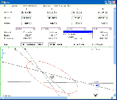
Using the same standards of accuracy as published tables but with a catalogue extending beyond Barnard's Star; it can be used as a sight calculator, a definative Astronomical reference or simply to print daily Nautical Almanac pages.Multiple sights can be plotted/ combined while allowing for changes in course and/ or speed. Once an altitude and bearing has been entered, a list of...
Category: Home & Education / Home Inventory
Publisher: navsoft.com, License: Shareware, Price: USD $32.00, GBP20, File Size: 8.5 MB
Platform: Windows