Free Downloads: Azimuth Map
WGS-84 Calculator is used to calculate geodetic distance and Azimuth between two points (latitude and longitude). In addition, it can calculate a new point from origin using the given Azimuth and distance.
Lat/long values can be inserted using three different formats; DD:MM:SS.ssss, DD:MM.mmmmmm or DD.dddddddd.
Calculations are based on WGS-84 (World...
Category: Home & Education / Mathematics
Publisher: MR Soft Tmi, License: Freeware, Price: USD $0.00, File Size: 502.0 KB
Platform: Windows
 Shareware
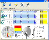
SatHunter is a program for calculating the orientation of a satellite antenna. SatHunter contains all the necessary information for adjusting the satellite antenna to the selected satellite. The adjustment is made with the help of available tools (a compass or a protractor, a plumb, a tape measure) and requires neither expensive equipment nor deep knowledge about satellite television....
Category: Home & Education / Astrology & Numerology
Publisher: Protectedsoft Ltd., License: Shareware, Price: USD $29.95, File Size: 5.4 MB
Platform: Windows
SatCalc is a free software which calculates Azimuth and Elevation for geostationary satellites used for television broadcast.
Features include the calculation of the LNB skew and calculation of sun outage which occurs in spring and fall. The calculated data is presented graphically and can also be printed out and exported to HTML or CSV.
A list of Longitude...
Category: Business & Finance / Applications
Publisher: Martin Kirisits, License: Freeware, Price: USD $0.00, File Size: 1.6 MB
Platform: Windows
Shareware
Toolkit to add GPS functionality to your software and scripts (GPS SDK). All NMEA0183 protocol versions are supported and can be filtered by NMEA sentence type and talker ID. Information on GPS status can also be retrieved: GPS fix quality, satellites used in fix, satellites in view, satellite Azimuth, elevation and signal strengths. The toolkit also offers functionality to perform...
Category: Software Development / ActiveX
Publisher: Eye4Software B.V., License: Shareware, Price: USD $150.81, File Size: 1.6 MB
Platform: Windows
Cool Flash Map Maker is a powerful Flash Map software for developing interactive flash mapping solutions and products for Real Estate, Spacial Statistics, Business Locator Applications, Vector USA Map,World Map, Germany Map,ASIA Map, Canada Map, Europe Map, Australia Map, Austria Map, Africa Map, UK Map, South...
Category: Multimedia & Design / Multimedia App's
Publisher: Go2Share, License: Shareware, Price: USD $29.95, File Size: 17.9 MB
Platform: Windows
You can enter your City/State OR Zipcode and it outputs a lot of useful information like Azimuth, Elevation, Latitude, Longitude, and Magnetic Deviation. It also has a text database for the satellites that makes it easy to modify satellite names and easy to add or delete satellites.
Category: Home & Education / Miscellaneous
Publisher: NeuroSoft, License: Freeware, Price: USD $0.00, File Size: 1.6 MB
Platform: Windows
Astro Helper will tell you the angle of elevation above the horizon (altitude) and the direction in degrees from North (Azimuth) of the selected objects. It will simultaneously display the coordinates of 22 objects from a database of over 22,000 objects. With these coordinates you can point your Dobsonian mounted telescope or other "Alt/Az" mounted scope. If you have an...
Category: Home & Education / Astrology & Numerology
Publisher: Mark Casazza Consulting, License: Freeware, Price: USD $0.00, File Size: 3.3 MB
Platform: Windows
Island Paradise shows you PathTransition, Timeline animation, and path elements that build specialized shapes. (The sun moves along an elliptical path created with path element ArcTo.)
The lighting is controlled by three factors:
- The Azimuth of the lighting effect on the land changes as the sun moves (the Azimuth is the angle of a distant light...
Category: Multimedia & Design / Multimedia App's
Publisher: Anderson Software Group, License: Freeware, Price: USD $0.00, File Size: 835 B
Platform: Windows
Shareware
GPS SDK to add GPS and coordinate conversion functionality to your software and scripts). All NMEA0183 protocol versions are supported and can be filtered by NMEA sentence type and talker ID. Garmin USB PVT support. Information on GPS status can also be retrieved: GPS fix quality, satellites used in fix, satellites in view, satellite Azimuth, elevation and signal strengths. The...
Category: Software Development
Publisher: Eye4Software B.V., License: Shareware, Price: USD $99.00, EUR79, File Size: 2.3 MB
Platform: Windows
Remere's Map Editor is a map editor for the OpenTibia Project which was created by Remere.
Remere's Map Editor is a Map editor for the OpenTibia Project which was created by Remere.
Remere's Map Editor is a Map editor coded in C to be used with OpenTibia. It supports many advanced features such as autobordering and placing of composite objects. Runs under both Linux and Windows using wxWidgets and OpenGL.
Category: Games / Tools & Editors
Publisher: Remere, License: Shareware, Price: USD $0.00, File Size: 4.2 MB
Platform: Windows
Freeware
An interactive Flash USA Map with all the features you need for your web site or project. This is the ideal solution for dealer maps, real-estate listings, or visualizing state statistics. Nearly every aspect of the Map is customizable. However, unlike competing products, our Map is very simple to install and edit. Just upload XML and SWF files and embed.
Category: Internet / Flash Tools
Publisher: http://www.flashusamap.com/trial/flashus, License: Freeware, Price: USD $0.00, File Size: 93.8 KB
Platform: Unknown
Map of Africa is one of the many maps created for GPS TrackMaker.
Map of Africa is one of the many maps created for GPS TrackMaker. You are able to download the installation package from the TrackMaker website. In order to preview the contents of this package, you need to install GPS TrackMaker.
Using the above mentioned application, you will be able to see the Map of Africa. Just click on the "Open Temporary...
Category: Home & Education / Miscellaneous
Publisher: Geo Studio Technology, License: Freeware, Price: USD $0.00, File Size: 18.3 MB
Platform: Windows
Program shows you an actual X3 sector-map, with detailed information about most in-game objects.
Program shows you an actual X3 sector-Map, with detailed information about most in-game objects. The Map is based on a log-file that is created with an in-game script (by Andrei[<>Ace]). If you just want to view the standard Map (or if you don’t have the game) the program will work with the included default Map, which was created with an English X3 game...
Category: Games / Misc. Games
Publisher: SUU Design, License: Freeware, Price: USD $0.00, File Size: 1.4 MB
Platform: Windows
New Zealand Map Reference Converter (NZMapConv) is software that LINZ provides to convert Map references between the old NZMS260 Map series and the new NZTopo50 Map series.NZMapConv is a Windows programme designed to convert individual coordinates entered manually.
Category: Multimedia & Design / Media Management
Publisher: Land Information New Zealand, License: Freeware, Price: USD $0.00, File Size: 2.4 MB
Platform: Windows
When the XMAP software is communicating with an XEDE via the comms cable each Map will show, at the top of the Map display, an RPM and load value (x and y axis for the Map) in real time. Also in each Map a yellow highlighted block will show the current position within the Map. Beside the real-time display on each Map are the undo and redo buttons which...
Category: Home & Education / Miscellaneous
Publisher: ChipTorque, License: Freeware, Price: USD $0.00, File Size: 1.7 MB
Platform: Windows
Sig Panama Has :
Digital maps of Panama, Digital Map of Panama-City, digital Map of Taboga, digital Map of Bocas del Toro, digital Map of Colon and Free Zone, digital Map of Contadora Island, digital Map of Coronado, Panama, Zona Libre, Map of Panama, Map of Panama City, Map of Colon, Map of Zona Libre, Map of...
Category: Internet / Misc. Plugins
Publisher: DP Imperial, LLC., License: Freeware, Price: USD $0.00, File Size: 44.9 MB
Platform: Windows
Freeware
Arm Map Explorer recreates all the functionalities of Google Maps on your desktop while expanding them with new extras. Map Explorer lets you locate and view any place on the planet using dynamic interactive maps. These maps are draggable, which means there is no need for you to click and wait for graphics to reload each time you want to view adjacent parts of a Map....
Category: Internet / Flash Tools
Publisher: ArmCode, License: Freeware, Price: USD $0.00, File Size: 5.5 MB
Platform: Windows
Time Zones Map is the flash world time Map featuring the time peculiarities of more then 50 cities all over the world. Its eye-catching but still pleasant design, varied functions and multiple application abilities combine everything the ultra-modern flash world time Map must have. You can put our Time Zone Map either on one of your website?s pages or put a banner,...
Category: Web Authoring / Flash Utilities
Publisher: USFlashMap.com, License: Shareware, Price: USD $249.00, File Size: 45.0 KB
Platform: Windows, Mac, Linux, Unix, MS-DOS, AS, 400
HNSKY 2.30 is a program that puts a planetarium in your computer´s screen. Hallo Northern Sky (this is the complete name) includes 26000 deepsky objects, all stars to magnitude 12, all planets and moons, along with hundreds of asteroids and comets. You will be able to view the actual sky that can be seen from your location in the Earth, or any given location in the planet. Just by...
Category: Home & Education / Astrology & Numerology
Publisher: Han Kleijn, License: Freeware, Price: USD $0.00, File Size: 39.7 MB
Platform: Windows
The easiest way to get a paper map with MapPlot is the Plot Map menu.
The easiest way to get a paper Map with MapPlot is the Plot Map menu.
On the following dialog, simply paper size and scale have to be chosen - the result is ready to be printed directly, edited (e.g. for additional entries) or to be displayed as a preview.
Category: Utilities / Misc. Utilities
Publisher: AGIS GmbH, License: Freeware, Price: USD $0.00, File Size: 5.4 MB
Platform: Windows
With LocationWizard you can easily map multiple addresses on a map.
With LocationWizard you can easily Map multiple addresses on a Map. LocationWizard helps you visualize the locations of customers or shops. LocationWizard supports the following database formats: MySQL, PostgreSQL, SQLite, FireBird, InterBase, Microsoft Access, Microsoft Excel and CSV.
Category: Business & Finance / Business Finance
Publisher: Location Wizard team, License: Shareware, Price: USD $85.00, File Size: 7.3 MB
Platform: Windows
OziExplorer3D is an impeccable application for viewing Map images in 3D, along with the options of rotating it in every possible direction, zoom in/out and lots more. The application actually creates grid of heights using the height data that has been obtained and writes it to a file, along with the other required information, loads the file and the Map image or the image section...
Category: Multimedia & Design / Multimedia App's
Publisher: Des Newman, License: Shareware, Price: USD $30.00, File Size: 1.9 MB
Platform: Windows
With EME System helps to track the moon or any selected radio source with a high accurate (16 bits) Azimuth/Elevation display (runs also without the interface) and a complete real time dialogue with the hardware interface to point your antenna toward the moon or the selected source with the same accuracy.
Category: Internet / Misc. Plugins
Publisher: F1EHN, License: Freeware, Price: USD $0.00, File Size: 3.0 MB
Platform: Windows
Tibia Map Viewer is a useful freeware and Open Source application that allows you to view maps generated by Tibia game client and create or edit Map symbols.
You can view the entire Tibia Map you have explored, both upper and lower levels of the Map, with zoom ratio from 25 to 400 percents. It also allows you to export to BMP file.
Category: Games / Tools & Editors
Publisher: Yury Sidorov, License: Freeware, Price: USD $0.00, File Size: 193.7 KB
Platform: Windows
Site Map for osCMax - osCMax Module - is very powerful and flexible module for dynamic site Map generation. With help of this module you will achieve two important goals: 1.your customers always will be able to find correct page on your site without any problem. Your visitors will like your site! 2.Search Engine Optimization. If you will use this module in conjunction with SEO...
Category: Software Development
Publisher: MagneticOne, License: Commercial, Price: USD $39.00, File Size: 70.3 KB
Platform: Windows, Linux, Unix, BEOS