Free Downloads: Blackberry Gps Outdoor Maps Hunting
Trimble Adventure Planner software is a PC-based trip planning, mapping and trip journaling application for lovers of hiking, biking, walking, fishing, running, geocaching and other Outdoor activities.
Adventure Planner can be used as a standalone product or with the Trimble Outdoors phone application. Is it NOT intended to be used with the AllSport Gps application...
Category: Home & Education / Miscellaneous
Publisher: Trimble Navigation Ltd., License: Freeware, Price: USD $0.00, File Size: 8.6 MB
Platform: Windows
ExpertGPS is helpful in viewing map points, Topo Maps, arial photos and many more.
ExpertGPS is helpful in viewing map points, Topo Maps, arial photos and many more. This is a revolutionary product called Expert Gps, Expert Gps is highly useful for people interested in Hunting, Scouting, Mountain biking, Fishing, Tracking, state and local agencies in the US as well as geometric studies.
Category: Internet / Communications
Publisher: TopoGrafix, License: Shareware, Price: USD $200.00, File Size: 9.2 MB
Platform: Windows
GPS Tuner was first launched in 2003.
Gps Tuner was first launched in 2003. Success followed introduction shortly. Over the years it became a best-selling favourite Gps software among off-roaders as a reliable, versatile feature-packed application suiting the needs of Outdoor enthusiasts and professional off-road users alike. After five years of continuous development of previous Gps Tuner versions...
Category: Web Authoring / Web Design Utilities
Publisher: GPS Tuner Ltd., License: Freeware, Price: USD $0.00, File Size: 4.5 MB
Platform: Windows
Create Gps enabled geo Maps directly on the background of aereal photos and road Maps from the internet. Import geodata from Google-Earth, OpenStreetMap, Gps tracks and Gps logger. Map editor , manually digitizing. Specifical graphical objects (borderlines, borderareas) to guarantee exact same borders of neighbour areas..Screen calibration for true to display...
Category: Multimedia & Design / Digital Media Editors
Publisher: GPSur Dr. Erhard Regener, License: Shareware, Price: USD $65.00, File Size: 6.4 MB
Platform: Windows
Hunting Forums is a hunting chat program for hunters.
Hunting Forums is a Hunting chat program for hunters. Hunting Forums is your premier on-line Hunting forums software for all hunters. You'll find Hunting forums for just about anything, including Archery Forums, Turkey Hunting Forums and more. Write a Hunting product or service review, help people in the forums or just hangout and enjoy the...
Category: Internet / Chat
Publisher: Hunting Forums, License: Freeware, Price: USD $0.00, File Size: 143.0 KB
Platform: Windows


 Shareware
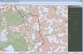
Gps Mapping Software for Windows, Loading topographic Maps, realtime navigation, track recording, manage Gps devices and more. The software can be used with various map formats including: GeoTiff, BSB Nautical Charts, AutoCad DXF files, ESRI Shapefiles. Using calibration you can also use scanned or downloaded JPG, BMP, GIF, PNG and TIF Maps. The software can be used...
Category: Home & Education / Science
Publisher: Eye4Software B.V., License: Shareware, Price: USD $149.00, EUR99, File Size: 11.1 MB
Platform: Windows
Terrain Tools - Create maps quickly and easily!
Terrain Tools - Create Maps quickly and easily!
Terrain Tools is the ideal tool for Outdoor recreationists, real-estate professionals, farmers, ecologists, archaeologists and others who need to create basic Maps, calculate areas, lengths, bearings and distances.
Overlay Gps tracks on scanned images such as USGS or Canadian NTS topos. Import...
Category: Business & Finance / Applications
Publisher: Softree, License: Shareware, Price: USD $124.00, File Size: 15.0 MB
Platform: Windows


 Shareware
Gps Mapping Software for Windows, Loading topographic Maps, manage Gps devices and more. The software can be used with various map formats including: GeoTiff, BSB Nautical Charts, AutoCad DXF files, ESRI Shapefiles. Using calibration you can also use scanned or downloaded JPG, BMP, GIF, PNG and TIF Maps. The software can be used for survey, research, track and trace,...
Category: Home & Education / Science
Publisher: Eye4Software B.V., License: Shareware, Price: USD $75.04, EUR49, File Size: 6.7 MB
Platform: Windows
GPS Send Map is a Windows interface program which uses (sendmap.
Gps Send Map is a Windows interface program which uses (sendmap.exe) to load the IMG Maps to the Gps.This program works well and setup is easy, although there seams to be minor issues in some windows OS.The Gps acted as usual and my Maps appeared on the screen as usual. NICE.
Category: Security & Privacy / Other
Publisher: DougsBrat, License: Freeware, Price: USD $0.00, File Size: 1.5 MB
Platform: Windows
With MetroWizzz- the Autorouting MetroGuide Wizard, you can make your Gps capable of autorouting with MetroGuide Maps. The wizard is self explaining. In just 6 simple steps you will have autorouting capabilities with MetroGuide Maps on your Gps. You can upload up to 1Gb of Maps to your Gps.
Category: Home & Education / Miscellaneous
Publisher: Geodude, License: Freeware, Price: USD $0.00, File Size: 962.2 KB
Platform: Windows
The Gps Detector software is used to update the Gps detector's database , updating Maps , routes and camera locations . The device itself is based on pre-installed Gps coordinates, the device can indicate various road hazards like: Fixed cameras, Red light speed cameras and bus lane cameras, Usual speed measurement places and dangerous zones.
Category: Business & Finance / Business Finance
Publisher: Euro Noliker Kft., License: Freeware, Price: USD $0.00, File Size: 5.5 MB
Platform: Windows
Moagu: The Mother Of All GPS Utilities.
Moagu: The Mother Of All Gps Utilities.
You can convert USGS topographic Maps, aerial/satellite imagery, and any other raster map imagery for use on Garmin handled Gps units.
Garmin Maps have been in a "vector" format; Moagu creates Maps using a "bitmap" format.
Category: Home & Education / Miscellaneous
Publisher: Moagu, License: Shareware, Price: USD $19.95, File Size: 38.2 MB
Platform: Windows
FREE GPS Software for your Garmin, Magellan or Lowrance GPS.
FREE Gps Software for your Garmin, Magellan or Lowrance Gps.
EasyGPS is the fast and easy way to upload and download waypoints, routes, and tracks between your Windows computer and your Garmin, Magellan, or Lowrance Gps. EasyGPS lists all of your waypoints on the left side of the screen, and shows a plot of your Gps data on the right. Use EasyGPS to back up...
Category: Internet / Communications
Publisher: TopoGrafix, License: Freeware, Price: USD $0.00, File Size: 3.9 MB
Platform: Windows
OZtopo provides an alternative set of maps, suitable for use on Garmin GPS units.
OZtopo provides an alternative set of Maps, suitable for use on Garmin Gps units. It has been designed as a detailed set of topographical Maps suitable for bushwalking, 4WDing and general touring . It is comprised of two mapsets, 10m Contours and Roads and Tracks. Both mapsets can be loaded onto a Gps at the same time. They can also be loaded concurrently with any of...
Category: Business & Finance / Business Finance
Publisher: Oztopo, License: Shareware, Price: USD $0.00, File Size: 75.7 MB
Platform: Windows
This is a mapset that displays areas (polygons) and borders (lines) for the various Washington State Deer and Elk Hunting Areas. Washington Hunting Units is made to be "transparent", which means that when loaded with other Mapsource products (or the GPSr base map) the Hunting Units appear as data laid over the top of the other Maps. Washington...
Category: Home & Education / Miscellaneous
Publisher: Switchbacks.com, License: Freeware, Price: USD $0.00, File Size: 6.1 MB
Platform: Windows
OkMap is a Gps and map software that:
-Works with vectorial Maps and calibrates raster Maps
-Organizes paths by creating waypoints, routes and tracks
-Uploads/downloads data to/from your Gps
-Uses altitude DEM data
-Supports Gps real-time navigation
-Sends/receives vehicles position and display tracks on Maps in real time
-Provides...
Category: Business & Finance / Applications
Publisher: Gian Paolo Saliola, License: Freeware, Price: USD $0.00, File Size: 20.2 MB
Platform: Windows
CompeGPS is an essential software to make the most of your Gps. With this PC software you will be able to download a wide variety of cartography from the internet and also analyse your routes. This software has been specially designed for free flight and motor flight pilots they use Gps and likes to create and accomplish their own routes and then later on analyse. CompeGPS...
Category: Home & Education
Publisher: CompeGPS TEAM S.L., License: Shareware, Price: USD $106.00, File Size: 14.9 MB
Platform: Windows
CompeGPS is an essential software to make the most of your Gps. With this PC software you will be able to download a wide variety of cartography from the internet and also analyse your routes. This software has been specially designed for 4x4 lovers, bike tourists, excursionists and, in general, everyone who uses Gps, likes to create and accomplish their own routes and then...
Category: Home & Education
Publisher: CompeGPS TEAM S.L., License: Shareware, Price: USD $106.00, File Size: 14.9 MB
Platform: Windows
BlackBerry Device Software v5.
Blackberry Device Software v5.0 is now available as a free upgrade for supported smartphones.1 By upgrading your software, you can enjoy new functionality on the Blackberry smartphone you already have:
-New features in Blackberry® Maps
-Chat-style SMS text messages with emoticons
-Integrated Gmail™ features3
...
Category: Internet / Communications
Publisher: Research In Motion Ltd., License: Freeware, Price: USD $0.00, File Size: 126.0 MB
Platform: Windows
Eye4Software Gps Mapping is a professional Gps mapping software tool that can be used in numerous applications. Use the software to load, view and edit your Maps, display your position realtime and record all your movements.
The software will work with almost any Gps and can be used on any desktop, laptop or needbook computer running Windows XP or...
Category: Home & Education / Miscellaneous
Publisher: Eye4Software B.V., License: Shareware, Price: USD $130.61, File Size: 14.6 MB
Platform: Windows
TOPO! Explorer is both the website you are viewing now and a free desktop application created by National Geographic Maps. The website contains freely browsable topographic Maps, aerial imagery, hybrids, and a national recreation database filled with updated trails, points-of-interest, photos, videos, trail reports, and descriptions from professional and community sources....
Category: Home & Education / Miscellaneous
Publisher: National Geographic Maps, License: Freeware, Price: USD $0.00, File Size: 22.9 MB
Platform: Windows


 Demo
DemoHunting Unlimited 4 combines traditional Hunting game elements with a fast-paced mission-based system, for intense Hunting action. Players hunt twelve different realistic species of animals across six completely new vast landscapes. Track the quarry of your choice as you explore rugged land across Northern America and on African Safari. Check out the expanded range of...
Category: Games / Simulations
Publisher: SCS Software, License: Demo, Price: USD $19.99, File Size: 351.2 MB
Platform: Windows
Map of Africa is one of the many maps created for GPS TrackMaker.
Map of Africa is one of the many Maps created for Gps TrackMaker. You are able to download the installation package from the TrackMaker website. In order to preview the contents of this package, you need to install Gps TrackMaker.
Using the above mentioned application, you will be able to see the Map of Africa. Just click on the "Open Temporary...
Category: Home & Education / Miscellaneous
Publisher: Geo Studio Technology, License: Freeware, Price: USD $0.00, File Size: 18.3 MB
Platform: Windows
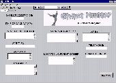
This is the perfect computer program for anyone into Ghost Hunting or any other types of hauntings. This program lets you record detailed information such as: DATE OF OCCURANCE, TIME OF OCCURANCE, LOCATION, Gps INFO, HISTORY LOCATION, TELEPHONE NUMBERS, NOTES, COMMENTS, SIGHTING INFO, SOUNDS, ODORS, TEMPERATURE ANOMALIES, and more. This program features: Unlimited number of...
Category: Business & Finance
Publisher: RB59.com Software, License: Shareware, Price: USD $9.99, File Size: 970.4 KB
Platform: Windows


 Freeware
GPS Converter will convert GPS coordinates between three different formats: 34. 26965, -116.
76783; N 34° 16. 179', W 116° 46. 07'; and N 34° 16' 10.
Category: Home & Education / Sports
Publisher: ALMSys, Inc., License: Freeware, Price: USD $0.00, File Size: 929.9 KB
Platform: Windows

