Free Downloads: Convert Picture To Esri
PDAT Classic/SE (CLSE) is an Esri ArcMap™ Extension that provides the means to load PODS centerline and event data from from a PODS data model to a Esri route Shapefiles™ or Personal Geodatabase™ and into an enterprise Esri ArcSDE™ database.
Manage the spatial component of the data stored in PODS.
Category: Business & Finance / MS Office Addons
Publisher: Eagle Information Mapping, Inc., License: Demo, Price: USD $0.00, File Size: 131.8 KB
Platform: Windows
Arcv2CAD is an application that is able to convert ESRI shapefiles to AutoCAD DXF and DWG formats.
Arcv2CAD is an application that is able to Convert Esri shapefiles to AutoCAD DXF and DWG formats. This allows shapefiles to be read by virtually all CAD software, for example AutoCAD, MicroStation, CivilCAD, DesignCAD, SolidWorks, as well as numerous other Mapping and Graphics software, eg CorelDraw, Surfer, World Construction Set.
Category: Multimedia & Design / Media Management
Publisher: Guthrie CAD/GIS Software Pty Ltd, License: Shareware, Price: USD $224.91, File Size: 10.9 MB
Platform: Windows
This utility scans exe or dll files of your choosing and detects usage of .
This utility scans exe or dll files of your choosing and detects usage of .NET types released by Esri. It then generates a report of this usage for your review.
Among other things, you can use the information provided to verify that you are not using types from assemblies that require licenses beyond your target license level or to generate a list of types that you can...
Category: Utilities / Misc. Utilities
Publisher: Environmental Systems Research Institute, Inc., License: Freeware, Price: USD $0.00, File Size: 743.3 KB
Platform: Windows
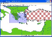
It`s a FREE Esri shape files (*.shp), MapInfo interchange (*.mif) and AutoCAD *.dxf viewer. Using this utility you can view *.shp files (Esri shape files), *.mif files (MapInfo interchange) and AutoDesk AutoCAD *.dxf. No other files are needed.
Category: Multimedia & Design
Publisher: Avangardo, License: Freeware, Price: USD $0.00, File Size: 420.9 KB
Platform: Windows
MapObjects—Java Edition 2 is the newest version of Esri's pure Java solution for the GIS Java developer.Support for additional file formats such as MrSID, CAD (DGN, DXG, and DWG), SDC, military formats, and much more.Support for Mac OS X and IBM AIX operating systems in addition to continued support for HP-UX, Linux, Solaris, and Windows.
MapObjects—Java Edition is...
Category: Software Development / Misc. Programming
Publisher: ESRI, License: Demo, Price: USD $0.00, File Size: 2.2 MB
Platform: Windows
ArcScripts is intended for the free exchange of scripts and tools related to ESRI software products.
ArcScripts is intended for the free exchange of scripts and tools related to Esri software products. Please alert the moderator if this script is a demo, trial-version, or an advertisement for a retail product.
New implementation of the toolbar, plus fixed an issue that was preventing the button from appearing for some users
Category: Home & Education / Miscellaneous
Publisher: ESRI, License: Freeware, Price: USD $0.00, File Size: 406.3 KB
Platform: Windows
CMSDialog offers an efficient solution for coding and displaying information with ESRI software.
CMSDialog offers an efficient solution for coding and displaying information with Esri software. Using drag-&-drop operations, you can create forms that feature standard Windows editing options such as drop-down lists, tab sheets, check boxes, radio groups, date pickers, hyperlinks and more.
Category: Utilities / Misc. Utilities
Publisher: Coulter Mapping Solutions Inc, License: Shareware, Price: USD $150.00, File Size: 4.1 MB
Platform: Windows
CAD2Shape converts AutoCAD DXF/DWG drawing files to ESRI shapefile format.
CAD2Shape converts AutoCAD DXF/DWG drawing files to Esri shapefile format. It can translate holes / islands /donuts from originating CAD drawing to Polygon shapefile. It can translate 3D surfaces to MultiPatch shapefile types.
The new version has MPolygon support and has additional XDATA types.
Category: Multimedia & Design / Image Editing
Publisher: Guthrie CAD/GIS Software Pty Ltd., License: Shareware, Price: USD $224.91, File Size: 10.7 MB
Platform: Windows
PDAT Graphics Engine (GE) is an ESRI ArcMap™ Extension that performs pipeline centerline edits.
PDAT Graphics Engine (GE) is an Esri ArcMap™ Extension that performs pipeline centerline edits.
PDAT GE is designed to manage pipeline geometries within ArcMap™ while supporting all facets of centerline coordinate modifications within the corresponding PODS database.
Category: Business & Finance / MS Office Addons
Publisher: Eagle Information Mapping, Inc, License: Demo, Price: USD $0.00, File Size: 1.0 MB
Platform: Windows
gSpatial Toolbar allows you to import, display and manipulate ESRI shapefile data in Google Earth.
gSpatial Toolbar allows you to import, display and manipulate Esri shapefile data in Google Earth. Annotate your data and perform thematic queries on your Excel spreadsheet data or ODBC data sources, visualize results in Google Earth
Category: Multimedia & Design / Graphics Viewers
Publisher: gSpatial, License: Freeware, Price: USD $0.00, File Size: 686.1 KB
Platform: Windows
 Freeware
Free Picture Converter is a powerful and 100% free batch Picture resize and Picture format conversion software that allow you resize and Convert your digital Picture in a few clicks! Feature: 1. Supports 5 different photo formats for conversion: jpg, bmp, gif, png, tiff. 2. Powerful resizing feature: supports maintain aspect ratio. 3. Batch processing...
Category: Multimedia & Design / Graphics Viewers
Publisher: www.freephotoconverter.com, License: Freeware, Price: USD $0.00, File Size: 976.7 KB
Platform: Windows
The PDMT Line Maintenance tool is designed to perform complex centerline maintenance operations on an APDM or PODS Esri Spatial pipeline centerline.
Allow for specific client customization of these models as needed using accepted ‘best-practices.
Supported database platforms including Oracle and Microsoft SQL Server.
Category: Business & Finance / MS Office Addons
Publisher: Eagle Information Mapping, Inc., License: Demo, Price: USD $0.00, File Size: 1.0 MB
Platform: Windows
This is a tool for converting CSV ("Comma Separated Value") files, or any delimited text files, into Esri Shapefiles, the format used by ArcMap and MapWindow. This software is open source under the MPL and was created using MapWinGIS. This tool works only with Net Framework 2.0.
Category: Multimedia & Design / Media Management
Publisher: Christopher Michaelis, License: Freeware, Price: USD $0.00, File Size: 47.8 MB
Platform: Windows
Freeware
Convert Esri ShapeFiles (.SHP) geolocation data into AnyMap format to be used with AnyChart. AnyChart Flash Map Converter allows making use of a wide choice of maps with AnyChart Flash Component, a GIS visualization system that recognizes map data in AnyMap format only. AnyChart Flash Map Converter makes it easy to visualize any geolocation data without hefty expenses associated...
Category: Web Authoring / Image Mapping Tools
Publisher: AnyChart.Com, License: Freeware, Price: USD $0.00, File Size: 1.6 MB
Platform: Windows
Shape2Earth Globe lets you quickly and easily capture Google Earth images for your personal use.
Shape2Earth Globe lets you quickly and easily capture Google Earth images for your personal use. Capture images for use in popular applications like Microsoft Office and Esri's ArcMap.
Shape2Earth Globe also saves the bounding box of the image in a kml file. This data is then used to generate a world file and projection file so that your image can be loaded into a GIS, such...
Category: Multimedia & Design / Multimedia App's
Publisher: Shape2Earth, License: Freeware, Price: USD $0.00, File Size: 402.5 KB
Platform: Windows
Easy to Convert video file like AVI, MPG, WMV, MKV, MOV, MP4, 3GP, RMVB to Picture files like JPG, GIF, BMP, TGA, TIF, PCX, Ico, etc. You can also capture single Picture from video. This process just need 3 steps: Load video > Select the output period > Run
Category: Multimedia & Design / Video
Publisher: Photo Watermark Software, License: Shareware, Price: USD $19.90, File Size: 5.6 MB
Platform: Windows
Shareware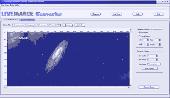
LiveImage Converter lets you convert your pictures smaller and easy for uploading and sharing.
LiveImage Converter lets you Convert Picture files easily, especially when you want to make your Picture size smaller or cut only a part of Picture. When you take pictures by the digital camera, you may have noticed that the sizes of pictures are very large. Most of the time you don't need to use the large pictures, especially when you want to send the pictures...
Category: Multimedia & Design / Image Editing
Publisher: LivePIM Software, Inc., License: Shareware, Price: USD $19.95, File Size: 773.6 KB
Platform: Windows
TIGOR is an integrated data product that gives you all the layers of the 2006 First Edition TIGER/Line® in Esri® Shapefile format! TIGOR files are regrouped in one database per state. Each database contains compressed version of TIGER/Lines data which can be viewed and exported as shapefiles (125,000 layers for all 56 databases). TIGOR Databases are: * Highly Compressed *...
Category: Home & Education / Miscellaneous
Publisher: Nextractor Inc., License: Shareware, Price: USD $39.99, File Size: 2.7 MB
Platform: Windows
ArcScripts is intended for the free exchange of scripts and tools related to ESRI software products.
ArcScripts is intended for the free exchange of scripts and tools related to Esri software products. Please alert the moderator if this script is a demo, trial-version, or an advertisement for a retail product.
Akin to the GRIDSPOT AML in workstation ArcInfo, this VB tool overlays a point shapefile or point coverage on a raster layer and assigns the value of the raster to...
Category: Multimedia & Design / Multimedia App's
Publisher: Dan Rathert, License: Freeware, Price: USD $0.00, File Size: 7.4 KB
Platform: Windows
Shape Viewer is a free tool, which you can use to view ESRI Shape files.
Shape Viewer is a free tool, which you can use to view Esri Shape files.
Shape Viewer can open (.shp) files that contain the geometry information of the shape file.With Shape Viewer you can also create new (.shx) file, and new empty (.dbf) file for your shape file.
If you have hundreds of shape files, and you want to view their contents rapidly, and you don't want to...
Category: Multimedia & Design / Graphics Viewers
Publisher: Mohammed Hammoud, License: Freeware, Price: USD $0.00, File Size: 35.0 KB
Platform: Windows
The PDMT Control Point Editor provides tools for creating and modifying control points stored in an APDM or PODS Esri Spatial geodatabase.
Included are tools for adding control points, graphically modifying a control point location, and adjusting the location/station value of a control point.
Category: Business & Finance / MS Office Addons
Publisher: Eagle Information Mapping. Inc, License: Demo, Price: USD $0.00, File Size: 1.0 MB
Platform: Windows
Want to quickly process numerous pictures for email or publishing on a web site? Then, the powerful and easy- to-use Picture Resizer Pro 2007 is the best choice for you. Not only you can resize pictures, but also make a basic Picture processing such as renaming pictures, rotating pictures, controlling Picture quality and finally creating a copyright watermarks over...
Category: Multimedia & Design
Publisher: Picture-Resizer.com, License: Shareware, Price: USD $29.95, File Size: 1.9 MB
Platform: Windows
InstantAtlas™ DeskTop, a product developed by GeoWise and which you can buy from Esri (UK), enables information analysts and GIS professionals to create highly-interactive web solutions that combine statistics and GIS data to improve visualisation, enhance communication, and engage people in more informed decision making.
InstantAtlas DeskTop is quick and easy to use...
Category: Multimedia & Design / Multimedia App's
Publisher: GeoWise, License: Demo, Price: USD $0.00, File Size: 552.0 KB
Platform: Windows
Shareware
PDF to Picture Converter is a Windows application with a Command Line interface that allows you to easily Convert PDF document to lots of different image formats. PDF to Picture Converter is fast and easy to use, and the best tool for the job of converting PDF documents to images! PDF to Picture Converter features: 1. PDF to Picture Converter software...
Category: Business & Finance / Document Management
Publisher: http://www.imagepdf.com, License: Shareware, Price: USD $59.95, File Size: 5.1 MB
Platform: Windows
CoordTrans converts geographic coordinates between different coordinate systems.
CoordTrans converts geographic coordinates between different coordinate systems.
CoordTrans is very easy to use, and full of Wizards to help you with more complex tasks.
Convert between UTM, WGS84 and NAD27 / NAD83, and more... almost all projections and datums on Earth are supported. See complete list..
You can Convert single coordinates, or...
Category: Business & Finance / Business Finance
Publisher: Franson, License: Shareware, Price: USD $49.00, File Size: 6.5 MB
Platform: Windows