Free Downloads: Coordinates Calculation
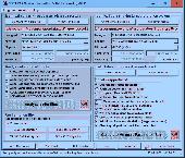
Cartesian Coordinates, spherical Coordinates und cylindrical Coordinates can be transformed into each other. (5 languages, 2 and 3 dimensions)
Category: Home & Education / Miscellaneous
Publisher: Greuer Andreas, License: Shareware, Price: USD $11.00, File Size: 993.3 KB
Platform: Windows
The Surface Area Calculator is a tool for easily calculating surface and planimetric areas, as well as volumes.
The extent and shape of the area in question are given in terms of the Coordinates of a number of points throughout the area.
These Coordinates can be specified as either latitude, longitude, and height, as GPS Coordinates (geocentric Cartesian...
Category: Business & Finance / Calculators
Publisher: Microsearch Corp, License: Shareware, Price: USD $134.00, File Size: 1.2 MB
Platform: Windows
SEVENPAR is a tool for the Calculation of highly exact transformation parameters for the Spatial Helmert and Molodensky Transformation, which make possible precise coordinate transformations from one reference system into another. The determined transformation parameters can be entered directly into suitable transformation software, e.g. TRANSDAT Coordinate Transformations, or into the...
Category: Home & Education / Science
Publisher: Killet GeoSoftware Ing.-GbR, License: Shareware, Price: USD $285.00, EUR240, File Size: 7.6 MB
Platform: Windows
Geodata International - World-wide database of countries with georeferenced towns, municipalities, postal codes and administrative units with WGS84 and UTM Coordinates and elevations for geocoding, proximity search, navigation, distance Calculation. Often is it necessarily, for an address characteristic, e.g. the place name or the postal code, to establish a local relationship - a...
Category: Software Development / Databases & Networks
Publisher: Killet GeoSoftware Ing.-GbR, License: Data Only, Price: USD $165.00, EUR150, File Size: 2.3 MB
Platform: Windows, Mac, Linux,
- Plot regular and parametric equations.
- Plot regular and parametric equations.
- Plot Coordinates tables.
Graphing Calculator 3D is an easy-to-use tool that plots 2D and 3D functions.
Graphing Calculator 3D features :
- Instant quick plotting after each key stroke.
- Cartesian/Polar Coordinates in 2D.
- Cart/Cylindrical/Spherical Coordinates in 3D.
- Inequalities in 2D...
Category: Home & Education / Mathematics
Publisher: Runiter Company, License: Shareware, Price: USD $49.95, File Size: 4.3 MB
Platform: Windows
SatCalc is a free software which calculates Azimuth and Elevation for geostationary satellites used for television broadcast.
Features include the Calculation of the LNB skew and Calculation of sun outage which occurs in spring and fall. The calculated data is presented graphically and can also be printed out and exported to HTML or CSV.
A list of...
Category: Business & Finance / Applications
Publisher: Martin Kirisits, License: Freeware, Price: USD $0.00, File Size: 1.6 MB
Platform: Windows
CoordTrans converts geographic coordinates between different coordinate systems.
CoordTrans converts geographic Coordinates between different coordinate systems.
CoordTrans is very easy to use, and full of Wizards to help you with more complex tasks.
Convert between UTM, WGS84 and NAD27 / NAD83, and more... almost all projections and datums on Earth are supported. See complete list..
You can convert single Coordinates, or...
Category: Business & Finance / Business Finance
Publisher: Franson, License: Shareware, Price: USD $49.00, File Size: 6.5 MB
Platform: Windows
Expandet calculation programme for validation of anchors in concrete.
Expandet Calculation programme for validation of anchors in concrete.
The programme offers possibilities for detailed anchor Calculation according to CC Method Design (ETAG 001, Annex C.)
The programme ensures: Quick overview and specific Calculation in PDF format, including all relevant information.
Category: Business & Finance / Calculators
Publisher: Expandet, License: Freeware, Price: USD $0.00, File Size: 14.5 MB
Platform: Windows
Aerial, topograhpic, and other types of maps are an important resource in the visualization of your information. HuntSmart big game hunting software gives you the ability to view your information on maps. Once you enter information with Coordinates into the system, this information can be viewed on all available maps that contain those Coordinates. One thing to remember is that...
Category: Multimedia & Design / Multimedia App's
Publisher: HuntingSouth, License: Shareware, Price: USD $0.00, File Size: 17.1 MB
Platform: Windows
DXF2XYZ converts a DXF file to an XYZ file, ie a comma delimited text file containing just xyz Coordinates. It can be useful for extracting the raw XYZ Coordinates from a DXF file containing say contours or other elevation entities.
This utility it limited to extracting the XYZ Coordinates from the following DXF entity types:
POINT, LINE, POLYLINE /...
Category: Business & Finance / Calculators
Publisher: H. Wind, License: Freeware, Price: USD $0.00, File Size: 657.6 KB
Platform: Windows
GoArrow displays an arrow on your screen that points towards coordinates that you specify.
GoArrow displays an arrow on your screen that points towards Coordinates that you specify. This is very handy if you have to run to Coordinates with obstacles in the way (like mountains), or if you're just directionally-challenged.
GoArrow has the ability to find a route between any two locations in Dereth, as well as look up locations' details from either the...
Category: Home & Education / Miscellaneous
Publisher: Digero of Leafcull, License: Freeware, Price: USD $0.00, File Size: 7.7 MB
Platform: Windows
The CooRecorder program is used for registration of coordinates taken from images.
The CooRecorder program is used for registration of Coordinates taken from images.
You can use your computer scanner to take interesting photos of things which can be placed on the top of your scanner. If the things are transparent and small, they can be taped up on transparent film and then inserted into a film scanner. An image scanned as a photo from such a thing can be...
Category: Home & Education / Science
Publisher: Cybis Elektronik & Data AB, License: Shareware, Price: USD $68.00, File Size: 0
Platform: Windows
Enventus has developed a set of calculation programs.
Enventus has developed a set of Calculation programs. The software allows any user to make a selection out of the products.
Eventus Calculation it is easy to use and can be installed on most standard PC's.
Enventus has developed thi program to include the possibility to make calculations of the products in your application. This program is a...
Category: Business & Finance / Calculators
Publisher: Enventus AB, License: Freeware, Price: USD $0.00, File Size: 954.4 KB
Platform: Windows
FlashPoints is a tool for creating and managing points Groups (topographic points for example). FlashPoints allows you to : * import/export points Coordinates from and to a file * create points and their attributes "Number", "Elevation" and "Description" by clicking * modify the points elevation * modify the height and rotation of the attributes * create...
Category: Multimedia & Design
Publisher: DeliCAD, License: Shareware, Price: USD $49.00, File Size: 1.2 MB
Platform: Windows
A new version calculation program to lighting calculations by EN 12464-1 standard.
A new version Calculation program to lighting calculations by EN 12464-1 standard.
Time of Calculation depends on number of luminaires, points and obstacles and Calculation setting; please, especially check value of Dimensions of areas; this value has no enormous fluence to precision, but to quality of view
Length dimension can be typed both in millimetres and...
Category: Home & Education / Miscellaneous
Publisher: ASTRA 92 a.s., License: Freeware, Price: USD $0.00, File Size: 2.4 MB
Platform: Windows
Do you have coordinates for some places of interest?
Do you have Coordinates for some places of interest? Do you want to find them on Earth's surface? There are more than 2,000 coordinate systems available to make Google Earth follow your interests! Plex.Mark! simply placemarks your world!
Have you found a place in Google Earth and you would like to have the Coordinates in your coordinate system? Plex.Mark! will now make...
Category: Internet / Browser Accessories
Publisher: Plexscape, License: Freeware, Price: USD $0.00, File Size: 601.9 KB
Platform: Windows
Free online calculation solitaire card game.
Free online Calculation solitaire card game. Win quickly, and play to beat your best online solitaire score. Calculation solitaire card game is playable directly out of your browser, without need to download. Calculation solitaire is like many other solitaire card games, but a little more difficult and a LOT more fun. Test your ability to predict the order of oncoming cards...
Category: Games / Cards, Casino, Lottery
Publisher: Solitaire Card Games, License: Freeware, Price: USD $0.00, File Size: 2.4 MB
Platform: Windows, Linux,
This program calculates the location of almost any tipe of locator.
This program calculates the location of almost any tipe of locator. It also calculates the distance, azimuth, longitude and latitude betweent two locators. The software converts latitude/longitude Coordinates to Maidenhead locators and vice versa. It converts IARU locator and longitude/latitude Coordinates ti UI-View format Coordinates.
Category: Home & Education / Miscellaneous
Publisher: ON6MU Group, License: Freeware, Price: USD $0.00, File Size: 367.8 KB
Platform: Windows
Geometric design and strength check of internal spur gear with straight and helical toothing.
Geometric design and strength check of internal spur gear with straight and helical toothing. Application is developed in MS Excel, is multi-language and supports Imperial and Metric units and solves the following main tasks: - Calculation of helical and straight toothing (internal). - Automatic design of a transmission with the minimum number of input requirements. - Design for entered...
Category: Multimedia & Design / Multimedia App's
Publisher: MITCalc, License: Shareware, Price: USD $24.00, File Size: 2.7 MB
Platform: Windows
 Demo
Demo
DXF Works is an application that allows to extract Coordinates and other various data from DXF files. You can choose which entities to process and which data to extract, creating your own file format. DXF Works can process several files at one time and lets save your settings in reusable configuration files. DXF Works can be used for several purposes : extracting Coordinates,...
Category: Multimedia & Design / Graphics Viewers
Publisher: DeliCAD, License: Demo, Price: USD $49.00, EUR49, File Size: 783.4 KB
Platform: Windows
TSC - Loan Calculation Software is a full featured loan Calculation software that will calculate your loans completely and precisely to the penny. With a simple user-friendly interface, TSC - Loan Calculation Software will display a graphical representation of where your payment is going, an integrated side-by side savings calculator and the yearly details of the loan....
Category: Business & Finance / Calculators
Publisher: TSCandDesign, License: Shareware, Price: USD $24.95, File Size: 2.1 MB
Platform: Windows
The VB Image Map OCX is an ActiveX Control designed to provide your applications with the ability to display interactive images. Hotspots, or specially designated areas on your image, can be defined that will react to various mouse events. It is easily integrated into your existing applications - just drop the control on a form, assign a background picture, and assign the hotspot...
Category: Software Development / Tools & Editors
Publisher: Silverband Software, License: Demo, Price: USD $49.95, File Size: 512.0 KB
Platform: Windows
TSC - Loan Calculation Software is a full featured loan Calculation software that will calculate your loans completely and precisely to the penny. With a simple user-friendly interface, TSC - Loan Calculation Software will display a graphical representation of where your payment is going, an integrated side-by side savings calculator and the yearly details of the loan....
Category: Business & Finance / Business Finance
Publisher: TSCandDesign, License: Shareware, Price: USD $14.95, File Size: 2.1 MB
Platform: Windows
Artificial lighting design program
Per standards
- EN 12464-1 - lightinf of indoow work places;
- ASSN EN 12464-1/Z1 - national addendum;
- EN 12193 - sports lighting;
- EN 13201 - road lighting;
- EN 1838 - emergency lighting;
Calculation methods
- universal point "division of sources" method for...
Category: Multimedia & Design / Multimedia App's
Publisher: ASTRA 92 a.s., License: Demo, Price: USD $0.00, File Size: 391.7 MB
Platform: Windows
The Balloon Browser recognizes and highlights geo-coordinates in web pages.
The Balloon Browser recognizes and highlights geo-Coordinates in web pages. Hovering over a recognized location advises another application to show a map of the corresponding area. For now the only program Balloon Browser can interact with is Google Earth.
Instead of waiting for the one true geo-notation and markup standard, Balloon Browser tries to parse a variety of common...
Category: Internet / Browsers
Publisher: Michael Krause, License: Freeware, Price: USD $0.00, File Size: 5.6 MB
Platform: Windows