Free Downloads: Distance And Route Mapping
Route Tracer is the application that allows you to trace the Route over the network between two systems, listing all the intermediate routers a connection must pass through to get to its destination. Route Tracer provides the physical geographical locations of network servers and routers. It shows the actual Route path on both the three-dimensional globe and the flat...
Category: Internet / Tools & Utilities
Publisher: MacSeal.COM, License: Shareware, Price: USD $25.00, File Size: 18.2 MB
Platform: Unknown
Free Satellite Maps is a free tool from Google which offers a satellite mapping service worldwide.
Free Satellite Maps is a free tool from Google which offers a satellite Mapping service worldwide.These are accompanied by a street service, a Route planner and information about business in almost all countries.In this way we can fly the world from satellite view or in birds eye.The level of detail is different depending on where you are located.Major cities have a very excellent...
Category: Home & Education / Science
Publisher: www.satelliteview-of-my-house.com, License: Freeware, Price: USD $0.00, File Size: 612.0 KB
Platform: Windows
 Shareware
Batch calculate Route distances, travel times, and/or estimated costs for point-to-point routes listed in a database (Access, Excel, or ODBC). Uses Microsoft MapPoint for point locations and Route calculations. Supports all of MapPoint's Route options including fastest routes, shortest routes, preferred roads, and straight lines (Great Circles). Start and end locations are...
Category: Business & Finance / MS Office Addons
Publisher: Winwaed Software Technology LLC, License: Shareware, Price: USD $75.00, File Size: 3.1 MB
Platform: Windows
SharewareThe RouteWriter add-in imports and exports waypoints for Microsoft MapPoint routes whilst maintaining their Route order. Although MapPoint can import and export waypoints as pushpins, their order is usually re-arranged. RouteWriter exports waypoints and their matching pushpins to Excel with their waypoint Distance, time, coordinate, address data, and all available pushpin...
Category: Business & Finance / Document Management
Publisher: Winwaed Software Technology LLC, License: Shareware, Price: USD $75.00, File Size: 3.0 MB
Platform: Windows
Super Route Manager is a comprehensive, fully integrated route management system.
Super Route Manager is a comprehensive, fully integrated Route management system. Developed for Windows system using either Microsoft's Access or SQL Server database, a SRM system represents the industry's most scalable package for AMUSEMENT, VENDING, and most any coin-operated Route operations. Whether you have five or five hundred locations, 100 or 10,000...
Category: Business & Finance / Business Finance
Publisher: Premier Data Software and SieCorp, License: Shareware, Price: USD $67.90, File Size: 10.2 MB
Platform: Windows
The Off-Route Data Acquiring software is designed to
download off-Route data from the STD-500/510/3300
instruments into a file on your computer.
Connect the data collector/analyzer to your
workstation.
-Load off-Route points you need.
-Select off-Route points of interest from the list.
-Save selected off-Route points...
Category: Business & Finance / Business Finance
Publisher: Technekon, License: Freeware, Price: USD $0.00, File Size: 5.3 MB
Platform: Windows
The five essential benefits:
PLAN ROUTES - Use real colour maps on a PC, Pocket PC or Smartphone to help you find your way. Simply click on the map to plan your Route and see leg Distance, compass bearing, journey length and estimated trip time. You can even visualise your routes in a continuous 3D landscape.
PRINT MAPS - Create and print...
Category: Home & Education / Miscellaneous
Publisher: Memory-Map, Inc., License: Shareware, Price: USD $0.00, File Size: 18.6 MB
Platform: Windows
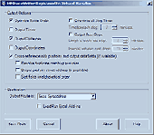
MyRouteOnline is an easy to use Route planner that that allows you to plan routes from Excel spreadsheet. Excel Add-in that uploads addresses and saves time, fuel and money by helping you map multiple locations and find the best Route. Online Route planning goes far beyond paper maps or a GPS system, it is the only way to find the optimal Route for your needs, giving...
Category: Business & Finance / Business Finance
Publisher: MyRouteOnline, License: Freeware, Price: USD $0.00, File Size: 3.1 MB
Platform: Windows
The MPRouteWriter add-in imports and exports waypoints for Microsoft MapPoint routes whilst maintaining their Route order. Although MapPoint can import and export waypoints as pushpins, their order is usually re-arranged. MPRouteWriter exports waypoints and their matching pushpins to Excel (or a text file) with their waypoint Distance, time, coordinate, address data, and all...
Category: Business & Finance / MS Office Addons
Publisher: Winwaed Software Technology LLC, License: Shareware, Price: USD $75.00, File Size: 3.3 MB
Platform: Windows
Maritime Software - Draft Survey, Lashing and Route calculations for Merchant Navy.
Maritime Software - Draft Survey, Lashing and Route calculations for Merchant Navy. User-friendly Draft Survey, Lashing Calculations and Route Planning software for Ships' Officers and Marine Surveyors. Mariners Office is easily operated using either Keyboard or Mouse. It complies with the latest UN ECE standards and MSC "Code of Safe Practice for Cargo Stowage and...
Category: Business & Finance / Applications
Publisher: MaritimeSoftware.com Inc., License: Shareware, Price: USD $149.95, File Size: 3.4 MB
Platform: Windows
Distance is a Windows-based computer package that allows you to design and analyze Distance sampling surveys of wildlife populations.
Distance evolved from program TRANSECT. However, Distance is quite different from its predecessor as a result of changes in analysis methods and expanded capabilities. The name Distance was chosen because it can be used to...
Category: Home & Education / Miscellaneous
Publisher: Research Unit for Wildlife Population Assessment, University of St Andrews, License: Freeware, Price: USD $0.00, File Size: 20.3 MB
Platform: Windows
Maritime Software - Draft Survey, Lashing and Route calculations for Merchant Navy.
Maritime Software - Draft Survey, Lashing and Route calculations for Merchant Navy. User-friendly Draft Survey, Lashing Calculations and Route Planning software for Ships' Officers and Marine Surveyors. Mariners Office is easily operated using either Keyboard or Mouse. It complies with the latest UN ECE standards and MSC "Code of Safe Practice for Cargo Stowage and...
Category: Business & Finance / Calculators
Publisher: MaritimeSoftware.com Inc., License: Shareware, Price: USD $149.95, File Size: 3.4 MB
Platform: Windows
Map Suite Winforms Edition is a powerful set of user controls enabling you to build compelling Mapping applications. Leveraging Microsoft's .NET framework, our APIs incorporate the latest technology to deliver ease of coding and intuitive streamlined interfaces. Developers using any .NET compatible language (VB.NET, C# ect...) can easily build Mapping applications with royalty...
Category: Software Development / Misc. Programming
Publisher: Spatially Aware, License: Demo, Price: USD $3995.00, File Size: 9.6 MB
Platform: Windows
A Windows based simulator to find the optimal route to the weather conditions and forecasts.
A Windows based simulator to find the optimal Route to the weather conditions and forecasts. According to one estimate Americans waste more than 65 billion dollars a year sitting in traffic. An efficient routing system is an indispensible tool for any delivery Route.
Manually routing your fleet even on a small scale is out of realm of human capacity and is best left...
Category: Multimedia & Design / Image Editing
Publisher: HouseOfAlgorithms, License: Freeware, Price: USD $0.00, File Size: 1.0 MB
Platform: Windows
Netpas Distance is a piece of software for those in the ship voyage business: ship agents and managers, cargo holders, charterers, and others. The utility will help them find ports on the map, see the Distance between different ports, track vessels, and manage voyages.
The utility includes more than 11000 ports, and a comprehensive table with distances, which includes...
Category: Business & Finance / Business Finance
Publisher: Seafuture Inc., License: Shareware, Price: USD $139.00, File Size: 24.6 MB
Platform: Windows
Streets On A Disk is full featured mapping software.
Streets On A Disk is full featured Mapping software. Streets includes the ability to overlay database or other custom information on the map, a professional map editor, and full search capabilities. Also featured is a router that can automatically create delivery groups, optimize a travel agenda, and give written travel directions (with Distance, time, fuel usage, etc.).
Category: Home & Education / Miscellaneous
Publisher: Klynas Engineering, License: Shareware, Price: USD $95.00, File Size: 2.3 MB
Platform: Windows
The program is intended to edit the network routes table. Visual TCP/IP Router has the convenient graphic interface for a new Route adding and for the deleting of any existent. It's very simple to create new or delete existent Route using the Visaul CP/IP Router. For adding select the connection type, addressable destination, network mask, metric (1 by default), select should this...
Category: Utilities
Publisher: TM Services, License: Freeware, Price: USD $0.00, File Size: 654.1 KB
Platform: Windows
Analyse your QTL experiments with interval Mapping, with the powerful MQM Mapping (=composite interval Mapping), or with a nonparametric method. MapQTL is easy to use, is very fast and presents the analysis results in tables and (adjustable) charts, that can be exported to MS-Windows text processing and presentation software.
Category: Business & Finance / Business Finance
Publisher: Kyazma B.V., Wageningen, Netherlands, License: Shareware, Price: USD $4534.00, File Size: 6.5 MB
Platform: Windows
Map Suite Desktop Edition is a powerful and feature-rich .NET Mapping control that enables C# and VB.NET software developers to build detailed desktop Mapping applications. Utilizing Microsoft's .NET Framework, the APIs for Map Suite Desktop Edition incorporate the very latest technology to deliver a powerful, user-friendly Mapping control. In addition, ease of coding and...
Category: Software Development
Publisher: ThinkGeo LLC, License: Commercial, Price: USD $4794.00, File Size: 28.4 MB
Platform: Windows
Track tropical storms and calculate closest point of approach from a certain Route.NavTools Stormtrack uses the same database as NavTools Route version 5 and will use voyages and routes constructed in NavTools Route, however it can be used as a stand-alone application.Version 5.09 is intended as a final beta test, please report any bugs or comments to support@navtools.nl or...
Category: Home & Education / Miscellaneous
Publisher: Andromeda Productions, License: Shareware, Price: USD $25.00, File Size: 2.1 MB
Platform: Unknown
Route Manager is a complete application that allows vending operators to easily manage and track every aspect of a vending operation. Track new and potential leads that become customers. Quickly place equipment in accounts and track the products, commissions and expenses for all your accounts. Route manager not only manages the standard Route information but has a built in...
Category: Business & Finance / Applications
Publisher: Nexphaze, License: Commercial, Price: USD $39.95, File Size: 1.1 MB
Platform: Windows
This tool allows to preview route files.
This tool allows to preview Route files. The camera can be moved, rotated and zoomed, you can jump to stations and points of interest, and also enable a series of options. If routes contain errors, a report can be optionally displayed.
A file that is passed as a command line argument is automatically opened at startup. If a CSV file is determined to be a CSV object instead...
Category: Multimedia & Design / Multimedia App's
Publisher: trainsimframework, License: Freeware, Price: USD $0.00, File Size: 171.3 KB
Platform: Windows
On proceeding to Cairo, the caravan took, for the first stage fromAdjeroud, a Route somewhat to the southward of that by which I had goneto Sinai, and joined the latter at Dar el Hamra. Six hours and a halffrom Adjeroud we passed Wady Khoeyfera [Arabic], the bed of a torrent,with trees growing in it, a very little below the level of thesurrounding plain. Here I saw the ruins of a small...
Category: Home & Education / Miscellaneous
Publisher: findassist.info, License: Freeware, Price: USD $0.00, File Size: 532.5 KB
Platform: Windows
OziExplorer is a flamboyant GPS Mapping Software that runs on the PC and works with varieties of GPS receivers such as Garmin, Lowrance, Magellan, Eagle, Brunton, Silva and MLR for the uploading or downloading the waypoints, routes and tracks and most brands of GPS receivers for real time tracking of GPS position.
Using this software, the user can use maps and charts that...
Category: Internet / Communications
Publisher: Des Newman, License: Shareware, Price: USD $95.00, File Size: 6.8 MB
Platform: Windows
Eye4Software GPS Mapping is a professional GPS Mapping software tool that can be used in numerous applications. Use the software to load, view and edit your maps, display your position realtime and record all your movements.
The software will work with almost any GPS and can be used on any desktop, laptop or needbook computer running Windows XP or higher. The...
Category: Home & Education / Miscellaneous
Publisher: Eye4Software B.V., License: Shareware, Price: USD $130.61, File Size: 14.6 MB
Platform: Windows