Free Downloads: Ecw Converter Ecw
ERDAS ER Viewer is a free, easy-to-use image viewer featuring interactive roaming and zooming with very large JPEG 2000 and Ecw files. It can also read most other common file types. Installing ERDAS ER Viewer also lets you embed large geospatial images in your Microsoft Word documents.
Category: Multimedia & Design / Graphics Viewers
Publisher: ERDAS, Inc., License: Freeware, Price: USD $0.00, File Size: 23.9 MB
Platform: Windows
ER Mapper Image Compressor - compressing, mosaicking and color balancing aerial and satellite images to JPEG 2000 and Ecw formats makes them manage, share and use in your business activities. ER Mapper Image Compressor is a flexible, high-speed geospatial image data compression application.
Main features:
-ER Mapper Algorithm (.alg)
-ER Mapper Raster...
Category: Multimedia & Design / Image Editing
Publisher: Earth Resource Mapping, License: Freeware, Price: USD $0.00, File Size: 33.5 MB
Platform: Windows
 Shareware
Total GIS Converter is an affordable Converter of GIS files. It converts AEP, GRD, ADF, E00, FLT, APR, SHP, DXF, BT, TOC, RT1, DEM, DLG, Ecw, IMG, DGF, GML, SID, MIF, TAB, WOR, DNG, DDF, BIL, TIF, JPEG, TTKPS, TTKGP, TTKLS, LFT, PFT, and TFT files. The target formats are TIFF, PNG, JPEG, BMP. The program can scale your GIS files to optimize their size. Besides, it...
Category: Multimedia & Design / Graphics Viewers
Publisher: Softplicity, License: Shareware, Price: USD $99.90, File Size: 7.6 MB
Platform: Windows
Solve the problems associated with handling large imagery datasets.
Solve the problems associated with handling large imagery datasets. The ERDAS Ecw/JP2 SDK allows software developers to enable rapid and efficient file handling in their applications by including robust support for selected wavelet compression formats and protocols.
Category: Software Development / Misc. Programming
Publisher: ERDAS, Inc., License: Freeware, Price: USD $0.00, File Size: 48.6 MB
Platform: Windows

OkMap is a GPS and map software that:
-Works with vectorial maps and calibrates raster maps
-Organizes paths by creating waypoints, routes and tracks
-Uploads/downloads data to/from your GPS
-Uses altitude DEM data
-Supports GPS real-time navigation
-Sends/receives vehicles position and display tracks on maps in real time
-Provides autorouting and geocoding...
Category: Business & Finance / Applications
Publisher: Gian Paolo Saliola, License: Freeware, Price: USD $0.00, File Size: 20.2 MB
Platform: Windows

OkCustomMap is a software to produce Garmin Custom Maps.
OkCustomMap is a software to produce Garmin Custom Maps.
Supports many map formats:
- OkMap
- Ecw
- GeoTiff
- World files
- OziExplorer
- GpsTuner
You can customize:
- The quality of the output JPEG images (0=Bad, 100=Good)
- The KML transparency (0=Transparent, 255=Opaque)
- The KML draw order (0=Invisible, 1-49=Under the vectorial...
Category: Business & Finance / Applications
Publisher: Gian Paolo Saliola, License: Freeware, Price: USD $0.00, File Size: 3.2 MB
Platform: Windows
LocalConnect is the included application for converting and uploading Vectors, Images, Maps, and Elevation to GISRoam.
LocalConnect includes tools to automatically convert your source data to GISRoam formats and projections in the following formats:
* Elevation in the form of DTED, DEM, ARCGrid, GEOTIFF, SRTM, XYZ Grid, and BIL.
* Imagery in the form of MRsid,...
Category: Internet / File Sharing
Publisher: Cogent3D, License: Freeware, Price: USD $0.00, File Size: 26.4 MB
Platform: Windows
Getmapping Viewer is an easy to use aerial photo and mapping viewer featuring interactive roaming, zooming, measuring tools and more.
Main features:
- Save imagery as TIFF, JPEG, BMP, ERS, and BIL directly from ER Viewer.
- View Ecw images served by an Image Web Server. See www.EarthEtc.com for demo images.
- View local images larger than...
Category: Multimedia & Design / Graphics Viewers
Publisher: Getmapping plc, License: Freeware, Price: USD $0.00, File Size: 3.4 MB
Platform: Windows
Freeware
VSceneGIS Desktop. (GIS) Analysis, Computing and Editing. Customer Project Development, Analysis, Computing and GIS editing. VSceneGIS Desktop applies the concept of Tree and Graph Topology to implement the data model in a GIS. Validation, Editing and Topological Behavior Export and import of data sources: PostgreSQL / PostGIS, Oracle, MySQL, SQLite / SpatiaLite, ShapeFile. Connection to...
Category: Home & Education / Science
Publisher: vscenegis.com, License: Freeware, Price: USD $0.00, File Size: 118.4 MB
Platform: Windows
ERDAS ER Mapper allows you to visualize, enhance and combine images for a broad array of applications. Extracting the quantitative information you need, ERDAS ER Mapper makes your data more meaningful to solve business problems.
This easy to use solution includes mosaic, color balancing, compression, geocoding and other image preparation wizards to simplify your workflow. With...
Category: Multimedia & Design / Graphics Viewers
Publisher: ERDAS, License: Shareware, Price: USD $0.00, File Size: 682.7 MB
Platform: Windows
OziExplorer is a flamboyant GPS Mapping Software that runs on the PC and works with varieties of GPS receivers such as Garmin, Lowrance, Magellan, Eagle, Brunton, Silva and MLR for the uploading or downloading the waypoints, routes and tracks and most brands of GPS receivers for real time tracking of GPS position.
Using this software, the user can use maps and charts that can be...
Category: Internet / Communications
Publisher: Des Newman, License: Shareware, Price: USD $95.00, File Size: 6.8 MB
Platform: Windows
CompeGPS is an essential software to make the most of your GPS. With this PC software you will be able to download a wide variety of cartography from the internet and also analyse your routes. This software has been specially designed for free flight and motor flight pilots they use GPS and likes to create and accomplish their own routes and then later on analyse. CompeGPS allows you to...
Category: Home & Education
Publisher: CompeGPS TEAM S.L., License: Shareware, Price: USD $106.00, File Size: 14.9 MB
Platform: Windows
CompeGPS is an essential software to make the most of your GPS. With this PC software you will be able to download a wide variety of cartography from the internet and also analyse your routes. This software has been specially designed for 4x4 lovers, bike tourists, excursionists and, in general, everyone who uses GPS, likes to create and accomplish their own routes and then later on...
Category: Home & Education
Publisher: CompeGPS TEAM S.L., License: Shareware, Price: USD $106.00, File Size: 14.9 MB
Platform: Windows
GeoVisu is a program that displays georeferenced data (images, graphics) and downloads data recorded by some GPS devices.
GeoVisu has a "Moving map" navigation function, which can be used with any NMEA 0183 compatible or Garmin USB GPS device.
Main features:
- Displays georeferenced image formats : GeoTiff, Ecw and ECWP, MrSID,...
Category: Multimedia & Design / Graphics Viewers
Publisher: GeoVisu, License: Freeware, Price: USD $0.00, File Size: 1.7 MB
Platform: Windows
Are you wasting too much time searching for a CAD files?
Are you wasting too much time searching for a CAD files? Etecad has an
effective and inexpensive CAD and graphic image organizer and viewer:
EtecadFile ManagerQuick View (EFM QV). EFM QV is a Windows CAD graphics file manager and viewer rolled in one. EFM is easy to learn and easy to use. It helps you:
- Locate, retrieve, view, and plot files quickly.
- Attach descriptions to files...
Category: Multimedia & Design / Multimedia App's
Publisher: Etecad, License: Shareware, Price: USD $69.00, File Size: 2.8 MB
Platform: Windows
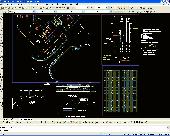
Architectural DWG Design for progeCAD AutoCAD DWG Clone, No learning curve for AutoCAD users.
Architectural DWG Design for progeCAD AutoCAD DWG Clone, No learning curve for AutoCAD users. Mechanical/Structural DWG Design for progeCAD AutoCAD DWG Clone, No learning curve for AutoCAD users. Get AutoCAD functionality for 1/10th the cost. Easily draw basic architectural design using walls, parametric windows, doors and more. Support for complex wall structures. Full library of room...
Category: Multimedia & Design / Multimedia App's
Publisher: iCADsales.com, License: Shareware, Price: USD $449.00, File Size: 198.8 MB
Platform: Windows
You will be able to enjoy many of CompeGPS Lands features such as waypoint and route creation and edition, full communication between PDA and GPS, use of maps and the moving map (real-time navigation). CompeGPS Pocket Land allows full communication between GPS and PDA (tracks, waypoints and routes). You will be able to create waypoints and routes, use maps and real-time navigation....
Category: Home & Education
Publisher: CompeGPS TEAM S.L., License: Shareware, Price: USD $76.00, File Size: 3.9 MB
Platform:
Architectural DWG Design for progeCAD AutoCAD DWG Clone, No learning curve for AutoCAD users.
Architectural DWG Design for progeCAD AutoCAD DWG Clone, No learning curve for AutoCAD users. Mechanical/Structural DWG Design for progeCAD AutoCAD DWG Clone, No learning curve for AutoCAD users. Get AutoCAD functionality for 1/10th the cost. Windows 7 32,Windows 7 64, Draw full residential or industrial circuit wiring, lighting, fire and safety, power distribution or telecommunications plans...
Category: Multimedia & Design / Multimedia App's
Publisher: iCADsales.com, License: Shareware, Price: USD $599.00, File Size: 198.8 MB
Platform: Windows
Are you wasting too much time searching for a CAD files?
Are you wasting too much time searching for a CAD files? Etecad has an effective CAD and graphic image organizer and viewer: Etecad File Manager (EFM). EFM is a Windows CAD graphics file manager and viewer rolled in one. EFM is easy to learn and easy to use. It helps you:
- Locate, retrieve, view, open, insert and plot files quickly.
- Attach descriptions to files and directories for easy...
Category: Multimedia & Design / Multimedia App's
Publisher: Etecad, License: Shareware, Price: USD $129.00, File Size: 8.1 MB
Platform: Windows
Shareware
Architectural DWG Design for progeCAD AutoCAD DWG Clone, No learning curve for AutoCAD users. Mechanical/Structural DWG Design for progeCAD AutoCAD DWG Clone, No learning curve for AutoCAD users. Get AutoCAD functionality for 1/10th the cost. Easily draw basic architectural design using walls, parametric windows, doors and more. Support for complex wall structures. Full library of room...
Category: Multimedia & Design / Graphics Viewers
Publisher: progeCAD USA / iCADsales.com, License: Shareware, Price: USD $350.00, File Size: 198.8 MB
Platform: Windows, Mac
IrfanView is a very fast, compact and innovative FREEWARE image viewer/Converter for Windows 9x/ME/NT/2000/XP/2003/Vista. IrfanView is fast and small, with extremely low system resources requirements. It is trying to be simple for beginners and powerful for professionals. Supported file formats: AIF, ANI/CUR, ASF, AU/SND, AVI, AWD, B3D, BMP/DIB, CAD formats, CLP, DDS, Dicom/ACR, DJVU,...
Category: Multimedia & Design / Graphics Viewers
Publisher: Irfan Skiljan, License: Freeware, Price: USD $0.00, File Size: 1.8 MB
Platform: Windows
Operational area:
With GERBING fotoalbum (fotos.
Operational area:
With GERBING fotoalbum (fotos.exe) you can look selectively for fotos or videos in a data base in which you have stored keywords and location. After the search in the data base you can display the found fotos or videos. At the installation a small example data base is laid out. Enlarging the example data base to your own data base is very simply possible with the tool...
Category: Multimedia & Design / Media Management
Publisher: Gerbingsoft, License: Shareware, Price: USD $0.00, File Size: 8.3 MB
Platform: Windows
Civil Survey AutoCAD Clone Software, no learning curve for AutoCAD users, Natively reads and writes AutoCAD DWG files, no need for conversion! Includes Data Colector File Import, COGO, Contours, DTM, Road Design, Sections and Profiles. low-cost alternative to otherwise high priced Land survey, coordinate geometry, digital terrain modeling, and corridor design software including working directly...
Category: Multimedia & Design / Multimedia App's
Publisher: iCADsales.com, License: Shareware, Price: USD $1399.00, File Size: 157.1 MB
Platform: Windows
Shareware
progeCAD IntelliCAD uses AutoCAD DWG files, no need for conversion. Windows 7 32,Windows 7 64, No learning curve for AutoCAD users. AutoLISP, VBA, ADS programming, import from PDF, Advanced Rendering, 3D ACIS Solid Modeling included. For architects, building kitchen and bath designers, civil, electrical, AEC, MEP and structural engineers, road, site and town planning etc. 2D and 3D CAD drawing...
Category: Multimedia & Design / Illustration
Publisher: progeCAD USA, License: Shareware, Price: USD $1725.00, File Size: 232.2 MB
Platform: Windows
Shareware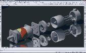
progeCAD IntelliCAD uses AutoCAD DWG files, no need for conversion. Windows 7 32,Windows 7 64, No learning curve for AutoCAD users. AutoLISP, VBA, ADS programming, import from PDF, Advanced Rendering, 3D ACIS Solid Modeling included. For architects, building kitchen and bath designers, civil, electrical, AEC, MEP and structural engineers, road, site and town planning etc. 2D and 3D CAD drawing...
Category: Multimedia & Design / Illustration
Publisher: progeCAD USA, License: Shareware, Price: USD $399.00, File Size: 252.6 MB
Platform: Windows