Free Downloads: Editing Raster Map
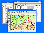
RxSpotlight for Windows is the next generation of raster and hybrid editing software.
RxSpotlight for Windows is the next generation of Raster and hybrid Editing software. Today most drawing information is stored on paper or aperture cards. By using scanning technology in combination with RxSpotlight for Windows, you can edit your drawings directly without having to convert them to a CAD format. RxSpotlight for Windows is an advanced program for Raster,...
Category: Multimedia & Design / Digital Media Editors
Publisher: Rasterex, License: Shareware, Price: USD $4302.35, File Size: 66.1 MB
Platform: Windows
TracTrix software provides a variety of other tools to assist CAD users with raster editing.
TracTrix software provides a variety of other tools to assist CAD users with Raster Editing. Open over 100 Raster formats and edit. Convert scans of drawings, logos, boards etc. in BMP, C4, CALS, TIFF, JPEG and other Raster formats to DWG, DXF, HPGL, IGES and EPS formats. With color separation, text recognition, clean-up and Editing tools.
...
Category: Multimedia & Design / Digital Media Editors
Publisher: Trix Systems AB, License: Shareware, Price: USD $865.00, File Size: 37.4 MB
Platform: Windows
Scan2CAD is a 2-in-1 Raster to Vector and PDF to CAD conversion.
Scan2CAD is a 2-in-1 Raster to Vector and PDF to CAD conversion.
It converts scanned drawings (Raster files including TIFF, JPEG, etc.) and PDF files (any type - Raster, vector or hybrid) into DXF files you can edit in your PC CAD, CNC or GIS program (vector).
Scan2CAD contains comprehensive Raster cleanup tools including tools for erasing areas of dirt,...
Category: Multimedia & Design / Image Editing
Publisher: Avia Systems Limited, License: Shareware, Price: USD $0.00, File Size: 0
Platform: Windows
With the CAD Studio's utility - GeoRefImg - you can automatically place georeferenced Raster files (pictures) also in AutoCAD or Architectural Desktop (this correlation functionality is by default available only in AutoCAD Map, Civil3D and Raster Design). GeoRefImg - georeferencing for AutoCAD and ADT - automatic repositioning of Raster images (with georeference...
Category: Multimedia & Design / Image Editing
Publisher: CAD Studio, License: Freeware, Price: USD $0.00, File Size: 55.3 KB
Platform: Windows
This program is a tool for stretching a bitmap image (a Raster image), trimming it to a box, and calibrating it. This is primarily of use when dealing with a scanned image of a paper Map. Often when making a scan it is hard to get the image precisely aligned; sometimes with old maps the paper has stretched. It can be useful where you want to make a tiled Map from a number...
Category: Multimedia & Design / Multimedia App's
Publisher: Map Library, License: Freeware, Price: USD $0.00, File Size: 755.8 KB
Platform: Windows
GraphicsGale is a software for editing raster format image.
GraphicsGale is a software for Editing Raster format image. You can retouch a photo, paint a picture, and so on. In addition, you can make an animation with seeing its preview in real-time. This feature must be useful for making an animated GIF or a video-game character.
Category: Multimedia & Design / Media Management
Publisher: HUMANBALANCE Co.,Ltd., License: Freeware, Price: USD $0.00, File Size: 1.6 MB
Platform: Windows
 Shareware
RasterStitch is a utility for putting together multiple Raster images (stitching). Use this program to create a panorama of several photographs or scan and join fragments of a paper document, which dimensions exceed the scanner workspace. For example, you can scan a draft of the A0 format with a desktop A4 (21x29 cm) scanner or scan a Map case of 50x50 cm by individual fragments...
Category: Multimedia & Design / Image Editing
Publisher: VextraSoft, License: Shareware, Price: USD $34.95, File Size: 6.3 MB
Platform: Windows
![MagicTracer [raster to vector converter] Screenshot](https://media.pcwin.com/images/thumbs/magictracer__raster_to_vector_converter_-350795.gif)
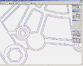
MagicTracer is a raster to vector conversion software for the Windows platform.
MagicTracer is a Raster to vector conversion software for the Windows platform. MagicTracer can turn Raster (bitmap) images into vector linework. With both Raster and vector tools, it is a versatile utility for image processing and vector cleanup. The vector convert tool guides you through the threshold and edge detection processes so better results can be easily obtained....
Category: Multimedia & Design / Multimedia App's
Publisher: Elgorithms, License: Demo, Price: USD $59.95, File Size: 9.7 MB
Platform: Windows
Shareware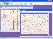
RasterStitch x64 is a utility for putting together multiple Raster images (stitching). Use this program to create a panorama of several photographs or scan and join fragments of a paper document, which dimensions exceed the scanner workspace. For example, you can scan a draft of the A0 format with a desktop A4 (21x29 cm) scanner or scan a Map case of 50x50 cm by individual...
Category: Multimedia & Design / Image Editing
Publisher: VextraSoft, License: Shareware, Price: USD $34.95, File Size: 2.6 MB
Platform: Unknown
MrImage is a win32 raster image editing application.
MrImage is a win32 Raster image Editing application. It is written in C++ using MFC and is based on CxImage. MrImage is open source and is released under the zlib license. It supports the following file formats: BMP, DIB, GIF (Graphics Interchange Format), ICO (Windows icon files), CUR (Windows cursor files), JBG (Joint Bi-level Image experts Group), JPG, JPEG.
Category: Multimedia & Design / Multimedia App's
Publisher: Matthew Page, License: Shareware, Price: USD $0.00, File Size: 1.2 MB
Platform: Windows
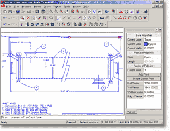
GTXImage CAD is a total Raster and vector drawing system for bringing paper drawings into a modern CAD, EDM or GIS environment. It includes powerful, industry standard two-dimensional CAD functionality that fully supports comprehensive hybrid Raster and vector capabilities. It also provides highly efficient Raster enhancement and Editing features that permit you to...
Category: Multimedia & Design / Image Editing
Publisher: GTX, License: Freeware, Price: USD $0.00, File Size: 248.0 MB
Platform: Windows
If you want to edit a Raster file in your CAD program, you first have to convert it to a vector file. AbleTracer does just that, transforming scanned paper drawings into a vector format. It looks like a typical graphics program, with toolbars and floating palettes, you can edit Raster image, vectorize it and edit the vector drawing. AbleTracer also offers TWAIN support for...
Category: Multimedia & Design / Image Editing
Publisher: AbleTracer Development, License: Shareware, Price: USD $79.95, EUR57.11, File Size: 2.4 MB
Platform: Windows
Freeware
If you want to edit a Raster file in your CAD program, you first have to convert it to a vector file. RasterVect does just that, transforming paper drawings or Raster images into a vector format. Raster images can be imported by scanning original paper drawings. There is TWAIN and WIA support for importing from all scanners. The target vector formats (DXF, WMF, EMF, EPS and...
Category: Multimedia & Design / Image Editing
Publisher: RasterVect Software, License: Freeware, Price: USD $0.00, File Size: 2.8 MB
Platform: Windows
Raster to Vector Converter SDK (DLL) is developed by DWGTool Software . It can convert Raster image into vector image, and output into dxf or text file. The format of Raster image include bmp, jpg, tiff, pcx and tga. It provides one main function and 12 parameter setting functions to complete the task. Please refer to the VB & VC sample to get the more detail of using...
Category: Multimedia & Design
Publisher: wang zhi xiang, License: Shareware, Price: USD $799.50, File Size: 432.5 KB
Platform: Windows
GIS ObjectLand is a universal Geographic Information System for Windows. Key features: - creation of vector-Raster maps with arbitrary structure of layers and feature types; - creation of themes. Theme is a user presentation of a Map; - control of displaying features depending on the chosen scale; - spatial data input and Editing by assigning feature coordinates and...
Category: Business & Finance
Publisher: Radom-T, License: Shareware, Price: USD $99.00, File Size: 24.0 MB
Platform: Windows
W3M Map Utilities is a tool for Editing maps, spells, graphics , actions , units and other things for warcraft 3. W3M Map Utilities includes : BLP Converter, Edit Button, BLP Viewer,
it has Fixed Map Detail Setting Bug, Added Remove Loading Screen, Convert to BLP in Change Loading Screen.
Category: Games / Misc. Games
Publisher: w3m.co.kr, License: Shareware, Price: USD $0.00, File Size: 0
Platform: Windows
Shareware
If you want to edit a Raster file in your CAD program, you first have to convert it to a vector file. RasterVect does just that, transforming Raster images or paper drawings into a vector format. Raster drawings can be imported by scanning original paper drawings. There is TWAIN and WIA support for importing from all scanners. The target vector formats (DXF, WMF, EMF, EPS...
Category: Multimedia & Design / Image Editing
Publisher: RasterVect Software, License: Shareware, Price: USD $79.95, EUR71.38, File Size: 23.2 MB
Platform: Windows

Raster to Vector is a stand-alone program that converts scanned drawings, maps and Raster images into accurate vector files (such as DXF, HPGL, WMF, EMF, etc) for Editing in any CAD application. Key Features: 1. Input image formats: BMP, JPG, TIF, GIF, PNG, PCX, TGA, RLE, JPE, J2K, JAS, JBG, MNG and more. 2. Output vector formats: DXF, HPGL, EMF, WMF and...
Category: Audio
Publisher: Raster to Vector, Inc., License: Shareware, Price: USD $99.00, File Size: 530.3 KB
Platform: Windows
Cool Flash Map Maker is a powerful Flash Map software for developing interactive flash mapping solutions and products for Real Estate, Spacial Statistics, Business Locator Applications, Vector USA Map,World Map, Germany Map,ASIA Map, Canada Map, Europe Map, Australia Map, Austria Map, Africa Map, UK Map, South...
Category: Multimedia & Design / Multimedia App's
Publisher: Go2Share, License: Shareware, Price: USD $29.95, File Size: 17.9 MB
Platform: Windows

Raster to Vector is a stand-alone program that converts scanned drawings, maps and Raster images into accurate vector files (such as DXF, HPGL, WMF, EMF, etc) for Editing in any CAD application. Key Features: 1. Input image formats: BMP, JPG, TIF, GIF, PNG, PCX, TGA, RLE, JPE, J2K, JAS, JBG, MNG and more. 2. Output vector formats: DXF, HPGL, EMF, WMF and...
Category: Audio
Publisher: Raster to Vector, Inc., License: Shareware, Price: USD $99.00, File Size: 546.9 KB
Platform: Windows

Raster to Vector is a stand-alone program that converts scanned drawings, maps and Raster images into accurate vector files (such as DXF, HPGL, WMF, EMF, etc) for Editing in any CAD application. Key Features: 1. Input image formats: BMP, JPG, TIF, GIF, PNG, PCX, TGA, RLE, JPE, J2K, JAS, JBG, MNG and more. 2. Output vector formats: DXF, HPGL, EMF, WMF and...
Category: Multimedia & Design
Publisher: Raster to Vector, Inc., License: Shareware, Price: USD $99.00, File Size: 546.9 KB
Platform: Windows
Shareware
Word to Raster Converter will be you good office helper when you need do file format conversion.
Word to Raster Converter enables users to convert several Word files to Raster images at one time. You can use Word to Raster Converter to set the image size and color depth for the output image files. Features of Word to Raster Converter: 1.All Windows systems are supported including both 32bit and 64bit. 2.Convert MS Office documents to PDF files in batch....
Category: Business & Finance / Business Finance
Publisher: VeryPDF.com Inc, License: Shareware, Price: USD $59.95, AED100, File Size: 9.2 MB
Platform: Windows
Raster to Vector Gold is a stand-alone program that converts scanned drawings, maps and Raster images into accurate vector files (such as DXF, HPGL, WMF, EMF, etc) for Editing in any CAD application. Key Features: 1. Input image formats: BMP, JPG, TIF, GIF, PNG, PCX, TGA, RLE, JPE, J2K, JAS, JBG, MNG and more. 2. Output vector formats: DXF, HPGL, EMF, WMF and...
Category: Multimedia & Design
Publisher: Raster to Vector, Inc., License: Shareware, Price: USD $99.00, File Size: 530.3 KB
Platform: Windows
Thuban is an Interactive Geographic Data Viewer with the following features:
- Vector Data Support: Shapefile, PostGIS Layer and OGR
- Raster Data Support: GeoTIFF Layer and GDAL
- Comfortable Map Navigation
- Object Identification and Annotation
- Legend Editor and Classification
- Table Queries and Joins
- Projection Support
-...
Category: Utilities / Misc. Utilities
Publisher: Intevation, License: Shareware, Price: USD $0.00, File Size: 772.9 KB
Platform: Windows
Font manager for TrueType and Raster fonts with Explorer-like interface with ZIP archives support.
Font manager for TrueType and Raster fonts with Explorer-like interface with ZIP archives support. Previewing, installing or uninstalling any font. Extracting from the font its characters Map and internal information about the font family, text metrics (height, width, weight, style, type, pitch...) copyrights, trademarks, supported character sets and much more.
Category: Multimedia & Design / Fonts
Publisher: Alex and Alex Soft, License: Shareware, Price: USD $0.00, File Size: 852.4 KB
Platform: Windows