Free Downloads: Elevation
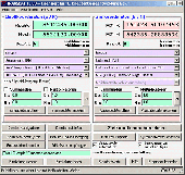
In the Dynamic Link Library GeoDLL geodesic functions like coordinate transformation, datum changes, meridian strip changes, user defined coordinate and reference systems, distance calculation, maps functions, Digital Elevation Models and more geodesic functions are contained to bind them into own applications. WINDOWS operating system allows building of function libraries intended for...
Category: Software Development
Publisher: Killet Softwareentwicklung GbR, License: Shareware, Price: USD $290.00, File Size: 999.9 KB
Platform: Windows
United States ZIP codes database one month subscription service. The database includes 3-Digit ZIP code, destination name, sectional center facility, area distribution center, 5-Digit ZIP code, city name, alias city name, state code, phone area code, city type, county name, country FIPS, time zone, day light saving flag, latitude, longitude, county Elevation, MSA, PMSA and Census 2000...
Category: Internet
Publisher: ZIPCodeWorld.com, License: Data Only, Price: USD $99.95, File Size: 289.1 KB
Platform: Windows, Linux, Palm, Unix, MS-DOS, AS/400, OS/2, Mac, OpenVMS
Geodata International - World-wide database of countries with georeferenced towns, municipalities, postal codes and administrative units with WGS84 and UTM coordinates and elevations for geocoding, proximity search, navigation, distance calculation. Often is it necessarily, for an address characteristic, e.g. the place name or the postal code, to establish a local relationship - a georeference....
Category: Software Development / Databases & Networks
Publisher: Killet GeoSoftware Ing.-GbR, License: Data Only, Price: USD $165.00, EUR150, File Size: 2.3 MB
Platform: Windows, Mac, Linux,
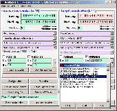
In the Dynamic Link Library GeoDLL geodesic functions like coordinate transformation, datum changes, meridian strip changes, user defined coordinate and reference systems, distance calculation, maps functions, Digital Elevation Models and more geodesic functions are contained to bind them into own applications. WINDOWS operating system allows building of function libraries intended for...
Category: Software Development
Publisher: Killet Softwareentwicklung GbR, License: Shareware, Price: USD $290.00, File Size: 999.9 KB
Platform: Windows
This map combines topographic mapping with road and tourist detail.
This map combines topographic mapping with road and tourist detail. The road information is clear and Elevation is shown using contours, spot heights and altitude shading. The map shows six different types of roads, highlighting scenic routes, places of interest, archaeological sites, monasteries, monuments and viewpoints.
Category: Home & Education / Miscellaneous
Publisher: Omni Resources, License: Shareware, Price: USD $21.99, File Size: 3.0 MB
Platform: Windows
Overview of Purpose: What is SpriteForge? SpriteForge is essentialy a tool for creating large numbers of 2D sprites from 3D models. You can 'photoraph' your model's animation frames (or simply it's static profile) from several different camera angles in just a few easy steps. Primarily designed for creating game sprites, spriteForge is also great for making 3D website graphics (ie spinning...
Category: Multimedia & Design
Publisher: D-Grafix, License: Shareware, Price: USD $16.00, File Size: 1.7 MB
Platform: Windows
In this game, you need to shoot free kicks.
In this game, you need to shoot free kicks. First, you need to set the angle of the shot, then you need to set the Elevation, and then you need to set the curvature, and finally you set the force of the shot. You need to set all these carefully so that yo
Category: Games / Sports
Publisher: novelgames.com, License: Freeware, Price: USD $0.00, File Size: 262.0 KB
Platform: Windows, Vista, 7 (32-Bit, 64-Bit)
VisualGPS incorporates many advanced features found in professional programs.
VisualGPS incorporates many advanced features found in professional programs. Its sole purpose is to display graphically specific NMEA 0183 sentences and show the effects of selective availability (SA).
Main Features:
- Azimuth and Elevation Graph - View all satellites that are in view. Each satellite identifies its pseudo random number (PRN) and its azimuth and...
Category: Home & Education / Miscellaneous
Publisher: VisualGPSLLC, License: Freeware, Price: USD $0.00, File Size: 1.7 MB
Platform: Windows
A powerful but very easy-to-use program for modeling and analyzing nearly any kind of antenna in its actual operating environment.
EZNEC plots azimuth and Elevation patterns; tells you gain, feedpoint impedance, SWR, and current distribution; finds and reports beamwidth, 3-dB pattern points, f/b ratio, takeoff angle, sidelobe characteristics; and more.
Category: Business & Finance / Applications
Publisher: Roy W. Lewallen, License: Shareware, Price: USD $89.00, File Size: 5.1 MB
Platform: Windows
The program runs on Autocad 2007/2008/2009 32bits, Autocad 2010 32bits, Autocad 2009 64bits, Autocad 2010 64bits, and BricsCAD v10.
Geographical information.- You can draw the DTM of all the world, because the program is compatible with SRTM format and it download the files by you and draws the result.
Professional.- It's not only a program to calculate a delaunay triangulation but you...
Category: Home & Education / Science
Publisher: Aplicaciones Topogr?ficas S.L., License: Freeware, Price: USD $0.00, File Size: 24.8 MB
Platform: Windows

The database includes total of 49 data fields which consists of:
ZIP Code, Classification, Primary Record, City, City Alias Name, City Type, Mailing Name, State, State FIPS, Latitude, Longitude, Elevation, Area Code, County Name, County FIPS, Time Zone, Day Light Saving, MSA, MSA Name, PMSA, PMSA Name, CSA, CBSA, CBSA Div, CBSA Type, CBSA Name, Region, Division, Population, Households...
Category: Web Authoring / Web Design Utilities
Publisher: IGEOCODE, License: Demo, Price: USD $45.95, File Size: 3.0 MB
Platform: Windows, Mac, Palm
Demonstrates high resolution imagery (0.
Demonstrates high resolution imagery (0.2 meters per pixel) and Elevation data (1.6 meters per pixel) served by the World Wind WMS, and visualized by the World Wind Java client. You can launch this application by using Java Web Start. It is a useful program for visualizing high resolution photos.
Category: Home & Education / Miscellaneous
Publisher: goworldwind, License: Freeware, Price: USD $0.00, File Size: 1.1 KB
Platform: Windows
TrainingPeaks WKO+ is the analysis software for coaches and athletes.
TrainingPeaks WKO+ is the analysis software for coaches and athletes. The desktop application is a powerful tool used to record and analyze individual workouts as well as fitness over time. Track your speed, pace, Elevation, distance and TrainingPeaks' trademark metrics: Training Stress Score (TSS), Running Training Stress Score (rTSS), Normalized Power (NP), Normalized Graded Pace...
Category: Home & Education / Health & Nutrition
Publisher: Peaksware, LLC., License: Shareware, Price: USD $129.00, File Size: 33.9 MB
Platform: Windows
StereoWorks is an easy to use yet powerful and intuitive tool to create 3D reconstruction surfaces from stereoscopic SEM images. The software is self-installing and requires no extra hardware to work.The software allows the user to make detailed Elevation maps from a pair of SEM images and obtain data such as height, area and roughness irrespective of the magnification.
Category: Multimedia & Design / Digital Media Editors
Publisher: LycoSoftware, License: Freeware, Price: USD $0.00, File Size: 2.2 MB
Platform: Windows
Coltop3D is a full featured LIDAR data processing and analyzing software for geologists.
Coltop3D is a full featured LIDAR data processing and analyzing software for geologists. It is designed for the interactive analysis of orientation of airborne and terrestrial LiDAR data and digital Elevation models (DEM) at local and regional scale. The software is capable of many applications; it is optimized for data visualization and structural analysis in different domains:
...
Category: Business & Finance / Applications
Publisher: Terranum, License: Shareware, Price: USD $2522.02, File Size: 3.7 MB
Platform: Windows
BfX is a tool for the sporting shooter who, from time to time, has to do some calculations.
BfX is a tool for the sporting shooter who, from time to time, has to do some calculations. BfX is accurate as long as the Elevation is between -15 and 15 degrees.
This is typically the case for a target shooter. This restriction allows one to make the so called flat fire approximation which results in mathematical formulas for bullet trajectories and stateless algorithms....
Category: Business & Finance / Database Management
Publisher: bfx, License: Demo, Price: USD $0.00, File Size: 813.8 KB
Platform: Windows
Solid Essential is Planit's entry level design for manufacturing software tool.
Solid Essential is Planit's entry level design for manufacturing software tool.
Offering cabinetmaker's the essentialsoftware tools for building cabinets, Solid Essential allows for room design & layout, plan, Elevation & 3D rendered views, generation of cabinet reports, cutlists, material & hardware requirements, plus basic estimating information
Category: Utilities / Misc. Utilities
Publisher: Planit Software Ltd., License: Shareware, Price: USD $995.00, File Size: 197.2 MB
Platform: Windows
Atlas DMT is a graphic interactive system for 3D surface modeling and visualization, featuring a special focus on terrain modeling.
Atlas DMT can process Elevation data (points, breaklines) from various sources - e.g., total stations, photogrammetry, digitized maps, proprietary formats (Kokes, Topol, Hydroinform) or text files (imported or prepared manually).
Category: Multimedia & Design / Image Editing
Publisher: Atlas, spol. s r. o., License: Shareware, Price: USD $0.00, File Size: 0
Platform: Windows
Mountain 3D is a virtual landscape generator software.
Mountain 3D is a virtual landscape generator software. It is based on fractal technology, and will create the relief, the forests, the ground, the rivers, and the sky with clouds. After creation, landscapes can be modified by a ground editor part of the the software. You can imagine a landscape and Mountain 3D will create it. It can also read DEM files for real ground Elevation files....
Category: Multimedia & Design / Digital Media Editors
Publisher: CJAIN, License: Shareware, Price: USD $14.00, File Size: 2.9 MB
Platform: Windows
HydroSHEDS is a mapping product that provides hydrographic information for regional and global-scale applications in a consistent format. It offers a suite of geo-referenced data sets (vector and raster) at various scales, including river networks, watershed boundaries, drainage directions, and flow accumulations. HydroSHEDS is based on high-resolution Elevation data obtained during a...
Category: Home & Education / Miscellaneous
Publisher: WWF-CSP, License: Freeware, Price: USD $0.00, File Size: 1.7 MB
Platform: Windows
"Ballistic Anatomic Trajectory" is a software dedicated to ballistic experts and police labs.
"Ballistic Anatomic Trajectory" is a software dedicated to ballistic experts and police labs.
Very easy to use, it will give you different trajectory angles in direction and Elevation. You will be able to see the body from every possible viewpoint, import another body model developed in a 3d modelling software. You will be able also to specify the exact body height and...
Category: Home & Education / Science
Publisher: Ballistic3D, License: Freeware, Price: USD $0.00, File Size: 8.8 MB
Platform: Windows
Increase your happiness by having this universal software affect your endorphin hormone (hormone of happiness). Become Happy slightly changes look and feel of your desktop, of all windows opened and all the music and sound playing, affecting your endorphin-hormone (the natural body's painkiller) release. This leads to mood Elevation, better health, and, finally, to becoming more happy !...
Category: Home & Education / Science
Publisher: BecomeHappy.com, License: Shareware, Price: USD $29.90, File Size: 336.0 KB
Platform: Windows
DXF2XYZ converts a DXF file to an XYZ file, ie a comma delimited text file containing just xyz coordinates. It can be useful for extracting the raw XYZ coordinates from a DXF file containing say contours or other Elevation entities.
This utility it limited to extracting the XYZ coordinates from the following DXF entity types:
POINT, LINE, POLYLINE / VERTEX, LWPOLYLINE
Category: Business & Finance / Calculators
Publisher: H. Wind, License: Freeware, Price: USD $0.00, File Size: 657.6 KB
Platform: Windows
EZNEC are powerful but very easy-to-use programs for modeling and analyzing nearly any kind of antenna in its actual operating environment. EZNEC plots azimuth and Elevation patterns; tells you gain, feedpoint impedance, SWR, and current distribution; finds and reports beamwidth, 3-dB pattern points, f/b ratio, takeoff angle, sidelobe characteristics; and more.
All...
Category: Business & Finance / Applications
Publisher: EZNEC, License: Shareware, Price: USD $99.00, File Size: 5.1 MB
Platform: Windows
SoftPlot is a graphical design program that makes it easy to drag-and-drop lighting fixtures, trusses, and other elements on the design surface. With this tool you can take a bird-eye's view and see your design in Plan, Cross Section, and Elevation views to make sure all your sight-lines and focuses are correct.
SoftPlot will also manage your paperwork from gel lists to...
Category: Multimedia & Design / Image Editing
Publisher: Stage Research, License: Shareware, Price: USD $0.00, File Size: 0
Platform: Windows