Free Downloads: Exif Editor Gps Mac
 Freeware
Since our Exif software for viewing Exif/IPTC/XMP data, editing and creating Exif/Gps data is integrated into the operating system, the programs give access to Exif information in most of applications.
Category: Multimedia & Design / Authoring Tools
Publisher: Two Pilots, License: Freeware, Price: USD $0.00, File Size: 5.4 MB
Platform: Windows
Shareware
Since our Exif software for viewing Exif, IPTC, and XMP data, and editing and creating Exif and Exif Gps data is integrated into the operating system, the programs give access to Exif information in most applications.Exif Farm Pro allows editing and creation of Exif and IPTC data forbatches of images directly in Windows Explorer.
Category: Multimedia & Design / Authoring Tools
Publisher: Two Pilots, License: Shareware, Price: USD $29.95, File Size: 5.1 MB
Platform: Windows
Shareware
A-PDF Photo Exif Editor a professional tool to view, edit, remove or create Exif (or metadata) data in images. As the best assistant to edit & modify images information for photographers, image pickers, A-PDF Photo Exif Editor allows to edit & modify all Exif data freely. With A-PDF Photo Exif Editor You can import/export Exif and...
Category: Multimedia & Design / Graphics Viewers
Publisher: A-PDF.com, License: Shareware, Price: USD $27.00, File Size: 2.1 MB
Platform: Windows
Freeware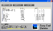
Detect and delete JPEG exif data with Easy Exif Delete, a freeware application from ConsumerSoft.
Detect and delete JPEG Exif data with Easy Exif Delete, a freeware application from ConsumerSoft. Exif data is a form of hidden metadata attached to jpeg (.jpg) images. This data can contain camera type, lens type, shutter speed and exposure, date and time, copyright information, author, programs used to edit the image, and even longitude and latitude for some photos...
Category: Utilities / File & Disk Management
Publisher: Consumer Software International, License: Freeware, Price: USD $0.00, File Size: 885.0 KB
Platform: Windows
Shareware
Exif Pilot Pro is Exif aditor that allows you to: - View Exif, Exif Gps and IPTC data. - Edit some Makernote tags. - Edit, create Exif, Exif Gps and IPTC data. - Import/export from/to XML format. - Import/export from/to MS Excel files. - Import/export from/to a text file in CSV format. - Edit batches of images. - Edit,...
Category: Multimedia & Design / Authoring Tools
Publisher: Two Pilots, License: Shareware, Price: USD $39.95, File Size: 2.4 MB
Platform: Windows
Freeware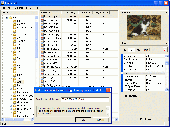
Edit, create, and view Exif data with Exif Pilot. This Exif Editor allows: - Viewing Exif, Exif Gps, IPTC, and XMP data. - Editing and creating Exif, Exif Gps and IPTC data. - Import/export from/to XML format. - Import/export from/to MS Excel files. - Import/export from/to Text file in CSV format. - Copy...
Category: Multimedia & Design / Authoring Tools
Publisher: Two Pilots, License: Freeware, Price: USD $0.00, File Size: 2.4 MB
Platform: Windows
Freeware
Right-click on your photos and view all Exif data. Easy to use utility that shows hidden data about your photos. Features: Exif 2 compliant, shows all Exif data, Gps coordinates, Works with Windows 7, Vista and XP, Easy-to-use application, just right-click on your JPEG photos and select properties.
Category: Multimedia & Design / Media Management
Publisher: Coder1 Software, License: Freeware, Price: USD $0.00, File Size: 412.0 KB
Platform: Windows

OziPhotoTool combines the technology of a Gps receiver and a digital camera to automatically keep a record of where digital photos were taken. It is designed to be used in conjunction with OziExplorer. Most digital cameras have Exif metadata stored as part of the photo. This includes is the date and time the photo was taken. Many Gps units have 'tracklogs'. The Gps...
Category: Utilities
Publisher: OziPhotoTool, License: Shareware, Price: USD $25.00, File Size: 14.3 MB
Platform: Windows
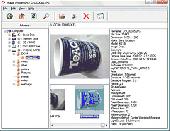
Exif Pilot Light allows you to view the EXIF, EXIF GPS and IPTC data. .
Exif Pilot Light allows you to view the EXIF, EXIF GPS and IPTC data.
Category: Multimedia & Design / Multimedia App's
Publisher: Two Pilots, License: Freeware, Price: USD $0.00, File Size: 1.6 MB
Platform: Windows
Shareware
This component helps you to manipulate Exif, IPTC and Gps information in JPEG and TIFF images plus known RAW formats (Canon CRW, Adobe DNG, Canon CR2, Fujifilm RAF, Minolta MRW, Nikon NEF, Pentax PEF, Sony ARW and Sony SR2). You can Change/Read/Write ALL Exif or IPTC fields in JPEG images. The component is useful for web-designers, hosting company and programmers, which...
Category: Software Development / ActiveX
Publisher: Watermarker.com, License: Shareware, Price: USD $49.95, File Size: 1.4 MB
Platform: Windows
Opanda PowerExif is a professional tool to edit Exif data in images.
Opanda PowerExif is a professional tool to edit Exif data in images. As the best assistant to edit & modify images information for photographers, image pickers, PowerExif allows to edit & modify all Exif data freely. Not only you could manage and record photographic data and Gps data of images, but also you could keep maxium 60,000 characters as multi-language code...
Category: Multimedia & Design / Image Editing
Publisher: Opanda Studio, License: Shareware, Price: USD $89.99, File Size: 1.2 MB
Platform: Windows
Shareware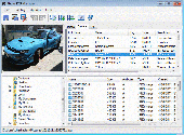
Photo Exif Manager Photo Exif Manager lets you read and edit Exif tags of many popular cameras. Photo Exif Manager lets you view and edit most well-known digital photo Exif tags. The edit capability extends to the more recent Gps tags too. All tags are listed in a table and grouped into three main groups Image, Camera, and Gps. Exif...
Category: Multimedia & Design / Digital Media Editors
Publisher: MIKLSOFT, License: Shareware, Price: USD $19.99, EUR17.99, File Size: 792.0 KB
Platform: Windows

X360 Exif & Tiff Tag Viewer ActiveX Control helps application developers to get all embed image information including Exif tags, TIFF tags and Gps tags. It allows you to write useful information back to Jpeg, Png and Tiff image. Also, you can use it as a simply image viewer ActiveX with many useful viewing functions such as flip, move, print, rotate, zoom-in and zoom-out...
Category: Software Development
Publisher: X360 Software, License: Shareware, Price: USD $49.90, File Size: 1.6 MB
Platform: Windows
Opanda IExif is a professional Exif viewer in Windows / IE / Firefox, From a photographer's eye, It displays the image taken from digital camera and every item of Exif data in the image from beginning to end. The user can learn about how and where to take the photo, what the camera's model is, the detail of photographer and more in IExif. You can know more information and some...
Category: Multimedia & Design / Graphics Viewers
Publisher: Lingoes Project, License: Freeware, Price: USD $0.00, File Size: 1.8 MB
Platform: Windows
Shareware
With AnyMP4 iPhone Gps Spoofer for Mac, you own one of the best Gps location spoofers for iOS devices. It lets you set the virtual Gps location within a few clicks. Whats more, you can play location-based games from anywhere in the world easily. Key Functions: 1. Fake yours iPhone location easily. AnyMP4 iPhone Gps Spoofer for Mac is an...
Category: Software Development
Publisher: AnyMP4 Studio, License: Shareware, Price: USD $9.96, File Size: 72.5 MB
Platform: Mac
Demo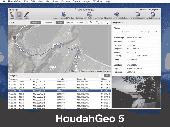
HoudahGeo is a photo geocoding and geotagging tool for Mac. Use HoudahGeo to attach Gps coordinates and location names to your photos. HoudahGeo writes Exif and XMP geotags to JPEG and RAW image files. This creates a permanent record of where a photo was taken. Just like a Gps-enabled camera. HoudahGeo is the only application that can both write future-proof...
Category: Multimedia & Design / Media Catalogers
Publisher: Houdah Software s.à r.l, License: Demo, Price: USD $39.00, File Size: 22.9 MB
Platform: Mac
Shareware
Sometimes, when we want to change the Gps location, we need to use location changer. If you are looking for an easy-to-use location changer, you could have a try with Aiseesoft AnyCoord for Mac. It is can help you change your location simply. Key functions: 1. Change Gps location As a powerful location changer, Aiseesoft AnyCoord for Mac enables you to...
Category: Utilities / Network
Publisher: Aiseesoft Studio, License: Shareware, Price: USD $9.56, File Size: 71.9 MB
Platform: Mac
is an easy to use and powerful Images manager and Photos Organizer, IPTC and Exif tag Editor and viewer. You can quickly and easily organize your photos collection, and complete the tag information for each and every file with all the best tools available. Some of these tools include filtering the view of files to work on by file type or all at once, renaming files according to...
Category: Multimedia & Design
Publisher: SoftArtStudio, License: Freeware, Price: USD $0.00, File Size: 1.9 MB
Platform: Windows
FREE GPS Software for your Garmin, Magellan or Lowrance GPS.
FREE Gps Software for your Garmin, Magellan or Lowrance Gps.
EasyGPS is the fast and easy way to upload and download waypoints, routes, and tracks between your Windows computer and your Garmin, Magellan, or Lowrance Gps. EasyGPS lists all of your waypoints on the left side of the screen, and shows a plot of your Gps data on the right. Use EasyGPS to back up...
Category: Internet / Communications
Publisher: TopoGrafix, License: Freeware, Price: USD $0.00, File Size: 3.9 MB
Platform: Windows
GPS-CCD:is a novel computational program for the
Prediction of Calpain Cleavage Sites.
Gps-CCD:is a novel computational program for the
Prediction of Calpain Cleavage Sites.
The online service and local packages of Gps-CCD 1.0 were
implemented in JAVA/. For the online service, we tested the Gps-CCD1.0 on a variety of internet browsers, including Internet Explorer 6.0, Netscape Browser 8.1.3 and Firefox 2 under the Windows XPOperating System...
Category: Web Authoring / JavaScript
Publisher: The CUCKOO Workgroup, License: Freeware, Price: USD $0.00, File Size: 19.2 MB
Platform: Windows
My Gps Logger 1.01 is a program designed to be used with My Fuel Tax 4.0. With My Gps Logger you can log all the locations where your truck has been to a monthly data file. This data file can later be imported into My Fuel Tax 4.0 by calculating the miles in state using Microsoftâ Mappoint. This is what you will need to use My Gps Logger with My Fuel Tax:a laptop with...
Category: Home & Education / Miscellaneous
Publisher: Spinnaker Software Solutions, License: Freeware, Price: USD $0.00, File Size: 477.7 KB
Platform: Windows
This is a utility designed to read EXIF information of JPEG images captured by camera phones.
This is a utility designed to read Exif information of JPEG images captured by camera phones. Several information that can be read using this utility are: file name, file size, phones brand, phones model, date and time, orientation, exposure, exposure program, Fstops, shutter speed, aperture, iso speed, pixelXdimensions, pixelYdimension, X resolution, Y resolution, metering mode,...
Category: Multimedia & Design / Graphics Viewers
Publisher: ExifCameraPhones.Com, License: Freeware, Price: USD $0.00, File Size: 738.3 KB
Platform: Windows
VisualGPSXP is a general purpose utility for monitoring the output of a GPS receiver.
VisualGPSXP is a general purpose utility for monitoring the output of a Gps receiver. Using the NMEA data from the Gps receiver, VisualGPSXP will display various statuses graphically.
Tools such as a survey utility average the position and shows accuracy of the Gps receiver in a static application.
Main features:
- Multiple connection...
Category: Home & Education / Miscellaneous
Publisher: VisualGPC, License: Shareware, Price: USD $25.00, File Size: 1.1 MB
Platform: Windows
With PixGPS it's easy to track the exact positioin where you took your photos.
With PixGPS it's easy to track the exact positioin where you took your photos. You need a Gps Receiver. All you need to do is to have the Gps turned on when you ake the photos. After your photo session, download the photos from your camera and the track file from the Gps. PixGPS will calculate the position of each photo and insert this in the Exif data of each...
Category: Multimedia & Design / Multimedia App's
Publisher: BR Software, License: Shareware, Price: USD $0.00, File Size: 1.5 MB
Platform: Windows
Create Gps enabled geo maps directly on the background of aereal photos and road maps from the internet. Import geodata from Google-Earth, OpenStreetMap, Gps tracks and Gps logger. Map Editor , manually digitizing. Specifical graphical objects (borderlines, borderareas) to guarantee exact same borders of neighbour areas..Screen calibration for true to display on the...
Category: Multimedia & Design / Digital Media Editors
Publisher: GPSur Dr. Erhard Regener, License: Shareware, Price: USD $65.00, File Size: 6.4 MB
Platform: Windows