Free Downloads: Gcc Countries Navigation Maps
xGPS Manager is a must-have tool for iPhone owners.
xGPS Manager is a must-have tool for iPhone owners. It is a desktop application that talks nice to iPhone application xGPS, which is a Maps and Navigation tool for iPhones. This desktop application allows you to carry out certain tasks that are harder to do on iPhone.
For example, you can manage your Maps in the desktop application and sync them with the iPhone...
Category: Home & Education / Miscellaneous
Publisher: Xwaves, License: Freeware, Price: USD $0.00, File Size: 4.5 MB
Platform: Windows
 Shareware
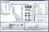
MTuner is a multi platform memory profiling and analysis tool supporting MSVC and Gcc compilers. Features include: entire time based history of memory activity, powerful filtering, SDK for manual instrumentation with source code, continuous integration support through command line usage, memory leak detection and much more, Profile any software targetting platforms with Gcc cross...
Category: Software Development
Publisher: RTM Tools, License: Shareware, Price: USD $299.00, File Size: 9.8 MB
Platform: Windows
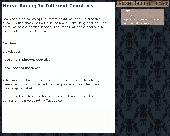
Learn about various types of horse racing in different countries in this informative eBook.
Learn about various types of horse racing in different Countries in this informative eBook. In this eBook you will also learn about the rising popularity of horse racing and betting in various Countries along with various events such as the Kentucky derby, Melbourne Cup, Prix de l'Arc de Triomphe and Japan.
All of the sections in the eBook are listed as...
Category: Games / Cards, Casino, Lottery
Publisher: Horse Betting Tactics, License: Freeware, Price: USD $0.00, File Size: 1.8 MB
Platform: Windows
It's a software for making landscape CG or amuzing 3D maps.
It's a software for making landscape CG or amuzing 3D Maps. You can render a beatiful landscape CG on your PC. You can use USGS's DEMs, Grayscale Bitmaps and so on. You can know which mountain you can see from your home.
Support for:
- 3D Navigation by GPS Receiver.
- Full-Raytracing rendering and Z-Buffer rendering.
- rendering clouds,...
Category: Multimedia & Design / Image Editing
Publisher: SUGIMOTO Tomohiko, License: Freeware, Price: USD $0.00, File Size: 5.1 MB
Platform: Windows
You will be able to enjoy many of CompeGPS Lands features such as waypoint and route creation and edition, full communication between PDA and GPS, use of Maps and the moving map (real-time Navigation). CompeGPS Pocket Land allows full communication between GPS and PDA (tracks, waypoints and routes). You will be able to create waypoints and routes, use Maps and...
Category: Home & Education
Publisher: CompeGPS TEAM S.L., License: Shareware, Price: USD $76.00, File Size: 3.9 MB
Platform:
With Country Locator you can scroll down a list of Countries and select the one whose location you want to know. The 3D globe will then rotate and zoom-in and find the country ! Pretty soon you will be visualizing the location of all the Countries of the world. You will notice the relative size of different Countries. Of course, not every significant place is a country....
Category: Home & Education / Miscellaneous
Publisher: DV Software, License: Shareware, Price: USD $0.00, File Size: 5.2 MB
Platform: Windows
think! Bubble Maps is a Windows tool for creating bubble Maps and capturing your thought. Using simple mouse click, drags and typing, your thoughts get put to paper (virtual), quickly and effectively.
The key feature of think! Bubble Maps is speed which makes it an excellent tool for live capture. You can use this program during meetings, workshops, and seminars.
Category: Multimedia & Design / Multimedia App's
Publisher: Lowrie Associates Ltd, License: Shareware, Price: USD $41.90, File Size: 5.9 MB
Platform: Windows
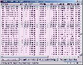
For many Countries house coordinates are present with coverage degrees upto 100 percent. The geo data offered here are in high-precision quality and are present in different coordinate and reference systems. House Coordinates or also called Geo Coded Building Addresses are meaning the connection between the postal addresses of buildings and their accurate positions. The house coordinates...
Category: Business & Finance
Publisher: C. Killet Software Ing.-GbR, License: Demo, Price: USD $1250.00, File Size: 111.7 KB
Platform: Unknown
Euratlas Periodis Expert is a database and a historical atlas of Europe with editing functions.
Euratlas Periodis Expert is a database and a historical atlas of Europe with editing functions. It describes the political status of Europe, North Africa and Near East at fixed intervals, from year 1 until year 2000.
Stress is put on the precise drawing of territories at one exact instant defined by fixed length intervals, that is the first day of each centennial year.
...
Category: Home & Education / Miscellaneous
Publisher: Euratlas, License: Shareware, Price: USD $77.80, File Size: 33.2 MB
Platform: Windows
MapComp is a powerful and free Windows Software for drawing images of linkage Maps and to compare linkage Maps and indicate common markers.
MapInspect can display, print and save images, and has no limit to the number of Maps it can compare (but only neighbouring Maps are compared). Maps can be flipped within MapINspect, an the on-screen order of...
Category: Multimedia & Design / Multimedia App's
Publisher: MapInspect, License: Freeware, Price: USD $0.00, File Size: 616.7 KB
Platform: Windows
Countries and Capitals provide a simple way to learn the location of different Countries and their capitals on the world map, as well as to see and memorize their flags. The program is extremely easy to use, which makes it a great choice for kids and adults alike. A virtual atlas will help you find your way on the map and locate the necessary country. You can also test your...
Category: Home & Education / Miscellaneous
Publisher: Geo4Kids, License: Shareware, Price: USD $17.95, File Size: 20.0 MB
Platform: Windows
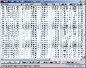
For many Countries street coordinates are present with coverage degrees upto 100 percent. The geo data offered here are in high-precision quality and are present in different coordinate and reference systems. Street coordinates or also called street section coordinates are meaning the summary of several postal house addresses to an averaged position on street or street section basis. The...
Category: Business & Finance
Publisher: C. Killet Software Ing.-GbR, License: Demo, Price: USD $625.00, File Size: 66.6 KB
Platform: Unknown
This software development kit (SDK) provides the binaries and programming reference for the Bing Maps Silverlight Control. You can use this control to build your own web sites that use Bing Maps.
The Bing Maps Silverlight Control combines the power of Silverlight and Bing Maps to provide an enhanced mapping experience. Developers can use the Bing...
Category: Utilities / Misc. Utilities
Publisher: Microsoft, License: Freeware, Price: USD $0.00, File Size: 3.8 MB
Platform: Windows
Representing a new concept in the field of Ham Maps, the Global Overlay Mapping System is packed full of features for all Ham Radio enthusiasts, including : 1 World Map, with specialised satellite images and world region-boundaries. 8 Continental Maps - Europe, Asia, Africa, North and South America, Oceania, Arctic, Antarctica. 29 Sub Continental Maps, with Single Click...
Category: Home & Education / Miscellaneous
Publisher: MapAbility, License: Freeware, Price: USD $0.00, File Size: 4.9 MB
Platform: Windows
Shareware
GPS Mapping Software for Windows, Loading topographic Maps, manage GPS devices and more. The software can be used with various map formats including: GeoTiff, BSB Nautical Charts, AutoCad DXF files, ESRI Shapefiles. Using calibration you can also use scanned or downloaded JPG, BMP, GIF, PNG and TIF Maps. The software can be used for survey, research, track and trace, real time...
Category: Home & Education / Science
Publisher: Eye4Software B.V., License: Shareware, Price: USD $75.04, EUR49, File Size: 6.7 MB
Platform: Windows
GPSMapEdit is an application designed for visual authoring of GPS-Maps in various cartographic formats: Polish format, Garmin MapSource, Lowrance MapCreate, Navitel Navigator (Navigation software for Windows Mobile, Android, Symbian, iPhone), ALAN Map 500/600, Holux MapSho, and custom POIs and speedcams.
The program may also load and convert GPS-tracks, waypoints and...
Category: Utilities / Misc. Utilities
Publisher: Konstantin Galichsky, License: Shareware, Price: USD $65.00, File Size: 2.4 MB
Platform: Windows
Macau GeoGuide PC version, developed and maintained by the Macao Cartography and Cadastre Bureau (DSCC), is an interactive map Navigation system running on desktop PC. The main functions are map Navigation, feature searching and path finding. The software contains rich geographic information and allows the users to explore and search for Macao Maps without connecting to the...
Category: Home & Education / Miscellaneous
Publisher: DSCC, License: Freeware, Price: USD $0.00, File Size: 29.5 MB
Platform: Windows
CyberDX-CW is a software simulation of an amateur radio station monitoring the world.
CyberDX-CW is a software simulation of an amateur radio station monitoring the world.
The user attempts to work all of the Countries in the world, using Morse code (CW). The Countries are the same as those defined by the ARRL DXCC program as of 9 May 2000 (currently 334 Countries). Only active Countries count for awards.
Category: Internet / Misc. Plugins
Publisher: B&B Cyber Software, License: Shareware, Price: USD $29.00, File Size: 2.6 MB
Platform: Windows
SensAct -SENSORS CONVERSION Maps AND ACTUATORS COMMAND Maps
This software pack contents the sensors conversion Maps and the actuators command Maps like motorized throttles, gasoline injectors corrections, ...
It is mandatory to install it to select the type of sensor and actuators that are equiping the ECUs, because these Maps are no longer...
Category: Business & Finance / Applications
Publisher: Skynam, License: Freeware, Price: USD $0.00, File Size: 3.4 MB
Platform: Windows
AtmanAvr is a high performance C/C compiler IDE for the Atmel AVR family of microcontrollers providing visual and modular programming that works with the Gcc compiler. AtmanAvr supports different Project Types for the production of C/C executable programs and libraries. An AtmanAvr workspace can contain multiple projects and their Debug and Release configurations.
The...
Category: Software Development / Misc. Programming
Publisher: Atman Electronics, License: Shareware, Price: USD $120.00, File Size: 20.4 MB
Platform: Windows
PlanetGIS Explorer is a free viewer for PlanetGIS maps and GIS exchange files.
PlanetGIS Explorer is a free viewer for PlanetGIS Maps and GIS exchange files. PlanetGIS Explorer allows you to navigate through Maps, query map elements and view attribute information from linked database tables. Also PlanetGIS Explorer allows you to customize the appearance of Maps for purposes of creating hardcopy printouts, but does not allow you to save any changes to...
Category: Multimedia & Design / Graphics Viewers
Publisher: Planet GIS, License: Freeware, Price: USD $0.00, File Size: 5.4 MB
Platform: Windows
The ICEbear adapter in conjunction with libbfemu, gdbproxy and the GNU toolchain (binutils, gdb, Gcc) is a cost effective and stable development tool for Blackfin hardware platforms.
Based on a USB 2.0 (1.1 compatible) connection to the host PC, the JTAG sequence generation happens on a JTAG controller with a extensive usage of software queueing to gain maximum transfer speed...
Category: Software Development / Misc. Programming
Publisher: section5, License: Shareware, Price: USD $190.76, File Size: 7.3 MB
Platform: Windows
With yalips maps you get 4 products in 1.
With yalips Maps you get 4 products in 1. You are more productive, more creative and perform better on your job when using visual software tools. With the resulting visualizations you can communicate more effectively and convincingly to your collegues, your boss, your customer or the chairman of the board. Therefore many companies spent a lot of money on such tools. Unfortunately, most...
Category: Business & Finance / Project Management
Publisher: yalips Software, License: Shareware, Price: USD $80.00, File Size: 29.6 MB
Platform: Windows