Free Downloads: Geo Data International Streets
For many countries street coordinates are present with coverage degrees upto 100 percent. The Geo Data offered here are in high-precision quality and are present in different coordinate and reference systems. Street coordinates or also called street section coordinates are meaning the summary of several postal house addresses to an averaged position on street or street section...
Category: Business & Finance
Publisher: C. Killet Software Ing.-GbR, License: Demo, Price: USD $625.00, File Size: 66.6 KB
Platform: Unknown

For the area of the Federal Republic of Germany more than 2,7 million street coordinates with a coverage of 100% are available. The Geo Data offered here are in high-precision quality and are present in different coordinate and reference systems. Street coordinates or also called street section coordinates are meaning the summary of several postal house addresses to an averaged...
Category: Business & Finance
Publisher: C. Killet Software Ing.-GbR, License: Demo, Price: USD $625.00, File Size: 68.4 KB
Platform: Unknown

For many countries house coordinates are present with coverage degrees upto 100 percent. The Geo Data offered here are in high-precision quality and are present in different coordinate and reference systems. House Coordinates or also called Geo Coded Building Addresses are meaning the connection between the postal addresses of buildings and their accurate positions. The...
Category: Business & Finance
Publisher: C. Killet Software Ing.-GbR, License: Demo, Price: USD $1250.00, File Size: 111.7 KB
Platform: Unknown
For many countries house coordinates are present with coverage degrees upto 100 percent.
For many countries house coordinates are present with coverage degrees upto 100 percent. The Geo Data offered here are in high-precision quality and are present in different coordinate and reference systems. House Coordinates or also called Geo Coded Building Addresses are meaning the connection between the postal addresses of buildings or building complexes and their...
Category: Business & Finance / Database Management
Publisher: C. Killet Software Ing.-GbR, License: Demo, Price: USD $1420.00, File Size: 234.0 KB
Platform: Windows
Streets On A Disk is full featured mapping software.
Streets On A Disk is full featured mapping software. Streets includes the ability to overlay database or other custom information on the map, a professional map editor, and full search capabilities. Also featured is a router that can automatically create delivery groups, optimize a travel agenda, and give written travel directions (with distance, time, fuel usage, etc.).
Category: Home & Education / Miscellaneous
Publisher: Klynas Engineering, License: Shareware, Price: USD $95.00, File Size: 2.3 MB
Platform: Windows
Streets Of Valhalla is an interesting shooting game.
Streets Of Valhalla is an interesting shooting game. Destroy enemy cars, face the Mafia, blow up cops, complete missions, and gain cash by killing enemy gangs and hostiles. Think Grand Flash Auto.
It's a cartoony ride through some very violent Streets. You have to be able to drive as well as you shoot to make it through this one. Arrow keys to move Mouse to aim...
Category: Games / Adventure & RPG
Publisher: NowStat, License: Freeware, Price: USD $0.00, File Size: 5.2 MB
Platform: Windows
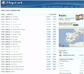
Zip Codes databases from most of the countries with all regions, cities, areas, districts, Streets, block numbers, latitude and longitude, area code, time zone and more. Tools and formulas to calcualte distance between postal codes and or coordinates. Format UTF-8 in TXT file comma separated for easy upload to any database system.
Category: Web Authoring / Web Design Utilities
Publisher: Mapanet, S de RL, License: Data Only, Price: USD $109.00, File Size: 120.0 KB
Platform: Windows
Welcome to the nanoworld of the Pixel Paradox universe of 2099 AD.
Welcome to the nanoworld of the Pixel Paradox universe of 2099 AD. Geo Gizmo is a pollution-free nanodevice that acts as a perpetual-motion machine to generate electricity from artificial gravitons in motion above a quantum energy plate, without any loss of kinetic energy. A constant electrostatic charge flows to the quantum energy plate, which can be linked to vast numbers of identical...
Category: Desktop Enhancements / Screensavers
Publisher: Pixel Paradox, License: Shareware, Price: USD $11.00, File Size: 1.7 MB
Platform: Windows
When posting a photo on your favorite Social Network, online photo gallery, or web page, you are inviting danger.Most smartphones and some cameras made today are equipped with Geo tags. Geo tags are imbedded in the picture and use the same concept as GPS.
The Geo tag in the photo is a smart tool that allows the photo to be tagged to an exact location. Unless you know...
Category: Security & Privacy / Other
Publisher: Geotag Security Software, Inc, License: Freeware, Price: USD $0.00, File Size: 2.2 MB
Platform: Windows
For the area of the Federal Republic of Germany more than 19 million House Coordinates with a coverage of 100% are available. The Geo Data offered here are in high-precision quality and are present in different coordinate and reference systems. House Coordinates are the cartographically representable positions of buildings, which are defined by their postal addresses. They are...
Category: Business & Finance
Publisher: C. Killet Software Ing.-GbR, License: Demo, Price: USD $1250.00, File Size: 111.7 KB
Platform: Unknown

For the area of the Federal Republic of Germany more than 19 million House Coordinates with a coverage of 100% are available. The Geo Data offered here are in high-precision quality and are present in different coordinate and reference systems. House Coordinates are the cartographically representable positions of buildings, which are defined by their postal addresses. They are...
Category: Software Development
Publisher: C. Killet Software Ing.-GbR, License: Demo, Price: USD $1250.00, File Size: 111.7 KB
Platform: Unknown
The Balloon Browser recognizes and highlights geo-coordinates in web pages.
The Balloon Browser recognizes and highlights Geo-coordinates in web pages. Hovering over a recognized location advises another application to show a map of the corresponding area. For now the only program Balloon Browser can interact with is Google Earth.
Instead of waiting for the one true Geo-notation and markup standard, Balloon Browser tries to parse a variety of...
Category: Internet / Browsers
Publisher: Michael Krause, License: Freeware, Price: USD $0.00, File Size: 5.6 MB
Platform: Windows
Successful on-site measurement, whether checking, staking or using machine control systems depends upon the preparation and integrity of the design Data. The software application used to prepare design Data for on-site measurement and machine control systems must maintain this integrity whether design Data comes in the form of a paper plan or a complete 3D digital model....
Category: Multimedia & Design / Image Editing
Publisher: SBG AB, License: Demo, Price: USD $0.00, File Size: 50.0 MB
Platform: Windows
GeoSetter is a freeware tool for Windows (XP or higher) for showing and changing Geo Data and other metadata (IPTC/XMP/Exif) of image files (e.g. images taken by digital cameras).
fEATURES:
- Reads and writes the formats JPEG and TIFF as well as camera RAW formats DNG (Adobe), CRW, CR2 and THM (Canon), NEF and NRW (Nikon), MRW (Konica Minolta), PEF (Pentax), ORF...
Category: Multimedia & Design / Media Management
Publisher: Friedemann Schmidt, License: Freeware, Price: USD $0.00, File Size: 18.8 MB
Platform: Windows
Create the GeoDatabase for the entire world. This program create the geographical location Latitude, Longitude, and Altitude (Elevation) for every city, village, region, state, county in the World. The program crawls the Data from the website www.heavens-above.com which collect Data from US Geological Survey for the USA (and dependencies) and The National Imaging and Mapping...
Category: Software Development
Publisher: Mewsoft, License: Freeware, Price: USD $0.00, File Size: 1.1 MB
Platform: Windows
Be sure to get it safely and effectively to the place you want.
Be sure to get it safely and effectively to the place you want. Whether you're following the traffic signs or instructions hastily printed from the website, it’s too easy to skip a turn or lose track of the street where he is or needs to be. The software for trip planning Streets & Trips 2009 makes planning your next trip is simple. We also help them find their destination...
Category: Audio / Utilities & Plug-Ins
Publisher: Microsoft, License: Shareware, Price: USD $0.00, File Size: 1.2 GB
Platform: Windows
Enter and enjoy this fighting game brought to you by SEGAbandonware.
Enter and enjoy this fighting game brought to you by SEGAbandonware. Roam the Streets and fight all the bad guys that are threatening you. Select one of the three characters and begin your adventure. Get out and seek revenge but keep a lookout for the police.
Category: Games / Arcade
Publisher: segabandonware, License: Freeware, Price: USD $0.00, File Size: 841.3 KB
Platform: Windows
This is a simple and yet reliable protection from accidentally accessing Internet websites located in at-risk geographical countries. Save your preferences into a file and load when you need it. 200+ countries and territories. It blocks all TCP/IP and UDP/IP traffic coming out/in from/to computer. Up until recently, the geographical blocking was only available to large companies with...
Category: Internet / Proxy Servers
Publisher: Verigio Communications, License: Shareware, Price: USD $24.95, File Size: 6.8 MB
Platform: Windows
How MobiAudit™ helps:
On-the-spot Data collection and submission
Data validation during entry
Instantaneous Data submission
Increased accuracy and efficiency of the shoppers
Geo-verification and time-validation of all answers
Seamless integration with the Shopmetrics™ mystery shopping platform
Category: Home & Education / Miscellaneous
Publisher: Research Metrics, LLC, License: Freeware, Price: USD $0.00, File Size: 2.4 MB
Platform: Windows
Panoply is a Java application which enables the user to plot raster images of Geo-gridded Data from netCDF datasets. Panoply is an utility that enable user to plot raster image. Depending on the Data, it can draw global longitude-latitude images or pole-t
Category: Multimedia & Design / Illustration
Publisher: giss.nasa.gov, License: Freeware, Price: USD $0.00, File Size: 9.4 MB
Platform: Windows, Mac, 2K, 2K3, Vista
Microsoft Streets & Trips with GPS Locator pairs the trip-planning features of Streets & Trips software with a compact, cable-free Global Positioning System (GPS) receiver.
This device plugs directly into your laptop and when used with Streets & Trips gives you spoken driving guidance plus automatic rerouting if you miss a turn, making it easier to...
Category: Home & Education / Miscellaneous
Publisher: Microsoft, License: Shareware, Price: USD $69.95, File Size: 1.2 GB
Platform: Windows
The MapSys Cadastral GIS offers specialized functionality for each stage of processing including the digital map creation, plotting cadastral and topographical plans, generating and combining Geo-referenced Data in order to obtain a validated relational Geo-database. This can be used in MapSys or in other GIS programs or database application.
Category: Home & Education / Teaching Tools
Publisher: GEOTOP, License: Freeware, Price: USD $0.00, File Size: 143.9 MB
Platform: Windows