Free Downloads: Geocoding
License: All | Free
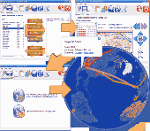
Geocoding Development Kit is a tool kit of software program, documentation and samples that are used for creating or customizing Geocoding rule bases. The Geocoding rule base is a collection of files that direct the Geocoding engine in how to standardize address data and match that data to the related location in the reference data.
This Geocoding...
Category: Utilities / Misc. Utilities
Publisher: Environmental Systems Research Institute, Inc., License: Freeware, Price: USD $0.00, File Size: 4.9 MB
Platform: Windows
EZ-Locate is an Internet-based Geocoding service that provides real-time access to the Tele Atlas address database and Geocoding technology. It is designed to let users enjoy the benefits of high volume batch Geocoding without the hassles or high price.
EZ-Locate Geocoding client software allows you to access our high-performance batch Geocoding...
Category: Internet / Misc. Plugins
Publisher: Tele Atlas, License: Freeware, Price: USD $0.00, File Size: 31.5 MB
Platform: Windows
Map Suite Geocode USA is a powerful and feature-rich .NET Geocoding engine that comes complete with a highly optimized dataset encompassing the entire United States. Map Suite Geocode USA features a fast, user-friendly .NET interface that enables C# and VB.NET software developers to take a United States address and quickly find its geographical location. In addition to Geocoding,...
Category: Software Development
Publisher: ThinkGeo LLC, License: Commercial, Price: USD $2394.00, File Size: 341.1 KB
Platform: Windows
Geocoding is the process of matching addresses to a point on the globe (latitude/longitude) and using that point against known regions.
In most cases those regions are census tracts, but they may also include counties or zip-codes. Once you have established regions where the points live within, you are able to link information to that point. You can call the results of this...
Category: Internet / Web Search Utilities
Publisher: QuestSoft Corporation., License: Shareware, Price: USD $395.00, File Size: 116.0 MB
Platform: Windows
This tool is downloaded and installed on your desktop.
This tool is downloaded and installed on your desktop. It geocodes a data table (i.e. table of addresses) from your local computer. The addresses in your table are encrypted and securely sent to their servers and geocoded. The Geocoding results are then sent back to Desktop Geocoder and added to your original table. This tool is secure and suitable for Geocoding confidential or...
Category: Security & Privacy / Other
Publisher: USC GIS Research Lab, License: Freeware, Price: USD $0.00, File Size: 4.2 MB
Platform: Windows
 Demo
Demo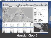
HoudahGeo is a photo Geocoding and geotagging tool for Mac. Use HoudahGeo to attach GPS coordinates and location names to your photos. HoudahGeo writes EXIF and XMP geotags to JPEG and RAW image files. This creates a permanent record of where a photo was taken. Just like a GPS-enabled camera. HoudahGeo is the only application that can both write future-proof GPS tags to original...
Category: Multimedia & Design / Media Catalogers
Publisher: Houdah Software s.à r.l, License: Demo, Price: USD $39.00, File Size: 22.9 MB
Platform: Mac
Panorado Flyer is a simple Geocoding tool for linking JPEG image files to the location where the picture was taken, using precise geographical coordinates. It can be lauched from the Windows Explorer's context menu. The coordinates of the place where the photo was taken are stored within the JPEG file in EXIF format - either manually or automatically from Google Earth. Later,...
Category: Multimedia & Design / Multimedia App's
Publisher: Karl Maloszek - Simple Software, License: Shareware, Price: USD $0.00, File Size: 223.5 KB
Platform: Windows
GeodesiX is an addin for Microsoft Excel which allows you to display maps, perform forward and reverse Geocoding, compute distances (Great Circle, driving, bicycling and walking) and verify your results in Google Maps, all within Excel.
The Geocode function returns geographic information, given the name of a place. Over 30 fields are provided (latitutude, longitude, postcode,...
Category: Multimedia & Design / Multimedia App's
Publisher: GeodesiX, License: Shareware, Price: USD $0.00, File Size: 0
Platform: Windows
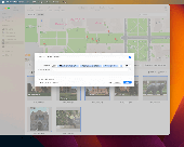
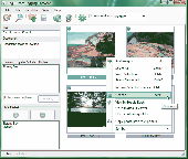
Photos Workbench is a companion application to Apple Photos on macOS. You can use Photos Workbench to browse your photos library: view albums, filter and sort photos, and organize photos into albums. Photos Workbench has unique capabilities to help you organize and find your photos: - Batch change titles. Give photos descriptive names -- Build names following a format. Example:...
Category: Multimedia & Design / Media Catalogers
Publisher: Houdah Software s.à r.l, License: Demo, Price: USD $29.00, File Size: 5.5 MB
Platform: Mac

OkMap is a GPS and map software that:
-Works with vectorial maps and calibrates raster maps
-Organizes paths by creating waypoints, routes and tracks
-Uploads/downloads data to/from your GPS
-Uses altitude DEM data
-Supports GPS real-time navigation
-Sends/receives vehicles position and display tracks on maps in real time
-Provides autorouting and Geocoding...
Category: Business & Finance / Applications
Publisher: Gian Paolo Saliola, License: Freeware, Price: USD $0.00, File Size: 20.2 MB
Platform: Windows
Geodata International - World-wide database of countries with georeferenced towns, municipalities, postal codes and administrative units with WGS84 and UTM coordinates and elevations for Geocoding, proximity search, navigation, distance calculation. Often is it necessarily, for an address characteristic, e.g. the place name or the postal code, to establish a local relationship - a...
Category: Software Development / Databases & Networks
Publisher: Killet GeoSoftware Ing.-GbR, License: Data Only, Price: USD $165.00, EUR150, File Size: 2.3 MB
Platform: Windows, Mac, Linux,
With GeoIPTC you will be able to read the IPTC city information in pictures and get the corresponding coordinates to your photos from several free services and embed this into the pictures in standard tags in a very professional way. You will also create sets of pictures with all the metadata they contain including geographical tags as KML or KMZ files for a quick view of the selection on map...
Category: Multimedia & Design / Media Catalogers
Publisher: SoftExperience, License: Shareware, Price: USD $112.00, File Size: 7.3 MB
Platform: Windows
The API is built on the Microsoft Silverlight platform which is integrated with Visual Studio 2010 and Expression Blend 4. The ArcGIS API for Silverlight enables you to create rich internet and desktop applications that utilize the powerful mapping, Geocoding, and geoprocessing capabilities provided by ArcGIS Server and Bing™ services.
To use the API, simply download and...
Category: Software Development / Misc. Programming
Publisher: ESRI, License: Freeware, Price: USD $0.00, File Size: 7.7 MB
Platform: Windows
Now you can link the individuals in your family tree to the powerful mapping capabilities of Google Earth. Automatically create Placemarks for events in the lives of individuals and view a path following the movements during their lifetime. Use the timespan slider feature of Google Earth to restrict the view to a period of history and watch your family's story unfold...Mapping your Ancestors is...
Category: Home & Education / Miscellaneous
Publisher: Integrated Earth, License: Shareware, Price: USD $20.00, File Size: 3.2 MB
Platform: Windows
iTag is a utility that allows you to easily add title, description and keyword tags to your digital photos. The data you enter is stored into the actual photo file itself - using the open standards of IPTC and XMP. Many applications can read and write the IPTC/XMP data, but iTag is especially powerful at editing a group of photos all at once. Geocoding your photos is also straight...
Category: Multimedia & Design / Media Catalogers
Publisher: iTag Software, License: Freeware, Price: USD $0.00, File Size: 576.9 KB
Platform: Windows
ERDAS ER Mapper allows you to visualize, enhance and combine images for a broad array of applications. Extracting the quantitative information you need, ERDAS ER Mapper makes your data more meaningful to solve business problems.
This easy to use solution includes mosaic, color balancing, compression, Geocoding and other image preparation wizards to simplify your workflow....
Category: Multimedia & Design / Graphics Viewers
Publisher: ERDAS, License: Shareware, Price: USD $0.00, File Size: 682.7 MB
Platform: Windows
Shareware
MyExifLibrary is fully managed .NET Framework easy-to-use library for .NET Framework 2.0 designed for reading, editing and saving the EXIF (Exchangeable Image File Format) data embeded in images taken from digital cameras. EXIF data can be both read and written or removed. Completely new EXIF data can also be added to images. Features: - written in fully managed .NET C# - reads and writes...
Category: Software Development / Components & Libraries
Publisher: SmartKite Software, License: Shareware, Price: USD $99.00, File Size: 792.5 KB
Platform: Windows
In the Dynamic Link Library GeoDLL geodesic functions like coordinate transformation, datum changes, meridian strip changes, user defined coordinate and reference systems, distance calculation, maps functions, Digital Elevation Models and more geodesic functions are contained to bind them into own applications. WINDOWS operating system allows building of function libraries intended for use by...
Category: Software Development
Publisher: Killet Softwareentwicklung GbR, License: Shareware, Price: USD $290.00, File Size: 999.9 KB
Platform: Windows
Geodata of the Federal Republic Germany with municipalities, postal codes, telefone preselections. Suitable for branch searches, periphery searches and distance computations. Georeferences as Gauss Krueger, UTM and Geographic Coordinates and also Ground Level Elevations. ORTREF: 12.500 geocoded cities and municipalities. ORTGEM: Allocation of 12.500 cities and municipalities to the localities....
Category: Business & Finance
Publisher: C. Killet Software Ing.-GbR, License: Demo, Price: USD $195.00, File Size: 313.3 KB
Platform: Unknown
License: All | Free