Free Downloads: Geodesy
License: All | Free
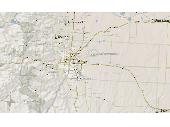
With Geodesy.NET, you can quickly and easily convert geographic coordinates from one system to another. Several hundred coordinate system conversions are supported, and all conversions can be done in under three lines of code. Full support is included for both desktops as well as mobile devices! This software is included FREE with any purchase of our GIS.NET 3.0 mapping component for...
Category: Software Development / Components & Libraries
Publisher: GeoFrameworks, LLC, License: Commercial, Price: USD $799.00, File Size: 123.7 MB
Platform: Windows,
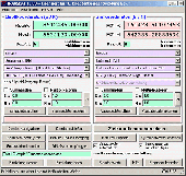
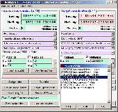
MOVE3 is a software package for the design, adjustment and quality control of 3D, 2D and 1D geodetic networks in compliance with the procedures of the "Delft School" of Geodesy. MOVE3 allows fully integrated processing of GPS and terrestrial observations.
Benefits:
- True 3D - No compromises
MOVE3 development started from the conviction...
Category: Business & Finance / Applications
Publisher: Grontmij, License: Demo, Price: USD $0.00, File Size: 12.6 MB
Platform: Windows
 Shareware
Java toolkit to add coordinate conversion functionality to your Java applications and applets. The toolkit offers functionality to perform map grid and datum transformations: latitude and longitude can be converted to various map grids, like Transverse Mercator (TM), Oblique Mercator, Mercator, Oblique Stereographic, Polar Stereographic, Cassini, Albers Equal Area Conal, Gauss Kruger or...
Category: Software Development / Components & Libraries
Publisher: Eye4Software B.V., License: Shareware, Price: USD $199.00, EUR179, File Size: 155.5 KB
Platform: Unknown
In the Dynamic Link Library GeoDLL geodesic functions like coordinate transformation, datum changes, meridian strip changes, user defined coordinate and reference systems, distance calculation, maps functions, Digital Elevation Models and more geodesic functions are contained to bind them into own applications. WINDOWS operating system allows building of function libraries intended for use by...
Category: Software Development
Publisher: Killet Softwareentwicklung GbR, License: Shareware, Price: USD $290.00, File Size: 999.9 KB
Platform: Windows
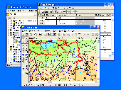
GIS ObjectLand is a universal Geographic Information System for Windows. Key features: - creation of vector-raster maps with arbitrary structure of layers and feature types; - creation of themes. Theme is a user presentation of a map; - control of displaying features depending on the chosen scale; - spatial data input and editing by assigning feature coordinates and also by interactive...
Category: Business & Finance
Publisher: Radom-T, License: Shareware, Price: USD $99.00, File Size: 24.0 MB
Platform: Windows
License: All | Free