Free Downloads: Gis Data Integration Schedule Flowchart
AvisMap Gis Engine is the basic development platform for AvisMap Gis suites, which is a new generation component Gis development platform for Gis application developers. AvisMap Gis Engine 5 provides powerful Gis functions through Active X controls based on Microsoft COM component technique standards. It allows users to rapidly develop professional...
Category: Multimedia & Design / Multimedia App's
Publisher: AvisMap GIS Technologies, License: Freeware, Price: USD $0.00, File Size: 60.5 MB
Platform: Windows
DIVA-GIS is a GIS for plant biodiversity analysis.
DIVA-Gis is a Gis for plant biodiversity analysis. The project will modernize the architecture for better collaboration and extensibility based on Eclipse RCP.
DIVA-Gis can be used to map and analyze biological distribution Data, such as can be provided by natural history collections and genetic resources collections. Typically, the distribution Data...
Category: Business & Finance / Business Finance
Publisher: International Potato Center (CIP), License: Freeware, Price: USD $0.00, File Size: 122.4 MB
Platform: Windows
 Shareware
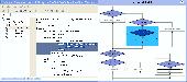
Code to Flowchart is designed to convert source code to Flowchart. It helps users to understand complex program structure by visual diagrams. Code to Flowchart is composed of 3 parts, Code Tree, Code Editor and Flowchart window. The Flowchart window is synchronal with the Code Editor. Click any logical box on the Flowchart, the corresponding source code...
Category: Software Development / Help File Utilities
Publisher: SharewareBoss Software, License: Shareware, Price: USD $119.00, File Size: 1.4 MB
Platform: Windows, Other
DIVA-Gis is a free computer program for mapping and geographic Data analysis (a geographic information system (Gis). With DIVA-Gis you can make maps of the world, or of a very small area, using, for example, state boundaries, rivers, a satellite image, and the locations of sites where an animal species was observed.
Category: Business & Finance / Applications
Publisher: diva-gis, License: Freeware, Price: USD $0.00, File Size: 3.8 MB
Platform: Windows
AutoFlowchart is a excellent source code flowcharting tool to generate flowchart from source code.
AutoFlowchart is a excellent source code flowcharting tool to generate Flowchart from source code. Its Flowchart can expand and shrink. and you can pre-define the the width , height,Horizontal spacing and vertical spacing. Move and zoom is also very easy. It can export the Flowchart as a Microsoft Word file or a bitmap file. It can help programmers understand, document and...
Category: Software Development / Tools & Editors
Publisher: WestWind Soft, License: Shareware, Price: USD $79.00, File Size: 1.4 MB
Platform: Windows
The CANVAS 9 Gis Mapping Edition adds native support for Geographic Information System (Gis) Data to Canvas. You can take measurements in geographic coordinates, import industry standard SHAPE and GeoTIFF files into unlimited numbers of automatically aligned overlapping layers and choose among the following options: 2,104 Coordinate Reference Systems 67 Operation Methods...
Category: Multimedia & Design / Multimedia App's
Publisher: ACD Systems, License: Shareware, Price: USD $549.99, File Size: 51.9 MB
Platform: Mac, PPC
TerraSync is designed for fast and efficient field GIS data collection.
TerraSync is designed for fast and efficient field Gis Data collection.Trimble® TerraSync™ software is designed for fast and efficient field Gis Data collection and maintenance.
Integrating all the ways you collect Data—with a GNSS handheld computer, laser rangefinder, or centimeter-grade equipment—it's a powerful system...
Category: Utilities / Misc. Utilities
Publisher: Trimble, License: Shareware, Price: USD $7000.00, File Size: 20.6 MB
Platform: Windows
Shareware
AvisMap Gis Engine is a comprehensive SDK for the development of custom Gis applications and solutions. This SDK provides several ActiveX (OCX) controls which support Visual Basic, VB.NET, C#, Visual C++ and other ActiveX compatible programming languages, with Microsoft Visual Studio versions 6, 2003, 2005, and Express. Supports .NET via COM. While the SDK is excellent for desktop...
Category: Software Development / Components & Libraries
Publisher: AvisMap GIS Technologies, License: Shareware, Price: USD $1199.00, File Size: 57.8 MB
Platform: Windows
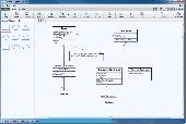
All it takes is a click of a button to transform assembly code into a flowchart.
All it takes is a click of a button to transform assembly code into a Flowchart. Just copy assembly code from any program and load it to Assembly Flowchart Creator™ using the LOAD CLIPBOARD button to create a Flowchart. Can leap between command source and its destination; can leap from specific point in the Flowchart to its code location in the CODE EDITOR or...
Category: Business & Finance / Business Finance
Publisher: AssemblyFlowchart.com, License: Shareware, Price: USD $58.54, File Size: 1.7 MB
Platform: Windows
Shareware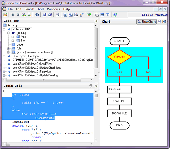
Code to Flowchart is widely used in software development and project documentation. It can help software developer or document writer to convert source code to flow charts automatically. It understands and improves your algorithms on software developing. By using Code to Flowchart, you can easily know the structure of unfamiliar source code. More than that, you can solve some very...
Category: Software Development / Compilers & Interpreters
Publisher: AthTek Software, License: Shareware, Price: USD $119.00, File Size: 1.5 MB
Platform: Windows
With this release, ArcGIS transforms the way you use GIS.
With this release, ArcGIS transforms the way you use Gis.Be more productive with your work and take advantage of Gis everywhere: via individual local desktops, across desktops and browsers leveraging central servers, and in the cloud.ArcGIS Desktop contains two applications: ArcMap and ArcCatalog. ArcMap provides Data display, query, and analysis. ArcCatalog provides...
Category: Business & Finance / Business Finance
Publisher: Environmental Systems Research Institute, Inc., License: Demo, Price: USD $0.00, File Size: 2.0 GB
Platform: Windows
Christine-GIS is a useful, easy-to-use tool that brings geographic information to your desktop.
Christine-Gis is a useful, easy-to-use tool that brings geographic information to your desktop. Christine gives you the power to visualize, explore, query and analyze Data spatially. A key feature of Christine is that it's easy to load tabular Data, such as dBASE files and Data from database servers.
Category: Home & Education / Miscellaneous
Publisher: christine-gis.com, License: Shareware, Price: USD $0.00, File Size: 0
Platform: Windows
Freeware
VSceneGIS Desktop. (Gis) Analysis, Computing and Editing. Customer Project Development, Analysis, Computing and Gis editing. VSceneGIS Desktop applies the concept of Tree and Graph Topology to implement the Data model in a Gis. Validation, Editing and Topological Behavior Export and import of Data sources: PostgreSQL / PostGIS, Oracle, MySQL, SQLite /...
Category: Home & Education / Science
Publisher: vscenegis.com, License: Freeware, Price: USD $0.00, File Size: 118.4 MB
Platform: Windows
So that you can identify the Mapping & Gis product that best suits your needs, use this simple Product Comparison. There are four main product types that you can use to create a GPS Data collection and maintenance system, or mobile Gis solution. Use the links below to select a product group, and compare the features of each product within that group.
Category: Internet / Communications
Publisher: Trimble Navigation Limited, License: Freeware, Price: USD $0.00, File Size: 2.7 MB
Platform: Windows
The Quantum GIS Tethys repository contains a lot of software from OSGeo projects.
The Quantum Gis Tethys repository contains a lot of software from OSGeo projects. Quantum Gis Tethys and all dependencies are included, along with Python, GRASS, GDAL, etc. This is most suitable for people who want to be able to update dependencies from the Quantum Gis Tethys repository easily. The installer is able to install from internet or just download all needed...
Category: Multimedia & Design / Graphics Viewers
Publisher: QGIS Development Team, License: Freeware, Price: USD $0.00, File Size: 369.0 KB
Platform: Windows
My World Gis™ is a Geographic Information System (Gis) designed specifically for use in middle school through college classrooms. It has been developed by the GEODE Initiative at Northwestern University as part of a research program on the adaptation of scientific visualization and Data analysis tools to support inquiry-based learning.
My World gives...
Category: Home & Education / Miscellaneous
Publisher: Northwestern University, License: Shareware, Price: USD $59.00, File Size: 100.2 MB
Platform: Windows
Create flowcharts easily with this free Windows software. Whether you're mapping out ideas, laying out the structure of your organization or creating UML diagrams, ClickCharts is the perfect user-friendly program to get you going. Simplify complex processes, troubleshoot bottlenecks and find areas for improvement. Organize your ideas visually and make even the most complicated process easier to...
Category: Business & Finance / Presentation Tools
Publisher: NCH Software, License: Freeware, Price: USD $0.00, File Size: 570.3 KB
Platform: Windows
The CANVAS 9 Advanced Gis Mapping Edition adds native support for Geographic Information System (Gis) Data to Canvas. You can take measurements in geographic coordinates, import industry standard SHAPE and GeoTIFF files into unlimited numbers of automatically aligned overlapping layers and choose among the following options:2,104 Coordinate Reference Systems67 Operation...
Category: Multimedia & Design / Multimedia App's
Publisher: ACD Systems, License: Shareware, Price: USD $999.95, File Size: 54.2 MB
Platform: Windows

Create flowcharts easily with this free Windows software. Whether you're mapping out ideas, laying out the structure of your organization or creating UML diagrams, ClickCharts is the perfect user-friendly program to get you going. Simplify complex processes, troubleshoot bottlenecks and find areas for improvement. Organize your ideas visually and make even the most complicated process easier to...
Category: Business & Finance / Business Finance
Publisher: NCH Software, License: Freeware, Price: USD $0.00, File Size: 1.5 MB
Platform:
AccuGlobe Desktop 2007,a standardized platform for delivering solutions to the global Gis community, offers even more of what you demand in a desktop Gis application. Combining user-friendly design with significantly increased functionality, AccuGlobe Desktop 2007 gives you greater freedom in analyzing spatial Data. In addition to functioning as the core engine behind many...
Category: Multimedia & Design / Multimedia App's
Publisher: Digital Data Technologies, Inc., License: Freeware, Price: USD $0.00, File Size: 9.8 MB
Platform: Windows
AvisMap Gis Engine is the basic development platform for AvisMap Gis suites, which is a new generation component Gis development platform for Gis application developers.AvisMap Gis Engine Sample Projects is a bundle of sample of different projects that you can see how they work.
Category: Software Development / Misc. Programming
Publisher: AvisMap GIS Technologies, License: Shareware, Price: USD $0.00, File Size: 30.9 MB
Platform: Windows
Freeware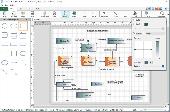
Create flowcharts easily with this free Windows software. Whether you're mapping out ideas, laying out the structure of your organization or creating UML diagrams, ClickCharts is the perfect user-friendly program to get you going. Simplify complex processes, troubleshoot bottlenecks and find areas for improvement. Organize your ideas visually and make even the most complicated process easier to...
Category: Business & Finance / Business Finance
Publisher: NCH Software, License: Freeware, Price: USD $0.00, File Size: 1.7 MB
Platform: Windows
The CANVAS 9 Advanced Gis Mapping Edition adds native support for Geographic Information System (Gis) Data to Canvas. You can take measurements in geographic coordinates, import industry standard SHAPE and GeoTIFF files into unlimited numbers of automatically aligned overlapping layers and choose among the following options:·2,104 Coordinate Reference...
Category: Multimedia & Design / Multimedia App's
Publisher: ACD Systems, License: Shareware, Price: USD $999.95, File Size: 51.9 MB
Platform: Mac, PPC
MAUS Flowchart Manager is a simple and easy to use Flowcharting software program.
MAUS Flowchart Manager is a simple and easy to use Flowcharting software program.
With this software you are able to create flowcharts, strategy maps, policies, procedures and business diagrams. MAUS Flowchart Manager also allows you to create diagrams, link nodes, add text and even create time nodes. At a click of a button your diagrams will be instantly exported...
Category: Business & Finance / Business Finance
Publisher: MAUS, License: Shareware, Price: USD $99.00, File Size: 13.2 MB
Platform: Windows
AEGIS– the leading GIS software in UK secondary schools.
AEGIS– the leading Gis software in UK secondary schools.
One-off software purchase and free upgrades – no subscriptions.
Brings industry-standard Gis maps to the classroom – Goad town plans, large-scale OS MasterMaps.
Try before you buy with the free AEGIS Viewer download.
Free materials: resources, help sheets,...
Category: Home & Education / Miscellaneous
Publisher: AU Enterprises Limited, License: Shareware, Price: USD $0.00, File Size: 0
Platform: Windows