Free Downloads: Gis Data Model Diagram
AvisMap Gis Engine is the basic development platform for AvisMap Gis suites, which is a new generation component Gis development platform for Gis application developers. AvisMap Gis Engine 5 provides powerful Gis functions through Active X controls based on Microsoft COM component technique standards. It allows users to rapidly develop professional...
Category: Multimedia & Design / Multimedia App's
Publisher: AvisMap GIS Technologies, License: Freeware, Price: USD $0.00, File Size: 60.5 MB
Platform: Windows
 Freeware
VSceneGIS Desktop. (Gis) Analysis, Computing and Editing. Customer Project Development, Analysis, Computing and Gis editing. VSceneGIS Desktop applies the concept of Tree and Graph Topology to implement the Data Model in a Gis. Validation, Editing and Topological Behavior Export and import of Data sources: PostgreSQL / PostGIS, Oracle, MySQL,...
Category: Home & Education / Science
Publisher: vscenegis.com, License: Freeware, Price: USD $0.00, File Size: 118.4 MB
Platform: Windows
DIVA-GIS is a GIS for plant biodiversity analysis.
DIVA-Gis is a Gis for plant biodiversity analysis. The project will modernize the architecture for better collaboration and extensibility based on Eclipse RCP.
DIVA-Gis can be used to map and analyze biological distribution Data, such as can be provided by natural history collections and genetic resources collections. Typically, the distribution Data...
Category: Business & Finance / Business Finance
Publisher: International Potato Center (CIP), License: Freeware, Price: USD $0.00, File Size: 122.4 MB
Platform: Windows
Shareware
Edraw is a new UML Diagram and software Diagram drawing tool for software engineers and designers. Easy to draw uml Model Diagram, COM and OLE, Data flow Model Diagram, Jacobson Use Case, SSADM Diagram, Nassi-Schneiderman diagrams, Booch OOD diagrams, ROOM Diagram, Yourdon and Coad diagrams and Shlaer-Mellor OOA diagrams, program...
Category: Games / Tools & Editors
Publisher: edrawsoft.com, License: Shareware, Price: USD $69.95, File Size: 34.6 MB
Platform: Windows
DIVA-Gis is a free computer program for mapping and geographic Data analysis (a geographic information system (Gis). With DIVA-Gis you can make maps of the world, or of a very small area, using, for example, state boundaries, rivers, a satellite image, and the locations of sites where an animal species was observed.
Category: Business & Finance / Applications
Publisher: diva-gis, License: Freeware, Price: USD $0.00, File Size: 3.8 MB
Platform: Windows
Map Suite Wpf Desktop Edition takes Gis application development for the Windows desktop to a whole new level.Using the intuitive object Model, even developers inexperienced in Geographic Information Systems (Gis) can have fully functional maps working in minutes. With blazing fast rendering performance, powerful mapping features and support for the most popular Data...
Category: Internet / Misc. Plugins
Publisher: ThinkGeo, License: Shareware, Price: USD $4995.00, File Size: 69.1 MB
Platform: Windows
The CANVAS 9 Gis Mapping Edition adds native support for Geographic Information System (Gis) Data to Canvas. You can take measurements in geographic coordinates, import industry standard SHAPE and GeoTIFF files into unlimited numbers of automatically aligned overlapping layers and choose among the following options: 2,104 Coordinate Reference Systems 67 Operation Methods...
Category: Multimedia & Design / Multimedia App's
Publisher: ACD Systems, License: Shareware, Price: USD $549.99, File Size: 51.9 MB
Platform: Mac, PPC
TerraSync is designed for fast and efficient field GIS data collection.
TerraSync is designed for fast and efficient field Gis Data collection.Trimble® TerraSync™ software is designed for fast and efficient field Gis Data collection and maintenance.
Integrating all the ways you collect Data—with a GNSS handheld computer, laser rangefinder, or centimeter-grade equipment—it's a powerful system...
Category: Utilities / Misc. Utilities
Publisher: Trimble, License: Shareware, Price: USD $7000.00, File Size: 20.6 MB
Platform: Windows
UML .FRI is visual Diagram editor. It's aimed towards Diagram types commonly used by people involved in IT.
Main Features:
Currently, it's possible to create and edit:
- UML class Diagram
- UML object Diagram
- UML activity Diagram
- UML use case Diagram
...
Category: Multimedia & Design / Digital Media Editors
Publisher: Faculty of Management Science and Informatics, University of Zilina, License: Freeware, Price: USD $0.00, File Size: 1.1 MB
Platform: Windows
The Nevron Diagram for .NET is a fully managed, extensible and powerful diagramming framework, which can help you create interactive and feature rich Diagram and map solutions in WinForms and ASP.NET projects. The product is based on the solid Model - View - Controller architecture, which ensures the scalability of its object Model. The API is designed to be as...
Category: Software Development / Components & Libraries
Publisher: Nevron Software LLC, License: Shareware, Price: USD $589.00, File Size: 245.0 MB
Platform: Windows
Shareware
AvisMap Gis Engine is a comprehensive SDK for the development of custom Gis applications and solutions. This SDK provides several ActiveX (OCX) controls which support Visual Basic, VB.NET, C#, Visual C++ and other ActiveX compatible programming languages, with Microsoft Visual Studio versions 6, 2003, 2005, and Express. Supports .NET via COM. While the SDK is excellent for desktop...
Category: Software Development / Components & Libraries
Publisher: AvisMap GIS Technologies, License: Shareware, Price: USD $1199.00, File Size: 57.8 MB
Platform: Windows
SceneDraw is an investigative tool, for police and private investigators that need to survey and Diagram scenes for criminal and civil litigation. Scene Draw is not a CAD program nor is it a drawing program, it is a Data Driven Diagram software program for your reconstruction purposes. It is the complete Data measurement collection software tool for Microsoft...
Category: Multimedia & Design
Publisher: DeliCAD and AK Corp, License: Commercial, Price: USD $149.99, File Size: 2.6 MB
Platform: Windows
With this release, ArcGIS transforms the way you use GIS.
With this release, ArcGIS transforms the way you use Gis.Be more productive with your work and take advantage of Gis everywhere: via individual local desktops, across desktops and browsers leveraging central servers, and in the cloud.ArcGIS Desktop contains two applications: ArcMap and ArcCatalog. ArcMap provides Data display, query, and analysis. ArcCatalog provides...
Category: Business & Finance / Business Finance
Publisher: Environmental Systems Research Institute, Inc., License: Demo, Price: USD $0.00, File Size: 2.0 GB
Platform: Windows
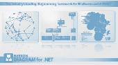
The Nevron Diagram for .NET is a fully managed, extensible and powerful diagramming framework, which can help you create interactive and feature rich diagramming solutions in WinForms and WebForms projects. The product is based on the solid Model ? View ? Controller architecture, which ensures the scalability of its object Model. The API is designed to be as native and...
Category: Software Development / Components & Libraries
Publisher: Nevron Software, License: Shareware, Price: USD $589.00, File Size: 156.2 MB
Platform: Windows
The UML stencil for Microsoft Visio supports complete UML, i.
The UML stencil for Microsoft Visio supports complete UML, i.e. UML use case Diagram, class Diagram, package Diagram, object Diagram, composite structure Diagram, interaction Diagram, sequence Diagram, communication Diagram, interaction overview Diagram, activity Diagram, state machine Diagram, component...
Category: Business & Finance / MS Office Addons
Publisher: Pavel Hruby, License: Freeware, Price: USD $0.00, File Size: 513.7 KB
Platform: Windows
Christine-GIS is a useful, easy-to-use tool that brings geographic information to your desktop.
Christine-Gis is a useful, easy-to-use tool that brings geographic information to your desktop. Christine gives you the power to visualize, explore, query and analyze Data spatially. A key feature of Christine is that it's easy to load tabular Data, such as dBASE files and Data from database servers.
Category: Home & Education / Miscellaneous
Publisher: christine-gis.com, License: Shareware, Price: USD $0.00, File Size: 0
Platform: Windows
So that you can identify the Mapping & Gis product that best suits your needs, use this simple Product Comparison. There are four main product types that you can use to create a GPS Data collection and maintenance system, or mobile Gis solution. Use the links below to select a product group, and compare the features of each product within that group.
Category: Internet / Communications
Publisher: Trimble Navigation Limited, License: Freeware, Price: USD $0.00, File Size: 2.7 MB
Platform: Windows
The Quantum GIS Tethys repository contains a lot of software from OSGeo projects.
The Quantum Gis Tethys repository contains a lot of software from OSGeo projects. Quantum Gis Tethys and all dependencies are included, along with Python, GRASS, GDAL, etc. This is most suitable for people who want to be able to update dependencies from the Quantum Gis Tethys repository easily. The installer is able to install from internet or just download all needed...
Category: Multimedia & Design / Graphics Viewers
Publisher: QGIS Development Team, License: Freeware, Price: USD $0.00, File Size: 369.0 KB
Platform: Windows
Hertzsprung - Russell Diagram is the software implementation of H-R [Hertzsprung-Russell] Diagram in stellar astronomy. This software is to make the H-R Diagram a little bit more handy to the astronomers adding some extra features inspite of just getting Temperature(K) and Absolute magnitude of a star. It serves the Data about the Luminosity and Radius of a star, for...
Category: Home & Education / Science
Publisher: Anindya Chatterjee, License: Shareware, Price: USD $20.00, File Size: 1.3 MB
Platform: Windows
The Exerciser Revision Tool is a stand-alone java application that helps students practice their skills at drawing entity-relation diagrams (ERDs) to Model Data. The tool contains a number of questions each containing a scenario from which the user is asked to draw an equivalent ERD.
Having drawn the ERD, the student can ask the tool to mark (grade) their...
Category: Home & Education / Miscellaneous
Publisher: Open University, License: Freeware, Price: USD $0.00, File Size: 554.8 KB
Platform: Windows
My World Gis™ is a Geographic Information System (Gis) designed specifically for use in middle school through college classrooms. It has been developed by the GEODE Initiative at Northwestern University as part of a research program on the adaptation of scientific visualization and Data analysis tools to support inquiry-based learning.
My World gives...
Category: Home & Education / Miscellaneous
Publisher: Northwestern University, License: Shareware, Price: USD $59.00, File Size: 100.2 MB
Platform: Windows
The CANVAS 9 Advanced Gis Mapping Edition adds native support for Geographic Information System (Gis) Data to Canvas. You can take measurements in geographic coordinates, import industry standard SHAPE and GeoTIFF files into unlimited numbers of automatically aligned overlapping layers and choose among the following options:2,104 Coordinate Reference Systems67 Operation...
Category: Multimedia & Design / Multimedia App's
Publisher: ACD Systems, License: Shareware, Price: USD $999.95, File Size: 54.2 MB
Platform: Windows
GSI3D utilizes a Digital Terrain Model, surface geological linework and downhole borehole Data to enable the geologist to construct cross sections by correlating boreholes and the outcrops to produce a geological fence Diagram. Mathematical interpolation between the nodes along the drawn sections and the limits of the units produces a solid Model comprising a stack...
Category: Utilities / Misc. Utilities
Publisher: British Geological Survey - Insight, License: Shareware, Price: USD $0.00, File Size: 44.6 MB
Platform: Windows
AccuGlobe Desktop 2007,a standardized platform for delivering solutions to the global Gis community, offers even more of what you demand in a desktop Gis application. Combining user-friendly design with significantly increased functionality, AccuGlobe Desktop 2007 gives you greater freedom in analyzing spatial Data. In addition to functioning as the core engine behind many...
Category: Multimedia & Design / Multimedia App's
Publisher: Digital Data Technologies, Inc., License: Freeware, Price: USD $0.00, File Size: 9.8 MB
Platform: Windows
AvisMap Gis Engine is the basic development platform for AvisMap Gis suites, which is a new generation component Gis development platform for Gis application developers.AvisMap Gis Engine Sample Projects is a bundle of sample of different projects that you can see how they work.
Category: Software Development / Misc. Programming
Publisher: AvisMap GIS Technologies, License: Shareware, Price: USD $0.00, File Size: 30.9 MB
Platform: Windows