Free Downloads: Gis Mind Map
Map Suite Wpf Desktop Edition takes Gis application development for the Windows desktop to a whole new level.Using the intuitive object model, even developers inexperienced in Geographic Information Systems (Gis) can have fully functional maps working in minutes. With blazing fast rendering performance, powerful mapping features and support for the most popular data...
Category: Internet / Misc. Plugins
Publisher: ThinkGeo, License: Shareware, Price: USD $4995.00, File Size: 69.1 MB
Platform: Windows
DIVA-GIS is a GIS for plant biodiversity analysis.
DIVA-Gis is a Gis for plant biodiversity analysis. The project will modernize the architecture for better collaboration and extensibility based on Eclipse RCP.
DIVA-Gis can be used to Map and analyze biological distribution data, such as can be provided by natural history collections and genetic resources collections. Typically, the distribution data would...
Category: Business & Finance / Business Finance
Publisher: International Potato Center (CIP), License: Freeware, Price: USD $0.00, File Size: 122.4 MB
Platform: Windows
 Shareware
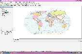
AvisMap Desktop Professional 5 is a professional desktop Gis software for Map editing, managing, analysis attribute data, aid decision-making transactions and output Map, print tables, 3D modeling, and other functions. As a complete analysis management tool, AvisMap Despro 5 is applicable in land management, forestry, electric power, telecom, traffic, city pipe network,...
Category: Multimedia & Design / Graphics Viewers
Publisher: AvisMap GIS Technologies, License: Shareware, Price: USD $499.00, File Size: 22.2 MB
Platform: Windows
Shareware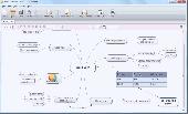
Mind Architect is the Mind mapping tool for creating professional looking Mind maps easily. Select from multiple predefined styles, create hyperlinks, embed images, format and style your Mind mappings just like you want, even use tables. Export your Mind Map as PDF, JPG, PNG and more with just one click. MindArchitect is free to be used, if you are...
Category: Home & Education
Publisher: Ambiera e.U., License: Shareware, Price: USD $25.00, EUR19, File Size: 2.7 MB
Platform: Windows, Other
Shareware
AvisMap Gis Engine is a comprehensive SDK for the development of custom Gis applications and solutions. This SDK provides several ActiveX (OCX) controls which support Visual Basic, VB.NET, C#, Visual C++ and other ActiveX compatible programming languages, with Microsoft Visual Studio versions 6, 2003, 2005, and Express. Supports .NET via COM. While the SDK is excellent for desktop...
Category: Software Development / Components & Libraries
Publisher: AvisMap GIS Technologies, License: Shareware, Price: USD $1199.00, File Size: 57.8 MB
Platform: Windows
The CANVAS 9 Gis Mapping Edition adds native support for Geographic Information System (Gis) data to Canvas. You can take measurements in geographic coordinates, import industry standard SHAPE and GeoTIFF files into unlimited numbers of automatically aligned overlapping layers and choose among the following options: 2,104 Coordinate Reference Systems 67 Operation Methods (like...
Category: Multimedia & Design / Multimedia App's
Publisher: ACD Systems, License: Shareware, Price: USD $549.99, File Size: 51.9 MB
Platform: Mac, PPC
AvisMap Gis Engine is the basic development platform for AvisMap Gis suites, which is a new generation component Gis development platform for Gis application developers. AvisMap Gis Engine 5 provides powerful Gis functions through Active X controls based on Microsoft COM component technique standards. It allows users to rapidly develop professional...
Category: Multimedia & Design / Multimedia App's
Publisher: AvisMap GIS Technologies, License: Freeware, Price: USD $0.00, File Size: 60.5 MB
Platform: Windows
Freeware
Convert ESRI ShapeFiles (.SHP) geolocation data into AnyMap format to be used with AnyChart. AnyChart Flash Map Converter allows making use of a wide choice of maps with AnyChart Flash Component, a Gis visualization system that recognizes Map data in AnyMap format only. AnyChart Flash Map Converter makes it easy to visualize any geolocation data without hefty...
Category: Web Authoring / Image Mapping Tools
Publisher: AnyChart.Com, License: Freeware, Price: USD $0.00, File Size: 1.6 MB
Platform: Windows
PocketGIS is a powerful mobile Geographical Information System (Gis) for field data capture which can display and edit Map geometry and attributes. PocketGIS brings real Gis functionality to highly portable handheld devices which are lightweight, convenient and have a long battery life.
Category: Utilities / Misc. Utilities
Publisher: Pocket Systems Ltd, License: Shareware, Price: USD $499.00, File Size: 42.8 MB
Platform: Windows
Gismaps Viewer is a GIS viewer that can be used for geospatial analysis and map production.
Gismaps Viewer is a Gis viewer that can be used for geospatial analysis and Map production.
The main features are:
- read Shape files using geographic coordinate system
- view satellite images (MrSid, jpeg, bmp and tiff file formats)
- generate thematic maps, queries and labels
- export do Google Earth KML (shp2kml)
- configure Map...
Category: Multimedia & Design / Graphics Viewers
Publisher: Gismaps Sistemas Ltda., License: Freeware, Price: USD $0.00, File Size: 10.2 MB
Platform: Windows
Shareware
MindOnMap starts with a main idea in the center of your Mind Map. You can add Main Nodes and some Sub or Free Nodes as needed, showing relationships between parts of the whole. Main features: 1. Bring efficiency to both your work and your life. MindOnMap allows you to visually generate your ideas on an infinite canvas. This allows you to continually track a...
Category: Multimedia & Design
Publisher: MindOnMap Studio, License: Shareware, Price: USD $8.00, File Size: 1.9 MB
Platform: Windows
Shareware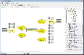
Mind Pad is a .NET Mind and concept mapping software for Windows. If you ever asked for simplicity of Mind or concept mapping and for Map topics with some properties that are right for your business needs, then Mind Pad is a great tool to start with. Creating and linking text blocks is easy with Mind Pad. But it can do more. Mind Pad...
Category: Business & Finance / Project Management
Publisher: AKS-Labs, License: Shareware, Price: USD $70.00, File Size: 3.2 MB
Platform: Windows
Freeware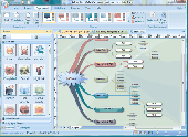
Easy to create Mind maps (graphical representations of thought processes) for brainstorming, problem solving, rational analysis, and decision marking. Easy to use drawing tools, many pre-drawn flowchart templates and more than 600 flowchart symbols and flowchart samples, drawing couldn't be easier! Why Choose Edraw Mind Map 1.Smart drawing guide can layout the Mind...
Category: Games / Tools & Editors
Publisher: EdrawSoft, License: Freeware, Price: USD $0.00, File Size: 28.6 MB
Platform: Windows
GeoSurveillance is software that combines spatial statistical routines with some basic Geographic Information Systems (Gis) functions to carry out retrospective and prospective statistical tests for the detection of geographic clustering. In this software, the focus is primarily on the spatial statistical analysis. Consequently, full Gis functionality is not provided. Gis...
Category: Home & Education / Miscellaneous
Publisher: NCGIA, License: Freeware, Price: USD $0.00, File Size: 2.4 MB
Platform: Windows
With MapAuthor you can create, print and save desktop maps, using data that you obtain from commercial sources or perhaps your in-hous Gis department as shapefiles (shapefiles are a very common Gis exchange format.) You can also produce internet-based maps based on Google Maps, for use on your web site.
MapAuthor allows you to link your own data to maps, for example if you...
Category: Internet / Misc. Plugins
Publisher: MapAuthor.com, License: Freeware, Price: USD $0.00, File Size: 6.3 MB
Platform: Windows
AutoDEM (aka as AutoMNT) is a freeware Gis software to create Digital Elevation Models (DEM) from scanned topographic maps for Windows.
Through different data layers (Map, contours, DEM, etc.), AutoDEM provides many tools for :
-Topographic Map analysis
-Contour lines extraction and reconstruction
-Contours to DEM interpolation and DEM analysis
...
Category: Multimedia & Design / Animation
Publisher: Joachim Pouderoux, License: Freeware, Price: USD $0.00, File Size: 27.6 MB
Platform: Windows
Field-Map is a software and hardware technology for field data collection and data processing.
Field-Map is a software and hardware technology for field data collection and data processing. Field-Map product line combines flexible realtime Gis software with electronic devices for mapping and dendrometric measurement. Field-Map software is divided into two main parts. FM Project Manager and FM Data Collector.
Category: Home & Education / Miscellaneous
Publisher: IFER, License: Shareware, Price: USD $0.00, File Size: 0
Platform: Windows
DIVA-Gis is a free computer program for mapping and geographic data analysis (a geographic information system (Gis). With DIVA-Gis you can make maps of the world, or of a very small area, using, for example, state boundaries, rivers, a satellite image, and the locations of sites where an animal species was observed.
Category: Business & Finance / Applications
Publisher: diva-gis, License: Freeware, Price: USD $0.00, File Size: 3.8 MB
Platform: Windows
GeoBase is a high performance OEM tool for embedding Gis functions in client and server applications. GeoBase has a small memory footprint - both on the hard disk for storage and in RAM during use. Compatible with both .NET and Linux, GeoBase is designed for a rapid development cycle and low deployment cost. The Map Engine displays rich, detailed maps for use in server or client...
Category: Software Development / Compilers & Interpreters
Publisher: Telogis, License: Freeware, Price: USD $0.00, File Size: 87.0 MB
Platform: Windows
Shareware
MatchWare OpenMind 2 is a professional Mind Mapping(R) software application that allows you to brainstorm and visualize ideas. Mind Mapping helps you organize complex ideas or processes to increase understanding, plan more efficiently and turn ideas into action faster. With one of the best integration to Microsoft(R) Office, OpenMind lets you capture the full potential of your...
Category: Business & Finance / Project Management
Publisher: MatchWare A/S, License: Shareware, Price: USD $279.00, File Size: 38.7 MB
Platform: Windows
The CANVAS 9 Advanced Gis Mapping Edition adds native support for Geographic Information System (Gis) data to Canvas. You can take measurements in geographic coordinates, import industry standard SHAPE and GeoTIFF files into unlimited numbers of automatically aligned overlapping layers and choose among the following options:2,104 Coordinate Reference Systems67 Operation Methods...
Category: Multimedia & Design / Multimedia App's
Publisher: ACD Systems, License: Shareware, Price: USD $999.95, File Size: 54.2 MB
Platform: Windows
My World Gis™ is a Geographic Information System (Gis) designed specifically for use in middle school through college classrooms. It has been developed by the GEODE Initiative at Northwestern University as part of a research program on the adaptation of scientific visualization and data analysis tools to support inquiry-based learning.
My World gives learners...
Category: Home & Education / Miscellaneous
Publisher: Northwestern University, License: Shareware, Price: USD $59.00, File Size: 100.2 MB
Platform: Windows
The Visual Mind Server is a separate application that enables multiple users of Visual Mind (Business Edition, Academic Edition or Basic Edition) to share Visual Mind content in real time. Any changes made to a server Map will instantly be visible to other users that work on the Map. This way, Visual Mind offers businesses and teams real-time...
Category: Business & Finance / Business Finance
Publisher: Mind Technologies AS, License: Shareware, Price: USD $800.00, File Size: 34.8 MB
Platform: Windows
ArcGIS for AutoCAD is a free, downloadable plug-in application for AutoCAD that provides improved interoperability between AutoCAD and ArcGIS. Within the AutoCAD environment, you gain easy access to enterprise Gis maps hosted by ArcGIS Server.
In addition, ArcGIS for AutoCAD gives you the ability to prepare CAD data for use with the ArcGIS system while leveraging your...
Category: Multimedia & Design / Image Editing
Publisher: Environmental Systems Research Institute, Inc., License: Demo, Price: USD $0.00, File Size: 1.4 MB
Platform: Windows
Shareware
Java toolkit to add coordinate conversion functionality to your Java applications and applets. The toolkit offers functionality to perform Map grid and datum transformations: latitude and longitude can be converted to various Map grids, like Transverse Mercator (TM), Oblique Mercator, Mercator, Oblique Stereographic, Polar Stereographic, Cassini, Albers Equal Area Conal, Gauss...
Category: Software Development / Components & Libraries
Publisher: Eye4Software B.V., License: Shareware, Price: USD $199.00, EUR179, File Size: 155.5 KB
Platform: Unknown