Free Downloads: Google Earth
Download the new version of Google Earth satellite with Google Pack.
Download the new version of Google Earth satellite with Google Pack.Google pack includes 13 totally free software selected by Google for your better internet experience.Software included in Google pack - Google Earth,Norton Security Scan,Google Desktop,Google Toolbar for Internet Explorer,Spyware Doctor Starter Edition,Picasa...
Category: Home & Education / Science
Publisher: www.satelliteimage-of-my-house.com, License: Freeware, Price: USD $0.00, File Size: 589.0 KB
Platform: Windows
View amazing satellite images of earth with the free version of google earth software.
View amazing satellite images of Earth with the free version of Google Earth software.Google Earth is a totally free software which enables you zoom in from satellite,view,rotate or tilt just like a camera of the entire Earth inside your pc.It works just point and click on any part of Earth or by typing addrees name of city or country and...
Category: Home & Education / Miscellaneous
Publisher: www.satelliteimage-of-my-house.com, License: Freeware, Price: USD $0.00, File Size: 798.0 KB
Platform: Windows
Korti is a Google Earth plugin which allows you to see the unique 3D satellite map of Korti within your Google Earth application.
Korti provides you a detailed satellite imagery and geographic information about this geographic place.
To have Korti installed on your PC, first install for free Google Earth and then Korti 3D map plugin. After...
Category: Multimedia & Design / Multimedia App's
Publisher: Maplandia, License: Freeware, Price: USD $0.00, File Size: 309 B
Platform: Windows
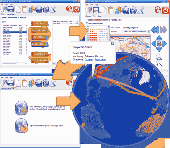
GEScene is a MapInfo utility that allows images to be exchanged in both directions between MapInfo and Google Earth. Placemarks can also be created in Google Earth by using MapInfo as a point of reference to easily pinpoint more obscure locations. Images saved in Google Earth can be registered and displayed in MapInfo to compliment existing map layers....
Category: Utilities / Misc. Utilities
Publisher: Peter Doyle, License: Freeware, Price: USD $0.00, File Size: 3.2 MB
Platform: Windows
Now you can link the individuals in your family tree to the powerful mapping capabilities of Google Earth. Automatically create Placemarks for events in the lives of individuals and view a path following the movements during their lifetime. Use the timespan slider feature of Google Earth to restrict the view to a period of history and watch your family's story...
Category: Home & Education / Miscellaneous
Publisher: Integrated Earth, License: Shareware, Price: USD $20.00, File Size: 3.2 MB
Platform: Windows
Placemarker is a stand-alone application for pictures and icons generation in Google Earth.
Placemarker is a stand-alone application for pictures and icons generation in Google Earth.
Placemarker lets you create a Google Earth placemark different than the standard placemarks available in the program.
A PNG of the placemark image will be created, and positioned centered at the on-screen marker.
Category: Multimedia & Design / Multimedia App's
Publisher: GIS Center, License: Shareware, Price: USD $0.00, File Size: 0
Platform: Windows
 Demo
Demo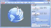
Only flying is more beautiful. Enjoy your travels for a second time with a flight over the globe. Simply insert start and destination point, the rest is handled by our AquaSoft Earth Pilot. This brand new AquaSoft program connects to Google Earth and produces your video. This works as easy as if a flight simulator lets you hover above the Earth, and finally your...
Category: Audio / Music Creation
Publisher: AquaSoft GmbH, License: Demo, Price: USD $19.90, EUR19.9, File Size: 7.2 MB
Platform: Windows
This application will measure paths in Google Earth, either saved in KML Files, or copied from the clipboard. The application uses the haversine formula to measure distances between points on a spherical object. These distances are approximate, but some test calculations I have made, show that they are in line with Google Earth's built in measuring tool...
Category: Home & Education / Miscellaneous
Publisher: Whaleycopter, License: Freeware, Price: USD $0.00, File Size: 457.5 KB
Platform: Windows
GTrek-IV, is a digital Image Viewer and Geo Tagging tool!
GTrek-IV, is a digital Image Viewer and Geo Tagging tool! Any picture taken by you can be tagged by the program to locate it with Google Earth. Of course, the place in the picture must be visible on Google Earth. GeoTagged data is stored in textural form as geographical coordinates. The program can be used to tag it as well as to view the image along with the...
Category: Multimedia & Design / Multimedia App's
Publisher: GTrek Ltd., License: Shareware, Price: USD $11.30, File Size: 5.8 MB
Platform: Windows
Shareware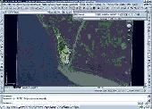
Using advanced mapping techniques, this AutoCAD plug-in gives you the ultimate interface to place your drawings in the real world. Plex.Earth connects your AutoCAD with Google Earth and our Web Services in order to provide you a set of unique features in order to enhance your design, boost your productivity and impress your customers. The must-have AutoCAD plug-in...
Category: Multimedia & Design / Image Editing
Publisher: Plexscape.com Environmental Web Services, License: Shareware, Price: USD $49.00, EUR39, File Size: 1.6 MB
Platform: Windows
Kml Builder makes it easy to create and edit KML files to be viewed in Google Earth.
Kml Builder makes it easy to create and edit KML files to be viewed in Google Earth.
Places you create with Kml Builder can be emailed to your friends or co-workers and can even be published on the Internet or on Intranets for a broader audience.
Anyone who has Google Earth Desktop installed on their computer can open your created KML files with just a...
Category: Utilities / Misc. Utilities
Publisher: NorthGates Systems, License: Shareware, Price: USD $0.00, File Size: 0
Platform: Windows
gSpatial Toolbar allows you to import, display and manipulate ESRI shapefile data in Google Earth.
gSpatial Toolbar allows you to import, display and manipulate ESRI shapefile data in Google Earth. Annotate your data and perform thematic queries on your Excel spreadsheet data or ODBC data sources, visualize results in Google Earth
Category: Multimedia & Design / Graphics Viewers
Publisher: gSpatial, License: Freeware, Price: USD $0.00, File Size: 686.1 KB
Platform: Windows

MB-GPS2KML converts a GPS log file (in plain NMEA format) to a KML file (placemark file for Google Earth) and opens this file in Google Earth. Velocity, number of satellites and HDOP are interpreted as height, color and size of the icons.
Category: Home & Education
Publisher: Markus Bader, License: Freeware, Price: USD $0.00, File Size: 441.4 KB
Platform: Windows
StarTraX is a real-time GPS track animator which works through Google Earth.
StarTraX is a real-time GPS track animator which works through Google Earth.
It allows you to relive your GPS journey in real time.
High definition images from Google Earth combine with StarTraX to show you exactly where you’ve been. Whether you are a pilot, a skier or cyclist, as long as you have a GPS recording of your journey, you...
Category: Multimedia & Design / Multimedia App's
Publisher: GPSAnimator, License: Shareware, Price: USD $0.00, File Size: 0
Platform: Windows
KMLer is the ArcGIS extension for professional work with Google Earth.
KMLer is the ArcGIS extension for professional work with Google Earth. We recommend using this module and our free Typeconvert extension. KMLer Plus also supports additional functionality at description building.
KMLer Pro also supports additional 3d features, LOD, Fade in Google Earth. Create overlays function in KMLer Pro supports Superoverlay projects...
Category: Multimedia & Design / Media Management
Publisher: GIS Center, License: Shareware, Price: USD $0.00, File Size: 584.6 KB
Platform: Windows
Sunrays is a program for photographers and cinematographers that shows the sun’s position during the course of a day. It uses Google Earth to display the positions.
The direction of the sun can be displayed as 2D projection or as 3D vectors. The 3D option allows to see obstacles such as tall buildings already in advance.
The program is shareware....
Category: Audio / Utilities & Plug-Ins
Publisher: Westfilm, License: Shareware, Price: USD $24.95, File Size: 6.5 MB
Platform: Windows
EasyAcreage is program for WinXP or Vista program that allows you to calculate area from KML files exported out of Google Earth. This means you do not even have to leave your house to measure a field anymore. Simply use the free version of Google Earth, mark the area you wish to measure, save it as a KML file and drag and drop it onto EasyAcreage.
Category: Home & Education / Miscellaneous
Publisher: Wildsoft, License: Shareware, Price: USD $20.00, File Size: 817.1 KB
Platform: Windows
EarthPaint is an ideal and easy-to-use painting and drawing application for creating graphic overlays for Google Earth. Just launch Google Earth and zoom into the geographical area you wish to work on, and then open your EarthPaint program which will provide you with the choice of synchronizing its view with the current one displayed by Google Earth, or...
Category: Desktop Enhancements / Shell & Desktop Managers
Publisher: EarthPlot Software, License: Freeware, Price: USD $0.00, File Size: 255.0 KB
Platform: Windows
Superoverlay software is a Google Earth application for tiling raster datasets and creating view based regions in KML or KMZ files.
Also Superoverlay can generate world files for all images in ArcView style (jgw, tfw,...). It helps you put large image overlays into Google Earth (for example alternative maps or aerial photography). GE Sky mode is supported.
Category: Home & Education / Miscellaneous
Publisher: GIS Center, License: Shareware, Price: USD $0.00, File Size: 0
Platform: Windows
Do you have coordinates for some places of interest?
Do you have coordinates for some places of interest? Do you want to find them on Earth's surface? There are more than 2,000 coordinate systems available to make Google Earth follow your interests! Plex.Mark! simply placemarks your world!
Have you found a place in Google Earth and you would like to have the coordinates in your coordinate system?...
Category: Internet / Browser Accessories
Publisher: Plexscape, License: Freeware, Price: USD $0.00, File Size: 601.9 KB
Platform: Windows
Shape2Earth leverages freely available and easy to use Geographic Information System (GIS) software to create professional visualizations for viewing in GoogleTM Earth.
Main features:
-Convert Any Shapefile to KML - Shape2Earth reprojects your data on the fly
-Apply Thematic Symbology to your Data - Color code to display information
-Present Data in Custom...
Category: Multimedia & Design / Image Editing
Publisher: Google, License: Demo, Price: USD $0.00, File Size: 9.5 MB
Platform: Windows
GPicSync automatically inserts location in your photos metadata so they can also be used with any 'geocode aware' application like Picasa/Google Earth, Flickr, loc.alize.us.
Main fetures:
- automatically geocode your photos (in the EXIF header)
- use a GPS tracklog in the GPX format or NMEA format (multiple selection possible)
- Support...
Category: Multimedia & Design / Digital Media Editors
Publisher: Google Project, License: Freeware, Price: USD $0.00, File Size: 0
Platform: Windows
Place Finder is a program that makes it easier to find a given place using Google Earth by generating places from the user data and then launching Google Earth to view the generated places.
Category: Internet / Tools & Utilities
Publisher: Pmcc, License: Freeware, Price: USD $0.00, File Size: 665.6 KB
Platform: Windows
If you are receiving Mode-S ADS-B position reports, PlanePlotter can interface to Google Earth to display aircraft positions over the Google Earth base map. It can even give you a dynamic real-time view from the flight deck of an aircraft that you designate. PlanePlotter can decode ACARS messages, display the message content and plot any positions on a chart.
...
Category: Internet / Communications
Publisher: COAA, License: Shareware, Price: USD $32.84, File Size: 3.6 MB
Platform: Windows
JCapPM allows you to associate coordinate information (x/y) to each photo.
JCapPM allows you to associate coordinate information (x/y) to each photo. JCapPM can communicate with Google Earth which allows you to geotag all your files using Google Earth. You can use JCapPM's filter in order to geotag only filtered photos at once.
Category: Home & Education / Miscellaneous
Publisher: ZeroG Software, License: Freeware, Price: USD $0.00, File Size: 2.5 MB
Platform: Windows