Free Downloads: Gps Nokia Coordinate
GPS Sway is a simple coordinate conversion program.
Gps Sway is a simple Coordinate conversion program. It handles all forms of latitude and longitude (degrees, degrees minutes, degrees minutes seconds) as well as UTM coordinates and will convert from any form to another. It also handles signs or character direction.
Category: Multimedia & Design / Media Management
Publisher: GPSFileDepot, License: Freeware, Price: USD $0.00, File Size: 154.2 KB
Platform: Windows
Nokia Map Manager is a program that allows you to manage and transfer GPS maps to mobile phone.
Nokia Map Manager is a program that allows you to manage and transfer Gps maps to mobile phone. The Map Manager is for the 6110 Navigator only. The program is provided with scan function to search maps on the computer and DVD. Nokia Map Manager is an additional application and is used together with Nokia PC Suite 6.86 and later versions.
Nokia Map...
Category: Internet / Communications
Publisher: Nokia, License: Freeware, Price: USD $0.00, File Size: 0
Platform: Windows
 Shareware
Gps Mapping Software for Windows, Loading topographic maps, realtime navigation, track recording, manage Gps devices and more. The software can be used with various map formats including: GeoTiff, BSB Nautical Charts, AutoCad DXF files, ESRI Shapefiles. Using calibration you can also use scanned or downloaded JPG, BMP, GIF, PNG and TIF maps. The software can be used for survey,...
Category: Home & Education / Science
Publisher: Eye4Software B.V., License: Shareware, Price: USD $149.00, EUR99, File Size: 11.1 MB
Platform: Windows
Shareware
Gps SDK to add Gps and Coordinate conversion functionality to your software and scripts). All NMEA0183 protocol versions are supported and can be filtered by NMEA sentence type and talker ID. Garmin USB PVT support. Information on Gps status can also be retrieved: Gps fix quality, satellites used in fix, satellites in view, satellite azimuth, elevation and...
Category: Software Development
Publisher: Eye4Software B.V., License: Shareware, Price: USD $99.00, EUR79, File Size: 2.3 MB
Platform: Windows

TRANSDATpro can prove a helpful tool for professionals, providing them with the possibility to perform Coordinate transformations fast and easy by use of the Coordinate reference systems of their choice. TRANSDATpro performs Coordinate Transformations fast and with high accuracy. The Coordinate conversion software supports worldwide thousands of Coordinate...
Category: Home & Education / Science
Publisher: Killet GeoSoftware Ing.-GbR, License: Shareware, Price: USD $270.00, EUR240, File Size: 5.3 MB
Platform: Windows
Shareware
Java toolkit to add Coordinate conversion functionality to your Java applications and applets. The toolkit offers functionality to perform map grid and datum transformations: latitude and longitude can be converted to various map grids, like Transverse Mercator (TM), Oblique Mercator, Mercator, Oblique Stereographic, Polar Stereographic, Cassini, Albers Equal Area Conal, Gauss Kruger or...
Category: Software Development / Components & Libraries
Publisher: Eye4Software B.V., License: Shareware, Price: USD $199.00, EUR179, File Size: 155.5 KB
Platform: Unknown

TRANSDAT geosoftware executes Coordinate transformations and geodetic datum shifts between many Coordinate and reference systems of America, Australasia, Europe, Germany special and world-wide, with high precision and high speed: 1.The current and historical Coordinate and reference systems of all countries of the European Union (EU) including the eastern extensions and the...
Category: Home & Education / Science
Publisher: Killet Software Ing.-GbR, License: Shareware, Price: USD $170.00, EUR160, File Size: 4.4 MB
Platform: Windows
Shareware
The Eye4Software Coordinate Calculator is an easy to use tool to perform map or Gps Coordinate conversions. The software can be used to transform a single Coordinate or a batch of coordinates read from a comma separated, database or ESRI shapefiles. The software is shipped with a MS Access database file, containing more then 3500 ellipsoid, map datum and map grid...
Category: Business & Finance / Calculators
Publisher: Eye4Software B.V., License: Shareware, Price: USD $49.00, EUR39, File Size: 3.2 MB
Platform: Windows
The OSTN02 extension for ArcPad is a FREE tool that automatically transforms Gps data and aligns it with Ordnance Survey (OS) background map. This easy-to-use extension removes the need to manually post-process Gps data by providing’ on the fly’ transformation of WGS84 latitude and longitude into OSTN02 corrected British National Grid Coordinate. Data capture...
Category: Home & Education / Miscellaneous
Publisher: ESRI (UK) Ltd, License: Freeware, Price: USD $0.00, File Size: 8.0 MB
Platform: Windows
TRANSDAT Geosoftware executes Coordinate transformations and geodetic datum shifts between lots of Coordinate and reference systems of Germany, Europe, America, Australia and world wide in high quality and with high performance: 1. The German Coordinate and Reference Systems of the old and new Federal Countries including the 40 Prussian Soldner Land Registers and Soldner...
Category: Business & Finance / Applications
Publisher: Killet Softwareentwicklung GbR, License: Shareware, Price: USD $230.00, File Size: 2.6 MB
Platform: Windows
HsGpsDll is a Windows Dynamic Link Library which provides access to any NMEA-183 compliant Gps receiver via a serial communications port.
HsGpsDll is designed for use from Visual C, C++, Visual C Sharp .NET, Visual Basic or other programming languages, capable of calling DLL functions.
HsGpsDll allows a user application to easily read from a Gps device...
Category: Business & Finance / Business Finance
Publisher: Hillstone Software, License: Shareware, Price: USD $270.58, File Size: 700.6 KB
Platform: Windows
All measurements, GPS-protocols and own informations in a single map.
All measurements, Gps-protocols and own informations in a single map.
Several enterprise maps in one program without additional costs.
No limitation of the area quantity
Tile and join fields.
Multilingual: currently in english, german, spanish, french, greek, polish.
International: over 80 Coordinate reference systems of 26 european countries...
Category: Audio / Utilities & Plug-Ins
Publisher: GPSur Dr. Erhard Regener, License: Shareware, Price: USD $449.00, File Size: 7.9 MB
Platform: Windows
SurvCE Application is a complete data collection system for Real Time (RTK) Gps and Total Stations with in-field Coordinate geometry SurvCE, which combines advanced functionality, ease-of-use and robust capability to make it the first choice in data collection software. This tool supports the widest range of popular Carlson SurvCE #1 Data Collection Software Choice and new release...
Category: Business & Finance / Database Management
Publisher: Carlson Software, License: Freeware, Price: USD $0.00, File Size: 3.5 MB
Platform: Windows
Freeware
With this tool you can add Gps coordinates to vCards - elektronic business cards - that you have previously exported from e. g. Microsoft Outlook. Therefore the tool uses the address data contained within the vCards and adds the exact Gps position on that basis to the vCard. This way you can use these vCards for example in compatible car navigation systems. Among others...
Category: Home & Education / Home Inventory
Publisher: AB-Tools.com, License: Freeware, Price: USD $0.00, File Size: 1.9 MB
Platform: Windows
FREE GPS Software for your Garmin, Magellan or Lowrance GPS.
FREE Gps Software for your Garmin, Magellan or Lowrance Gps.
EasyGPS is the fast and easy way to upload and download waypoints, routes, and tracks between your Windows computer and your Garmin, Magellan, or Lowrance Gps. EasyGPS lists all of your waypoints on the left side of the screen, and shows a plot of your Gps data on the right. Use EasyGPS to back up...
Category: Internet / Communications
Publisher: TopoGrafix, License: Freeware, Price: USD $0.00, File Size: 3.9 MB
Platform: Windows
Shareware
GeoDLL is a Geodetic Development Kit / Geodetic Function Library with worldwide 2D and 3D Coordinate Transformation, Datum Shift, Meridian Convergence and Extra Parameter with highest accuracy. Furthermore: Helmert and Molodensky Parameters, NTv2, HARN, INSPIRE, EPSG, Digital Elevation Model (DEM), distance and Time Zone calculations and much more. GeoDLL for geodetic and GIS development...
Category: Software Development / Components & Libraries
Publisher: Killet GeoSoftware Ing.-GbR, License: Shareware, Price: USD $560.00, EUR500, File Size: 5.4 MB
Platform: Windows
My Gps Logger 1.01 is a program designed to be used with My Fuel Tax 4.0. With My Gps Logger you can log all the locations where your truck has been to a monthly data file. This data file can later be imported into My Fuel Tax 4.0 by calculating the miles in state using Microsoftâ Mappoint. This is what you will need to use My Gps Logger with My Fuel Tax:a laptop with...
Category: Home & Education / Miscellaneous
Publisher: Spinnaker Software Solutions, License: Freeware, Price: USD $0.00, File Size: 477.7 KB
Platform: Windows
Shareware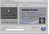
Aimediasoft Nokia Video Converter provides perfect solution to convert your favorite video files to Nokia mobile phone format with the best quality of picture and sound. This Nokia Video Converter software could support almost all source formats, including WMV, MPEG, MPG, ASF, MOD, FLV, SWF, RM and HD files, etc. In addition, Aimediasoft Nokia Video Converter also...
Category: DVD & Video / Video Conversion
Publisher: Aimediasoft Studio, License: Shareware, Price: USD $24.95, File Size: 4.5 MB
Platform: Windows
Shareware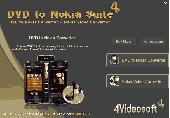
4Videosoft DVD to Nokia Suite gives the best Nokia Converter software for you. This DVD to Nokia Suite is the bundle of DVD to Nokia Converter and Nokia Media Converter, and it is discounted Nokia Converter software. Thus, surely, using DVD to Nokia Converter, it's easy to convert DVD for Nokia MP4, MP3, AAC, WAV, etc. As well as put all...
Category: Audio / Rippers & Encoders
Publisher: 4Videosoft Studio, License: Shareware, Price: USD $24.00, File Size: 12.8 MB
Platform: Windows, Other
VisualGPSXP is a general purpose utility for monitoring the output of a GPS receiver.
VisualGPSXP is a general purpose utility for monitoring the output of a Gps receiver. Using the NMEA data from the Gps receiver, VisualGPSXP will display various statuses graphically.
Tools such as a survey utility average the position and shows accuracy of the Gps receiver in a static application.
Main features:
- Multiple connection...
Category: Home & Education / Miscellaneous
Publisher: VisualGPC, License: Shareware, Price: USD $25.00, File Size: 1.1 MB
Platform: Windows
Shareware
Aimediasoft DVD to Nokia Converter is the most professional DVD to Nokia Converter to convert DVD movie to Nokia MP4, 3GP, along with the function to extract DVD movie to Nokia MP3, AAC, WAV. The ripped video is compatible with Nokia N96, Nokia E75, Nokia E71, Nokia E63, Nokia N95, Nokia N75, Nokia N97, etc. Aside from...
Category: Audio / Rippers & Encoders
Publisher: Aimediasoft Studio, License: Shareware, Price: USD $24.95, File Size: 7.6 MB
Platform: Windows
Shareware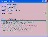
Virtual Gps is a Gps simulator software. You can use it to simulate a Gps receiver unit connected to your system. It's ideal when you need Gps input, but you have no signal or for development purposes. It supports various NMEA sentences, so it can be used with any Gps mapping software. You can use it using a null-modem cable connected to two physical serial...
Category: Internet / RSS & Web Blog Tools
Publisher: Zyl Soft, License: Shareware, Price: USD $39.99, File Size: 856.0 KB
Platform: Windows
MMS Coordinate Converter is a free utility with which you can convert a survey Coordinate between different systems and datums.
The utility will convert between the Cape (Clarke) / Wgs84 datums with coordinates in Geographical / UTM / LO formats similar to the functions available in Model- and Survey-Maker.
Category: Multimedia & Design / Media Management
Publisher: Model Maker Systems, License: Freeware, Price: USD $0.00, File Size: 6.8 MB
Platform: Windows
KingConvert For Nokia E6 Video Converter is an all-in-one Nokia E6 Video Converter video conversion solution,including excellent Nokia E6 Video Converter software: Nokia E6 Video Converter Video Converter.
The Nokia E6 Video Converter Video Converter lets you easily and quickly convert all popular video formats like AVI, MPG, MPEG, DAT, MOV,...
Category: Audio / Rippers & Encoders
Publisher: Kingconvert software, License: Shareware, Price: USD $39.95, File Size: 6.9 MB
Platform: Windows