Free Downloads: Gps Satellite Coordinates
The fast track to GPS success.
The fast track to Gps success. The Linx MDEV-Gps-SR contains everything needed to rapidly evaluate the SR Series Gps modules and implement them in record time. This all-inclusive Master Development System features a pre-assembled development board with an on-board OLED display for standalone testing. The system can also be attached to a PC via USB and operated using the...
Category: Software Development / Misc. Programming
Publisher: Linx Technologies, Inc., License: Freeware, Price: USD $0.00, File Size: 98.5 MB
Platform: Windows
The OSTN02 extension for ArcPad is a FREE tool that automatically transforms Gps data and aligns it with Ordnance Survey (OS) background map. This easy-to-use extension removes the need to manually post-process Gps data by providing’ on the fly’ transformation of WGS84 latitude and longitude into OSTN02 corrected British National Grid coordinate. Data capture using...
Category: Home & Education / Miscellaneous
Publisher: ESRI (UK) Ltd, License: Freeware, Price: USD $0.00, File Size: 8.0 MB
Platform: Windows
The program accepts NMEA GPS sentences from most GPS receivers that connect to a USB port.
The program accepts NMEA Gps sentences from most Gps receivers that connect to a USB port.
The program can display Satellite images of waypoint locations on the track plotter.
Is a free software for recording , monitoring and plotting Gps data, very useful and very easy.
Category: Home & Education / Miscellaneous
Publisher: Club Cruceros de La Paz A.C., License: Freeware, Price: USD $0.00, File Size: 10.6 MB
Platform: Windows
 Freeware
With this tool you can add Gps Coordinates to vCards - elektronic business cards - that you have previously exported from e. g. Microsoft Outlook. Therefore the tool uses the address data contained within the vCards and adds the exact Gps position on that basis to the vCard. This way you can use these vCards for example in compatible car navigation systems. Among...
Category: Home & Education / Home Inventory
Publisher: AB-Tools.com, License: Freeware, Price: USD $0.00, File Size: 1.9 MB
Platform: Windows

Improve your golf game with a handheld Gps that gives distance to pin, club suggestions, locations of hazards and much more. Wherever in the world you play golf, the sureshotgps will allow you to obtain distances from tee to green. Experience the difference with better club selection, speedier play and statistical information per round of golf. The sureshotgps relies on Gps...
Category: Home & Education
Publisher: Absolute Software Pty Ltd, License: Shareware, Price: USD $399.00, File Size: 3.8 MB
Platform: Windows
The Surface Area Calculator is a tool for easily calculating surface and planimetric areas, as well as volumes.
The extent and shape of the area in question are given in terms of the Coordinates of a number of points throughout the area.
These Coordinates can be specified as either latitude, longitude, and height, as Gps Coordinates (geocentric...
Category: Business & Finance / Calculators
Publisher: Microsearch Corp, License: Shareware, Price: USD $134.00, File Size: 1.2 MB
Platform: Windows
Freeware
GPS Converter will convert GPS coordinates between three different formats: 34. 26965, -116.
76783; N 34° 16. 179', W 116° 46. 07'; and N 34° 16' 10.
Category: Home & Education / Sports
Publisher: ALMSys, Inc., License: Freeware, Price: USD $0.00, File Size: 929.9 KB
Platform: Windows
NovaGPS provides manual or automatic setting of time and location from consumer-grade (or better) Gps receivers. NovaGPS is not the same as Dr. Tom Clark's Totally Accurate Clock because NovaGPS does not require a specialized Gps receiver or modification to other Gps receivers.
Instead, NovaGPS offers accuracy to better than 0.5 seconds using off-the-shelf...
Category: Home & Education / Miscellaneous
Publisher: Northern Lights Software Associates, License: Shareware, Price: USD $19.95, File Size: 1.0 MB
Platform: Windows
The Gps Detector software is used to update the Gps detector's database , updating maps , routes and camera locations . The device itself is based on pre-installed Gps Coordinates, the device can indicate various road hazards like: Fixed cameras, Red light speed cameras and bus lane cameras, Usual speed measurement places and dangerous zones.
Category: Business & Finance / Business Finance
Publisher: Euro Noliker Kft., License: Freeware, Price: USD $0.00, File Size: 5.5 MB
Platform: Windows
Immageo is all about making your photos as memorable as when you took them, by geotagging each photo. Immageo is a truly exciting example of what you can and should do with your photo collections. Its more than an album organiser, it embeds map locations and notes into your photos. And when you come to review them Immageo displays them all in context of when and where in the Immageo map,...
Category: Multimedia & Design / Media Catalogers
Publisher: Immageo, License: Freeware, Price: USD $0.00, File Size: 11.0 MB
Platform: Windows
The navigation device is a kind of mini computer which contains a GPS satellite navigation receiver.
The navigation device is a kind of mini computer which contains a Gps Satellite navigation receiver. This allows the device to determine its current position. At least 4 satellites need to be received in order to be able to perform acceptable navigation. The fifth Satellite is required to obtain an altitude. As navigation takes place in a dynamic state, there is scarcely...
Category: Business & Finance / Business Finance
Publisher: United Navigation, License: Freeware, Price: USD $0.00, File Size: 13.8 MB
Platform: Windows
Keep track of discount Garmin GPS deals on with this Firefox toolbar.
Keep track of discount Garmin Gps deals on with this Firefox toolbar.compare and buy all the latest Garmin Satellite navigation systems. If you want a discount Garmin Gps system this is the Firefox toolbar to use. We also provide information on the latest offers, price cuts and discount voucher codes to help you buy the latest Garmin Gps at the cheapest price...
Category: Internet / Browsers
Publisher: Discount Garmin GPS, License: Freeware, Price: USD $0.00, File Size: 1.1 MB
Platform: Windows
Develop precise, efficient, and reliable location-based services with this multithreaded framework for desktop and mobile devices, including PocketPC, Tablet PC and now Smartphone! Over fifty classes in one lightweight assembly gives you unparalleled features while saving you hundreds of dollars in development and testing.
Gps.NET is loaded with features, including:
NEW:...
Category: Software Development / Components & Libraries
Publisher: StormSource Software, LLC, License: Commercial, Price: USD $98.00, File Size: 4.6 MB
Platform: Windows
The Orbit Visualization Tool (OVT) is a software for visualization of Satellite orbits in the Earth's magnetic field. The program can display Satellite orbits in five coordinate systems (GEI, GEO, GSM, SMC, GSE), Satellite footprints projected on the Earth's surface and shown in either geographic (GEO) or geomagnetic (SMC) Coordinates. In addition to...
Category: Home & Education / Astrology & Numerology
Publisher: OVT Team, License: Freeware, Price: USD $0.00, File Size: 0
Platform: Windows
GPS Sway is a simple coordinate conversion program.
Gps Sway is a simple coordinate conversion program. It handles all forms of latitude and longitude (degrees, degrees minutes, degrees minutes seconds) as well as UTM Coordinates and will convert from any form to another. It also handles signs or character direction.
Category: Multimedia & Design / Media Management
Publisher: GPSFileDepot, License: Freeware, Price: USD $0.00, File Size: 154.2 KB
Platform: Windows
Shareware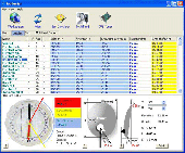
SatHunter is a program for calculating the orientation of a Satellite antenna. SatHunter contains all the necessary information for adjusting the Satellite antenna to the selected Satellite. The adjustment is made with the help of available tools (a compass or a protractor, a plumb, a tape measure) and requires neither expensive equipment nor deep knowledge about...
Category: Home & Education / Astrology & Numerology
Publisher: Protectedsoft Ltd., License: Shareware, Price: USD $29.95, File Size: 5.4 MB
Platform: Windows

Overview Gps Simulator is software that generates a virtual Gps data Used to develop and simulation of Gps applications -Save testing and development time -No location restriction or work everywhere -No Gps device needed Feature Easy routing Selectable map(7EA Map) Support speed control Support 10EA NMEA protocol messages(GGA, GNS, GLL, RMC, VTG,...
Category: Desktop Enhancements / Shell & Desktop Managers
Publisher: NMEAsoft, License: Demo, Price: USD $150.00, File Size: 3.3 MB
Platform: Windows
Moagu: The Mother Of All GPS Utilities.
Moagu: The Mother Of All Gps Utilities.
You can convert USGS topographic maps, aerial/Satellite imagery, and any other raster map imagery for use on Garmin handled Gps units.
Garmin maps have been in a "vector" format; Moagu creates maps using a "bitmap" format.
Category: Home & Education / Miscellaneous
Publisher: Moagu, License: Shareware, Price: USD $19.95, File Size: 38.2 MB
Platform: Windows
The easiest and most advanced golf Gps unit now available, Sonocaddie V300 with patented color layout.
Using the most advanced Gps Satellite system, Sonocaddie calculates the distance from any point on the course to the green or any other target you choose.
Category: Utilities / Misc. Utilities
Publisher: Sonocaddie V300, License: Shareware, Price: USD $99.00, File Size: 3.6 MB
Platform: Windows
GPS PLUS Collar Manager for your PC is a powerful tool to manage your collars.
Gps PLUS Collar Manager for your PC is a powerful tool to manage your collars. It is designed to communicate with your collars, the UHF/VHF handheld terminal and GSM ground station and is the basic tool to design your study. You can:
- manage collars and GSM/email communication details,
- read out data from collar, handheld terminal and GSM ground station,
- store,...
Category: Home & Education / Miscellaneous
Publisher: VECTRONIC Aerospace GmbH, License: Freeware, Price: USD $0.00, File Size: 8.4 MB
Platform: Windows
FlashPoints is a tool for creating and managing points Groups (topographic points for example). FlashPoints allows you to : * import/export points Coordinates from and to a file * create points and their attributes "Number", "Elevation" and "Description" by clicking * modify the points elevation * modify the height and rotation of the attributes * create...
Category: Multimedia & Design
Publisher: DeliCAD, License: Shareware, Price: USD $49.00, File Size: 1.2 MB
Platform: Windows
FREE GPS Software for your Garmin, Magellan or Lowrance GPS.
FREE Gps Software for your Garmin, Magellan or Lowrance Gps.
EasyGPS is the fast and easy way to upload and download waypoints, routes, and tracks between your Windows computer and your Garmin, Magellan, or Lowrance Gps. EasyGPS lists all of your waypoints on the left side of the screen, and shows a plot of your Gps data on the right. Use EasyGPS to back up...
Category: Internet / Communications
Publisher: TopoGrafix, License: Freeware, Price: USD $0.00, File Size: 3.9 MB
Platform: Windows
The Balloon Browser recognizes and highlights geo-coordinates in web pages.
The Balloon Browser recognizes and highlights geo-Coordinates in web pages. Hovering over a recognized location advises another application to show a map of the corresponding area. For now the only program Balloon Browser can interact with is Google Earth.
Instead of waiting for the one true geo-notation and markup standard, Balloon Browser tries to parse a variety of common...
Category: Internet / Browsers
Publisher: Michael Krause, License: Freeware, Price: USD $0.00, File Size: 5.6 MB
Platform: Windows
PreviSat is a satellite tracking software for observing purposes.
PreviSat is a Satellite tracking software for observing purposes. Very easy to use, it shows the positions of the satellites in real-time or manual mode. PreviSat is able to make predictions of their passes and also predictions of Iridium flares.
Features
- NORAD SGP4 model (Vallado, 2006)
- Real time / manual mode
- Topocentric / Equatorial /...
Category: Home & Education / Astrology & Numerology
Publisher: Astropedia, License: Freeware, Price: USD $0.00, File Size: 1.4 MB
Platform: Windows
My Gps Logger 1.01 is a program designed to be used with My Fuel Tax 4.0. With My Gps Logger you can log all the locations where your truck has been to a monthly data file. This data file can later be imported into My Fuel Tax 4.0 by calculating the miles in state using Microsoftâ Mappoint. This is what you will need to use My Gps Logger with My Fuel Tax:a laptop with...
Category: Home & Education / Miscellaneous
Publisher: Spinnaker Software Solutions, License: Freeware, Price: USD $0.00, File Size: 477.7 KB
Platform: Windows