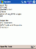
Free Downloads: Gpx To Map Info Converter
Easy way to convert Waypoints from KMZ or KML to Gpx file format with the KML/KMZ to Gpx Converter free.
Easy Steps :
- Save your waypoints in KMZ or KML format with google earth
- Import that format in the KML/KMZ to Gpx Converter free
- Then select waypoint you want to convert to Gpx format
- Export the Gpx...
Category: Audio / Rippers & Encoders
Publisher: HotelResortClub.com, License: Freeware, Price: USD $0.00, File Size: 656.6 KB
Platform: Windows
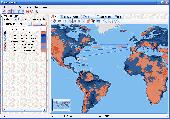
gpxflash is a Gpx-File Parser that parses Gpx-Files, shows the contained GPS-Tracks on a Google Map using the Google Maps Flash-API and draws Height-Profiles of the Tracks. In the Map-Tab Tracks can be Played back in GPXFlash (with adjustable Speed-Factor)
Category: Home & Education / Miscellaneous
Publisher: Google, License: Shareware, Price: USD $0.00, File Size: 1.1 MB
Platform: Windows
Creating a Map based on Gpx files for your GPS and for MapSource/BaseCamp on your computer is possible with several existing programs, but it's certainly not easy to accomplish. With IMGfromGPX it's a matter of a few mouse clicks! This program can generate a Map with the following features:
tracks in 8 different colors, as lines or areas;
POIs divided...
Category: Home & Education / Miscellaneous
Publisher: JaVaWa GPS-tools, License: Shareware, Price: USD $0.00, File Size: 4.9 MB
Platform: Windows
Geocache Manager is an intuitive geocache management and planning tool.
Geocache Manager is an intuitive geocache management and planning tool. Manage all your Geocaches from one place. Send only the caches you want to your GPS receiver. When you’re done Geocaching, download them to Geocache Manager to automatically update your finds.
Import Geocaches from pocket queries, .loc or .Gpx files. View all your caches on a Map with the...
Category: Multimedia & Design / Multimedia App's
Publisher: Mien Software, License: Shareware, Price: USD $19.95, File Size: 2.9 MB
Platform: Windows
GPX to USR Geocaching Utility allows you to import your GPX files and convert them in to Lowrance .
Gpx to USR Geocaching Utility allows you to import your Gpx files and convert them in to Lowrance .USR files. You can easily import all your geocaching information contained in your Gpx files such as Name, Owner, Difficult and Terrain, Type (traditional, multi, virtual, etc.), size( micro, small, regular, large), waypoint code and hints. You can also assign geocaching...
Category: Software Development / Misc. Programming
Publisher: Lowrance, License: Freeware, Price: USD $0.00, File Size: 637.1 KB
Platform: Windows
CacheMagnet is a free, open source geocaching waypoint management program.
CacheMagnet is a free, open source geocaching waypoint management program.
With CacheMagnet, you can read and display contents of .Gpx or .LOC files, download waypoints to your GPSr, load .ZIP files from geocaching.com pocket queries, edit cache descriptions and waypoint locations (great for puzzle caches), save changes to Gpx files, print reports and maps, combine...
Category: Home & Education / Miscellaneous
Publisher: Brian Erickson, License: Freeware, Price: USD $0.00, File Size: 609.0 KB
Platform: Windows
This program converts from GPX format to CSV format or vice versa.
This program converts from Gpx format to CSV format or vice versa. You can create waypoints in MapSource and then convert them to POI (CSV) files for download or sharing with others.
You can also convert POI (CSV) files that others have created, and then edit them in MapSource. Now that the Garmin POI loader supports Gpx files, GPXtoPOI's most important role is...
Category: Business & Finance / Calculators
Publisher: MasterClass, License: Freeware, Price: USD $0.00, File Size: 1.4 MB
Platform: Windows
A program to convert GPS-track of *. gpx, *.
mps, *. plt or *. nmea format to Navitel Tracks.
Category: Home & Education / Sports
Publisher: DXsoft, License: Freeware, Price: USD $0.00, File Size: 31.6 KB
Platform: Windows
 Freeware
org, uses file and position names that suit to the display of the TomTom Rider, uses file, route and position names that suit to the display of the Map&Guide Motorrad Tourenplaner, remembers language, paths, window size and position. . .
Category: Business & Finance / Conversion Applications
Publisher: Christian Pesch, License: Freeware, Price: USD $0.00, File Size: 6.6 MB
Platform: Windows, Mac, Linux, Solaris, FreeBSD, OpenBSD, Java

Importation/Exportation: Import/export trails to Gpx file. Unlimited number of trails, and TrackPoints. Export to Gpx, Excel, PDF, XPS and KML/KMZ. Data table: Very flexible data table that allows sorting by columns, with inheritance of data, attributes, etc. Presentation on Map: View on Map in accordance with the active trail, which comes from providers of...
Category: Home & Education / Miscellaneous
Publisher: Aplicaciones Topográficas S.L., License: Freeware, Price: USD $0.00, File Size: 27.0 MB
Platform: Windows
GeePeeEx Editor is specifically designed to produce and edit Gpx files destined for Garmin's® Automotive Satnav (GPSr) systems. These files can be used as input to Garmin's® POI Loader to produce enhanced Custom POI's (Points of Interest).
Convert CSV files to Gpx. Optionally and uniquely, GeePeeEx Editor will search for valid telephone numbers...
Category: Audio / Rippers & Encoders
Publisher: Them, License: Freeware, Price: USD $0.00, File Size: 2.6 MB
Platform: Windows
Currently it supports loading stand alone Gpx tracks and Gpx track data from the OSM database as well as loading and editing existing nodes, ways, metadata tags and relations from the OSM database.
JOSM is an editor for OpenStreetMap (OSM) written in Java 1.6.
Category: Business & Finance / Business Finance
Publisher: OpenStreetMap, License: Freeware, Price: USD $0.00, File Size: 15.2 MB
Platform: Windows

Commercial realtors require accurate and reliable tools to publish available properties online and show them on the website (specifying region, county, state, and city). We have created a unique Interactive Real Estate Map with all USA states and counties on it for real estate business. USA Real Estate Map is a unique and amazing vector-based tool that is very simple to use....
Category: Internet
Publisher: USFlashMap.com, License: Shareware, Price: USD $399.00, File Size: 3.9 MB
Platform: Windows, Mac, Linux, Unix, MS-DOS, AS/400, OS/2
New Zealand Map Reference Converter (NZMapConv) is software that LINZ provides to convert Map references between the old NZMS260 Map series and the new NZTopo50 Map series.NZMapConv is a Windows programme designed to convert individual coordinates entered manually.
Category: Multimedia & Design / Media Management
Publisher: Land Information New Zealand, License: Freeware, Price: USD $0.00, File Size: 2.4 MB
Platform: Windows
Cool Flash Map Maker is a powerful Flash Map software for developing interactive flash mapping solutions and products for Real Estate, Spacial Statistics, Business Locator Applications, Vector USA Map,World Map, Germany Map,ASIA Map, Canada Map, Europe Map, Australia Map, Austria Map, Africa Map, UK Map, South...
Category: Multimedia & Design / Multimedia App's
Publisher: Go2Share, License: Shareware, Price: USD $29.95, File Size: 17.9 MB
Platform: Windows

World Map Pro in Flash is a dynamic mapping solution to show any information worldwide Use our Map: - to show international offices (international affiliates, hotel networks, etc) - to show worldwide communities and information on them - to improve search by providing information on any country or region - as a real estate or any other Map/catalogue - to show zones...
Category: Internet
Publisher: USFlashMap.com, License: Shareware, Price: USD $199.00, File Size: 120.0 KB
Platform: Windows, Mac, Linux, Unix, MS-DOS, AS/400, OS/2
With WinPIM, you can:
-Storage contacts info, organize & track them, create relationship map.
With WinPIM, you can:
-Storage contacts Info, organize & track them, create relationship Map.
-Manage time, allocate tasks.
-Compose HTML format diary, notes. Support Sound Recording.
-Communicated with friends via email.
-Sync with mobile phones or PDA, works with other programs.
-Share data over network, access data anytime anywhere.
Category: Business & Finance / Personal Info Managers
Publisher: YQSoft, Inc., License: Shareware, Price: USD $39.95, File Size: 6.4 MB
Platform: Windows
Freeware
Convert ESRI ShapeFiles (.SHP) geolocation data into AnyMap format to be used with AnyChart. AnyChart Flash Map Converter allows making use of a wide choice of maps with AnyChart Flash Component, a GIS visualization system that recognizes Map data in AnyMap format only. AnyChart Flash Map Converter makes it easy to visualize any geolocation data without hefty...
Category: Web Authoring / Image Mapping Tools
Publisher: AnyChart.Com, License: Freeware, Price: USD $0.00, File Size: 1.6 MB
Platform: Windows
Provides a very intuitive visualisation of your ride or run by coloring the track on the Map according to speed/pace, heart rate and lots of other parameters.
Track Coloring plugin is a port of parts of our ST2 "Map Overlay plugin" to ST3. It took a while, but now this outstanding work has been done.
The plugin has two major features: track coloring...
Category: Business & Finance / Business Finance
Publisher: Old Man Biking's SportTracks Plugins, License: Shareware, Price: USD $7.17, File Size: 915.7 KB
Platform: Windows
With Magellan Communicator for PC you can create a direct connection between your web browser and your Magellan GPS receiver connected to PC via USB cable. Enables data transfer from Geocaching.com in Gpx format.
Main features:
- Compatible with Geocaching.com
- Enable “Send to GPS" function
- Transfer Gpx files
Category: Utilities / Misc. Utilities
Publisher: MiTAC International Corporation, License: Freeware, Price: USD $0.00, File Size: 8.5 MB
Platform: Windows

OkMap is a GPS and Map software that:
-Works with vectorial maps and calibrates raster maps
-Organizes paths by creating waypoints, routes and tracks
-Uploads/downloads data to/from your GPS
-Uses altitude DEM data
-Supports GPS real-time navigation
-Sends/receives vehicles position and display tracks on maps in real time
-Provides autorouting and geocoding...
Category: Business & Finance / Applications
Publisher: Gian Paolo Saliola, License: Freeware, Price: USD $0.00, File Size: 20.2 MB
Platform: Windows
Now you can trace your network activity on world Map.GEO Spider helps you to trace, identify and monitor your network activity on world Map.You can trace any website or IP address. Whois reports give to you more Info about site, host, domain, ip address...
Category: Internet / Tools & Utilities
Publisher: Oreware.com, License: Shareware, Price: USD $20.00, File Size: 10.4 MB
Platform: Unknown
Shareware
GPS Mapping Software for Windows, Loading topographic maps, manage GPS devices and more. The software can be used with various Map formats including: GeoTiff, BSB Nautical Charts, AutoCad DXF files, ESRI Shapefiles. Using calibration you can also use scanned or downloaded JPG, BMP, GIF, PNG and TIF maps. The software can be used for survey, research, track and trace, real time...
Category: Home & Education / Science
Publisher: Eye4Software B.V., License: Shareware, Price: USD $75.04, EUR49, File Size: 6.7 MB
Platform: Windows
Remere's Map Editor is a map editor for the OpenTibia Project which was created by Remere.
Remere's Map Editor is a Map editor for the OpenTibia Project which was created by Remere.
Remere's Map Editor is a Map editor coded in C to be used with OpenTibia. It supports many advanced features such as autobordering and placing of composite objects. Runs under both Linux and Windows using wxWidgets and OpenGL.
Category: Games / Tools & Editors
Publisher: Remere, License: Shareware, Price: USD $0.00, File Size: 4.2 MB
Platform: Windows
This application was written for importing .
This application was written for importing .Map files created with editors such as Hammer into Cartography Shop. It will scan a .Map file and generate a .CSM file with all dependent textures required by the .CSM file. All brushes are separated for easier level modification.
Category: Utilities / Misc. Utilities
Publisher: Apex, License: Freeware, Price: USD $0.00, File Size: 1.4 MB
Platform: Windows