Free Downloads: Gpx To Mapinfo
EasyLoader is a Windows-only utility available from Pitney Bowes Mapinfo Corporation that allows you to upload Mapinfo .tab files to a remote database.If using this release of the EasyLoader v10.0 MBX via the Tools menu in Mapinfo Professional, it will require Mapinfo Professional v10.0.
Category: Multimedia & Design / Multimedia App's
Publisher: Pitney Bowes Software Inc., License: Freeware, Price: USD $0.00, File Size: 1.8 MB
Platform: Windows
The Mapinfo License Server must be installed on your network and be accessible to all Mapinfo Professional users. Mapinfo Professional is a powerful Microsoft Windows-based mapping and geographic analysis application from the experts in location intelligence. Designed to easily visualize the relationships between data and geography, Mapinfo Professional helps...
Category: Home & Education / Miscellaneous
Publisher: Pitney Bowes MapInfo, License: Freeware, Price: USD $0.00, File Size: 12.1 MB
Platform: Windows
Mapinfo ProViewer™ lets you share location intelligence with clients and co-workers, even if they do not have Mapinfo Professional. ProViewer allows anyone to open, view and manipulate your Mapinfo Professional maps, tables and analyses with easy-to-use functionality including print, zoom, scroll, select objects, measure distances and view details.
Category: Multimedia & Design / Graphics Viewers
Publisher: MapInfo Corporation, License: Freeware, Price: USD $0.00, File Size: 419.6 KB
Platform: Windows
The Mapinfo Line Style Editor works by modifying the file from which Mapinfo reads its line style definitions. MILISTED can open any valid Mapinfo line style definition file, modify it, and save it with any name, however, Mapinfo only experiences the changes when it starts up and reads the mapinfow.pen file it finds in the same directory as mapinfow.exe. You can have...
Category: Multimedia & Design / Digital Media Editors
Publisher: Victor O. Lomtev, License: Freeware, Price: USD $0.00, File Size: 961.7 KB
Platform: Windows
GEScene is a Mapinfo utility that allows images to be exchanged in both directions between Mapinfo and Google Earth. Placemarks can also be created in Google Earth by using Mapinfo as a point of reference to easily pinpoint more obscure locations. Images saved in Google Earth can be registered and displayed in Mapinfo to compliment existing map layers. Conversely,...
Category: Utilities / Misc. Utilities
Publisher: Peter Doyle, License: Freeware, Price: USD $0.00, File Size: 3.2 MB
Platform: Windows
Easy way to convert Waypoints from KMZ or KML to Gpx file format with the KML/KMZ to Gpx Converter free.
Easy Steps :
- Save your waypoints in KMZ or KML format with google earth
- Import that format in the KML/KMZ to Gpx Converter free
- Then select waypoint you want to convert to Gpx format
- Export the Gpx format
- Upload...
Category: Audio / Rippers & Encoders
Publisher: HotelResortClub.com, License: Freeware, Price: USD $0.00, File Size: 656.6 KB
Platform: Windows
The Geosoft Plug-in for Mapinfo is an extension to the Mapinfo desktop software that provides data retrieval using DAP and also support for reading Geosoft file formats. The plug-in enables users to view Geosoft grid files as a raster layer inside Mapinfo. The plug-in also enables users to view Geosoft Maps as layers.
Category: Home & Education / Miscellaneous
Publisher: GEOSoft, License: Freeware, Price: USD $0.00, File Size: 109.1 MB
Platform: Windows
Allows to display and register rasters of ERDAS Imagine (*.
Allows to display and register rasters of ERDAS Imagine (*.IMG files) in Mapinfo. Georeferenced *.IMG images will be displayed directly in Mapinfo Professional, MapX, and MapXtreme environments. Additional utilities for free: img2tab utility - creates *.TAB file for each *.IMG file in batch mode. Mapinfo Table is created automatically and then can be used to open the...
Category: Utilities / System Utilities
Publisher: MicroOLAP Technologies LTD, License: Shareware, Price: USD $99.95, File Size: 1.1 MB
Platform: Windows
GPX to USR Geocaching Utility allows you to import your GPX files and convert them in to Lowrance .
Gpx to USR Geocaching Utility allows you to import your Gpx files and convert them in to Lowrance .USR files. You can easily import all your geocaching information contained in your Gpx files such as Name, Owner, Difficult and Terrain, Type (traditional, multi, virtual, etc.), size( micro, small, regular, large), waypoint code and hints. You can also assign geocaching...
Category: Software Development / Misc. Programming
Publisher: Lowrance, License: Freeware, Price: USD $0.00, File Size: 637.1 KB
Platform: Windows
This program converts from GPX format to CSV format or vice versa.
This program converts from Gpx format to CSV format or vice versa. You can create waypoints in MapSource and then convert them to POI (CSV) files for download or sharing with others.
You can also convert POI (CSV) files that others have created, and then edit them in MapSource. Now that the Garmin POI loader supports Gpx files, GPXtoPOI's most important role is...
Category: Business & Finance / Calculators
Publisher: MasterClass, License: Freeware, Price: USD $0.00, File Size: 1.4 MB
Platform: Windows
BosqMap software is a .mbx program for Mapinfo which enables the user to add, view and edit data held in Mapinfo tables, simply and easily link tables to other tables and link multiple photos and other files to map-objects and all this through one simple dialog box or form.
BosqMap can display your existing Mapinfo tables or can be used to design new ones
BosqMap...
Category: Business & Finance / Applications
Publisher: BosqMap Limited, License: Shareware, Price: USD $90.00, File Size: 2.0 KB
Platform: Windows
Mapinfo Professional® is a powerful Microsoft® Windows®–based mapping and geographic analysis application. Designed to easily visualise the relationships between data and geography, Mapinfo Professional 11 makes it faster and easier than ever to create, share and use maps.
Category: Software Development / Misc. Programming
Publisher: Pitney Bowes Software, Inc, License: Shareware, Price: USD $1950.00, File Size: 15.1 MB
Platform: Windows
GeePeeEx Editor is specifically designed to produce and edit Gpx files destined for Garmin's® Automotive Satnav (GPSr) systems. These files can be used as input to Garmin's® POI Loader to produce enhanced Custom POI's (Points of Interest).
Convert CSV files to Gpx. Optionally and uniquely, GeePeeEx Editor will search for valid telephone numbers...
Category: Audio / Rippers & Encoders
Publisher: Them, License: Freeware, Price: USD $0.00, File Size: 2.6 MB
Platform: Windows
Currently it supports loading stand alone Gpx tracks and Gpx track data from the OSM database as well as loading and editing existing nodes, ways, metadata tags and relations from the OSM database.
JOSM is an editor for OpenStreetMap (OSM) written in Java 1.6.
Category: Business & Finance / Business Finance
Publisher: OpenStreetMap, License: Freeware, Price: USD $0.00, File Size: 15.2 MB
Platform: Windows
gpxflash is a Gpx-File Parser that parses Gpx-Files, shows the contained GPS-Tracks on a Google Map using the Google Maps Flash-API and draws Height-Profiles of the Tracks. In the Map-Tab Tracks can be Played back in GPXFlash (with adjustable Speed-Factor)
Category: Home & Education / Miscellaneous
Publisher: Google, License: Shareware, Price: USD $0.00, File Size: 1.1 MB
Platform: Windows
Mapinfo Professional® is a powerful Microsoft® Windows®-based mapping and geographic analysis application from the experts in location intelligence. Designed to easily visualize the relationships between data and geography, Mapinfo Professional helps business analysts, planners, GIS professionals – even non-GIS users – gain new insights into their markets,...
Category: Home & Education / Miscellaneous
Publisher: Pitney Bowes Software Inc., License: Shareware, Price: USD $0.00, File Size: 58.8 KB
Platform: Windows
It`s a FREE ESRI shape files (*.shp), Mapinfo interchange (*.mif) and AutoCAD *.dxf viewer. Using this utility you can view *.shp files (ESRI shape files), *.mif files (Mapinfo interchange) and AutoDesk AutoCAD *.dxf. No other files are needed.
Category: Multimedia & Design
Publisher: Avangardo, License: Freeware, Price: USD $0.00, File Size: 420.9 KB
Platform: Windows
With MapCAD another 11 CAD features are available for MapInfo Pro.
With MapCAD another 11 CAD features are available for Mapinfo Pro. Particularly MapCAD cells are an excellent opportunity to create symbols and one's own pattern or hatches. These cells are vector symbols managed in a library.
Category: Multimedia & Design / Image Editing
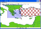
An existing polyline or area (red object) can be converted to a Spline with the Spline function. The result is a polyline again (blue object).
Publisher: AGIS GmbH, License: Shareware, Price: USD $0.00, File Size: 2.2 MB
Platform: Windows
Geocache Manager is an intuitive geocache management and planning tool.
Geocache Manager is an intuitive geocache management and planning tool. Manage all your Geocaches from one place. Send only the caches you want to your GPS receiver. When you’re done Geocaching, download them to Geocache Manager to automatically update your finds.
Import Geocaches from pocket queries, .loc or .Gpx files. View all your caches on a map with the integrated Map...
Category: Multimedia & Design / Multimedia App's
Publisher: Mien Software, License: Shareware, Price: USD $19.95, File Size: 2.9 MB
Platform: Windows
NTF2MIF translates Ordnance Survey NTF data files to MapInfo MIF/MID format.
NTF2MIF translates Ordnance Survey NTF data files to Mapinfo MIF/MID format. This format can also be imported into many other GIS applications.
NTF2MIF translates the following data products:
Land-Line Plus; Meridian 2; Strategi; Landform Panorama Contour and DTM; Landform Profile Contour and DTM; OSCAR Traffic-Manager; OSCAR Asset-Manager; Code-Point NTF.
Category: Home & Education / Miscellaneous
Publisher: Nigel James, License: Shareware, Price: USD $0.00, File Size: 0
Platform: Windows
With Magellan Communicator for PC you can create a direct connection between your web browser and your Magellan GPS receiver connected to PC via USB cable. Enables data transfer from Geocaching.com in Gpx format.
Main features:
- Compatible with Geocaching.com
- Enable “Send to GPS" function
- Transfer Gpx files
Category: Utilities / Misc. Utilities
Publisher: MiTAC International Corporation, License: Freeware, Price: USD $0.00, File Size: 8.5 MB
Platform: Windows
GlobeXplorer's ImageConnect for Mapinfo is a unique extension that instantly brings georeferenced satellite and aerial photos into your desktop or mobile project from our online database. ImageConnect takes away the time, cost and hassle of locating an image provider, waiting for delivery, and managing large image files.
Category: Internet / Misc. Plugins
Publisher: GlobeXplorer, LLC, License: Freeware, Price: USD $0.00, File Size: 2.0 MB
Platform: Windows
Creating a map based on Gpx files for your GPS and for MapSource/BaseCamp on your computer is possible with several existing programs, but it's certainly not easy to accomplish. With IMGfromGPX it's a matter of a few mouse clicks! This program can generate a map with the following features:
tracks in 8 different colors, as lines or areas;
POIs divided into...
Category: Home & Education / Miscellaneous
Publisher: JaVaWa GPS-tools, License: Shareware, Price: USD $0.00, File Size: 4.9 MB
Platform: Windows
A program to convert GPS-track of *. gpx, *.
mps, *. plt or *. nmea format to Navitel Tracks.
Category: Home & Education / Sports
Publisher: DXsoft, License: Freeware, Price: USD $0.00, File Size: 31.6 KB
Platform: Windows
This free utility counts the number of finds and tabulates the finders by name for the caches in a Gpx file.
Use it to keep track of how many cachers have found your caches, or to compare the activity of your caches with your geocaching neighbors and which of your neighbors have found the most of your caches. The program provides results in simple text files and in CSV files...
Category: Utilities / Misc. Utilities
Publisher: Jim Evans, License: Freeware, Price: USD $0.00, File Size: 377.9 KB
Platform: Windows