Free Downloads: Html Image Map Coordinate Software
 Shareware
The Eye4Software Coordinate Calculator is an easy to use tool to perform Map or GPS Coordinate conversions. The Software can be used to transform a single Coordinate or a batch of coordinates read from a comma separated, database or ESRI shapefiles. The Software is shipped with a MS Access database file, containing more then 3500 ellipsoid, Map...
Category: Business & Finance / Calculators
Publisher: Eye4Software B.V., License: Shareware, Price: USD $49.00, EUR39, File Size: 3.2 MB
Platform: Windows
Shareware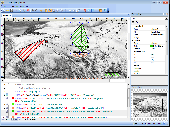
Visual Imagemapper is an Image Map editor; easy to use for the amateur, but still powerful enough for the professional developer. An Image Map is an Image that contains one or more clickable areas, also known as hotspots. Adding hotspots is both quick and easy when using Visual Imagemapper. You no longer have to cut and paste incomprehensible Html code...
Category: Internet / RSS & Web Blog Tools
Publisher: Vicentas, License: Shareware, Price: USD $30.00, File Size: 4.6 MB
Platform: Windows
The VB Image Map OCX is an ActiveX Control designed to provide your applications with the ability to display interactive images. Hotspots, or specially designated areas on your Image, can be defined that will react to various mouse events. It is easily integrated into your existing applications - just drop the control on a form, assign a background picture, and assign the...
Category: Software Development / Tools & Editors
Publisher: Silverband Software, License: Demo, Price: USD $49.95, File Size: 512.0 KB
Platform: Windows
This program is a tool for stretching a bitmap Image (a raster Image), trimming it to a box, and calibrating it. This is primarily of use when dealing with a scanned Image of a paper Map. Often when making a scan it is hard to get the Image precisely aligned; sometimes with old maps the paper has stretched. It can be useful where you want to make a tiled...
Category: Multimedia & Design / Multimedia App's
Publisher: Map Library, License: Freeware, Price: USD $0.00, File Size: 755.8 KB
Platform: Windows
Easily create Html Image/photo maps with this free friendly Image mapping utility from the authors of the best free photo editing Software - Photo Pos Pro photo editor . Pos Html Image Mapper includes WYSIWYG interface allowing you mapping images and photos fast and easy. Using the Software you can easily create graphic toolbars to your...
Category: Web Authoring / HTML Color Pickers
Publisher: PowerOfSoftware Ltd., License: Freeware, Price: USD $0.00, File Size: 7.9 MB
Platform: Windows
Freeware
Arm Map Explorer recreates all the functionalities of Google Maps on your desktop while expanding them with new extras. Map Explorer lets you locate and view any place on the planet using dynamic interactive maps. These maps are draggable, which means there is no need for you to click and wait for graphics to reload each time you want to view adjacent parts of a Map....
Category: Internet / Flash Tools
Publisher: ArmCode, License: Freeware, Price: USD $0.00, File Size: 5.5 MB
Platform: Windows
Shareware
Java toolkit to add Coordinate conversion functionality to your Java applications and applets. The toolkit offers functionality to perform Map grid and datum transformations: latitude and longitude can be converted to various Map grids, like Transverse Mercator (TM), Oblique Mercator, Mercator, Oblique Stereographic, Polar Stereographic, Cassini, Albers Equal Area Conal,...
Category: Software Development / Components & Libraries
Publisher: Eye4Software B.V., License: Shareware, Price: USD $199.00, EUR179, File Size: 155.5 KB
Platform: Unknown
Shareware
GPS SDK to add GPS and Coordinate conversion functionality to your Software and scripts). All NMEA0183 protocol versions are supported and can be filtered by NMEA sentence type and talker ID. Garmin USB PVT support. Information on GPS status can also be retrieved: GPS fix quality, satellites used in fix, satellites in view, satellite azimuth, elevation and signal strengths....
Category: Software Development
Publisher: Eye4Software B.V., License: Shareware, Price: USD $99.00, EUR79, File Size: 2.3 MB
Platform: Windows
Trellian Image Mapper is the quickest way to create image mapped images for your website.
Trellian Image Mapper is the quickest way to create Image mapped images for your website. Full support for hyperlinked rectangles, circles and even polygon regions is provided and you can import all your current Image maps. After you have created your Image Map, Trellian Image Mapper will generate the required Html code ready to be pasted...
Category: Multimedia & Design / Multimedia App's
Publisher: Trellian, License: Shareware, Price: USD $19.95, File Size: 1.8 MB
Platform: Windows
CoffeeCup Image Mapper++ has MouseOver Html capability, includes a fully functional Image Map wizard, and it enables you to assign parts of an Image to different links. Image Mapper++ can Map any interlaced GIF, non-interlaced GIF, standard JPEG, progressive JPEG, or even the first frame of an Animated GIF. There are three different shape methods...
Category: Multimedia & Design / Media Management
Publisher: Idyle Software, License: Shareware, Price: USD $0.00, File Size: 4.0 MB
Platform: Windows
Shareware
GPS Mapping Software for Windows, Loading topographic maps, realtime navigation, track recording, manage GPS devices and more. The Software can be used with various Map formats including: GeoTiff, BSB Nautical Charts, AutoCad DXF files, ESRI Shapefiles. Using calibration you can also use scanned or downloaded JPG, BMP, GIF, PNG and TIF maps. The Software can be used...
Category: Home & Education / Science
Publisher: Eye4Software B.V., License: Shareware, Price: USD $149.00, EUR99, File Size: 11.1 MB
Platform: Windows
Shareware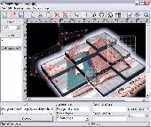
Create Html Image Maps of any shape in just a few clicks! Map Designer automates the creation of Html Image Maps, making it easy for designers and Web developers to specify hot-links and clickable areas within images. Map Designer helps Web developers specify rectangular, round or arbitrary-shape areas in a what-you-see-is-what-you-get mode....
Category: Web Authoring / HTML Editors
Publisher: ForthTech Software, License: Shareware, Price: USD $23.00, File Size: 1.1 MB
Platform: Windows
Shareware
CoffeeCup Image Mapper has mouseover Html capability, includes a fully functional Image Map wizard, and enables users to attach parts of an Image to different links. Image Mapper can Map any noninterlaced GIF, interlaced GIF, standard JPEG, and progressive JPEG, as well as the first frame of an animated GIF. Users can choose from three different...
Category: Multimedia & Design / Button Creators
Publisher: CoffeeCup Software, License: Shareware, Price: USD $24.00, File Size: 3.8 MB
Platform: Windows
There has never been a more comprehensive, powerful, all-in-one Software solution that provides an easy-to-use and intuitive user interface for digitizing, geographic referencing, reprojection, tiling, and mosaicking.
Didger solves the problem of combining data files in different Coordinate systems, by providing extensive tools to transform the data into one cohesive...
Category: Home & Education / Miscellaneous
Publisher: Golden Software, License: Shareware, Price: USD $0.00, File Size: 0
Platform: Windows
OziExplorer3D is an impeccable application for viewing Map images in 3D, along with the options of rotating it in every possible direction, zoom in/out and lots more. The application actually creates grid of heights using the height data that has been obtained and writes it to a file, along with the other required information, loads the file and the Map Image or the...
Category: Multimedia & Design / Multimedia App's
Publisher: Des Newman, License: Shareware, Price: USD $30.00, File Size: 1.9 MB
Platform: Windows
MMS Coordinate Converter is a free utility with which you can convert a survey Coordinate between different systems and datums.
The utility will convert between the Cape (Clarke) / Wgs84 datums with coordinates in Geographical / UTM / LO formats similar to the functions available in Model- and Survey-Maker.
Category: Multimedia & Design / Media Management
Publisher: Model Maker Systems, License: Freeware, Price: USD $0.00, File Size: 6.8 MB
Platform: Windows
Free Imagemapper is one of the most user-friendly tools available to produce HTML image maps.
Free Imagemapper is one of the most user-friendly tools available to produce Html Image maps. Its simplicity of use makes it suitable for all types of users, novice and expert alike. This application allows you to add hyperlinks and comments to specific sections of an Image, so that you can then navigate from each of them to their corresponding destination.
In...
Category: Multimedia & Design / Multimedia App's
Publisher: 4dots Software, License: Freeware, Price: USD $0.00, File Size: 2.4 MB
Platform: Windows
ArcGIS for AutoCAD is a free, downloadable plug-in application for AutoCAD that provides improved interoperability between AutoCAD and ArcGIS. Within the AutoCAD environment, you gain easy access to enterprise GIS maps hosted by ArcGIS Server.
In addition, ArcGIS for AutoCAD gives you the ability to prepare CAD data for use with the ArcGIS system while leveraging your existing CAD...
Category: Multimedia & Design / Image Editing
Publisher: Environmental Systems Research Institute, Inc., License: Demo, Price: USD $0.00, File Size: 1.4 MB
Platform: Windows
Gismaps Viewer is a GIS viewer that can be used for geospatial analysis and map production.
Gismaps Viewer is a GIS viewer that can be used for geospatial analysis and Map production.
The main features are:
- read Shape files using geographic Coordinate system
- view satellite images (MrSid, jpeg, bmp and tiff file formats)
- generate thematic maps, queries and labels
- export do Google Earth KML (shp2kml)
- configure Map...
Category: Multimedia & Design / Graphics Viewers
Publisher: Gismaps Sistemas Ltda., License: Freeware, Price: USD $0.00, File Size: 10.2 MB
Platform: Windows
All measurements, GPS-protocols and own informations in a single map.
All measurements, GPS-protocols and own informations in a single Map.
Several enterprise maps in one program without additional costs.
No limitation of the area quantity
Tile and join fields.
Multilingual: currently in english, german, spanish, french, greek, polish.
International: over 80 Coordinate reference systems of 26 european countries...
Category: Audio / Utilities & Plug-Ins
Publisher: GPSur Dr. Erhard Regener, License: Shareware, Price: USD $449.00, File Size: 7.9 MB
Platform: Windows
GIFfyCutter is a powerful and efficient tool that allows you to spit your Image into parts and make Image Map for any part. Mouseover JavaScript capability, multiformat support, browser previewing, powerful zoom feature, well-written help make GIFfyCutter best utility of that kind. It doesn't matter if you use it just to create clickable images (Image maps) for...
Category: Multimedia & Design / Multimedia App's
Publisher: fCoder Group International, License: Shareware, Price: USD $19.00, File Size: 1.8 MB
Platform: Windows
Create Image maps for your website with this easy-to-use tool from Multimedia Australia. Simply select the Image you want to use, choose a shape, then visually draw the Image Map regions. The Image Map coordinates can be copied to the clipboard for insertion into your favourite text editor.
Category: Web Authoring / Web Design Utilities
Publisher: Multimedia Australia, License: Shareware, Price: USD $24.95, File Size: 931.8 KB
Platform: Unknown
Cool Flash Map Maker is a powerful Flash Map Software for developing interactive flash mapping solutions and products for Real Estate, Spacial Statistics, Business Locator Applications, Vector USA Map,World Map, Germany Map,ASIA Map, Canada Map, Europe Map, Australia Map, Austria Map, Africa Map, UK Map,...
Category: Multimedia & Design / Multimedia App's
Publisher: Go2Share, License: Shareware, Price: USD $29.95, File Size: 17.9 MB
Platform: Windows
DraftSight is a drafting automation software tool.
DraftSight is a drafting automation Software tool.A Coordinate system determines each point of a drawing surface or entity unambiguosly.DraftSight uses the Cartesian Coordinate system consisting of three Coordinate axes.Axes are arranged orthogonally crossing at the origin.
Category: Multimedia & Design / Image Editing
Publisher: Dassault Systemes, License: Freeware, Price: USD $0.00, File Size: 66.5 MB
Platform: Windows
Commercial
Bas-relief is intended for 2D to 3D conversion using the depth Map. The application opens two images: one is a coloured flat Image, the other is its depth Map, which shows us what areas are closer to us, and what are more distant. The white area is located at the foreground, the black one is at the background. Thereby, the general task is the acceptable depth Map...
Category: Multimedia & Design / Image Editing
Publisher: 3Dmix, License: Commercial, Price: USD $103.00, File Size: 1000 B
Platform: Windows