Free Downloads: Html Map States
 Freeware
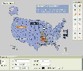
An interactive Flash USA Map with all the features you need for your web site or project. This is the ideal solution for dealer maps, real-estate listings, or visualizing state statistics. Nearly every aspect of the Map is customizable. However, unlike competing products, our Map is very simple to install and edit. Just upload XML and SWF files and embed.
Category: Internet / Flash Tools
Publisher: http://www.flashusamap.com/trial/flashus, License: Freeware, Price: USD $0.00, File Size: 93.8 KB
Platform: Unknown
Want to brush up on the names and locations of the 48 contiguous states of the USA?
Want to brush up on the names and locations of the 48 contiguous States of the USA? This program from the Family Games Web Center will help you. United States Geography Tutor presents a scrolling Map of the U.S. along with a list of States. As your mouse pointer passes over the Map, the state under the pointer highlights, along with its entry in the list....
Category: Home & Education / Genealogy
Publisher: AHA! Software Inc., License: Freeware, Price: USD $0.00, File Size: 500.0 KB
Platform: Windows
Learn the U.S. States and capitals in a fun (and funny) way. A full screen clickable Map of the U.S. is used to teach names and locations of States and capitals in a variety of ways. When the student completes ten problems they are rewarding with a silly animation using 3D graphics. The tutorial section helps the student learn where States are on a Map and...
Category: Home & Education / Genealogy
Publisher: Flix Productions, License: Shareware, Price: USD $18.00, File Size: 9.3 MB
Platform: Windows
Drag and drop the country names of United States correctly onto the map.
Drag and drop the country names of United States correctly onto the Map. A greate geography game. Good for kids from all around the globe to study and to learn about the geography of the united States. A greate test for the children in the united States, to find out if they know united States geography.
Category: Home & Education / Miscellaneous
Publisher: Sobolsoft, License: Shareware, Price: USD $19.99, File Size: 3.0 MB
Platform: Windows
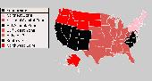
USA Real Estate Map Pro is a premium class software for mapping: real estate properties, contact listings, offices and other geo spatial data. Interactive Real Estate Map is rather simple to integrate with database listings: both to specify the States and counties that should be active on Map, and pass the selected county name or ID back, for further use. Among the...
Category: Business & Finance / Database Management
Publisher: USFlashMap.com, License: Shareware, Price: USD $399.00, File Size: 10.4 MB
Platform: Windows, Mac, Linux, Unix, MS-DOS, AS, 400
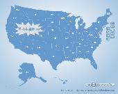
US States Flash Map Silver (with FLA source)
for web sites, interactive applications, presentations, and more.
With this fully-clickable Map you will be able to improve navigation and provide visitors with better and quicker access to information as well as improve the way you present the information. The Map can be easily customizable. In just a few minutes...
Category: Web Authoring / Web Design Utilities
Publisher: Fla-shop.com Inc., License: Demo, Price: USD $44.90, File Size: 140.0 KB
Platform: Windows
Anychart is a flexible Macromedia Flash based-solution, which allows you to easily display any sort of data dealing with geographical locations. It contains United States Maps with Counties, World Map, etc. XML data file and a set of customizable options make AnyChart Maps a universal solution for web developers. AnyChart allows you to create superb, compact, interactive maps....
Category: Software Development
Publisher: AnyChart.Com, License: Shareware, Price: USD $199.00, File Size: 2.8 MB
Platform: Windows, Mac, Linux, Palm,
Single State Mapping Tool allows you to create maps of individual States with Microsoft® MapPoint® 2002, 2004 or 2006. Make maps of individual States. For various purposes, many users of Microsoft MapPoint would like to cover up neighboring States for their maps in Microsoft MapPoint. This tool allows you to do that. Demo data file allows you to create an individual...
Category: Business & Finance
Publisher: MP2KMag and Winwaed Software Technology LLC, License: Data Only, Price: USD $75.00, File Size: 1.4 MB
Platform: Windows
Interactive Flash maps US States.
Interactive Flash maps US States.
Suitable for Real-Estate, Dealer Maps, Branch Offices Locators.
With this fully-clickable Map you will be able to improve navigation and provide visitors with better and quicker access to information as well as improve the way you present the information. The Map can be used "as is" however it is also easily customizable....
Category: Web Authoring / Web Design Utilities
Publisher: Fla-shop.com, License: Demo, Price: USD $24.90, File Size: 229.0 KB
Platform: Windows
United States and Counties Map Locator for websites, presentations and more.
United States and Counties Map Locator for websites, presentations and more. The Map contains locator maps of each state!Easy adjustment. Variants of using a Map locator:- Real-Estate websites- Quick access to contact organization data, having affiliated network in USAWith this fully-clickable Map you will be able to improve navigation and provide visitors...
Category: Web Authoring / Flash Utilities
Publisher: Fla-shop.com Inc., License: Demo, Price: USD $399.00, File Size: 747.5 KB
Platform: Windows, Mac
Interactive Flash Dealer Store locator is a unique vector-based tool that helps you to originally represent the information about your business locations. Now it is not only a simple list of offices or stores but also an interactive flash Map with nice animation. Moreover this flash locator can be customized to perfectly fit your website design. This Map can make your...
Category: Internet
Publisher: USFlashMap.com, License: Shareware, Price: USD $399.00, File Size: 3.9 MB
Platform: Windows, Mac, Linux, Unix, MS-DOS, AS/400, OS/2
TerraClient allows viewing and printing of ground level satellite photographs of the United States.
TerraClient allows viewing and printing of ground level satellite photographs of the United States. Featured is a unique Map overlay option that automatically superimposes a "paper" roadmap over the satellite photos. This Map overlay option has been designed to help users identify indistinct land features in the satellite photos. All Map and photographic...
Category: Home & Education / Miscellaneous
Publisher: Bill Friedrich Software, License: Freeware, Price: USD $0.00, File Size: 1.3 MB
Platform: Windows
Knowing a list of states and capitals is only a beginning.
Knowing a list of States and capitals is only a beginning. The United States of America leads the 21st century. Make your reading or TV more interesting and educational by relating information on this vast geographical territory to your mind picture. Grasp the USA will build you a lasting mind Map - the sure foundation for your lifetime of learning, knowing and...
Category: Home & Education
Publisher: Clarkscript, License: Shareware, Price: USD $19.99, File Size: 1.6 MB
Platform: Windows

Commercial realtors require accurate and reliable tools to publish available properties online and show them on the website (specifying region, county, state, and city). We have created a unique Interactive Real Estate Map with all USA States and counties on it for real estate business. USA Real Estate Map is a unique and amazing vector-based tool that is very simple...
Category: Internet
Publisher: USFlashMap.com, License: Shareware, Price: USD $399.00, File Size: 3.9 MB
Platform: Windows, Mac, Linux, Unix, MS-DOS, AS/400, OS/2
USA Geography Tutor is an educational game, part of a series of geography games, that can be really helpful to those who want to learn the names and locations of the 48 States of the USA. The program is very straightforward, and features two simple games which are extremely easy to play.
It is divided into three sections, one of which will be the preliminary step before...
Category: Home & Education / Miscellaneous
Publisher: AHA! Software Inc., License: Freeware, Price: USD $0.00, File Size: 935.0 KB
Platform: Windows
Shareware
Visual Imagemapper is an image Map editor; easy to use for the amateur, but still powerful enough for the professional developer. An image Map is an image that contains one or more clickable areas, also known as hotspots. Adding hotspots is both quick and easy when using Visual Imagemapper. You no longer have to cut and paste incomprehensible Html code between the image...
Category: Internet / RSS & Web Blog Tools
Publisher: Vicentas, License: Shareware, Price: USD $30.00, File Size: 4.6 MB
Platform: Windows
The VB Image Map OCX is an ActiveX Control designed to provide your applications with the ability to display interactive images. Hotspots, or specially designated areas on your image, can be defined that will react to various mouse events. It is easily integrated into your existing applications - just drop the control on a form, assign a background picture, and assign the hotspot...
Category: Software Development / Tools & Editors
Publisher: Silverband Software, License: Demo, Price: USD $49.95, File Size: 512.0 KB
Platform: Windows
Freeware
Arm Map Explorer recreates all the functionalities of Google Maps on your desktop while expanding them with new extras. Map Explorer lets you locate and view any place on the planet using dynamic interactive maps. These maps are draggable, which means there is no need for you to click and wait for graphics to reload each time you want to view adjacent parts of a Map....
Category: Internet / Flash Tools
Publisher: ArmCode, License: Freeware, Price: USD $0.00, File Size: 5.5 MB
Platform: Windows
Cool Flash Map Maker is a powerful Flash Map software for developing interactive flash mapping solutions and products for Real Estate, Spacial Statistics, Business Locator Applications, Vector USA Map,World Map, Germany Map,ASIA Map, Canada Map, Europe Map, Australia Map, Austria Map, Africa Map, UK Map, South...
Category: Multimedia & Design / Multimedia App's
Publisher: Go2Share, License: Shareware, Price: USD $29.95, File Size: 17.9 MB
Platform: Windows
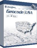
Map Suite Geocode USA is a powerful and feature-rich .NET geocoding engine that comes complete with a highly optimized dataset encompassing the entire United States. Map Suite Geocode USA features a fast, user-friendly .NET interface that enables C# and VB.NET software developers to take a United States address and quickly find its geographical location. In addition...
Category: Software Development
Publisher: ThinkGeo LLC, License: Commercial, Price: USD $2394.00, File Size: 341.1 KB
Platform: Windows
Europe Flash map Silver (with FLA source) 1.
Europe Flash Map Silver (with FLA source) 1.0for web sites, interactive applications, presentations, and more.With this fully-clickable Map you will be able to improve navigation and provide visitors with better and quicker access to information as well as improve the way you present the information. The Map can be easily customizable. In just a few minutes you can make any...
Category: Web Authoring / Flash Utilities
Publisher: Fla-shop.com Inc., License: Demo, Price: USD $69.00, File Size: 140.0 KB
Platform: Windows
Build your Site Map
Generate an Html site Map to allow serarch engines to index more pages on your website.
Create an XML sitemap format that can be submitted to Google to help them crawl your website better.
Create a Text sitemap to submit to Yahoo and other search engines.
Category: Web Authoring / Web Design Utilities
Publisher: Supernova-soft, License: Shareware, Price: USD $0.00, File Size: 421.5 KB
Platform: Windows
Time Zones Map is the flash world time Map featuring the time peculiarities of more then 50 cities all over the world. Its eye-catching but still pleasant design, varied functions and multiple application abilities combine everything the ultra-modern flash world time Map must have. You can put our Time Zone Map either on one of your website?s pages or put a banner,...
Category: Web Authoring / Flash Utilities
Publisher: USFlashMap.com, License: Shareware, Price: USD $249.00, File Size: 45.0 KB
Platform: Windows, Mac, Linux, Unix, MS-DOS, AS, 400
Easily create Html image/photo maps with this free friendly image mapping utility from the authors of the best free photo editing software - Photo Pos Pro photo editor . Pos Html Image Mapper includes WYSIWYG interface allowing you mapping images and photos fast and easy. Using the software you can easily create graphic toolbars to your website; you can easily link desired...
Category: Web Authoring / HTML Color Pickers
Publisher: PowerOfSoftware Ltd., License: Freeware, Price: USD $0.00, File Size: 7.9 MB
Platform: Windows
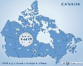
Canada Flash map (with FLA source) for web sites, interactive applications, presentations, and more.
Canada Flash Map (with FLA source) for web sites, interactive applications, presentations, and more.
With this fully-clickable Map you will be able to improve navigation and provide visitors with better and quicker access to information as well as improve the way you present the information. The Map can be easily customizable. In just a few minutes you can make any...
Category: Web Authoring / Web Design Utilities
Publisher: Fla-shop.com, License: Demo, Price: USD $44.90, File Size: 83.0 KB
Platform: Windows