Free Downloads: Interactive Maps
 Shareware
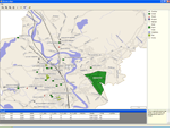
ActualMap is a set of high-performance, .NET mapping components and controls for embedding Maps in desktop (Windows Forms) applications. ActualMap gives you the ability to generate Maps, drill-down capability, thematic mapping, routing, vehicle tracking and other features that will make the Maps fully Interactive. Features : Multiple map layers. Dynamic map...
Category: Software Development / Components & Libraries
Publisher: VDS Technologies, License: Shareware, Price: USD $799.00, File Size: 8.0 MB
Platform: Windows
With yalips maps you get 4 products in 1.
With yalips Maps you get 4 products in 1. You are more productive, more creative and perform better on your job when using visual software tools. With the resulting visualizations you can communicate more effectively and convincingly to your collegues, your boss, your customer or the chairman of the board. Therefore many companies spent a lot of money on such tools. Unfortunately, most...
Category: Business & Finance / Project Management
Publisher: yalips Software, License: Shareware, Price: USD $80.00, File Size: 29.6 MB
Platform: Windows
Anychart is a flexible Macromedia Flash based-solution, which allows you to easily display any sort of data dealing with geographical locations. It contains United States Maps with Counties, World Map, etc. XML data file and a set of customizable options make AnyChart Maps a universal solution for web developers. AnyChart allows you to create superb, compact, Interactive...
Category: Software Development
Publisher: AnyChart.Com, License: Shareware, Price: USD $199.00, File Size: 2.8 MB
Platform: Windows, Mac, Linux, Palm,
TopoGun is a stand-alone resurfacing, and maps baking application.
TopoGun is a stand-alone resurfacing, and Maps baking application. The resurfacing functions in TopoGun will help you modify and/or recreate the edgeflow of your digital 3D models.
The Maps baking functions, will help you bake various types of texture Maps from your high resolution 3D models and then allow you to apply them to your newly created optimized...
Category: Multimedia & Design / Animation
Publisher: SC PIXELMACHINE SRL, License: Shareware, Price: USD $100.00, File Size: 55.5 MB
Platform: Windows
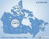
Canada Flash map (with FLA source) for web sites, interactive applications, presentations, and more.
Canada Flash map (with FLA source) for web sites, Interactive applications, presentations, and more.
With this fully-clickable map you will be able to improve navigation and provide visitors with better and quicker access to information as well as improve the way you present the information. The map can be easily customizable. In just a few minutes you can make any required changes -...
Category: Web Authoring / Web Design Utilities
Publisher: Fla-shop.com, License: Demo, Price: USD $44.90, File Size: 83.0 KB
Platform: Windows
You can create a backup of your maps with JaVaWa GMTK and restore these (e.
You can create a backup of your Maps with JaVaWa GMTK and restore these (e.g. on another computer) including unlock codes. Re-installing Maps is unnecessary.
Migration of your Garmin Maps from and old computer to a new one is straightforward with this application.
Category: Utilities / Backup
Publisher: JaVaWa GPS-tools, License: Shareware, Price: USD $0.00, File Size: 5.4 MB
Platform: Windows
Live Satellite Maps or Google maps is a web server mapping applications.
Live Satellite Maps or Google Maps is a web server mapping applications.Provides scrolling map images and satellite photos around the earth and even the route between different places.Since 6 October 2005, live satellite Maps is part of local Google.Google live satellite Map provides the ability to zoom in or zoom out to show the map.The user can control the map with your...
Category: Home & Education / Science
Publisher: www.satelliteview-of-my-house.com, License: Freeware, Price: USD $0.00, File Size: 643.0 KB
Platform: Windows
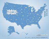
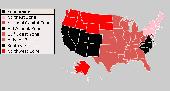
US States Flash map Silver (with FLA source)
for web sites, Interactive applications, presentations, and more.
With this fully-clickable map you will be able to improve navigation and provide visitors with better and quicker access to information as well as improve the way you present the information. The map can be easily customizable. In just a few minutes you can make any...
Category: Web Authoring / Web Design Utilities
Publisher: Fla-shop.com Inc., License: Demo, Price: USD $44.90, File Size: 140.0 KB
Platform: Windows
Freeware
Arm Map Explorer recreates all the functionalities of Google Maps on your desktop while expanding them with new extras. Map Explorer lets you locate and view any place on the planet using dynamic Interactive Maps. These Maps are draggable, which means there is no need for you to click and wait for graphics to reload each time you want to view adjacent parts of a map....
Category: Internet / Flash Tools
Publisher: ArmCode, License: Freeware, Price: USD $0.00, File Size: 5.5 MB
Platform: Windows
ArcReader is a free, easy-to-use desktop mapping application that allows users to view, explore, and print Maps and globes. Anyone with ArcReader can view high-quality Interactive Maps authored by a high-level ArcGIS Desktop product and published with the ArcGIS Publisher extension.
ArcReader is a free and easy-to-use application that allows users to view and...
Category: Desktop Enhancements / Shell & Desktop Managers
Publisher: Environmental System Research Institute, Inc., License: Freeware, Price: USD $0.00, File Size: 499.2 MB
Platform: Windows
Nokia Maps 3D browser plugin is a free mapping product and service by Nokia for its mobile phones and for internet browsers. Nokia Maps includes voice guided navigation for both pedestrians and drivers for 74 countries in 46 different languages and there are Maps for over 180 countries.
See the world in high-resolution 3D. Everything from the sky to the street. Plan...
Category: Internet / Browser Accessories
Publisher: Nokia, License: Freeware, Price: USD $0.00, File Size: 9.8 MB
Platform: Windows
From the Sacre Coeur to the Arc de Triomphe, your holiday to Paris starts from the moment you open your guide, plus you get Paris Maps and transport Maps.
Discover the best cafe terraces, unmissable museums and galleries, loveliest parks and gardens, best areas to shop or browse, unforgettable shows and live music venues, most fun places for children, and best restaurants to...
Category: Internet / Communications
Publisher: Mobile Systems, License: Shareware, Price: USD $9.80, File Size: 0
Platform: Windows
Covering every month of every theatre of World War II, this huge atlas is for wargamers and anyone interested in World War II. It provides a highly Interactive and thought-provoking view of the war, and is a great starting point for what-if scenarios. Each map contains date, movement, unit strengths and other military details.
From the world overview you can cycle through...
Category: Home & Education / Miscellaneous
Publisher: ProFantasy Software, License: Shareware, Price: USD $27.95, File Size: 57.0 MB
Platform: Windows
When you are looking for a powerful tool to satisfy various needs regarding vectors, raster and satellite imagery, you will find ILWIS Academic an efficient application. The program comes with such useful features as points to create Maps, lines for segment Maps, closed area segments for polygon Maps, spatial operations for raster Maps and so on. Whilst using images...
Category: Home & Education / Miscellaneous
Publisher: ITC, License: Freeware, Price: USD $0.00, File Size: 19.4 MB
Platform: Unknown
GDS Images and Document Maps is a unique document search utility.
GDS Images and Document Maps is a unique document search utility. GDS Images and Document Maps is a rather unique application that will enable you to store all your documents and images alongside other important files and folders right on your desktop so that you can use it straight from there, without the need to bother around with looking with looking for every single file...
Category: Utilities / Misc. Utilities
Publisher: toggle, License: Freeware, Price: USD $0.00, File Size: 558.8 KB
Platform: Windows
MapCreator combines a cartography and a graphics programme.
MapCreator combines a cartography and a graphics programme. The software is designed to create Maps and animated Maps of the highest quality as often required for presentations. For example, this could be Maps needed for a travel presentation. But also in
Category: Multimedia & Design
Publisher: primap.com, License: Freeware, Price: USD $0.00, File Size: 103.3 MB
Platform: Windows, Vista
CacheMaps retreives a variety of maps for your caches from the Internet.
CacheMaps retreives a variety of Maps for your caches from the Internet.
CacheMaps uses the Geocaching loc- or gpx-files as input. Directely from the Geocaching site or as exported from GSAK.CacheMaps v4 has been designed to be used next to GSAK. A lot of the functionality that was available in previous versions of CacheMaps, is available in GSAK now in a much better form. What...
Category: Audio / Utilities & Plug-Ins
Publisher: BigBird Productions, License: Freeware, Price: USD $0.00, File Size: 153.2 KB
Platform: Windows
MAPC2MAPC is a program to manipulate digital Maps,it loads map images and calibrate them,loads calibrations in many different formats and Datums,view the calibrated map,crop and rescale Maps whilst preserving the calibration,reproject Maps to 'Plate Carre' (Equirectangular),rotate Maps to true North.
Category: Multimedia & Design / Digital Media Editors
Publisher: Thorn, License: Shareware, Price: USD $0.00, File Size: 1.6 MB
Platform: Windows
Create GPS enabled geo Maps directly on the background of aereal photos and road Maps from the internet. Import geodata from Google-Earth, OpenStreetMap, GPS tracks and GPS logger. Map editor , manually digitizing. Specifical graphical objects (borderlines, borderareas) to guarantee exact same borders of neighbour areas..Screen calibration for true to display on the screnn.
Category: Multimedia & Design / Digital Media Editors
Publisher: GPSur Dr. Erhard Regener, License: Shareware, Price: USD $65.00, File Size: 6.4 MB
Platform: Windows
Terrain Tools - Create maps quickly and easily!
Terrain Tools - Create Maps quickly and easily!
Terrain Tools is the ideal tool for outdoor recreationists, real-estate professionals, farmers, ecologists, archaeologists and others who need to create basic Maps, calculate areas, lengths, bearings and distances.
Overlay GPS tracks on scanned images such as USGS or Canadian NTS topos. Import and export...
Category: Business & Finance / Applications
Publisher: Softree, License: Shareware, Price: USD $124.00, File Size: 15.0 MB
Platform: Windows
DataDrafter? is a new and unique program that allows you to create your own Interactive graphics applications with data editing, navigation, search and reporting features built in. Use DataDrafter? instead of Visio for example, to create diagrams, Maps an
Category: Multimedia & Design / Illustration
Publisher: datadrafter.com, License: Freeware, Price: USD $0.00, File Size: 3.0 KB
Platform: Unknown
Shareware
Offline Map Maker is a tool that help you to get offline tile images from Google Maps, Openstreetmap, Yandex Maps, Yahoo Maps, Mapquest, Gaode map, Tencent Maps, Baidu Maps, Tianditu, Arcgis Online, OneMap, Whereis, mapy.cz, Mappy, Waze, Sentinel-2 map, Strava Gloabal Heatmap, Wikimapia, GoMap.Az, Longdo Map, Bhuvan, National Map Australia, New Zealand...
Category: Internet / Download Managers
Publisher: allmapsoft.com, License: Shareware, Price: USD $79.00, File Size: 31.1 MB
Platform: Windows
With MapAuthor you can create, print and save desktop Maps, using data that you obtain from commercial sources or perhaps your in-hous GIS department as shapefiles (shapefiles are a very common GIS exchange format.) You can also produce internet-based Maps based on Google Maps, for use on your web site.
MapAuthor allows you to link your own data to Maps, for...
Category: Internet / Misc. Plugins
Publisher: MapAuthor.com, License: Freeware, Price: USD $0.00, File Size: 6.3 MB
Platform: Windows
Download, View, and Print Maps with the MrSID Viewer.
Download, View, and Print Maps with the MrSID Viewer.
To download and view Maps offline you need a special viewer. Maps are stored in MrSID format. The MRSID Viewer is a freeware tool. This library provides access to the MrSID viewer developed by LizardTech.
NOTE:
LizardTech dropped the link for that stand-alone viewer download from...
Category: Multimedia & Design / Graphics Viewers
Publisher: Lizardtech, License: Freeware, Price: USD $0.00, File Size: 2.0 MB
Platform: Windows
The Interactive SyslogViewer is derived from the WinSyslog Interactive SyslogServer, and separately available now. It's purpose is to display Syslog messages in real-time for direct analysis. isplays Syslog messages in Realtime on a configurable port in a datagrid view. Adiscon's Interactive SyslogViewer. Interactive SyslogViewer is a realtime syslog viewer...
Category: Internet / Communications
Publisher: Adiscon GmbH, License: Shareware, Price: USD $29.99, File Size: 26.6 MB
Platform: Windows