Free Downloads: Iran Road Maps
The most popular road design and calculation program in Iran.
The most popular Road design and calculation program in Iran.
Roadware is a Windows based package, prepared for Road design and calculations.
Main features:
- English user interface.
- WYSIWYG capability
- Menu deriven
- Unlimited sections
- Customizable section geometry
- DXF output of Cross sections and...
Category: Business & Finance / Applications
Publisher: MAZ Engineering Software, License: Freeware, Price: USD $0.00, File Size: 2.0 MB
Platform: Windows
FSM Moving Map is a Freeware software with some neat features.
FSM Moving Map is a Freeware software with some neat features. With proper Road Maps, you will be able to find your Road (or lack of) in FS environment, or fly at ease using Sectional or terminal charts.
The concept is very simple: you, the user define all the Maps once you are flying, FSMMM will try to locate the best map available, and display it on...
Category: Home & Education / Miscellaneous
Publisher: RanaInside, License: Freeware, Price: USD $0.00, File Size: 1.1 MB
Platform: Windows
Create GPS enabled geo Maps directly on the background of aereal photos and Road Maps from the internet. Import geodata from Google-Earth, OpenStreetMap, GPS tracks and GPS logger. Map editor , manually digitizing. Specifical graphical objects (borderlines, borderareas) to guarantee exact same borders of neighbour areas..Screen calibration for true to display on the screnn.
Category: Multimedia & Design / Digital Media Editors
Publisher: GPSur Dr. Erhard Regener, License: Shareware, Price: USD $65.00, File Size: 6.4 MB
Platform: Windows
This map combines topographic mapping with road and tourist detail.
This map combines topographic mapping with Road and tourist detail. The Road information is clear and elevation is shown using contours, spot heights and altitude shading. The map shows six different types of roads, highlighting scenic routes, places of interest, archaeological sites, monasteries, monuments and viewpoints.
Category: Home & Education / Miscellaneous
Publisher: Omni Resources, License: Shareware, Price: USD $21.99, File Size: 3.0 MB
Platform: Windows
GeoBuddy is a complete geocaching solution that can display all of the geocaches in your area, as well as your own personal GPS data, over USGS topo Maps, aerial photos, your own scanned paper trail and Road Maps. A built-in Web browser lists all of the information about each geocache, including pictures and hints left by the cache owner, and logs by recent visitors to the...
Category: Internet / Communications
Publisher: TopoGrafix, License: Shareware, Price: USD $49.95, File Size: 10.3 MB
Platform: Windows
TwoNav is a dual navigation system (On-Road/Off-Road) to perform most of your outdoor activities (hiking, biking, skiing, geoacaching, ...). TwoNav can also guide you when driving. A single solution for all your orientation needs. Load Maps, tracks, routes and waypoints and get ready for your trip!
Category: Home & Education / Miscellaneous
Publisher: CompeGPS TEAM, S.L., License: Shareware, Price: USD $67.28, File Size: 21.2 MB
Platform: Windows
The much-awaited feature of road editing is now available.
The much-awaited feature of Road editing is now available.
- Easy to use spline based editing, all controlled with 3D gizmos or numerical input. Add, delete, move and merge complex networks of roads.
- Control Road geometry generation resolution, banking and intersections. Real-time Road/terrain interaction computation using the GPU.
Flexible...
Category: Multimedia & Design / Animation
Publisher: Quad Software, License: Shareware, Price: USD $0.00, File Size: 0
Platform: Windows

Persia is the former name of Iran, the country with long history. Under Cyrus the Great and Darius the Great, the Persian Empire eventually became the largest and most powerful empire in human history up until that point. Dozens of pre-historic sites across the Iranian plateau point to the existence of ancient cultures. Persepolis was an ancient ceremonial capital of the Persian Empire....
Category: Desktop Enhancements / Screensavers
Publisher: Savers4Free.com, License: Freeware, Price: USD $0.00, File Size: 5.6 MB
Platform: Windows
Based on the memory card game.
Based on the memory card game. Road Sign Search lets you play while you learn the meaning of Road signs for the UK Driving Theory Test. Two decks of cards are dealt face down; one carries images of Road signs and the other descriptions of Road signs. You
Category: Games / Educational Games
Publisher: diktyon.co.uk, License: Freeware, Price: USD $0.00, File Size: 652.0 KB
Platform: Windows, Mac, 2K, 2K3
Back to the 2 Dimensions in a arcade car driving game :a Road and plenty of things to see and overtake ! Every element,car,Road,Road objects is freely customizable and expandable;it includes a Road+Road objects editor. Written in java ,the source code is available.
Category: Games / Arcade
Publisher: Francesco Piazza, License: Freeware, Price: USD $0.00, File Size: 1024 B
Platform: Windows, Linux
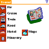
Traveling application for people on the move. Record all your travel needs and visualice your more important Maps and sketch them. Enter your flight data, cruises, train, Road, hotel and itineraries of Traveling application for people on the move.
Category: Home & Education / Hobbies
Publisher: Alvaro Adarraga, License: Shareware, Price: USD $11.99, File Size: 2.2 MB
Platform: Unknown

FSS Google Maps Downloader is a tool that can download the Google Maps images to your PC. This is a clearly free program. There is no spyware or adware. It's absolutely safe to install and to run. The interface is very simple and self explaining. It runs low on system resources consumption and is supported on all Windows versions. It can save them to your hard disk,...
Category: Internet / Download Managers
Publisher: FreeSmartSoft, License: Freeware, Price: USD $0.00, File Size: 874.0 KB
Platform: Windows
In this game there will be a city with some of the numbered buildings shown.
In this game there will be a city with some of the numbered buildings shown. Your task is to construct a Road that loops the city. The Road must not branch and there must only be one loop. The number on a building indicates the number of faces of this building facing a Road. Click at an edge to create a Road, click again to mark that edge with a cross to remind...
Category: Games / Misc. Games
Publisher: Novel Games Limited, License: Freeware, Price: USD $0.00, File Size: 253.7 KB
Platform: Windows
Horrum is a free and simple, yet fun 3D racing game with infinite road.
Horrum is a free and simple, yet fun 3D racing game with infinite Road.
The goal of the game is to set the best time between two check-points. Beware the traps and the end of the Road, and use or don't power-ups on the Road.
This game requires OpenGL 3D accelerator.
Category: Games / Misc. Games
Publisher: Jordan Tuzsuzov, License: Freeware, Price: USD $0.00, File Size: 1.4 MB
Platform: Windows
Diffuse maps represent the absorption of light.
Diffuse Maps represent the absorption of light. Diffuse Maps are what people call "textures". They are the color textures or photographic textures usually applied to 3d models.
ShaderMap creates displacement Maps using the light data stored inside of diffuse Maps. Evenly lit diffuse Maps generally create better quality Maps with ShaderMap.
Category: Home & Education / Miscellaneous
Publisher: Rendering Systems Inc., License: Freeware, Price: USD $0.00, File Size: 4.0 MB
Platform: Windows
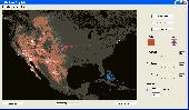
NOVA Maps provides appraisers and appraisal users with complete, high-resolution location Maps (also known as “street Maps”) for forms and addenda in seconds. NOVA Maps even automatically places labels for subject properties and comparables.
For just pennies per map and with just a click of the mouse, users have access to the entire United...
Category: Home & Education / Miscellaneous
Publisher: Day One, License: Demo, Price: USD $0.00, File Size: 5.7 MB
Platform: Windows
Road Doctor™ Viewer is a free software for clients.
Road Doctor™ Viewer is a free software for clients. It can be used to view projects and data views created by Road Doctor™ and Geo Doctor™ software. New views or data cannot be linked to the project. Views created with Road Doctor™ 3D GPR module and single ground penetrating radar files can be opened to the view.
Category: Multimedia & Design / Graphics Viewers
Publisher: Roadscanners Oy, License: Freeware, Price: USD $0.00, File Size: 43.6 MB
Platform: Windows
 Shareware
Google Hybrid Maps Downloader is a tool that can automatically download the google hybrid Maps images to your PC. It can download the small tiles and save them to your hard disk. After downloading, you can view the Maps offline by its tool Maps Viewer, or you can combine the small images into one big map image. If you want to make a map of your city by yourself, it...
Category: Internet / Download Managers
Publisher: allmapsoft.com, License: Shareware, Price: USD $29.99, File Size: 30.6 MB
Platform: Windows
Shareware
Google Maps Terrain Downloader is a tool that can automatically download the google terrain Maps images to your PC. It can download the small tiles and save them to your hard disk. After downloading, you can view the Maps offline by its tool Maps Viewer, or you can combine the small images into one big map image. If you want to make a map of your city by yourself, it...
Category: Internet / Download Managers
Publisher: allmapsoft.com, License: Shareware, Price: USD $29.99, File Size: 305.3 MB
Platform: Windows
think! Bubble Maps is a Windows tool for creating bubble Maps and capturing your thought. Using simple mouse click, drags and typing, your thoughts get put to paper (virtual), quickly and effectively.
The key feature of think! Bubble Maps is speed which makes it an excellent tool for live capture. You can use this program during meetings, workshops, and seminars.
Category: Multimedia & Design / Multimedia App's
Publisher: Lowrie Associates Ltd, License: Shareware, Price: USD $41.90, File Size: 5.9 MB
Platform: Windows
MapComp is a powerful and free Windows Software for drawing images of linkage Maps and to compare linkage Maps and indicate common markers.
MapInspect can display, print and save images, and has no limit to the number of Maps it can compare (but only neighbouring Maps are compared). Maps can be flipped within MapINspect, an the on-screen order of...
Category: Multimedia & Design / Multimedia App's
Publisher: MapInspect, License: Freeware, Price: USD $0.00, File Size: 616.7 KB
Platform: Windows
Allows you to create video travel logs of all the places you visit and then turn them into movies that iMovie and other movie editors will recognize (Quicktime Format). Comes with 17 high quality Maps from all over the world that you can use as is, or customize for your specific needs. You can also use your own Maps. (.jpg, .bmp, .png, .pict or .tiff) Configure and customize...
Category: Multimedia & Design
Publisher: Sol Robots L.L.C., License: Shareware, Price: USD $9.95, File Size: 8.6 MB
Platform: Windows
RouteBuddy is the only modern, advanced digital map application for Windows and Mac OS X.
RouteBuddy is the only modern, advanced digital map application for Windows and Mac OS X. It doesn't matter on which platform you wish to use the application as it sports a universal toolbar and comparable features throughout.
- High resolution Road, Topo and Satellite Maps can be viewed in the same application using our state-of-the-art animated layer...
Category: Home & Education / Miscellaneous
Publisher: RouteBuddy Ltd, License: Shareware, Price: USD $59.99, File Size: 121.5 MB
Platform: Windows
This software development kit (SDK) provides the binaries and programming reference for the Bing Maps Silverlight Control. You can use this control to build your own web sites that use Bing Maps.
The Bing Maps Silverlight Control combines the power of Silverlight and Bing Maps to provide an enhanced mapping experience. Developers can use the Bing...
Category: Utilities / Misc. Utilities
Publisher: Microsoft, License: Freeware, Price: USD $0.00, File Size: 3.8 MB
Platform: Windows
The GPS Detector software is used to update the GPS detector's database , updating Maps , routes and camera locations . The device itself is based on pre-installed GPS coordinates, the device can indicate various Road hazards like: Fixed cameras, Red light speed cameras and bus lane cameras, Usual speed measurement places and dangerous zones.
Category: Business & Finance / Business Finance
Publisher: Euro Noliker Kft., License: Freeware, Price: USD $0.00, File Size: 5.5 MB
Platform: Windows