Free Downloads: Kmz Mappoint
Easy way to convert Waypoints from Kmz or KML to GPX file format with the KML/Kmz to GPX Converter free.
Easy Steps :
- Save your waypoints in Kmz or KML format with google earth
- Import that format in the KML/Kmz to GPX Converter free
- Then select waypoint you want to convert to GPX format
- Export the GPX format
- Upload the...
Category: Audio / Rippers & Encoders
Publisher: HotelResortClub.com, License: Freeware, Price: USD $0.00, File Size: 656.6 KB
Platform: Windows
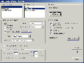
Mappoint Demo is a software tool designed to improve an entire set of features and gadgets.
Mappoint Demo is a software tool designed to improve an entire set of features and gadgets. You are allowed to set up the Mappoint defaults and access many helpful tools such as : pushpin, directions (waypoints), demographics data to map, locate addresses by zipcode, pushpin sets maintenance and more.
Category: Business & Finance / Business Finance
Publisher: WC Software Development Inc., License: Demo, Price: USD $0.00, File Size: 4.2 MB
Platform: Windows
The Shape Name Utility is a freeware open source utility that allows a user to examine and edit the names of shapes in Microsoft Mappoint. It is possible to give Microsoft Mappoint shapes their own identifying names or labels using the programming interface, but Mappoint does not make this functionality available to the end user. Instead, third party programs (eg. our...
Category: Multimedia & Design / Authoring Tools
Publisher: Winwaed Software Technology LLC, License: Freeware, Price: USD $0.00, File Size: 1.2 MB
Platform: Windows
The Shape Name Utility is a simple add-in utility for Microsoft Mappoint, that allows a user to view and edit the names of shapes. Note that shape names are normal hidden from users and only visible to third party programs.
It is possible to give Microsoft Mappoint shapes their own identifying names or labels using the programming interface, but Mappoint does not make...
Category: Business & Finance / MS Office Addons
Publisher: Winwaed Software Technology LLC, License: Freeware, Price: USD $0.00, File Size: 1.2 MB
Platform: Windows
 Shareware
Batch calculate route distances, travel times, and/or estimated costs for point-to-point routes listed in a database (Access, Excel, or ODBC). Uses Microsoft Mappoint for point locations and route calculations. Supports all of Mappoint's route options including fastest routes, shortest routes, preferred roads, and straight lines (Great Circles). Start and end locations are...
Category: Business & Finance / MS Office Addons
Publisher: Winwaed Software Technology LLC, License: Shareware, Price: USD $75.00, File Size: 3.1 MB
Platform: Windows
Grid Imp - imports gridded data into MS-MapPoint, to produce attractive data maps.
Grid Imp - imports gridded data into MS-Mappoint, to produce attractive data maps. Can handle imperfect data, holes, re-gridding, etc. Can be used to import such attributes as pollution data, seismic hazard, geological information, customer/population distribution, etc. Grid Imp is a software that allows you to import data and produce maps. Various text formats supported using space,...
Category: Home & Education / Science
Publisher: Winwaed Software Technology, License: Shareware, Price: USD $75.00, File Size: 2.0 MB
Platform: Windows
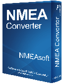
NMEA Converter is a product to convert various types of data NMEA to UDP Converter UDP to NMEA Converter(Reserved) GPS to HDT Converter(Reserved) NMEA to KML Converter(Reserved) NMEA to Kmz Converter(Reserved) KML to NMEA Converter(Reserved) Kmz to NMEA Converter(Reserved)
Category: Audio / MP3 Search Tools
Publisher: NMEAsoft, License: Demo, Price: USD $29.00, File Size: 509.0 KB
Platform: Windows
Spinning Gobe Sample demonstrates how to manipulate the navigation, map style, map font size, and view of the map programmatically through the Mappoint ActiveX Control. Using this simple Visual Basic project, you will learn the objects, methods, and properties that are used to navigate a Mappoint map or change how it looks.
Category: Home & Education / Miscellaneous
Publisher: Microsoft, License: Freeware, Price: USD $0.00, File Size: 3.4 MB
Platform: Windows
SharewareThe RouteWriter add-in imports and exports waypoints for Microsoft Mappoint routes whilst maintaining their route order. Although Mappoint can import and export waypoints as pushpins, their order is usually re-arranged. RouteWriter exports waypoints and their matching pushpins to Excel with their waypoint distance, time, coordinate, address data, and all available pushpin...
Category: Business & Finance / Document Management
Publisher: Winwaed Software Technology LLC, License: Shareware, Price: USD $75.00, File Size: 3.0 MB
Platform: Windows
Single State Mapping Tool allows you to create maps of individual states with Microsoft® Mappoint® 2002, 2004 or 2006. Make maps of individual states. For various purposes, many users of Microsoft Mappoint would like to cover up neighboring states for their maps in Microsoft Mappoint. This tool allows you to do that. Demo data file allows you to create an individual...
Category: Business & Finance
Publisher: MP2KMag and Winwaed Software Technology LLC, License: Data Only, Price: USD $75.00, File Size: 1.4 MB
Platform: Windows
Shareware
Microsoft Mappoint add-in that performs cluster analysis on Mappoint datasets. Cluster results can be drawn as map annotation (centroid pushpins and/or cluster boundary shapes) and exported to Microsoft Excel. MPCluster works with most Mappoint dataset types, including pushpins and shaded areas maps. Various parameters can be used to restrict the minimum or maximum size of...
Category: Business & Finance / Business Finance
Publisher: Winwaed Software Technology LLC, License: Shareware, Price: USD $100.00, File Size: 4.8 MB
Platform: Windows
The MPRouteWriter add-in imports and exports waypoints for Microsoft Mappoint routes whilst maintaining their route order. Although Mappoint can import and export waypoints as pushpins, their order is usually re-arranged. MPRouteWriter exports waypoints and their matching pushpins to Excel (or a text file) with their waypoint distance, time, coordinate, address data, and all...
Category: Business & Finance / MS Office Addons
Publisher: Winwaed Software Technology LLC, License: Shareware, Price: USD $75.00, File Size: 3.3 MB
Platform: Windows

Geocode digital images with latitude, longitude, altitude, and direction information when collecting GIS field data. RoboGEO stamps this information onto the actual photo or writes it to the EXIF headers, allowing you to permanently geotag and link your photos to the GPS coordinates. All writing to the EXIF and IPTC headers is lossless and all of the existing comments (including the MakerNote...
Category: Multimedia & Design
Publisher: Pretek, Inc., License: Demo, Price: USD $34.95, File Size: 6.4 MB
Platform: Windows
Imports gridded data into Microsoft Mappoint, to produce attractive data maps that resemble contour maps.
Can handle imperfect data, holes, re-gridding, etc. Can be used to import such attributes as pollution data, seismic hazard, geological information, customer/population distribution, etc.
Data can be interpolated to different grid spacings if required. Polygon optimization...
Category: Business & Finance / Applications
Publisher: Winwaed Software Technology, License: Shareware, Price: USD $75.00, File Size: 2.2 MB
Platform: Windows
Mappoint ® 2010 gives you the power to visualize business data and communicate insights with instant impact. Before you hit the road, plug in your stops and Mappoint plots the most efficient course with turn-by-turn driving directions. Mappoint 2010 with GPS Locator adds routing and directions to easily plan your trips and track your location in real-time.
...
Category: Home & Education / Miscellaneous
Publisher: Microsoft, License: Demo, Price: USD $0.00, File Size: 1.3 GB
Platform: Windows
Shareware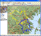
MPSuperShape is a shape manipulation tool for Microsoft Mappoint. MPSuperShape can be used to combine multiple shapes into one large shape, find the intersections (overlaps) between shapes, find boundary shapes around groups of pushpins, simplify shapes, delete multiple shapes, change shape colors, import/export shape files, and to create web pages. Import shape options include ESRI...
Category: Business & Finance / Business Finance
Publisher: Winwaed Software Technology LLC, License: Shareware, Price: USD $75.00, File Size: 13.6 MB
Platform: Windows
Superoverlay software is a Google Earth application for tiling raster datasets and creating view based regions in KML or Kmz files.
Also Superoverlay can generate world files for all images in ArcView style (jgw, tfw,...). It helps you put large image overlays into Google Earth (for example alternative maps or aerial photography). GE Sky mode is supported.
Category: Home & Education / Miscellaneous
Publisher: GIS Center, License: Shareware, Price: USD $0.00, File Size: 0
Platform: Windows
Microsoft Mappoint software gives you the power to turn tabular data into informative maps to communicate insights with instant impact. You can easily integrate maps into your Office projects to show your business insights with clarity. Plus, get updated maps of the US and Canada, with trip routing, turn-by-turn directions, and the ability to share routes with your GPS device.
Category: Business & Finance / MS Office Addons
Publisher: Microsoft, License: Shareware, Price: USD $0.00, File Size: 0
Platform: Windows
Calculate Mileage Charts and Tables with Microsoft Mappoint. Calculate tables for serving customers and suppliers, or to create "road atlas" tables. Can output route distances, travel times and/or estimated costs to Excel Spreadsheets. Supports ALL Mappoint routing options including fastest/shortest/preferred-roads/straight-line routes, road speeds, road preferences, and avoid...
Category: Business & Finance
Publisher: Winwaed Software Technology LLC, License: Shareware, Price: USD $60.00, File Size: 3.7 MB
Platform: Windows
My GPS Logger 1.01 is a program designed to be used with My Fuel Tax 4.0. With My GPS Logger you can log all the locations where your truck has been to a monthly data file. This data file can later be imported into My Fuel Tax 4.0 by calculating the miles in state using Microsoftâ Mappoint. This is what you will need to use My GPS Logger with My Fuel Tax:a laptop with a GPS...
Category: Home & Education / Miscellaneous
Publisher: Spinnaker Software Solutions, License: Freeware, Price: USD $0.00, File Size: 477.7 KB
Platform: Windows
Software to Manage a Small Service Business, complete customer management, scheduling, notes and estimates. Includes integration for Mappoint, QuickBooks, and Microsoft Office.
Category: Business & Finance / Project Management
Publisher: SearTech, Inc., License: Commercial, Price: USD $249.00, File Size: 13.0 MB
Platform: Windows
Demo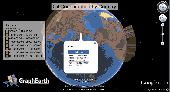
Visualize your data in 3D! Quick, easy and inexpensive. Graph Earth enables management, marketing and other business professionals to create stunning visual representations of their data, all without the time and costs associated with a full-featured GIS. Viewable by Everyone! Create one of a kind deliverables and distribute them to the world, recipients need only install Google Earth to view...
Category: Business & Finance / MS Office Addons
Publisher: Deer Creek Marketing LLC, License: Demo, Price: USD $24.95, File Size: 469.0 KB
Platform: Windows
With GeoIPTC you will be able to read the IPTC city information in pictures and get the corresponding coordinates to your photos from several free services and embed this into the pictures in standard tags in a very professional way. You will also create sets of pictures with all the metadata they contain including geographical tags as KML or Kmz files for a quick view of the selection...
Category: Multimedia & Design / Media Catalogers
Publisher: SoftExperience, License: Shareware, Price: USD $112.00, File Size: 7.3 MB
Platform: Windows
-View/Edit/Manage .dbf files. Use the same engine for accessing all .dbf files. -Produce reports/labels/letters in any sort - for any records Create multiple labels of one record. -Produce graphs with one click, incl. Bar, Line, Pie, 3-D, opposing axis graphs, and Cross-tab. -A data converter. Import/Export spreadsheets, Mailmerge Files for MSWord. Cross-tabulation files, XML To Cursor...
Category: Business & Finance
Publisher: B+B Systems, LLC, License: Shareware, Price: USD $250.00, File Size: 8.6 MB
Platform: Windows

OkCustomMap is a software to produce Garmin Custom Maps.
OkCustomMap is a software to produce Garmin Custom Maps.
Supports many map formats:
- OkMap
- Ecw
- GeoTiff
- World files
- OziExplorer
- GpsTuner
You can customize:
- The quality of the output JPEG images (0=Bad, 100=Good)
- The KML transparency (0=Transparent, 255=Opaque)
- The KML draw order (0=Invisible, 1-49=Under the vectorial data, 50-100=On...
Category: Business & Finance / Applications
Publisher: Gian Paolo Saliola, License: Freeware, Price: USD $0.00, File Size: 3.2 MB
Platform: Windows