Free Downloads: Land Map Interface Gps
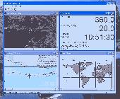
You will be able to enjoy many of CompeGPS Lands features such as waypoint and route creation and edition, full communication between PDA and Gps, use of maps and the moving Map (real-time navigation). CompeGPS Pocket Land allows full communication between Gps and PDA (tracks, waypoints and routes). You will be able to create waypoints and routes,...
Category: Home & Education
Publisher: CompeGPS TEAM S.L., License: Shareware, Price: USD $76.00, File Size: 3.9 MB
Platform:
GPS Send Map is a Windows interface program which uses (sendmap.
Gps Send Map is a Windows Interface program which uses (sendmap.exe) to load the IMG maps to the Gps.This program works well and setup is easy, although there seams to be minor issues in some windows OS.The Gps acted as usual and my maps appeared on the screen as usual. NICE.
Category: Security & Privacy / Other
Publisher: DougsBrat, License: Freeware, Price: USD $0.00, File Size: 1.5 MB
Platform: Windows
Map of Africa is one of the many maps created for GPS TrackMaker.
Map of Africa is one of the many maps created for Gps TrackMaker. You are able to download the installation package from the TrackMaker website. In order to preview the contents of this package, you need to install Gps TrackMaker.
Using the above mentioned application, you will be able to see the Map of Africa. Just click on the "Open Temporary...
Category: Home & Education / Miscellaneous
Publisher: Geo Studio Technology, License: Freeware, Price: USD $0.00, File Size: 18.3 MB
Platform: Windows
CompeGPS is an essential software to make the most of your Gps. With this PC software you will be able to download a wide variety of cartography from the internet and also analyse your routes. This software has been specially designed for 4x4 lovers, bike tourists, excursionists and, in general, everyone who uses Gps, likes to create and accomplish their own routes and then...
Category: Home & Education
Publisher: CompeGPS TEAM S.L., License: Shareware, Price: USD $106.00, File Size: 14.9 MB
Platform: Windows
CompeGPS Pocket Air is a new software specially designed for Pocket PC mobile devices, with wich you can obtain a new and revolutionary free flight instrument. You will enjoy most of the CompeGPS PC version functions, like the waypoint and routes creation and edition, full Gps and Pocket PC communication, use of digital maps and moving Map (real time navigation), to obtain...
Category: Home & Education
Publisher: CompeGPS TEAM S.L., License: Shareware, Price: USD $105.00, File Size: 5.2 MB
Platform:
The Gps Map will help you give you with turn by turn directions to your destination using a POI, city point and/or longitude and latitude.It has the ability to preplan driving destinations before getting into your car. Compatible with ALL Garmin Gps units. Don't pay more than US$10 per day when you already own a Garmin, this is the most comprehensive Gps...
Category: Home & Education / Miscellaneous
Publisher: GPSTravelMaps.com, License: Shareware, Price: USD $0.00, File Size: 0
Platform: Windows
The OSTN02 extension for ArcPad is a FREE tool that automatically transforms Gps data and aligns it with Ordnance Survey (OS) background Map. This easy-to-use extension removes the need to manually post-process Gps data by providing’ on the fly’ transformation of WGS84 latitude and longitude into OSTN02 corrected British National Grid coordinate. Data capture...
Category: Home & Education / Miscellaneous
Publisher: ESRI (UK) Ltd, License: Freeware, Price: USD $0.00, File Size: 8.0 MB
Platform: Windows


 Shareware
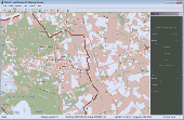
Gps Mapping Software for Windows, Loading topographic maps, realtime navigation, track recording, manage Gps devices and more. The software can be used with various Map formats including: GeoTiff, BSB Nautical Charts, AutoCad DXF files, ESRI Shapefiles. Using calibration you can also use scanned or downloaded JPG, BMP, GIF, PNG and TIF maps. The software can be used for...
Category: Home & Education / Science
Publisher: Eye4Software B.V., License: Shareware, Price: USD $149.00, EUR99, File Size: 11.1 MB
Platform: Windows
OziExplorer is a flamboyant Gps Mapping Software that runs on the PC and works with varieties of Gps receivers such as Garmin, Lowrance, Magellan, Eagle, Brunton, Silva and MLR for the uploading or downloading the waypoints, routes and tracks and most brands of Gps receivers for real time tracking of Gps position.
Using this software, the user can use...
Category: Internet / Communications
Publisher: Des Newman, License: Shareware, Price: USD $95.00, File Size: 6.8 MB
Platform: Windows
Overview Gps Simulator is software that generates a virtual Gps data Used to develop and simulation of Gps applications -Save testing and development time -No location restriction or work everywhere -No Gps device needed Feature Easy routing Selectable Map(7EA Map) Support speed control Support 10EA NMEA protocol messages(GGA, GNS,...
Category: Desktop Enhancements / Shell & Desktop Managers
Publisher: NMEAsoft, License: Demo, Price: USD $150.00, File Size: 3.3 MB
Platform: Windows
Inmarsat LaunchPad is a standard user Interface that can be used across all Land Portable, Land Mobile and FleetBroadBand terminals.
Support for both BGAN Land Portable, Land Mobile and FleetBroadband terminals in a combined application
- English, Spanish, Chinese, Japanese, French and Russian languages are now supported with all terminals
-...
Category: Business & Finance / Business Finance
Publisher: Inmarsat, License: Freeware, Price: USD $0.00, File Size: 6.1 MB
Platform: Windows


 Shareware
Toolkit to add Gps functionality to your software and scripts (Gps SDK). All NMEA0183 protocol versions are supported and can be filtered by NMEA sentence type and talker ID. Information on Gps status can also be retrieved: Gps fix quality, satellites used in fix, satellites in view, satellite azimuth, elevation and signal strengths. The toolkit also offers...
Category: Software Development / ActiveX
Publisher: Eye4Software B.V., License: Shareware, Price: USD $150.81, File Size: 1.6 MB
Platform: Windows
Whether you are surfing at the beaches, climbing mountains and volcanos, or trekking through the rainforest, this Map will help you orient yourself the whole time you are exploring Costa Rica. A local, scale Gps Map of the entire country of Costa Rica in Central America with many features you would not normally have in your Gps.
In addition to roads and...
Category: Internet / Misc. Plugins
Publisher: GPSTravelMaps.com, License: Shareware, Price: USD $0.00, File Size: 0
Platform: Windows
Nokia Map Manager is a program that allows you to manage and transfer GPS maps to mobile phone.
Nokia Map Manager is a program that allows you to manage and transfer Gps maps to mobile phone. The Map Manager is for the 6110 Navigator only. The program is provided with scan function to search maps on the computer and DVD. Nokia Map Manager is an additional application and is used together with Nokia PC Suite 6.86 and later versions.
Nokia Map...
Category: Internet / Communications
Publisher: Nokia, License: Freeware, Price: USD $0.00, File Size: 0
Platform: Windows


 Shareware
Gps SDK to add Gps and coordinate conversion functionality to your software and scripts). All NMEA0183 protocol versions are supported and can be filtered by NMEA sentence type and talker ID. Garmin USB PVT support. Information on Gps status can also be retrieved: Gps fix quality, satellites used in fix, satellites in view, satellite azimuth, elevation and signal...
Category: Software Development
Publisher: Eye4Software B.V., License: Shareware, Price: USD $99.00, EUR79, File Size: 2.3 MB
Platform: Windows


 Shareware
Gps Mapping Software for Windows, Loading topographic maps, manage Gps devices and more. The software can be used with various Map formats including: GeoTiff, BSB Nautical Charts, AutoCad DXF files, ESRI Shapefiles. Using calibration you can also use scanned or downloaded JPG, BMP, GIF, PNG and TIF maps. The software can be used for survey, research, track and trace, real...
Category: Home & Education / Science
Publisher: Eye4Software B.V., License: Shareware, Price: USD $75.04, EUR49, File Size: 6.7 MB
Platform: Windows
Gps Navigator with using a scanned maps and possibility to open a lot of maps together. - you can show a current Gps data (Speed, Direction, Longitude, Latitude, Time, Date, Height); - you can open any of scanned maps (in a "bmp" or "dib" format); - you can calibrate the scanned maps yourself by two calibration points only (left-top and right-bottom); - calibrations are...
Category: Home & Education
Publisher: Valeri Vlassov, License: Demo, Price: USD $19.00, File Size: 4.6 MB
Platform: Windows
All measurements, GPS-protocols and own informations in a single map.
All measurements, Gps-protocols and own informations in a single Map.
Several enterprise maps in one program without additional costs.
No limitation of the area quantity
Tile and join fields.
Multilingual: currently in english, german, spanish, french, greek, polish.
International: over 80 coordinate reference systems of 26 european countries...
Category: Audio / Utilities & Plug-Ins
Publisher: GPSur Dr. Erhard Regener, License: Shareware, Price: USD $449.00, File Size: 7.9 MB
Platform: Windows
Creating a Map based on GPX files for your Gps and for MapSource/BaseCamp on your computer is possible with several existing programs, but it's certainly not easy to accomplish. With IMGfromGPX it's a matter of a few mouse clicks! This program can generate a Map with the following features:
tracks in 8 different colors, as lines or areas;
POIs divided...
Category: Home & Education / Miscellaneous
Publisher: JaVaWa GPS-tools, License: Shareware, Price: USD $0.00, File Size: 4.9 MB
Platform: Windows
GPSBabel is a program that allows users to transfer GPS data files to and from numerous GPS devices.
GPSBabel is a program that allows users to transfer Gps data files to and from numerous Gps devices. It also enables the transfer of waypoints, routes and tracks between Gps receivers and mapping programs. As already mentioned before, this application offers support for several popular Gps devices, such as Tom Tom, Garmin, Magellan, Columbus, etc.
...
Category: Multimedia & Design / Media Management
Publisher: Robert Lipe, License: Freeware, Price: USD $0.00, File Size: 973.5 KB
Platform: Windows
Northwest Trails is a mapset of trails designed for upload to any map-enabled Garmin GPS receiver.
Northwest Trails is a mapset of trails designed for upload to any Map-enabled Garmin Gps receiver. It is more than just a mapset, though; it is also a community effort initiated to record and collect Gps data for trails in the Northwest (Washington, Idaho, Oregon, Montana, Wyoming, Alaska, British Columbia and Alberta) and provide that data for general public use.
Category: Internet / Misc. Plugins
Publisher: Jon F. Stanley, License: Freeware, Price: USD $0.00, File Size: 31.7 MB
Platform: Windows


 Freeware
GPS Converter will convert GPS coordinates between three different formats: 34. 26965, -116.
76783; N 34° 16. 179', W 116° 46. 07'; and N 34° 16' 10.
Category: Home & Education / Sports
Publisher: ALMSys, Inc., License: Freeware, Price: USD $0.00, File Size: 929.9 KB
Platform: Windows


 Shareware
Java toolkit to add coordinate conversion functionality to your Java applications and applets. The toolkit offers functionality to perform Map grid and datum transformations: latitude and longitude can be converted to various Map grids, like Transverse Mercator (TM), Oblique Mercator, Mercator, Oblique Stereographic, Polar Stereographic, Cassini, Albers Equal Area Conal, Gauss...
Category: Software Development / Components & Libraries
Publisher: Eye4Software B.V., License: Shareware, Price: USD $199.00, EUR179, File Size: 155.5 KB
Platform: Unknown
The leading GPS interface tool for Windows!
The leading Gps Interface tool for Windows! Gps answers the significant world demand for accurate, viable and cost effective positioning systems. The Geographic Tracker delivers all of the power and utility of Gps to the Windows environment by allowing you to link a Gps receiver to other Microsoft Windows applications through standard Windows DDE messaging.
Category: Home & Education / Miscellaneous
Publisher: Bluemarble Geographics, License: Shareware, Price: USD $0.00, File Size: 0
Platform: Windows
GPS Tuner was first launched in 2003.
Gps Tuner was first launched in 2003. Success followed introduction shortly. Over the years it became a best-selling favourite Gps software among off-roaders as a reliable, versatile feature-packed application suiting the needs of outdoor enthusiasts and professional off-road users alike. After five years of continuous development of previous Gps Tuner versions Gps...
Category: Web Authoring / Web Design Utilities
Publisher: GPS Tuner Ltd., License: Freeware, Price: USD $0.00, File Size: 4.5 MB
Platform: Windows

