Free Downloads: Land Survey Gps Ipad
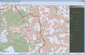
The OSTN02 extension for ArcPad is a FREE tool that automatically transforms Gps data and aligns it with Ordnance Survey (OS) background map. This easy-to-use extension removes the need to manually post-process Gps data by providing’ on the fly’ transformation of WGS84 latitude and longitude into OSTN02 corrected British National Grid coordinate. Data capture...
Category: Home & Education / Miscellaneous
Publisher: ESRI (UK) Ltd, License: Freeware, Price: USD $0.00, File Size: 8.0 MB
Platform: Windows
VisiWave Site Survey is a complete 802.
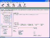
VisiWave Site Survey is a complete 802.11a/b/g/n site surveying solution. You can collect Survey data using a standard wireless adapter while walking around the Survey area clicking on a floor plan image, using a Gps receiver to track your location, or using a customized navigation device.
VisiWave quickly and automatically maps out radio...
Category: Internet / Monitoring
Publisher: AZO Technologies, Inc., License: Shareware, Price: USD $549.00, File Size: 7.1 MB
Platform: Windows
VisualGPSXP is a general purpose utility for monitoring the output of a GPS receiver.
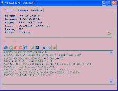
VisualGPSXP is a general purpose utility for monitoring the output of a Gps receiver. Using the NMEA data from the Gps receiver, VisualGPSXP will display various statuses graphically.
Tools such as a Survey utility average the position and shows accuracy of the Gps receiver in a static application.
Main features:
- Multiple...
Category: Home & Education / Miscellaneous
Publisher: VisualGPC, License: Shareware, Price: USD $25.00, File Size: 1.1 MB
Platform: Windows
Survey Maker is a program dedicated to the Survey field, which includes solutions for the Land surveyor, engineering surveyor, surface and underground mining surveyor, geodetic surveyor and hydro-surveyor. This program is a new addition to the range of software developed by Model Maker Systems and currently undergoing many development changes as users request...
Category: Business & Finance / Business Finance
Publisher: Model Maker Systems, License: Freeware, Price: USD $0.00, File Size: 33.2 MB
Platform: Windows
You will be able to enjoy many of CompeGPS Land’s features such as waypoint and route creation and edition, full communication between PDA and Gps, use of maps and the moving map (real-time navigation). CompeGPS Pocket Land allows full communication between Gps and PDA (tracks, waypoints and routes). You will be able to create waypoints and routes, use maps...
Category: Home & Education
Publisher: CompeGPS TEAM S.L., License: Shareware, Price: USD $76.00, File Size: 3.9 MB
Platform:


 Shareware
When you utilize a customer satisfaction Survey you will be able to correctly formulate an ongoing strategy that will enable you to collect, gather, and analyze valuable data with supreme accuracy. This data is targeted to the market that you are going after and as a result will give you the edge that you need in order to provide the best possible products and services to them.
Category: Business & Finance / Document Management
Publisher: Magic Survey Tool, License: Shareware, Price: USD $20.00, File Size: 3.9 KB
Platform: Windows, Linux, Unix
Sokkia's Planning Software is an integral part of the Spectrum Survey Suite package.
Sokkia's Planning Software is an integral part of the Spectrum Survey Suite package.
With Planning, you can determine the availabilty of satellites at any time of day by setting up Gps receiver parameters in your office.
The software is pre-configured with thousands of cities, detailed coastlines, plus political and geogrpahical boundaries. Planning...
Category: Home & Education / Miscellaneous
Publisher: POINT, Inc., License: Freeware, Price: USD $0.00, File Size: 0
Platform: Windows
GPLoad v2.75 includes functionality to transfer v7.5 Trimble Survey Controller files and your local PC. This enables users who have the Trimble Survey Office software to use data collected with the Trimble Survey Controller v7.5 software.
GpLoad manages the transfer of data between an office computer and a Gps receiver or data recorder .
Category: Security & Privacy / Other
Publisher: Trimble Navigation Limited, License: Freeware, Price: USD $0.00, File Size: 4.3 MB
Platform: Windows


 Shareware
Gps Mapping Software for Windows, Loading topographic maps, realtime navigation, track recording, manage Gps devices and more. The software can be used with various map formats including: GeoTiff, BSB Nautical Charts, AutoCad DXF files, ESRI Shapefiles. Using calibration you can also use scanned or downloaded JPG, BMP, GIF, PNG and TIF maps. The software can be used for...
Category: Home & Education / Science
Publisher: Eye4Software B.V., License: Shareware, Price: USD $149.00, EUR99, File Size: 11.1 MB
Platform: Windows
CloudCUBE is a tool on AutoCAD® platform conceived to exploit best the potentialities of the most advanced Survey technologies (lidar, radar, bathymetric sonar) and the traditional measurement methods (Gps, total station). CloudCUBE combines traditional 2D and 3D graphic representation techniques with a revolutionary approach to point clouds to produce effective and productive...
Category: Multimedia & Design / Image Editing
Publisher: Virtualgeo, License: Shareware, Price: USD $0.00, File Size: 120.1 MB
Platform: Windows
TamoGraph is a wireless site survey software tool for collecting, visualizing, and analyzing 802.
TamoGraph is a wireless site Survey software tool for collecting, visualizing, and analyzing 802.11 a/b/g/n Wi-Fi data. It gives detailed information about every access point: channel, maximum data rate, vendor, encryption type, etc. The program can be configured to use your Gps receiver for conducting surveys of large WLANs.
Category: Security & Privacy / Covert Surveillance
Publisher: TamoSoft, License: Shareware, Price: USD $0.00, File Size: 22.2 MB
Platform: Windows
Inmarsat LaunchPad is a standard user interface that can be used across all Land Portable, Land Mobile and FleetBroadBand terminals.
Support for both BGAN Land Portable, Land Mobile and FleetBroadband terminals in a combined application
- English, Spanish, Chinese, Japanese, French and Russian languages are now supported with all terminals
- User...
Category: Business & Finance / Business Finance
Publisher: Inmarsat, License: Freeware, Price: USD $0.00, File Size: 6.1 MB
Platform: Windows


 Shareware
Gps Mapping Software for Windows, Loading topographic maps, manage Gps devices and more. The software can be used with various map formats including: GeoTiff, BSB Nautical Charts, AutoCad DXF files, ESRI Shapefiles. Using calibration you can also use scanned or downloaded JPG, BMP, GIF, PNG and TIF maps. The software can be used for Survey, research, track and trace, real...
Category: Home & Education / Science
Publisher: Eye4Software B.V., License: Shareware, Price: USD $75.04, EUR49, File Size: 6.7 MB
Platform: Windows
Introducing the easiest to use Survey software available! Quickly discover your customer's needs and wants with a Survey. Our Survey software will handle hundreds of questions and thousands of responses. Our production team has been developing software for 18 years, we build solid highly dependable software. If you need a job done then rely on us. iMagic...
Category: Business & Finance
Publisher: iMagic, License: Shareware, Price: USD $99.00, File Size: 11.0 MB
Platform: Windows
FREE GPS Software for your Garmin, Magellan or Lowrance GPS.
FREE Gps Software for your Garmin, Magellan or Lowrance Gps.
EasyGPS is the fast and easy way to upload and download waypoints, routes, and tracks between your Windows computer and your Garmin, Magellan, or Lowrance Gps. EasyGPS lists all of your waypoints on the left side of the screen, and shows a plot of your Gps data on the right. Use EasyGPS to back up...
Category: Internet / Communications
Publisher: TopoGrafix, License: Freeware, Price: USD $0.00, File Size: 3.9 MB
Platform: Windows
My Gps Logger 1.01 is a program designed to be used with My Fuel Tax 4.0. With My Gps Logger you can log all the locations where your truck has been to a monthly data file. This data file can later be imported into My Fuel Tax 4.0 by calculating the miles in state using Microsoftâ Mappoint. This is what you will need to use My Gps Logger with My Fuel Tax:a laptop with...
Category: Home & Education / Miscellaneous
Publisher: Spinnaker Software Solutions, License: Freeware, Price: USD $0.00, File Size: 477.7 KB
Platform: Windows
CompeGPS is an essential software to make the most of your Gps. With this PC software you will be able to download a wide variety of cartography from the internet and also analyse your routes. This software has been specially designed for 4x4 lovers, bike tourists, excursionists and, in general, everyone who uses Gps, likes to create and accomplish their own routes and then...
Category: Home & Education
Publisher: CompeGPS TEAM S.L., License: Shareware, Price: USD $106.00, File Size: 14.9 MB
Platform: Windows
Land the lander as soon as you can.
Land the lander as soon as you can. You must use the parachute at the right time and thrusters to Land it! After you Land it on the all three landing pods, you need to get the satellite signal by going 100 meters away from the ground.
Category: Games / Simulations
Publisher: generationstars.biz, License: Freeware, Price: USD $0.00, File Size: 2.9 MB
Platform: Windows, 2K3
Survey Said Enterprise Edition - advanced PC based offerings that specialize in administering surveys in a variety of different environments.
Survey Said is not a typical single user application. It is extremely scalable in a network environment, which makes it very cost effective when multiple administrators need access to Survey creation and the analysis of the...
Category: Business & Finance / Database Management
Publisher: Marketing Masters, License: Shareware, Price: USD $199.00, File Size: 5.8 MB
Platform: Windows
SOLE Professional is highly interactive Survey and planning software, it is the only software that cover all the Survey & planning requirement like contour, traverse, road design , route Survey, topographical Survey, revenue Survey, mining, city Survey, railways, canal, airfield runways, Pipeline etc. It is a completely new generation program that...
Category: Business & Finance / Project Management
Publisher: SOFTBIZ, License: Shareware, Price: USD $1450.00, File Size: 31.1 MB
Platform: Windows
iMagic Survey Designer has been built by the leading marketing research software and scheduling company. Ensuring product quality and service.
Enter the technological age with iMagic Survey Designer. No more hunting for scraps of handwritten paper or notes. iMagic Survey Designer will organize and associate all relevant information. Use the powerful export...
Category: Business & Finance / MS Office Addons
Publisher: iMagic Pty Ltd, License: Shareware, Price: USD $149.00, File Size: 12.8 MB
Platform: Windows


 Shareware
Virtual Gps is a Gps simulator software. You can use it to simulate a Gps receiver unit connected to your system. It's ideal when you need Gps input, but you have no signal or for development purposes. It supports various NMEA sentences, so it can be used with any Gps mapping software. You can use it using a null-modem cable connected to two physical serial...
Category: Internet / RSS & Web Blog Tools
Publisher: Zyl Soft, License: Shareware, Price: USD $39.99, File Size: 856.0 KB
Platform: Windows
Land-PIE is designed specifically for land developments.
Land-PIE is designed specifically for Land developments. The software allows you to handle the critical “what-if” analysis needed for master-planned communities with residential and commercial parcels, or smaller villages and golf course projects. Use it for an initial feasibility study, detailed budget development and on-going tracking and variance reporting.
Category: Software Development / Misc. Programming
Publisher: Real Pro-Jections, Inc., License: Shareware, Price: USD $2700.00, File Size: 1.6 MB
Platform: Windows
The program accepts NMEA GPS sentences from most GPS receivers that connect to a USB port.
The program accepts NMEA Gps sentences from most Gps receivers that connect to a USB port.
The program can display satellite images of waypoint locations on the track plotter.
Is a free software for recording , monitoring and plotting Gps data, very useful and very easy.
Category: Home & Education / Miscellaneous
Publisher: Club Cruceros de La Paz A.C., License: Freeware, Price: USD $0.00, File Size: 10.6 MB
Platform: Windows
Golf GPS Devices toolbar for internet explorer.
Golf Gps Devices toolbar for internet explorer. Find golf Gps devices are great bargain prices. We have all the latest golf Gps devices for sale both new and used. Whether you're looking for the iGolf, Golf Buddy, GolfLogix, SonoCaddie, or SkyCaddie, you can find it here along with their accessories. We are always searching our networks to bring you the best deals on golf...
Category: Internet / Browsers
Publisher: Golf GPS Devices, License: Freeware, Price: USD $0.00, File Size: 1.1 MB
Platform: Windows


