Free Downloads: Magellan Cam
Used Magellan toolbar for Internet Explorer.
Used Magellan toolbar for Internet Explorer. Find great deals on used Magellan gps devices at prices you can afford. Whether your looking for the Magellan Roadmate, Magellan Maestro, or Magellan CrossoverGPS you'll find it here at low prices. We are always searching our networks on a daily basis to bring you the best prices in used Magellan gps devices...
Category: Internet / Browsers
Publisher: Used Magellan, License: Freeware, Price: USD $0.00, File Size: 1.1 MB
Platform: Windows
With Magellan Communicator for PC you can create a direct connection between your web browser and your Magellan GPS receiver connected to PC via USB cable. Enables data transfer from Geocaching.com in GPX format.
Main features:
- Compatible with Geocaching.com
- Enable “Send to GPS" function
- Transfer GPX files
Category: Utilities / Misc. Utilities
Publisher: MiTAC International Corporation, License: Freeware, Price: USD $0.00, File Size: 8.5 MB
Platform: Windows
BCL Magellan converts PDF files and MS Office files to HTML format. You can also print almost any type of file directly to HTML. Magellan creates an HTML version of your document that looks just like the original. Viewers can zoom, search, and print the HTML document.
Category: Web Authoring / HTML Conversion Tools
Publisher: BCL Technologies, License: Commercial, Price: USD $129.00, File Size: 5.1 MB
Platform: Unknown
FREE GPS Software for your Garmin, Magellan or Lowrance GPS.
FREE GPS Software for your Garmin, Magellan or Lowrance GPS.
EasyGPS is the fast and easy way to upload and download waypoints, routes, and tracks between your Windows computer and your Garmin, Magellan, or Lowrance GPS. EasyGPS lists all of your waypoints on the left side of the screen, and shows a plot of your GPS data on the right. Use EasyGPS to back up and organize...
Category: Internet / Communications
Publisher: TopoGrafix, License: Freeware, Price: USD $0.00, File Size: 3.9 MB
Platform: Windows
Magellan Real Time Data Server ( RTDS ) is a new software offering land surveying companies the possibility of using GNSS equipment to build their own direct IP RTK corrections server.
The RTDS software will collect corrections sent by a GNSS base station and act as a gateway to make them available to any rover that connects to the software. Magellan RTDS is a PC...
Category: Internet / Misc. Servers
Publisher: Plaska GPS Service, Inc., License: Demo, Price: USD $0.00, File Size: 24.6 MB
Platform: Windows
devCad Cam Pro is a full integrated Cad/Cam system.
devCad Cam Pro is a full integrated Cad/Cam system.
It includes all the functions of devCad Pro, the same interface and commands, but adds all what is required to make a powerful Cam application for 3 axis CNC milling machines .
The devCad Team developed new 'smart' technologies to improve the user's work.
Category: Multimedia & Design / Image Editing
Publisher: devCad Team, License: Shareware, Price: USD $0.00, File Size: 15.3 MB
Platform: Windows
The Y-Cam Setup software is an essential piece of kit for any Y-Cam user, searching through your local network and finding any available Y-Cam camera on the system. Previously only available in English, the Y-Cam Setup software has now been updated to include French, German, Italian, Spanish and Dutch languages.
Category: Multimedia & Design / Video
Publisher: Y-CAM, License: Freeware, Price: USD $0.00, File Size: 409.6 KB
Platform: Windows
CamProtect is a utility that allows you to send the image grabbed by your Web Cam or IP Cam to ProtectView Server. You worry for your home or office? Cam Protect and ProtectView Server help to track safety and will inform you if something happen. Our server motion detection feature to alert you immediately when activity is detected. The alert will send on your Cell phone or...
Category: Audio / Utilities & Plug-Ins
Publisher: Logiciels Cronus ltee, License: Freeware, Price: USD $0.00, File Size: 424.0 KB
Platform: Windows
CC-CAM is an alarm system based on movement detection.
CC-Cam is an alarm system based on movement detection. It can send to you the photos of the intruder on your cell phone by email. CC-Cam records the pictures on hard drive send them to your email address or on your web site. The threshold of detection adjusts itself automatically. The live-Cam mode allows you to watch the picture of your webcam on other computers by using...
Category: Internet / Communications
Publisher: CCDeveloppement, License: Shareware, Price: USD $33.00, File Size: 5.4 MB
Platform: Windows
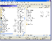
Magellan Explorer makes it fun and easy to manage and organize your files. Use the built-in high-speed FTP client to update your web site, work directly with popular archive formats, and view pictures. All within a single, easy-to-use, attractive package. Whether you prefer the dual window layout of Norton Commander or are more familiar with Windows Explorer, you will feel right at...
Category: Utilities
Publisher: Enriva Development, License: Shareware, Price: USD $39.95, File Size: 4.4 MB
Platform: Windows
Magellan RoadMate
Category: Utilities / Misc. Utilities
Publisher: THALES, License: Shareware, Price: USD $0.00, File Size: 0
Platform: Windows
Use for personal or business use to display real time snapshots from a web cam .
Use for personal or business use to display real time snapshots from a web Cam .Web Cam Broadcaster PRO - this software creates a snapshot, via your web Cam at your preferred time interval, then publishes on our server for a very small monthly fee! Send the link, of your *private web page, to friends, family or post on your site for public viewing.
Category: Internet / Communications
Publisher: Code-it Software(1), License: Shareware, Price: USD $19.99, File Size: 17.6 MB
Platform: Windows
IP Cam Driver is an app that turns your existing IP camera into a webcam for your computer. With IP Cam Driver, you will be able to use your IP Camera with any apps that need a webcam, such as Skype, FaceTime, Message, Yahoo! Messenger, and QuickTime Player. You can also use it with web-based online chat such as Google Hangouts and Chatroulette. Using with IP Cam...
Category: DVD & Video / Cam Tools
Publisher: Senstic, License: Shareware, Price: USD $12.99, File Size: 9.1 MB
Platform: Mac
IP Cam Driver is an app that turns your existing IP camera into a webcam for your computer. With IP Cam Driver, you will be able to use your IP Camera with any apps that need a webcam, such as Skype, FaceTime, Message, Yahoo! Messenger, and QuickTime Player. You can also use it with web-based online chat such as Google Hangouts and Chatroulette. Using with IP Cam...
Category: DVD & Video / Cam Tools
Publisher: Senstic, License: Shareware, Price: USD $12.99, File Size: 3.3 MB
Platform: Windows
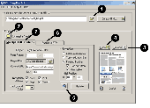
For years, many users worldwide rely on Cam to Scan, the comprehensive solution for optimizing photographed documents.
Version 2 sports plenty of ground-breaking new features:
- Never before it was so easy to correct photographed documents - Cam to Scan automatically detects the outline of an object and makes it look like a scan with only a few mouse clicks.
-...
Category: Business & Finance / MS Office Addons
Publisher: Simon Loessl, License: Shareware, Price: USD $29.95, File Size: 932.7 KB
Platform: Windows
AdvaNum Milling Cam is milling CAD/Cam software that allows rapid creation of CNC programs from part drawings. With this product you can create new or import existing part drawings, and convert them into NC programs in just a few simple steps.
It’s easy to create part drawings with AdvaNum. As with any other CAD you can define lines, arcs, circles, build chamfer...
Category: Multimedia & Design / Image Editing
Publisher: Advameric Technologies, License: Shareware, Price: USD $399.00, File Size: 3.6 MB
Platform: Windows
EaziCAM is a 2D and 3D CAD/CAM system.
EaziCAM is a 2D and 3D CAD/Cam system.
Using EaziCAM you can programme drilling, profiling, pocketing and contouring operations from CAD data or models. EaziCAM is based on the EaziForm CAD/Cam software used by the automotive industry to rapidly manufacture 3D form-blocks for assembly lines and fixtures.
Category: Business & Finance / Applications
Publisher: Conqueror Design and Engineering Limited, License: Shareware, Price: USD $350.00, File Size: 7.0 MB
Platform: Windows
 Shareware
Cam Wizard for Windows is compatible with all networked IP cameras and USB webcams, the application helps you find your networked IP camera on your LAN. When Cam Wizard is running it constantly monitors your PC camera looking for any motion in user defined areas within the scene. When motion is detected, video capture begins. Captured video can then be archived to your hard disk...
Category: Security & Privacy / Covert Surveillance
Publisher: LEDSET Software, License: Shareware, Price: USD $29.95, File Size: 7.6 MB
Platform: Windows
The online web Cam recorder is a free online web Cam record service that allows people can use any WebCam take a snapshot and record video to wmv video format within their web browsers. By using it, webmasters, bloggers or anyone creating a web site are able to embed the video capture features into their web pages. Support Snapshot to JPEG file from any Web Cam. Capture to...
Category: DVD & Video / Video Tools
Publisher: Viscomsoft Online, License: Freeware, Price: USD $0.00, File Size: 7.3 MB
Platform: Windows
Shareware
Screen MP4 Cam is software for Screen Capture. Screen MP4 Cam supports user-defined hotkeys to start, pause, stop screen recording. Screen MP4 Cam supports capture playback video. Select the video encoder for your MP4 file. Record any part of the screen. Record sound from microphone or all sound of computer. Set the recording format of your audio. Show...
Category: Multimedia & Design / Screen Capture
Publisher: SProsoft, License: Shareware, Price: USD $39.00, USD39, File Size: 3.6 MB
Platform: Windows
Screen AVI Cam is software for screen capture. - Screen AVI Cam supports user-defined hotkeys to start, pause, stop screen recording. - Screen AVI Cam supports capture playback video. - Select the video encoder for your AVI file. - Record any part of the screen. - Record sound from microphone or all sound of computer. - Set the recording format of...
Category: Multimedia & Design / Screen Capture
Publisher: SProsoft, License: Shareware, Price: USD $39.00, USD39, File Size: 2.7 MB
Platform: Windows
Screen WMV Cam is software for screen capture. - Screen WMV Cam supports user-defined hotkeys to start, pause, stop screen recording. - Screen WMV Cam supports capture playback video. - Select the video encoder for your WMV file. - Record any part of the screen. - Record sound from microphone or all sound of computer. - Set the recording format of...
Category: Multimedia & Design / Screen Capture
Publisher: SProsoft, License: Shareware, Price: USD $39.00, USD39, File Size: 2.0 MB
Platform: Windows
cctv ptoto capture utility, communication with web Cam, photo capture with web Cam, communicate with multi hardware like WEB Cam, TV Tuner card, Enter TV Tuner 2.0, TV Box. its use for photo capture and save photo on dard drive. save photo with auto name, name use in date time . any confution in use or any problem in using please feel free to contactme.
Category: Multimedia & Design / Video
Publisher: Imagic Solution, License: Freeware, Price: USD $0.00, File Size: 3.9 KB
Platform: Windows
The Windows PC shareware program for Garmin and Magellan GPS receivers.
The Windows PC shareware program for Garmin and Magellan GPS receivers.
Main Features:
- transfer your waypoints, routes, and tracks from and to the GPS receiver, and save it on your computer disk
- review your waypoints
- enter and edit your waypoints
- define your routes and get the estimated traveling time
- review and edit your...
Category: Home & Education / Miscellaneous
Publisher: Heinrich Pfeifer, License: Freeware, Price: USD $0.00, File Size: 2.9 MB
Platform: Windows
River Past 3GP Converter and Booster Pack is an Add-on that allows some River Past applications like Cam 3D, Cam 3D Webmaster Edition, Cam Do, Cam Do Webmaster Edition, Screen Recorder Pro, Video Cleaner, Video Cleaner Pro, Video Perspective, and Video Slice output video to 3GP files compatible with most mobile phones.
Category: Audio / Rippers & Encoders
Publisher: River Past, License: Shareware, Price: USD $29.95, File Size: 2.8 MB
Platform: Windows