Free Downloads: Make Region Grid Map Info
If you don't have internet access on your phone, or you want to self-select a larger Region of mapping, then the Map Chooser tool can be used to make Map tile selections. Choose your own mapping areas with the flexible select tool that lets you select unlimited areas of mapping. Based on a Grid, you can choose any Grid squares you like - so you can pick...
Category: Home & Education / Miscellaneous
Publisher: ViewRanger, License: Freeware, Price: USD $0.00, File Size: 213.2 MB
Platform: Windows

Region Map Generator is a tool to make Region Map with self-definition color. The original maps in the software are blank political Region ones for different countries or areas. You can color any Region with whatever color as you like. By this software, you can easily make lively maps. These maps can be used as data analysis charts, teaching materials,...
Category: Business & Finance / Applications
Publisher: cciyy, License: Shareware, Price: USD $36.95, File Size: 1.3 MB
Platform: Windows

World Map Pro in Flash is a dynamic mapping solution to show any information worldwide Use our Map: - to show international offices (international affiliates, hotel networks, etc) - to show worldwide communities and information on them - to improve search by providing information on any country or Region - as a real estate or any other Map/catalogue - to show...
Category: Internet
Publisher: USFlashMap.com, License: Shareware, Price: USD $199.00, File Size: 120.0 KB
Platform: Windows, Mac, Linux, Unix, MS-DOS, AS/400, OS/2

Commercial realtors require accurate and reliable tools to publish available properties online and show them on the website (specifying Region, county, state, and city). We have created a unique Interactive Real Estate Map with all USA states and counties on it for real estate business. USA Real Estate Map is a unique and amazing vector-based tool that is very simple...
Category: Internet
Publisher: USFlashMap.com, License: Shareware, Price: USD $399.00, File Size: 3.9 MB
Platform: Windows, Mac, Linux, Unix, MS-DOS, AS/400, OS/2
OziExplorer3D is an impeccable application for viewing Map images in 3D, along with the options of rotating it in every possible direction, zoom in/out and lots more. The application actually creates Grid of heights using the height data that has been obtained and writes it to a file, along with the other required information, loads the file and the Map image or the image...
Category: Multimedia & Design / Multimedia App's
Publisher: Des Newman, License: Shareware, Price: USD $30.00, File Size: 1.9 MB
Platform: Windows
In this game there will be a map filled with colored grids.
In this game there will be a Map filled with colored grids. Your colony starts with the home Grid in the center of the Map marked by a flag. The goal of the game is to turn all the grids into the same color. You can change the color of your home Grid and all connected grids by clicking on other colored grids in the Map. Continue the process and you will be...
Category: Games / Misc. Games
Publisher: Novel Games Limited, License: Freeware, Price: USD $0.00, File Size: 264.5 KB
Platform: Windows
Spitfire is a software tool for the Benefon ESC!
Spitfire is a software tool for the Benefon ESC! GPS/GSM mobile phone which allows users to create and load their own or vendor supplied maps into their handset. Spitfire is low cost and simple to use and can load Map images in a variety of bit Map file formats. It provides tools to geographically calibrate a plain bit Map image and correct distortions introduced by...
Category: Business & Finance / Business Finance
Publisher: Barhop Apps, License: Shareware, Price: USD $39.90, File Size: 2.6 MB
Platform: Windows
La Rioja Topo is a free software Map about the mountain Region La Rioja from Spain recognized for the wonderful climbing experience. This software will guide you throughout your visit of this Region and show the best and safe routes, in order to make your trip a great experience
Category: Home & Education / Miscellaneous
Publisher: PilPil Haute Cuisine in GPS Solutions, License: Freeware, Price: USD $0.00, File Size: 22.0 MB
Platform: Windows
 Freeware
Arm Map Explorer recreates all the functionalities of Google Maps on your desktop while expanding them with new extras. Map Explorer lets you locate and view any place on the planet using dynamic interactive maps. These maps are draggable, which means there is no need for you to click and wait for graphics to reload each time you want to view adjacent parts of a Map....
Category: Internet / Flash Tools
Publisher: ArmCode, License: Freeware, Price: USD $0.00, File Size: 5.5 MB
Platform: Windows
Shareware
Toolkit to add GPS functionality to your software and scripts (GPS SDK). All NMEA0183 protocol versions are supported and can be filtered by NMEA sentence type and talker ID. Information on GPS status can also be retrieved: GPS fix quality, satellites used in fix, satellites in view, satellite azimuth, elevation and signal strengths. The toolkit also offers functionality to perform Map...
Category: Software Development / ActiveX
Publisher: Eye4Software B.V., License: Shareware, Price: USD $150.81, File Size: 1.6 MB
Platform: Windows
SemGrid (Simple easy manager of Grid data, for SEMoLa).
SemGrid (Simple easy manager of Grid data, for SEMoLa). Some of its features are: Freeware raster GIS, for Windows OS, import and export of Grid layers from ASCII Grid files of Surfer (grd), GeoMedia (asc), ArcGis (asc) and binary or ASCII from Idrisi32 (rdc, rst), GeoEAS, GRASS, Map algebra, Markov chains estimation and simulation and much more.
Category: Business & Finance / Applications
Publisher: Francesco Danuso, University of Udine, License: Freeware, Price: USD $0.00, File Size: 7.9 MB
Platform: Windows
Shareware
Java toolkit to add coordinate conversion functionality to your Java applications and applets. The toolkit offers functionality to perform Map Grid and datum transformations: latitude and longitude can be converted to various Map grids, like Transverse Mercator (TM), Oblique Mercator, Mercator, Oblique Stereographic, Polar Stereographic, Cassini, Albers Equal Area Conal,...
Category: Software Development / Components & Libraries
Publisher: Eye4Software B.V., License: Shareware, Price: USD $199.00, EUR179, File Size: 155.5 KB
Platform: Unknown
Shareware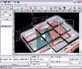
Create HTML Image Maps of any shape in just a few clicks! Map Designer automates the creation of HTML Image Maps, making it easy for designers and Web developers to specify hot-links and clickable areas within images. Map Designer helps Web developers specify rectangular, round or arbitrary-shape areas in a what-you-see-is-what-you-get mode. Specifying an active Region...
Category: Web Authoring / HTML Editors
Publisher: ForthTech Software, License: Shareware, Price: USD $23.00, File Size: 1.1 MB
Platform: Windows
Shareware
GPS SDK to add GPS and coordinate conversion functionality to your software and scripts). All NMEA0183 protocol versions are supported and can be filtered by NMEA sentence type and talker ID. Garmin USB PVT support. Information on GPS status can also be retrieved: GPS fix quality, satellites used in fix, satellites in view, satellite azimuth, elevation and signal strengths. The toolkit also...
Category: Software Development
Publisher: Eye4Software B.V., License: Shareware, Price: USD $99.00, EUR79, File Size: 2.3 MB
Platform: Windows
Geosoft Plug-In for ER Viewer enables users to view and use Geosoft grid (.
Geosoft Plug-In for ER Viewer enables users to view and use Geosoft Grid (.grd) and Map (.Map) files in the ER Viewer application.
This plug-in use a globe explorer, to find, view, and extract data from a variety of data servers. You can use internal servers as well as public servers including DAP servers, WMS servers, ArcIMS servers, and Tile Servers.
Category: Home & Education / Miscellaneous
Publisher: Geosoft Inc., License: Freeware, Price: USD $0.00, File Size: 50.3 MB
Platform: Windows
WordRama is a word game. You are required to move and line up letters in a line horizontal, vertical or across in a Grid and make valid words. You start with an empty Grid. As you make words, random letters are dropped into the Grid for you to arrange and make new words.
Category: Games / Misc. Games
Publisher: Ihsan, License: Freeware, Price: USD $0.00, File Size: 818.4 KB
Platform: Windows
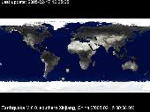
QuakeSaver is a Windows screensaver which shows, geolocalized on a true color Earth Map, recent earthquakes. You can choose to display past day earthquakes, or past week earthquakes on the full world Map, or select a specific Region. Surprise your friends, relatives or colleagues, showing them how many earthquakes hit our planet everyday!
Category: Desktop Enhancements / Screensavers
Publisher: MGShareware, License: Shareware, Price: USD $15.00, File Size: 1.8 MB
Platform: Unknown
Cool Flash Map Maker is a powerful Flash Map software for developing interactive flash mapping solutions and products for Real Estate, Spacial Statistics, Business Locator Applications, Vector USA Map,World Map, Germany Map,ASIA Map, Canada Map, Europe Map, Australia Map, Austria Map, Africa Map, UK Map, South...
Category: Multimedia & Design / Multimedia App's
Publisher: Go2Share, License: Shareware, Price: USD $29.95, File Size: 17.9 MB
Platform: Windows
Finitor is a system to make a map (ground plan) of a terrain.
Finitor is a system to make a Map (ground plan) of a terrain. It is a survey system in combination with a data processing program.
The Map represents roads, buildings, manholes, trees, railings, levels. The surveyor determines in the field the properties of the Map objects. He is constructing the source of a complete drawing.
The system guarantees a high...
Category: Software Development / Help File Utilities
Publisher: Basten Software, License: Demo, Price: USD $0.00, File Size: 3.1 MB
Platform: Windows
Gismaps Viewer is a GIS viewer that can be used for geospatial analysis and map production.
Gismaps Viewer is a GIS viewer that can be used for geospatial analysis and Map production.
The main features are:
- read Shape files using geographic coordinate system
- view satellite images (MrSid, jpeg, bmp and tiff file formats)
- generate thematic maps, queries and labels
- export do Google Earth KML (shp2kml)
- configure Map colors...
Category: Multimedia & Design / Graphics Viewers
Publisher: Gismaps Sistemas Ltda., License: Freeware, Price: USD $0.00, File Size: 10.2 MB
Platform: Windows
With WinPIM, you can:
-Storage contacts info, organize & track them, create relationship map.
With WinPIM, you can:
-Storage contacts Info, organize & track them, create relationship Map.
-Manage time, allocate tasks.
-Compose HTML format diary, notes. Support Sound Recording.
-Communicated with friends via email.
-Sync with mobile phones or PDA, works with other programs.
-Share data over network, access data anytime anywhere.
Category: Business & Finance / Personal Info Managers
Publisher: YQSoft, Inc., License: Shareware, Price: USD $39.95, File Size: 6.4 MB
Platform: Windows
When a user wants to extract several files of nc format, simultaneously, he/she requires to load them at a same time with together. In the first version of NetCDF Extractor, the user can load one file to extract desirable Region, so AgriMetSoft has developed the new version of NetCDF Extractor (NetCDF Extractor V.2.0) for extracting many files at once. If the user wants to load the...
Category: Home & Education / Science
Publisher: AgriMetSoft, License: Shareware, Price: USD $54.95, File Size: 63.2 MB
Platform: Windows
Make your most demanding users happy with the fast and reliable cross-browser data grid component.
Make your most demanding users happy with the fast and reliable cross-browser data Grid component. Complete with fixed headers, client-side sorting, resizable columns, images, tooltips and a lot more - the Grid widget will save you weeks of JavaScript/DHTML/CSS/XML programming. Professional design, well documented source code, tutorial, API reference, examples, active support...
Category: Web Authoring / JavaScript
Publisher: ActiveWidgets Ltd., License: Freeware, Price: USD $0.00, File Size: 337.0 KB
Platform: Windows, Linux
This version is for use with X5.
This version is for use with X5.
This add-on allows for quick and easy one-click toggling on/off the visibility and active state of the Grid.
These enhancements and updates have been tested and released by the Quality Control Department and will function inside Mastercam X5. Follow the instructions given in the 'Info' button of each download for install...
Category: Multimedia & Design / Multimedia App's
Publisher: CNC Software, Inc., License: Freeware, Price: USD $0.00, File Size: 526.9 KB
Platform: Windows
A chess sudoku online game. Sudoku rules - Sudoku is played over a 9x9 Grid, divided to 3x3 sub grids called "regions": Region - Sudoku begins with some of the Grid cells already filled with numbers:
- The object of Sudoku is to fill the other empty cells with numbers between 1 and 9 (1 number only in each cell) according the following guidelines:
Category: Games / Misc. Games
Publisher: Fun chess, License: Freeware, Price: USD $0.00, File Size: 13.0 KB
Platform: Windows, Mac