Free Downloads: Manage Waypoints
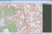
With Cartopro Evolution create,modify and save routes, tracks, and Waypoints by simple click on the screen.
Main features:
-Simple and reliable.
-Scan your maps directly from Cartopro
-3 types of powerful calibrations are available
-Large number of Datums available. You can also add them manually.
-Import and Export your track, routes and...
Category: Home & Education / Miscellaneous
Publisher: Sigrist Alain, License: Shareware, Price: USD $0.00, File Size: 0
Platform: Windows
The Windows PC shareware program for Garmin and Magellan GPS receivers.
The Windows PC shareware program for Garmin and Magellan GPS receivers.
Main Features:
- transfer your Waypoints, routes, and tracks from and to the GPS receiver, and save it on your computer disk
- review your Waypoints
- enter and edit your Waypoints
- define your routes and get the estimated traveling time
- review and...
Category: Home & Education / Miscellaneous
Publisher: Heinrich Pfeifer, License: Freeware, Price: USD $0.00, File Size: 2.9 MB
Platform: Windows
A very powerful plugin that seamlessly integrates GPS Waypoints and Garmin courses into SportTracks, features for which you would have to use Garmin Mapsource™ and Garmin TrainingCenter™ or similar 3rd party applications otherwise.
Some of the outstanding features of this plugin are:
-create courses with autorouting
-create Waypoints from...
Category: Home & Education / Miscellaneous
Publisher: Old Man Biking's SportTracks Plugins, License: Shareware, Price: USD $13.08, File Size: 1.4 MB
Platform: Windows
FREE GPS Software for your Garmin, Magellan or Lowrance GPS.
FREE GPS Software for your Garmin, Magellan or Lowrance GPS.
EasyGPS is the fast and easy way to upload and download Waypoints, routes, and tracks between your Windows computer and your Garmin, Magellan, or Lowrance GPS. EasyGPS lists all of your Waypoints on the left side of the screen, and shows a plot of your GPS data on the right. Use EasyGPS to back up and organize...
Category: Internet / Communications
Publisher: TopoGrafix, License: Freeware, Price: USD $0.00, File Size: 3.9 MB
Platform: Windows


 Shareware
The RouteWriter add-in imports and exports Waypoints for Microsoft MapPoint routes whilst maintaining their route order. Although MapPoint can import and export Waypoints as pushpins, their order is usually re-arranged. RouteWriter exports Waypoints and their matching pushpins to Excel with their waypoint distance, time, coordinate, address data, and all available...
Category: Business & Finance / Document Management
Publisher: Winwaed Software Technology LLC, License: Shareware, Price: USD $75.00, File Size: 3.0 MB
Platform: Windows
The GPS TrackManager is an application for planning routes and managing routes, Waypoints and trackpoints.
The application support functions such as: open and save trackpoints files in various formats (GPX, Ozi Trackpoint file, Ozi Waypoint file, NMEA log, EasyGPS file), transmit Trackpoints, Waypoints and Routes to Garmin GPS receivers (Geko 201, GPSmap 60C), saves...
Category: Internet / Communications
Publisher: Frank Hamaekers, Write4u, License: Freeware, Price: USD $0.00, File Size: 4.8 MB
Platform: Windows
The MPRouteWriter add-in imports and exports Waypoints for Microsoft MapPoint routes whilst maintaining their route order. Although MapPoint can import and export Waypoints as pushpins, their order is usually re-arranged. MPRouteWriter exports Waypoints and their matching pushpins to Excel (or a text file) with their waypoint distance, time, coordinate, address data,...
Category: Business & Finance / MS Office Addons
Publisher: Winwaed Software Technology LLC, License: Shareware, Price: USD $75.00, File Size: 3.3 MB
Platform: Windows
An easy to use GPS downloading utility that lets you download your GPS Waypoints easily and export them into a variety of formats useful for editing, display and importing into many different mapping programs.
Use Lobal to save GPS Waypoints as:
- Text Files
- HTML Tables
- Shape Files
- Google Earth KML
- DBase Files.
Category: Utilities / Misc. Utilities
Publisher: Ecological Software Solutions, License: Freeware, Price: USD $0.00, File Size: 2.2 MB
Platform: Windows
GPS Software for Garmin. Download Waypoints, routes and tracks from Garmin GPS. Upload Waypoints, routes and tracks to Garmin GPS. Excel and Text files supported! This software is very easy to use!
Category: Utilities / System Utilities
Publisher: Oy Frontbase Ltd, License: Shareware, Price: USD $29.95, File Size: 1.4 MB
Platform: Windows
GSAK is the all in one Geocaching and waypoint management tool.
GSAK is the all in one Geocaching and waypoint management tool. Major features include: Multiple databases, sending/receiving Waypoints to GPSr, Google maps, conversion to many mapping formats, PDA output (including CacheMate support), HTML output, extensive searching, macro support, backup and restore, distance/direction from other Waypoints (including caches, locations, post...
Category: Business & Finance / Project Management
Publisher: CWE computer services, License: Shareware, Price: USD $30.00, File Size: 18.2 MB
Platform: Windows
Easy way to convert Waypoints from KMZ or KML to GPX file format with the KML/KMZ to GPX Converter free.
Easy Steps :
- Save your Waypoints in KMZ or KML format with google earth
- Import that format in the KML/KMZ to GPX Converter free
- Then select waypoint you want to convert to GPX format
- Export the GPX format
- Upload the GPX format in...
Category: Audio / Rippers & Encoders
Publisher: HotelResortClub.com, License: Freeware, Price: USD $0.00, File Size: 656.6 KB
Platform: Windows
You will be able to enjoy many of CompeGPS Lands features such as waypoint and route creation and edition, full communication between PDA and GPS, use of maps and the moving map (real-time navigation). CompeGPS Pocket Land allows full communication between GPS and PDA (tracks, Waypoints and routes). You will be able to create Waypoints and routes, use maps and real-time...
Category: Home & Education
Publisher: CompeGPS TEAM S.L., License: Shareware, Price: USD $76.00, File Size: 3.9 MB
Platform:
CompeGPS is an essential software to make the most of your GPS. With this PC software you will be able to download a wide variety of cartography from the internet and also analyse your routes. This software has been specially designed for free flight and motor flight pilots they use GPS and likes to create and accomplish their own routes and then later on analyse. CompeGPS allows you to...
Category: Home & Education
Publisher: CompeGPS TEAM S.L., License: Shareware, Price: USD $106.00, File Size: 14.9 MB
Platform: Windows
CompeGPS is an essential software to make the most of your GPS. With this PC software you will be able to download a wide variety of cartography from the internet and also analyse your routes. This software has been specially designed for 4x4 lovers, bike tourists, excursionists and, in general, everyone who uses GPS, likes to create and accomplish their own routes and then later on...
Category: Home & Education
Publisher: CompeGPS TEAM S.L., License: Shareware, Price: USD $106.00, File Size: 14.9 MB
Platform: Windows
TrackProfiler is a small free utility for exporting GPS track profiles into PNG images.
TrackProfiler is a small free utility for exporting GPS track profiles into PNG images. It works with java (version 1.3, 1.4 or 1.5)
Main Features:
- Load a track (OziExplorer file type: .PLT) and view its profile
- The track profile can be smoothed
- You can view track extremes
- You can load track Waypoints (in .WPT file format)
- You...
Category: Web Authoring / JavaScript
Publisher: Tomo Krajina, License: Shareware, Price: USD $0.00, File Size: 819 B
Platform: Windows
The Angler's Genie was designed to be a tool to help anyone become a better angler.
The Angler's Genie was designed to be a tool to help anyone become a better angler. From one place, you'll be able to Track your time on the water, Organize your Contacts, Manage Your Money, Organize your Tasks, Track your Tournaments, and even Organize the Waypoints by importing/exporting directly from your GPS unit.
Category: Home & Education / Miscellaneous
Publisher: Business Technology Integration, LLC, License: Commercial, Price: USD $39.95, File Size: 4.4 MB
Platform: Windows
GPSBabel is a program that allows users to transfer GPS data files to and from numerous GPS devices.
GPSBabel is a program that allows users to transfer GPS data files to and from numerous GPS devices. It also enables the transfer of Waypoints, routes and tracks between GPS receivers and mapping programs. As already mentioned before, this application offers support for several popular GPS devices, such as Tom Tom, Garmin, Magellan, Columbus, etc.
GPSBabel comes with plenty...
Category: Multimedia & Design / Media Management
Publisher: Robert Lipe, License: Freeware, Price: USD $0.00, File Size: 973.5 KB
Platform: Windows
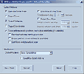
Northstar Waypoint Loader is a simple and easy to use software application that helps you load or upload Waypoints and routes to and from your PC
This software can be configured to use PC serial COM ports 1,2, 3 or 4, the only drawback being that It is not possible to separate the waypoint and route information contained in a file. They are downloaded and uploaded together as one...
Category: Utilities / Misc. Utilities
Publisher: Navico, License: Freeware, Price: USD $0.00, File Size: 4.2 MB
Platform: Windows
Now you can plan and organize trips with MapSource, a very useful computer software.
Now you can plan and organize trips with MapSource, a very useful computer software.
MapSource is included with the purchase of a Garmin map on DVD or CD. With MapSource, you can:
- Back up important trip data separately from your Garmin device.
- Plan routes from the convenience of your computer instead of on your device.
- Create, view, and edit Waypoints,...
Category: Business & Finance / Database Management
Publisher: Garmin Ltd or its subsidiaries, License: Shareware, Price: USD $0.00, File Size: 54.4 MB
Platform: Windows
OziExplorer is a flamboyant GPS Mapping Software that runs on the PC and works with varieties of GPS receivers such as Garmin, Lowrance, Magellan, Eagle, Brunton, Silva and MLR for the uploading or downloading the Waypoints, routes and tracks and most brands of GPS receivers for real time tracking of GPS position.
Using this software, the user can use maps and charts that...
Category: Internet / Communications
Publisher: Des Newman, License: Shareware, Price: USD $95.00, File Size: 6.8 MB
Platform: Windows
K&R Easy TRAXX automatically records your path up to 500 Waypoints and you can use this path to trace back to your starting point or to upload the route to your PC.
After you have recorded your path, Easy Traxx can trace back to your starting point. Likewise you can plan a route or path with the software in GOOGLE-MAP.
Category: Home & Education / Miscellaneous
Publisher: Kasper & Richter GmbH & Co. KG, License: Freeware, Price: USD $0.00, File Size: 6.1 MB
Platform: Windows
CompeGPS Pocket Air is a new software specially designed for Pocket PC mobile devices, with wich you can obtain a new and revolutionary free flight instrument. You will enjoy most of the CompeGPS PC version functions, like the waypoint and routes creation and edition, full GPS and Pocket PC communication, use of digital maps and moving map (real time navigation), to obtain the most of...
Category: Home & Education
Publisher: CompeGPS TEAM S.L., License: Shareware, Price: USD $105.00, File Size: 5.2 MB
Platform:
Complete voyage planning utility for ocean and coastal shipping and yachts,
unlimited number of Waypoints, greatcircle or rhumbline. Caculates average weather enroute
as well as estimated vessels performance and optimal speed settings.
Includes hurricane tracking, calculation of CPA and TCPA of tropical storm compared to any route. Automatically generates AMVER, SISREP, AUSREP,...
Category: Business & Finance / Applications
Publisher: Andromeda Productions, License: Shareware, Price: USD $75.00, File Size: 1.9 MB
Platform: Windows


 Shareware
GPS Mapping Software for Windows, Loading topographic maps, realtime navigation, track recording, Manage GPS devices and more. The software can be used with various map formats including: GeoTiff, BSB Nautical Charts, AutoCad DXF files, ESRI Shapefiles. Using calibration you can also use scanned or downloaded JPG, BMP, GIF, PNG and TIF maps. The software can be used for survey, research,...
Category: Home & Education / Science
Publisher: Eye4Software B.V., License: Shareware, Price: USD $149.00, EUR99, File Size: 11.1 MB
Platform: Windows


 Shareware
GPS Mapping Software for Windows, Loading topographic maps, Manage GPS devices and more. The software can be used with various map formats including: GeoTiff, BSB Nautical Charts, AutoCad DXF files, ESRI Shapefiles. Using calibration you can also use scanned or downloaded JPG, BMP, GIF, PNG and TIF maps. The software can be used for survey, research, track and trace, real time...
Category: Home & Education / Science
Publisher: Eye4Software B.V., License: Shareware, Price: USD $75.04, EUR49, File Size: 6.7 MB
Platform: Windows


