Free Downloads: Map Control
The VB Image Map OCX is an ActiveX Control designed to provide your applications with the ability to display interactive images. Hotspots, or specially designated areas on your image, can be defined that will react to various mouse events. It is easily integrated into your existing applications - just drop the Control on a form, assign a background picture, and assign the...
Category: Software Development / Tools & Editors
Publisher: Silverband Software, License: Demo, Price: USD $49.95, File Size: 512.0 KB
Platform: Windows
Spinning Gobe Sample demonstrates how to manipulate the navigation, Map style, Map font size, and view of the Map programmatically through the MapPoint ActiveX Control. Using this simple Visual Basic project, you will learn the objects, methods, and properties that are used to navigate a MapPoint Map or change how it looks.
Category: Home & Education / Miscellaneous
Publisher: Microsoft, License: Freeware, Price: USD $0.00, File Size: 3.4 MB
Platform: Windows
Cool Flash Map Maker is a powerful Flash Map software for developing interactive flash mapping solutions and products for Real Estate, Spacial Statistics, Business Locator Applications, Vector USA Map,World Map, Germany Map,ASIA Map, Canada Map, Europe Map, Australia Map, Austria Map, Africa Map, UK Map, South...
Category: Multimedia & Design / Multimedia App's
Publisher: Go2Share, License: Shareware, Price: USD $29.95, File Size: 17.9 MB
Platform: Windows
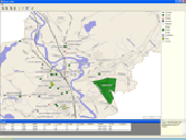
Map Suite Desktop Edition is a powerful and feature-rich .NET mapping Control that enables C# and VB.NET software developers to build detailed desktop mapping applications. Utilizing Microsoft's .NET Framework, the APIs for Map Suite Desktop Edition incorporate the very latest technology to deliver a powerful, user-friendly mapping Control. In addition, ease of...
Category: Software Development
Publisher: ThinkGeo LLC, License: Commercial, Price: USD $4794.00, File Size: 28.4 MB
Platform: Windows
Live Satellite Maps or Google maps is a web server mapping applications.
Live Satellite Maps or Google maps is a web server mapping applications.Provides scrolling Map images and satellite photos around the earth and even the route between different places.Since 6 October 2005, live satellite Maps is part of local Google.Google live satellite Map provides the ability to zoom in or zoom out to show the Map.The user can Control the...
Category: Home & Education / Science
Publisher: www.satelliteview-of-my-house.com, License: Freeware, Price: USD $0.00, File Size: 643.0 KB
Platform: Windows


 Shareware
ActualMap is a set of high-performance, .NET mapping components and controls for embedding maps in desktop (Windows Forms) applications. ActualMap gives you the ability to generate maps, drill-down capability, thematic mapping, routing, vehicle tracking and other features that will make the maps fully interactive. Features : Multiple Map layers. Dynamic Map layers. Pan and...
Category: Software Development / Components & Libraries
Publisher: VDS Technologies, License: Shareware, Price: USD $799.00, File Size: 8.0 MB
Platform: Windows
Map Suite Web Edition is a powerful and feature-rich ASP.Net server Control that enables C# and VB.NET software developers to build detailed internet mapping applications. Utilizing Microsoft's .NET Framework, the APIs for Map Suite Web Edition incorporate the very latest technology to deliver a powerful, user-friendly .NET component that makes it easy to develop mapping...
Category: Software Development
Publisher: ThinkGeo LLC, License: Commercial, Price: USD $4794.00, File Size: 28.8 MB
Platform: Windows
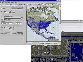
FS2004/02/00. Complete with a color Map to track all your moves in a separate window.Can be used with or without Flight Simulator running.Allows you to use all the planes in your hangar, Control the weather and much more.Can also print a simple Map to help you.Comes complete with the default FS database with all the airports, VOR, ILS, and airways, but, you can build your...
Category: Games / Simulations
Publisher: MyOddweb.com, License: Shareware, Price: USD $30.00, File Size: 14.2 MB
Platform: Unknown
Remere's Map Editor is a map editor for the OpenTibia Project which was created by Remere.
Remere's Map Editor is a Map editor for the OpenTibia Project which was created by Remere.
Remere's Map Editor is a Map editor coded in C to be used with OpenTibia. It supports many advanced features such as autobordering and placing of composite objects. Runs under both Linux and Windows using wxWidgets and OpenGL.
Category: Games / Tools & Editors
Publisher: Remere, License: Shareware, Price: USD $0.00, File Size: 4.2 MB
Platform: Windows
Map Suite™ is a full-featured mapping control that makes it easy for any Microsoft .
Map Suite™ is a full-featured mapping Control that makes it easy for any Microsoft .NET developer to add mapping functionality to a Microsoft .NET application quickly and efficiently. Using the intuitive object model, even developers inexperienced in Geographic Information Systems (GIS) can have fully functional maps working in minutes.
The purpose of this guide is to...
Category: Web Authoring / Web Design Utilities
Publisher: ThinkGeo, License: Shareware, Price: USD $995.00, File Size: 69.1 MB
Platform: Windows


 Freeware
An interactive Flash USA Map with all the features you need for your web site or project. This is the ideal solution for dealer maps, real-estate listings, or visualizing state statistics. Nearly every aspect of the Map is customizable. However, unlike competing products, our Map is very simple to install and edit. Just upload XML and SWF files and embed.
Category: Internet / Flash Tools
Publisher: http://www.flashusamap.com/trial/flashus, License: Freeware, Price: USD $0.00, File Size: 93.8 KB
Platform: Unknown
Map of Africa is one of the many maps created for GPS TrackMaker.
Map of Africa is one of the many maps created for GPS TrackMaker. You are able to download the installation package from the TrackMaker website. In order to preview the contents of this package, you need to install GPS TrackMaker.
Using the above mentioned application, you will be able to see the Map of Africa. Just click on the "Open Temporary...
Category: Home & Education / Miscellaneous
Publisher: Geo Studio Technology, License: Freeware, Price: USD $0.00, File Size: 18.3 MB
Platform: Windows
You can capture the Google Map window and save it as JPG format, and also show the planned route on Google Map directly.
Main Features:
- Travel Planning
- Travel database saved by calendar
- Travel detail information
- Travel files list
- Software Control Function
Category: Home & Education / Miscellaneous
Publisher: GlobalSat Technology Corporation, License: Freeware, Price: USD $0.00, File Size: 68.1 MB
Platform: Windows
SC3K Map Editor is the fastest and most accurate terrain editor currently available for SimCity 3000. It gives you the finest possible Control over modifications to your terrain.
With SC3K Map Editor you can use an interface very similar to that given by SimCity 3000 so that you can see exactly what your terrain will look like as you create it.
Also you...
Category: Games / Tools & Editors
Publisher: Tenermerx Software, License: Freeware, Price: USD $0.00, File Size: 990.5 KB
Platform: Windows
Program shows you an actual X3 sector-map, with detailed information about most in-game objects.
Program shows you an actual X3 sector-Map, with detailed information about most in-game objects. The Map is based on a log-file that is created with an in-game script (by Andrei[<>Ace]). If you just want to view the standard Map (or if you don’t have the game) the program will work with the included default Map, which was created with an English X3 game...
Category: Games / Misc. Games
Publisher: SUU Design, License: Freeware, Price: USD $0.00, File Size: 1.4 MB
Platform: Windows
New Zealand Map Reference Converter (NZMapConv) is software that LINZ provides to convert Map references between the old NZMS260 Map series and the new NZTopo50 Map series.NZMapConv is a Windows programme designed to convert individual coordinates entered manually.
Category: Multimedia & Design / Media Management
Publisher: Land Information New Zealand, License: Freeware, Price: USD $0.00, File Size: 2.4 MB
Platform: Windows
When the XMAP software is communicating with an XEDE via the comms cable each Map will show, at the top of the Map display, an RPM and load value (x and y axis for the Map) in real time. Also in each Map a yellow highlighted block will show the current position within the Map. Beside the real-time display on each Map are the undo and redo buttons which...
Category: Home & Education / Miscellaneous
Publisher: ChipTorque, License: Freeware, Price: USD $0.00, File Size: 1.7 MB
Platform: Windows
Sig Panama Has :
Digital maps of Panama, Digital Map of Panama-City, digital Map of Taboga, digital Map of Bocas del Toro, digital Map of Colon and Free Zone, digital Map of Contadora Island, digital Map of Coronado, Panama, Zona Libre, Map of Panama, Map of Panama City, Map of Colon, Map of Zona Libre, Map of...
Category: Internet / Misc. Plugins
Publisher: DP Imperial, LLC., License: Freeware, Price: USD $0.00, File Size: 44.9 MB
Platform: Windows
ArcGIS for AutoCAD is a free, downloadable plug-in application for AutoCAD that provides improved interoperability between AutoCAD and ArcGIS. Within the AutoCAD environment, you gain easy access to enterprise GIS maps hosted by ArcGIS Server.
In addition, ArcGIS for AutoCAD gives you the ability to prepare CAD data for use with the ArcGIS system while leveraging your existing CAD...
Category: Multimedia & Design / Image Editing
Publisher: Environmental Systems Research Institute, Inc., License: Demo, Price: USD $0.00, File Size: 1.4 MB
Platform: Windows
Map Suite Engine is a powerful and feature-rich low level component that enables C# and VB.NET software developers to generate great-looking Map images for presentations. At the heart of the Map Suite product line is a non-visual component library designed to generate maps. With this tool in your hands, you will be able to “roll your own” mapping Control in...
Category: Software Development
Publisher: ThinkGeo LLC, License: Commercial, Price: USD $4794.00, File Size: 15.1 MB
Platform: Windows


 Freeware
Arm Map Explorer recreates all the functionalities of Google Maps on your desktop while expanding them with new extras. Map Explorer lets you locate and view any place on the planet using dynamic interactive maps. These maps are draggable, which means there is no need for you to click and wait for graphics to reload each time you want to view adjacent parts of a Map....
Category: Internet / Flash Tools
Publisher: ArmCode, License: Freeware, Price: USD $0.00, File Size: 5.5 MB
Platform: Windows
SimTouch Plus2 has just got better once you use it , you will never want to fly without it.
SimTouch Plus2 has just got better once you use it , you will never want to fly without it.
New improved TCAS and Map system All aircraft on Map positioned in the direction of their heading.
Only aircraft in the air monitored traffic colours warning system and voice commands climb / descend
SimTouch Plus2 is a FSX addon which allows you to...
Category: Games / Simulations
Publisher: SimTouch Ltd, License: Shareware, Price: USD $55.02, File Size: 26.4 MB
Platform: Windows
Time Zones Map is the flash world time Map featuring the time peculiarities of more then 50 cities all over the world. Its eye-catching but still pleasant design, varied functions and multiple application abilities combine everything the ultra-modern flash world time Map must have. You can put our Time Zone Map either on one of your website?s pages or put a banner,...
Category: Web Authoring / Flash Utilities
Publisher: USFlashMap.com, License: Shareware, Price: USD $249.00, File Size: 45.0 KB
Platform: Windows, Mac, Linux, Unix, MS-DOS, AS, 400
This software development kit (SDK) provides programming references and how-to topics for getting started with the Virtual Earth map control.
Category: Software Development / Misc. Programming
Publisher: microsoft.com, License: Freeware, Price: USD $0.00, File Size: 999.0 KB
Platform: Windows, Vista
The easiest way to get a paper map with MapPlot is the Plot Map menu.
The easiest way to get a paper Map with MapPlot is the Plot Map menu.
On the following dialog, simply paper size and scale have to be chosen - the result is ready to be printed directly, edited (e.g. for additional entries) or to be displayed as a preview.
Category: Utilities / Misc. Utilities
Publisher: AGIS GmbH, License: Freeware, Price: USD $0.00, File Size: 5.4 MB
Platform: Windows

