Free Downloads: Map Datum Conversion
 Shareware
Java toolkit to add coordinate Conversion functionality to your Java applications and applets. The toolkit offers functionality to perform Map grid and Datum transformations: latitude and longitude can be converted to various Map grids, like Transverse Mercator (TM), Oblique Mercator, Mercator, Oblique Stereographic, Polar Stereographic, Cassini, Albers Equal Area...
Category: Software Development / Components & Libraries
Publisher: Eye4Software B.V., License: Shareware, Price: USD $199.00, EUR179, File Size: 155.5 KB
Platform: Unknown
Shareware
GPS SDK to add GPS and coordinate Conversion functionality to your software and scripts). All NMEA0183 protocol versions are supported and can be filtered by NMEA sentence type and talker ID. Garmin USB PVT support. Information on GPS status can also be retrieved: GPS fix quality, satellites used in fix, satellites in view, satellite azimuth, elevation and signal strengths. The...
Category: Software Development
Publisher: Eye4Software B.V., License: Shareware, Price: USD $99.00, EUR79, File Size: 2.3 MB
Platform: Windows
The Geocentric Datum of Australia (GDA) is a coordinate reference system that best fits the shape of the earth as a whole. It has an origin that coincides with the centre of mass of the earth, hence the term 'geocentric'.
The state Datum in Queensland is the Geocentric Datum of Australia 1994 (GDA94) replacing the previously adopted Australian Geodetic...
Category: Home & Education / Miscellaneous
Publisher: Department of Natural Resources and Mines, License: Freeware, Price: USD $0.00, File Size: 7.7 MB
Platform: Windows
Shareware
Toolkit to add GPS functionality to your software and scripts (GPS SDK). All NMEA0183 protocol versions are supported and can be filtered by NMEA sentence type and talker ID. Information on GPS status can also be retrieved: GPS fix quality, satellites used in fix, satellites in view, satellite azimuth, elevation and signal strengths. The toolkit also offers functionality to perform Map...
Category: Software Development / ActiveX
Publisher: Eye4Software B.V., License: Shareware, Price: USD $150.81, File Size: 1.6 MB
Platform: Windows
Shareware
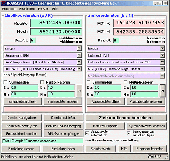
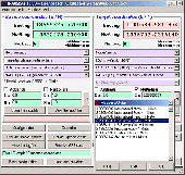
The Eye4Software Coordinate Calculator is an easy to use tool to perform Map or GPS coordinate conversions. The software can be used to transform a single coordinate or a batch of coordinates read from a comma separated, database or ESRI shapefiles. The software is shipped with a MS Access database file, containing more then 3500 ellipsoid, Map Datum and Map grid...
Category: Business & Finance / Calculators
Publisher: Eye4Software B.V., License: Shareware, Price: USD $49.00, EUR39, File Size: 3.2 MB
Platform: Windows
Freeware
Datum Locker assists safe record keeping of account credentials and note taking which are deemed sensitive. Its strength comes from the use of Nullox's linearistic distance cryptographic (LDC) algorithm to securely store your data on disk thereby presenting an intruder with random symbols due to the omittance of a valid key. Datum Locker operates on a timer thus monitoring when...
Category: Security & Privacy / Anti-Spam & Anti-Spy Tools
Publisher: Nullox Software, License: Freeware, Price: USD $0.00, File Size: 522.0 KB
Platform: Windows
This softwareis a program specially designed to convert MapInfo files from the old Australian Geodetic Datum (AGD) to the new Geocentric Datum of Australia (GDA) using the distortion modeling method which is the most accurate method possible. It provides consistency of Australia's mapping Datum with international coordinate systems.
Category: Home & Education / Miscellaneous
Publisher: Peter Meier, License: Shareware, Price: USD $1582.19, File Size: 9.8 MB
Platform: Windows
GEOPosCalc is an easy to use and powerfull tool for coordinate systems (grid) and datum conversion.
GEOPosCalc is an easy to use and powerfull tool for coordinate systems (grid) and Datum Conversion. It does support more than 200 predefined datums, 20 ellipsoids and 10 coordinate systemsand the ability to define your own datums and ellipsoids.
Category: Home & Education / Science
Publisher: American Outland, License: Shareware, Price: USD $40.00, File Size: 4.7 MB
Platform: Windows
DatumPro is the most comprehensive and accurate co-ordinate Conversion package available, handling thousands of coordinate systems, including Gauss Kruger, UTM, and Lambert Conic grids With over 600 Datum conversions and over 450 Grid Projections, and hundreds of specific TM and Lambert conic conformal grids and all the latest EPSG transformations. DatumPro not only converts...
Category: Home & Education / Miscellaneous
Publisher: Geomatix Ltd, License: Shareware, Price: USD $119.00, File Size: 5.6 MB
Platform: Windows
SHPTRANS is a fast, high-precision NTv2 Datum transformation and projection utility which reads and writes shapefiles. SHPTRANS is intended to complement, not replace, existing projection tools such as those within ArcView GIS 3.x and ArcGIS 8.x.SHPTRANS supports the following projections: UTM (tested for North America; intended to support all 60 zones in both hemispheres), MTM 3-degree...
Category: Utilities / Misc. Utilities
Publisher: Bruce Dodson, License: Shareware, Price: USD $0.00, File Size: 335.0 KB
Platform: Windows
Cool Flash Map Maker is a powerful Flash Map software for developing interactive flash mapping solutions and products for Real Estate, Spacial Statistics, Business Locator Applications, Vector USA Map,World Map, Germany Map,ASIA Map, Canada Map, Europe Map, Australia Map, Austria Map, Africa Map, UK Map, South...
Category: Multimedia & Design / Multimedia App's
Publisher: Go2Share, License: Shareware, Price: USD $29.95, File Size: 17.9 MB
Platform: Windows
In the Dynamic Link Library GeoDLL geodesic functions like coordinate transformation, Datum changes, meridian strip changes, user defined coordinate and reference systems, distance calculation, maps functions, Digital Elevation Models and more geodesic functions are contained to bind them into own applications. WINDOWS operating system allows building of function libraries intended for...
Category: Software Development
Publisher: Killet Softwareentwicklung GbR, License: Shareware, Price: USD $290.00, File Size: 999.9 KB
Platform: Windows
Software from the SeisSoft Company stores its projection and Datum constants in the Windows Registry. A true propeller-head can find these constants in HKEY_CURRENT_USER\Software\SeisSoft. For those
Category: Utilities / System Utilities
Publisher: The SeisSoft Company, License: Freeware, Price: USD $0.00, File Size: 395.5 KB
Platform: Windows
Commercial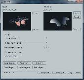
Bas-relief is intended for 2D to 3D Conversion using the depth Map. The application opens two images: one is a coloured flat image, the other is its depth Map, which shows us what areas are closer to us, and what are more distant. The white area is located at the foreground, the black one is at the background. Thereby, the general task is the acceptable depth Map...
Category: Multimedia & Design / Image Editing
Publisher: 3Dmix, License: Commercial, Price: USD $103.00, File Size: 1000 B
Platform: Windows

TRANSDATpro can prove a helpful tool for professionals, providing them with the possibility to perform coordinate transformations fast and easy by use of the coordinate reference systems of their choice. TRANSDATpro performs Coordinate Transformations fast and with high accuracy. The coordinate Conversion software supports worldwide thousands of Coordinate Systems, geodetic Reference...
Category: Home & Education / Science
Publisher: Killet GeoSoftware Ing.-GbR, License: Shareware, Price: USD $270.00, EUR240, File Size: 5.3 MB
Platform: Windows
Remere's Map Editor is a map editor for the OpenTibia Project which was created by Remere.
Remere's Map Editor is a Map editor for the OpenTibia Project which was created by Remere.
Remere's Map Editor is a Map editor coded in C to be used with OpenTibia. It supports many advanced features such as autobordering and placing of composite objects. Runs under both Linux and Windows using wxWidgets and OpenGL.
Category: Games / Tools & Editors
Publisher: Remere, License: Shareware, Price: USD $0.00, File Size: 4.2 MB
Platform: Windows
Freeware
An interactive Flash USA Map with all the features you need for your web site or project. This is the ideal solution for dealer maps, real-estate listings, or visualizing state statistics. Nearly every aspect of the Map is customizable. However, unlike competing products, our Map is very simple to install and edit. Just upload XML and SWF files and embed.
Category: Internet / Flash Tools
Publisher: http://www.flashusamap.com/trial/flashus, License: Freeware, Price: USD $0.00, File Size: 93.8 KB
Platform: Unknown
Map of Africa is one of the many maps created for GPS TrackMaker.
Map of Africa is one of the many maps created for GPS TrackMaker. You are able to download the installation package from the TrackMaker website. In order to preview the contents of this package, you need to install GPS TrackMaker.
Using the above mentioned application, you will be able to see the Map of Africa. Just click on the "Open Temporary...
Category: Home & Education / Miscellaneous
Publisher: Geo Studio Technology, License: Freeware, Price: USD $0.00, File Size: 18.3 MB
Platform: Windows
Program shows you an actual X3 sector-map, with detailed information about most in-game objects.
Program shows you an actual X3 sector-Map, with detailed information about most in-game objects. The Map is based on a log-file that is created with an in-game script (by Andrei[<>Ace]). If you just want to view the standard Map (or if you don’t have the game) the program will work with the included default Map, which was created with an English X3 game...
Category: Games / Misc. Games
Publisher: SUU Design, License: Freeware, Price: USD $0.00, File Size: 1.4 MB
Platform: Windows
New Zealand Map Reference Converter (NZMapConv) is software that LINZ provides to convert Map references between the old NZMS260 Map series and the new NZTopo50 Map series.NZMapConv is a Windows programme designed to convert individual coordinates entered manually.
Category: Multimedia & Design / Media Management
Publisher: Land Information New Zealand, License: Freeware, Price: USD $0.00, File Size: 2.4 MB
Platform: Windows
When the XMAP software is communicating with an XEDE via the comms cable each Map will show, at the top of the Map display, an RPM and load value (x and y axis for the Map) in real time. Also in each Map a yellow highlighted block will show the current position within the Map. Beside the real-time display on each Map are the undo and redo buttons which...
Category: Home & Education / Miscellaneous
Publisher: ChipTorque, License: Freeware, Price: USD $0.00, File Size: 1.7 MB
Platform: Windows
Sig Panama Has :
Digital maps of Panama, Digital Map of Panama-City, digital Map of Taboga, digital Map of Bocas del Toro, digital Map of Colon and Free Zone, digital Map of Contadora Island, digital Map of Coronado, Panama, Zona Libre, Map of Panama, Map of Panama City, Map of Colon, Map of Zona Libre, Map of...
Category: Internet / Misc. Plugins
Publisher: DP Imperial, LLC., License: Freeware, Price: USD $0.00, File Size: 44.9 MB
Platform: Windows
Freeware
Convert ESRI ShapeFiles (.SHP) geolocation data into AnyMap format to be used with AnyChart. AnyChart Flash Map Converter allows making use of a wide choice of maps with AnyChart Flash Component, a GIS visualization system that recognizes Map data in AnyMap format only. AnyChart Flash Map Converter makes it easy to visualize any geolocation data without hefty expenses...
Category: Web Authoring / Image Mapping Tools
Publisher: AnyChart.Com, License: Freeware, Price: USD $0.00, File Size: 1.6 MB
Platform: Windows
Freeware
Arm Map Explorer recreates all the functionalities of Google Maps on your desktop while expanding them with new extras. Map Explorer lets you locate and view any place on the planet using dynamic interactive maps. These maps are draggable, which means there is no need for you to click and wait for graphics to reload each time you want to view adjacent parts of a Map....
Category: Internet / Flash Tools
Publisher: ArmCode, License: Freeware, Price: USD $0.00, File Size: 5.5 MB
Platform: Windows