Free Downloads: Map King Maps Europe
Europe Flash map Silver (with FLA source) 1.
Europe Flash Map Silver (with FLA source) 1.0for web sites, interactive applications, presentations, and more.With this fully-clickable Map you will be able to improve navigation and provide visitors with better and quicker access to information as well as improve the way you present the information. The Map can be easily customizable. In just a few minutes you can...
Category: Web Authoring / Flash Utilities
Publisher: Fla-shop.com Inc., License: Demo, Price: USD $69.00, File Size: 140.0 KB
Platform: Windows
Euratlas Periodis Expert is a database and a historical atlas of Europe with editing functions.
Euratlas Periodis Expert is a database and a historical atlas of Europe with editing functions. It describes the political status of Europe, North Africa and Near East at fixed intervals, from year 1 until year 2000.
Stress is put on the precise drawing of territories at one exact instant defined by fixed length intervals, that is the first day of each centennial...
Category: Home & Education / Miscellaneous
Publisher: Euratlas, License: Shareware, Price: USD $77.80, File Size: 33.2 MB
Platform: Windows
Flash Map of Europe.Suitable for Real-Estate, Dealer Maps, Branch Offices Locators.With this fully-clickable Map you will be able to improve navigation and provide visitors with better and quicker access to information as well as improve the way you present the information. The Map can be used "as is" however it is also easily customizable. In just a...
Category: Web Authoring / Flash Utilities
Publisher: Fla-shop.com Inc., License: Demo, Price: USD $69.00, File Size: 117.0 KB
Platform: Windows
Anychart is a flexible Macromedia Flash based-solution, which allows you to easily display any sort of data dealing with geographical locations. It contains United States Maps with Counties, World Map, etc. XML data file and a set of customizable options make AnyChart Maps a universal solution for web developers. AnyChart allows you to create superb, compact, interactive...
Category: Software Development
Publisher: AnyChart.Com, License: Shareware, Price: USD $199.00, File Size: 2.8 MB
Platform: Windows, Mac, Linux, Palm,
Golden SpotsMap of Europe for websites, presentations and more.
Golden SpotsMap of Europe for websites, presentations and more. The Map contains detailed Maps of each state. Easy adjustment.Variants of using a Map locator:- Real-Estate websites- Quick access to contact organization data, having affiliated network in USAWith this fully-clickable Map you will be able to improve navigation and provide visitors with a better...
Category: Web Authoring / Flash Utilities
Publisher: Fla-shop.com Inc., License: Demo, Price: USD $149.00, File Size: 470.0 KB
Platform: Windows, Mac
Europe Flash Map Locator for websites, presentations and more.
Europe Flash Map Locator for websites, presentations and more. Easy adjustment.
Variants of using a Map locator:
- Real-Estate websites
- Quick access to contact organization data, having affiliated network in Europe
With this fully-clickable Map you will be able to improve navigation and provide visitors with a better and faster means of accessing...
Category: Web Authoring / Web Design Utilities
Publisher: Fla-shop.com Inc., License: Demo, Price: USD $69.00, File Size: 111.0 KB
Platform: Windows, Mac
Live Satellite Maps or Google maps is a web server mapping applications.
Live Satellite Maps or Google Maps is a web server mapping applications.Provides scrolling Map images and satellite photos around the earth and even the route between different places.Since 6 October 2005, live satellite Maps is part of local Google.Google live satellite Map provides the ability to zoom in or zoom out to show the Map.The user can...
Category: Home & Education / Science
Publisher: www.satelliteview-of-my-house.com, License: Freeware, Price: USD $0.00, File Size: 643.0 KB
Platform: Windows
The King has died without producing an heir.
The King has died without producing an heir. The Star Kingdom has fallen apart, with most of the worlds declaring their independence. Only you and one other noble house have declared their right to the throne. Take control of one of the houses and fight for your right to become the next Star King ... but watch out for the Indies!
<BR><BR>
* Interstellar...
Category: Games / Action
Publisher: ApeZone Inc, License: Shareware, Price: USD $19.95, File Size: 8.5 MB
Platform: Windows
Centennia is a Map-based guide to the history of Europe and the Middle East from the beginning of the 11th century to the present. It is a dynamic, animated historical atlas including over 9,000 border changes. A good feature is the Map controls that evolves the Map forward or backward in time bringing the static Map to life.
Category: Home & Education / Miscellaneous
Publisher: Centennia Software, License: Shareware, Price: USD $79.00, File Size: 3.3 MB
Platform: Windows
 Shareware
Google Hybrid Maps Downloader is a tool that can automatically download the google hybrid Maps images to your PC. It can download the small tiles and save them to your hard disk. After downloading, you can view the Maps offline by its tool Maps Viewer, or you can combine the small images into one big Map image. If you want to make a Map of your city by...
Category: Internet / Download Managers
Publisher: allmapsoft.com, License: Shareware, Price: USD $29.99, File Size: 30.6 MB
Platform: Windows
Shareware
Google Maps Terrain Downloader is a tool that can automatically download the google terrain Maps images to your PC. It can download the small tiles and save them to your hard disk. After downloading, you can view the Maps offline by its tool Maps Viewer, or you can combine the small images into one big Map image. If you want to make a Map of your city...
Category: Internet / Download Managers
Publisher: allmapsoft.com, License: Shareware, Price: USD $29.99, File Size: 305.3 MB
Platform: Windows
Aerial, topograhpic, and other types of Maps are an important resource in the visualization of your information. HuntSmart big game hunting software gives you the ability to view your information on Maps. Once you enter information with coordinates into the system, this information can be viewed on all available Maps that contain those coordinates. One thing to remember is...
Category: Multimedia & Design / Multimedia App's
Publisher: HuntingSouth, License: Shareware, Price: USD $0.00, File Size: 17.1 MB
Platform: Windows
zMapper is general purpose Map database creation program.
zMapper is general purpose Map database creation program. Create your own Maps of games or real-life from scratch. Overlay your Map database on any graphical image. Enhance Maps with shapes, icons, and text. Supports Cartesian, hexagonal, or octagonal Map layouts. Maps are compatible with zMUD and zExplorer. Windows 95, 98, ME, 2000, NT and XP.
Category: Audio / Music Creation
Publisher: Zugg Software, License: Shareware, Price: USD $20.00, File Size: 4.1 MB
Platform: Windows
Want to brush up on the names and locations of the 40 or so countries of the new Europe?
Want to brush up on the names and locations of the 40 or so countries of the new Europe? This program from the Family Games Web Center will help you. European Geography Tutor presents a scrolling Map of Europe along with a list of countries. As your mouse pointer passes over the Map, the country under the pointer highlights, along with its entry in the list. Simply...
Category: Home & Education / Genealogy
Publisher: AHA! Software Inc., License: Freeware, Price: USD $0.00, File Size: 508.0 KB
Platform: Windows
C&C 3 Map Manager streamlines the process of installing custom Maps for C&C 3: Tiberium Wars and Kane's Wrath. Now you can install fan Maps from C&C fansites without having to delve into your computer's folders to find the right place to put them: Map Manager handles this for you. Map Manager also allows you to delete fan Maps...
Category: Games / Tools & Editors
Publisher: CNC Generals World, License: Freeware, Price: USD $0.00, File Size: 612.3 KB
Platform: Windows
Freeware
Arm Map Explorer recreates all the functionalities of Google Maps on your desktop while expanding them with new extras. Map Explorer lets you locate and view any place on the planet using dynamic interactive Maps. These Maps are draggable, which means there is no need for you to click and wait for graphics to reload each time you want to view adjacent parts of...
Category: Internet / Flash Tools
Publisher: ArmCode, License: Freeware, Price: USD $0.00, File Size: 5.5 MB
Platform: Windows
Freeware
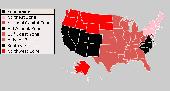
An interactive Flash USA Map with all the features you need for your web site or project. This is the ideal solution for dealer Maps, real-estate listings, or visualizing state statistics. Nearly every aspect of the Map is customizable. However, unlike competing products, our Map is very simple to install and edit. Just upload XML and SWF files and embed.
Category: Internet / Flash Tools
Publisher: http://www.flashusamap.com/trial/flashus, License: Freeware, Price: USD $0.00, File Size: 93.8 KB
Platform: Unknown
Region Map Generator is a tool to make region Map with self-definition color. The original Maps in the software are blank political region ones for different countries or areas. You can color any region with whatever color as you like. By this software, you can easily make lively Maps. These Maps can be used as data analysis charts, teaching materials,...
Category: Business & Finance / Applications
Publisher: cciyy, License: Shareware, Price: USD $36.95, File Size: 1.3 MB
Platform: Windows

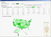
Commercial realtors require accurate and reliable tools to publish available properties online and show them on the website (specifying region, county, state, and city). We have created a unique Interactive Real Estate Map with all USA states and counties on it for real estate business. USA Real Estate Map is a unique and amazing vector-based tool that is very simple to use....
Category: Internet
Publisher: USFlashMap.com, License: Shareware, Price: USD $399.00, File Size: 3.9 MB
Platform: Windows, Mac, Linux, Unix, MS-DOS, AS/400, OS/2
Map of Africa is one of the many maps created for GPS TrackMaker.
Map of Africa is one of the many Maps created for GPS TrackMaker. You are able to download the installation package from the TrackMaker website. In order to preview the contents of this package, you need to install GPS TrackMaker.
Using the above mentioned application, you will be able to see the Map of Africa. Just click on the "Open Temporary...
Category: Home & Education / Miscellaneous
Publisher: Geo Studio Technology, License: Freeware, Price: USD $0.00, File Size: 18.3 MB
Platform: Windows
Representing a new concept in the field of Ham Maps, the Global Overlay Mapping System is packed full of features for all Ham Radio enthusiasts, including : 1 World Map, with specialised satellite images and world region-boundaries. 8 Continental Maps - Europe, Asia, Africa, North and South America, Oceania, Arctic, Antarctica. 29 Sub Continental Maps, with...
Category: Home & Education / Miscellaneous
Publisher: MapAbility, License: Freeware, Price: USD $0.00, File Size: 4.9 MB
Platform: Windows
Shareware
Offline Map Maker is a tool that help you to get offline tile images from Google Maps, Openstreetmap, Yandex Maps, Yahoo Maps, Mapquest, Gaode Map, Tencent Maps, Baidu Maps, Tianditu, Arcgis Online, OneMap, Whereis, mapy.cz, Mappy, Waze, Sentinel-2 Map, Strava Gloabal Heatmap, Wikimapia, GoMap.Az, Longdo Map, Bhuvan, National...
Category: Internet / Download Managers
Publisher: allmapsoft.com, License: Shareware, Price: USD $79.00, File Size: 31.1 MB
Platform: Windows
Know Your Europe is a Map based Geography application designed to help people of all ages to develop and test their knowledge of European geography through both English and Irish.
Know Your Europe works great with an interactive whiteboard, in a group, or one-on-one with the computer. The software is suitable for anyone who wishes to extend their knowledge of European...
Category: Home & Education / Miscellaneous
Publisher: EdWare, License: Shareware, Price: USD $170.85, File Size: 48.2 MB
Platform: Windows
Aviasoft European Birds is a program dedicated to bird watching in Europe.
Aviasoft European Birds is a program dedicated to bird watching in Europe. It has over 600 birds with bird songs, text descriptions, illustrations, photographs, distribution Maps and detailed seasonal and regional plumage images. The bird record set can be edited, birds can be deleted or added using the lists editor.
A limited version of this program is part of Nature...
Category: Home & Education / Miscellaneous
Publisher: AviaSoft, License: Freeware, Price: USD $0.00, File Size: 121.3 MB
Platform: Windows
MapCreator 2.0 is a software to create Maps and animated Maps with a good quality.
MapCreator can be used in presentations because is versatile and can be adequate for any kind of presentation, from travel presentations to professional presentations.
MapCreator is geo-referenced so any Map or portion of the Map will have the exactly portions of latitude...
Category: Home & Education / Miscellaneous
Publisher: primap software, License: Freeware, Price: USD $0.00, File Size: 103.3 MB
Platform: Windows