Free Downloads: Map Plotting Software
With AstroSynthesis, you can can Map out large portions of space - Plotting stars, interstellar routes, and subsectors. And best of all, you do it completely in 3D space.
Zoom in and out on your sector, pan and rotate around stars, follow routes, and watch fantastic animation effects all in 3D.
Because star systems contain so much data, AstroSynthesis...
Category: Multimedia & Design / Multimedia App's
Publisher: NBOS Software, License: Shareware, Price: USD $34.95, File Size: 30.0 MB
Platform: Windows
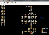
MUD Map Designer is a tool that was developed for MUD programmers that wish to make maps for Plotting or simply beneficial reasons. All files can be exported to several different image types. You can create your own setup files and Map icons to use to customize each game!
Here are some key features:
-You can save, load, or export maps. You can export maps into one...
Category: Software Development / Help File Utilities
Publisher: Stonefall Studios, License: Freeware, Price: USD $0.00, File Size: 455.0 KB
Platform: Windows
PyPlotter is an open source 2D graph plotting package for Python and Jython.
PyPlotter is an open source 2D graph Plotting package for Python and Jython. It was primarily written for use in the CoopSim package. If you do not rely on Jython support or any other of PyPlotter's special featurs (see key features list below), you will probably be better off with one of the more common Python Plotting packages like Matplotlib or ReportLab, both of which...
Category: Home & Education / Miscellaneous
Publisher: Eckhart Arnold, License: Freeware, Price: USD $0.00, File Size: 116.7 KB
Platform: Windows
Cool Flash Map Maker is a powerful Flash Map Software for developing interactive flash mapping solutions and products for Real Estate, Spacial Statistics, Business Locator Applications, Vector USA Map,World Map, Germany Map,ASIA Map, Canada Map, Europe Map, Australia Map, Austria Map, Africa Map, UK Map,...
Category: Multimedia & Design / Multimedia App's
Publisher: Go2Share, License: Shareware, Price: USD $29.95, File Size: 17.9 MB
Platform: Windows
 Freeware
SimplexNumerica is an object-oriented numerical data analyzer, plot and presentation program. SimplexNumerica is proving to be extremely popular among scientists. Ergonomic programming using the newest Windows programming guidelines with toolbars, context dialogs and interactive diagrams providing easy handling with difficult numeric mathematics. SimplexNumerica is best suited for publication...
Category: Home & Education / Mathematics
Publisher: Dipl.-Phys.-Ing. Ralf Wirtz, License: Freeware, Price: USD $0.00, File Size: 21.8 MB
Platform: Windows
This program is an advanced curve plotting application for mobile Java devices.
This program is an advanced curve Plotting application for mobile Java devices. It supports Plotting multiple explicite, polar or parametric function curves. It can also perform numeric calculations such as calculating the value, derivative, integral, roo
Category: Home & Education / Mathematics
Publisher: greenfish.xtreemhost.com, License: Freeware, Price: USD $0.00, File Size: 63.6 KB
Platform: Unknown
The MapSys Cadastral GIS offers specialized functionality for each stage of processing including the digital Map creation, Plotting cadastral and topographical plans, generating and combining geo-referenced data in order to obtain a validated relational geo-database. This can be used in MapSys or in other GIS programs or database application.
Category: Home & Education / Teaching Tools
Publisher: GEOTOP, License: Freeware, Price: USD $0.00, File Size: 143.9 MB
Platform: Windows
If you are receiving Mode-S ADS-B position reports, PlanePlotter can interface to Google Earth to display aircraft positions over the Google Earth base Map. It can even give you a dynamic real-time view from the flight deck of an aircraft that you designate. PlanePlotter can decode ACARS messages, display the message content and plot any positions on a chart.
PlanePlotter...
Category: Internet / Communications
Publisher: COAA, License: Shareware, Price: USD $32.84, File Size: 3.6 MB
Platform: Windows
Map Suite Desktop Edition is a powerful and feature-rich .NET mapping control that enables C# and VB.NET Software developers to build detailed desktop mapping applications. Utilizing Microsoft's .NET Framework, the APIs for Map Suite Desktop Edition incorporate the very latest technology to deliver a powerful, user-friendly mapping control. In addition, ease of coding and...
Category: Software Development
Publisher: ThinkGeo LLC, License: Commercial, Price: USD $4794.00, File Size: 28.4 MB
Platform: Windows
Map Suite Engine is a powerful and feature-rich low level component that enables C# and VB.NET Software developers to generate great-looking Map images for presentations. At the heart of the Map Suite product line is a non-visual component library designed to generate maps. With this tool in your hands, you will be able to “roll your own” mapping control in...
Category: Software Development
Publisher: ThinkGeo LLC, License: Commercial, Price: USD $4794.00, File Size: 15.1 MB
Platform: Windows

The program DISGCL is an interpreter based on the data Plotting library DISLIN. DISLIN statements can be written to a script file and then be executed with DISGCL, or can be entered in an interactive mode. Similar to programming languages, high-level language elements are available in DISGCL such as variables, operators, expressions, array operations, loops, if and switch statements,...
Category: Software Development
Publisher: MPI fuer Sonnensystemforschung, License: Freeware, Price: USD $0.00, File Size: 385.7 KB
Platform: Unknown

The program DISGCL is an interpreter based on the data Plotting library DISLIN. DISLIN statements can be written to a script file and then be executed with DISGCL, or can be entered in an interactive mode. Similar to programming languages, high-level language elements are available in DISGCL such as variables, operators, expressions, array operations, loops, if and switch statements,...
Category: Software Development
Publisher: MPI fuer Sonnensystemforschung, License: Freeware, Price: USD $0.00, File Size: 4.6 MB
Platform: Windows
Map Suite Web Edition is a powerful and feature-rich ASP.Net server control that enables C# and VB.NET Software developers to build detailed internet mapping applications. Utilizing Microsoft's .NET Framework, the APIs for Map Suite Web Edition incorporate the very latest technology to deliver a powerful, user-friendly .NET component that makes it easy to develop mapping...
Category: Software Development
Publisher: ThinkGeo LLC, License: Commercial, Price: USD $4794.00, File Size: 28.8 MB
Platform: Windows

DISLIN is a high-level library of subroutines and functions that display data graphically. It is intended to be a powerful and easy to use Software package for programmers and scientists that does not require knowledge of hardware features. The Software is available for the programming languages C, Fortran 77, Fortran 90, Perl, Python and Java. DISLIN can display graphic...
Category: Software Development
Publisher: MPI fuer Sonnensystemforschung, License: Freeware, Price: USD $0.00, File Size: 4.8 MB
Platform: Windows

DISLIN is a high-level library of subroutines and functions that display data graphically. It is intended to be a powerful and easy to use Software package for programmers and scientists that does not require knowledge of hardware features. The Software is available for the programming languages C, Fortran 77, Fortran 90, Perl, Python and Java. DISLIN can display graphic...
Category: Software Development
Publisher: MPI fuer Sonnensystemforschung, License: Freeware, Price: USD $0.00, File Size: 6.7 MB
Platform: Windows

DISLIN is a high-level library of subroutines and functions that display data graphically. It is intended to be a powerful and easy to use Software package for programmers and scientists that does not require knowledge of hardware features. The Software is available for the programming languages C, Fortran 77, Fortran 90, Perl, Python and Java. DISLIN can display graphic...
Category: Software Development
Publisher: MPI fuer Sonnensystemforschung, License: Freeware, Price: USD $0.00, File Size: 5.8 MB
Platform: Windows

DISLIN is a high-level library of subroutines and functions that display data graphically. It is intended to be a powerful and easy to use Software package for programmers and scientists that does not require knowledge of hardware features. The Software is available for the programming languages C, Fortran 77, Fortran 90, Perl, Python and Java. DISLIN can display graphic...
Category: Software Development
Publisher: MPI fuer Sonnensystemforschung, License: Freeware, Price: USD $0.00, File Size: 4.9 MB
Platform: Windows

DISLIN is a high-level library of subroutines and functions that display data graphically. It is intended to be a powerful and easy to use Software package for programmers and scientists that does not require knowledge of hardware features. The Software is available for the programming languages C, Fortran 77, Fortran 90, Perl, Python and Java. DISLIN can display graphic...
Category: Software Development
Publisher: MPI fuer Sonnensystemforschung, License: Freeware, Price: USD $0.00, File Size: 4.1 MB
Platform: Windows

DISLIN is a high-level library of subroutines and functions that display data graphically. It is intended to be a powerful and easy to use Software package for programmers and scientists that does not require knowledge of hardware features. The Software is available for the programming languages C, Fortran 77, Fortran 90, Perl, Python and Java. DISLIN can display graphic...
Category: Software Development
Publisher: MPI fuer Sonnensystemforschung, License: Freeware, Price: USD $0.00, File Size: 2.1 MB
Platform: Unknown

DISLIN is a high-level library of subroutines and functions that display data graphically. It is intended to be a powerful and easy to use Software package for programmers and scientists that does not require knowledge of hardware features. The Software is available for the programming languages C, Fortran 77, Fortran 90, Perl, Python and Java. DISLIN can display graphic...
Category: Software Development
Publisher: MPI fuer Sonnensystemforschung, License: Freeware, Price: USD $0.00, File Size: 2.7 MB
Platform: Unknown

DISLIN is a high-level library of subroutines and functions that display data graphically. It is intended to be a powerful and easy to use Software package for programmers and scientists that does not require knowledge of hardware features. The Software is available for the programming languages C, Fortran 77, Fortran 90, Perl, Python and Java. DISLIN can display graphic...
Category: Software Development
Publisher: MPI fuer Sonnensystemforschung, License: Freeware, Price: USD $0.00, File Size: 5.8 MB
Platform: Windows

DISLIN is a high-level library of subroutines and functions that display data graphically. It is intended to be a powerful and easy to use Software package for programmers and scientists that does not require knowledge of hardware features. The Software is available for the programming languages C, Fortran 77, Fortran 90, Perl, Python and Java. DISLIN can display graphic...
Category: Software Development
Publisher: MPI fuer Sonnensystemforschung, License: Freeware, Price: USD $0.00, File Size: 4.7 MB
Platform: Windows

DISLIN is a high-level library of subroutines and functions that display data graphically. It is intended to be a powerful and easy to use Software package for programmers and scientists that does not require knowledge of hardware features. The Software is available for the programming languages C, Fortran 77, Fortran 90, Perl, Python and Java. DISLIN can display graphic...
Category: Software Development
Publisher: MPI fuer Sonnensystemforschung, License: Freeware, Price: USD $0.00, File Size: 4.9 MB
Platform: Windows

DISLIN is a high-level library of subroutines and functions that display data graphically. It is intended to be a powerful and easy to use Software package for programmers and scientists that does not require knowledge of hardware features. The Software is available for the programming languages C, Fortran 77, Fortran 90, Perl, Python and Java. DISLIN can display graphic...
Category: Software Development
Publisher: MPI fuer Sonnensystemforschung, License: Freeware, Price: USD $0.00, File Size: 5.1 MB
Platform: Windows