Free Downloads: Map Projection
SHPTRANS is a fast, high-precision NTv2 datum transformation and Projection utility which reads and writes shapefiles. SHPTRANS is intended to complement, not replace, existing Projection tools such as those within ArcView GIS 3.x and ArcGIS 8.x.SHPTRANS supports the following projections: UTM (tested for North America; intended to support all 60 zones in both hemispheres), MTM...
Category: Utilities / Misc. Utilities
Publisher: Bruce Dodson, License: Shareware, Price: USD $0.00, File Size: 335.0 KB
Platform: Windows
Astral Projection product review application that gives honest and trusted reviews of three major products to help with astral projection and other psychic phenomena
Category: Home & Education
Publisher: astral projection, License: Freeware, Price: USD $0.00, File Size: 373.2 KB
Platform: Windows
The Q+ System Projection Application developed by NanoH20, Inc.
The Q+ System Projection Application developed by NanoH20, Inc. is used to predict reverse osmosis system performance based on NanoH2O membrane characteristics . It is also capable of simulating polymeric RO membranes if their performance is entered.
Category: Utilities / Misc. Utilities
Publisher: NanoH20, Inc., License: Freeware, Price: USD $0.00, File Size: 27.0 MB
Platform: Windows
Is a special application to calculate Projection distance and Projection size for Mitsubishi Electric projectors. Simply choose the desired model, lens and unit, then enter a value in a box to calculate the following: distance between projector and screen, required screen dimensions, and the appropriate distance of the screen from the floor or ceiling. Values can be displayed in...
Category: Home & Education / Miscellaneous
Publisher: MITSUBISHI ELECTRIC CORPORATION, License: Freeware, Price: USD $0.00, File Size: 5.9 MB
Platform: Windows
This example will get you familiar with the gluunproject perspective Projection, ray picking and the use of glreadpixels. Also explains the glulookat implementation, the right mathematical formula to use, the correct matrix Projection and gives a connection between these commands. Get full OpenGL source.
Category: Multimedia & Design / Multimedia App's
Publisher: Og.delcode.com , Inc., License: Shareware, Price: USD $14.50, File Size: 215.9 KB
Platform: Windows


 Shareware
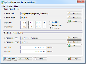
The Eye4Software Coordinate Calculator is an easy to use tool to perform Map or GPS coordinate conversions. The software can be used to transform a single coordinate or a batch of coordinates read from a comma separated, database or ESRI shapefiles. The software is shipped with a MS Access database file, containing more then 3500 ellipsoid, Map datum and Map grid...
Category: Business & Finance / Calculators
Publisher: Eye4Software B.V., License: Shareware, Price: USD $49.00, EUR39, File Size: 3.2 MB
Platform: Windows
Presentation Manager - Praise and Worship Software for Church Projection
Presentation software that offers the ease and features you are looking for to streamline and simplify your worship Projection.
Included song and Bible database.
Text over video.
Play DVD segments and flash media files.
Category: Audio / Utilities & Plug-Ins
Publisher: PresentationPro, License: Shareware, Price: USD $200.00, File Size: 61.8 MB
Platform: Windows
This software will not work unless you already own a MapSource product.
This software will not work unless you already own a MapSource product.
Main Features:
- Improved memory issues when running on Windows 7.
- Improved Map Projection for many Map products.
- Changed mouse-wheel functionality to zoom in and out.
- Added support for enhanced Map security.
-...
Category: Home & Education / Miscellaneous
Publisher: Garmin Ltd or its subsidiaries, License: Freeware, Price: USD $0.00, File Size: 8.4 MB
Platform: Windows
WolfPack software is for educational use.
WolfPack software is for educational use. It includes:
-Wolfpack.exe: The executable program.
-Wolfpack.chm: A compiled help file
-30 sample data files located in the Elementary Surveying subdirectory of My Documents
-6 digital aerial photo files in three resolutions: Only one resolution (low, medium, high) can be loaded with one installation of the software. This also...
Category: Home & Education / Miscellaneous
Publisher: Elementary Surveying, License: Freeware, Price: USD $0.00, File Size: 102.8 MB
Platform: Windows
This program is a tool for stretching a bitmap image (a raster image), trimming it to a box, and calibrating it. This is primarily of use when dealing with a scanned image of a paper Map. Often when making a scan it is hard to get the image precisely aligned; sometimes with old maps the paper has stretched. It can be useful where you want to make a tiled Map from a number of...
Category: Multimedia & Design / Multimedia App's
Publisher: Map Library, License: Freeware, Price: USD $0.00, File Size: 755.8 KB
Platform: Windows
Cool Flash Map Maker is a powerful Flash Map software for developing interactive flash mapping solutions and products for Real Estate, Spacial Statistics, Business Locator Applications, Vector USA Map,World Map, Germany Map,ASIA Map, Canada Map, Europe Map, Australia Map, Austria Map, Africa Map, UK Map, South...
Category: Multimedia & Design / Multimedia App's
Publisher: Go2Share, License: Shareware, Price: USD $29.95, File Size: 17.9 MB
Platform: Windows
Major USA Cities and Highway Map has been developed for the business-minded people, who need quick and on-hand access to the network of US roads. It is a rather simple version of professional software with several background images and a nice monitor glass Projection. With our user-friendly USA Cities and Highways Map it is possible to:? add/remove locations? hide/show...
Category: Web Authoring / Flash Utilities
Publisher: USFlashMap.com, License: Shareware, Price: USD $399.00, File Size: 13.4 MB
Platform: Windows, Mac, Linux, Unix, MS-DOS, AS, 400
EvenLED is a high-brightness modular system of RGB LED panels used together with a rear-Projection material to create a completely even and flicker-free field of light over cycloramas and other semi-transparent Projection surfaces.
Features:
-Extremely smooth dimming
-Cabling: Daisy-chained power and data
-Easy to assemble and rig; very...
Category: Internet / Communications
Publisher: Martin Professional, License: Freeware, Price: USD $0.00, File Size: 26.8 MB
Platform: Windows
HD View also makes creating and hosting your own HD View images easy.
HD View also makes creating and hosting your own HD View images easy. HD View is available as a plug-in for Windows-based browsers, including Internet Explorer and Firefox.
Recent advances in camera and sensor technology and software for stitching images together has led to the creation of images containing billions of pixels (gigapixels).
These images are often...
Category: Internet / Browser Accessories
Publisher: Microsoft Research, License: Freeware, Price: USD $0.00, File Size: 1.2 MB
Platform: Windows
Nevron Map for Reporting Services is an advanced report for all versions Microsoft Reporting Services. It is designed to provide report authors with an easy and powerful way to create choropleth maps that are tightly integrated with your data. The component delivers an unmatched set of features related to visual quality, layout, data integration and data analysis. Nevron Map for...
Category: Business & Finance / Database Management
Publisher: Nevron Software LLC, License: Shareware, Price: USD $589.00, File Size: 182.2 MB
Platform: Windows
Nevron Map for SharePoint is an advanced web part for all versions Microsoft SharePoint (WSS3.0, SharePoint 2007, 2010, 2013 and 2016). It is designed to provide an easy and powerful way to create choropleth maps that are tightly integrated with your data. The Map Web Part delivers a great set of features including: - Multiple Map Layers - unlimited number of Map...
Category: Software Development / Components & Libraries
Publisher: Nevron Software LLC, License: Shareware, Price: USD $889.00, File Size: 121.9 MB
Platform: Windows
EasyMap VCL is a Delphi/C++Builder components set for creating your own GIS-related solutions without MapInfo, MapX, MapObjects, WinGIS and so on. EasyMap VCL allows to add following functionalities in Delphi/C++Builder application: - MIF/MID vector maps displaying in Longitude/Lantitude Projection; - Map objects related data in grid or tabular controls displaying; -...
Category: Software Development / Tools & Editors
Publisher: MicroOLAP Technologies LTD, License: Shareware, Price: USD $79.95, File Size: 2.3 MB
Platform: Windows


 Shareware
Toolkit to add GPS functionality to your software and scripts (GPS SDK). All NMEA0183 protocol versions are supported and can be filtered by NMEA sentence type and talker ID. Information on GPS status can also be retrieved: GPS fix quality, satellites used in fix, satellites in view, satellite azimuth, elevation and signal strengths. The toolkit also offers functionality to perform Map...
Category: Software Development / ActiveX
Publisher: Eye4Software B.V., License: Shareware, Price: USD $150.81, File Size: 1.6 MB
Platform: Windows
Projection Engine Expansion Pack - Adds more projections and geotransformations for use with ArcGIS Explorer Desktop.
ArcGIS Explorer Desktop adds value to any GIS because it helps you deliver your authoritative data to a broad audience.
With ArcGIS Explorer Desktop, you can access ready-to-use ArcGIS Online basemaps and layers.
Category: Multimedia & Design / Multimedia App's
Publisher: Environmental Systems Research Institute, Inc., License: Freeware, Price: USD $0.00, File Size: 69.9 MB
Platform: Windows
"Excel Profit and Loss Projection Template Software" offers a solution for businesses which need to organize yearly profit and loss statements. Easy to navigate and simple to customize, with this program will save you time by automatically generating a visually appealing, print-ready P&L balance sheet. You only need to choose a fiscal year start date and tab through the...
Category: Business & Finance / MS Office Addons
Publisher: Sobolsoft, License: Shareware, Price: USD $19.99, File Size: 3.1 MB
Platform: Windows


 Shareware
Java toolkit to add coordinate conversion functionality to your Java applications and applets. The toolkit offers functionality to perform Map grid and datum transformations: latitude and longitude can be converted to various Map grids, like Transverse Mercator (TM), Oblique Mercator, Mercator, Oblique Stereographic, Polar Stereographic, Cassini, Albers Equal Area Conal, Gauss...
Category: Software Development / Components & Libraries
Publisher: Eye4Software B.V., License: Shareware, Price: USD $199.00, EUR179, File Size: 155.5 KB
Platform: Unknown
This program is an easy to use geographical projection converter.
This program is an easy to use geographical Projection converter. With this program you can convert either manually entered locations or all the locations in a file (the current version only imports ASCII text files for universal compatibility). LOTE develop over 200 regional datums using 24 ellipsoid parameters. This means local datum shifts require less you defined input.
Category: Home & Education / Miscellaneous
Publisher: Ecological Software Solutions, License: Freeware, Price: USD $0.00, File Size: 1.6 MB
Platform: Windows
The OSTN02 extension for ArcPad is a FREE tool that automatically transforms GPS data and aligns it with Ordnance Survey (OS) background Map. This easy-to-use extension removes the need to manually post-process GPS data by providing’ on the fly’ transformation of WGS84 latitude and longitude into OSTN02 corrected British National Grid coordinate. Data capture using GPS and...
Category: Home & Education / Miscellaneous
Publisher: ESRI (UK) Ltd, License: Freeware, Price: USD $0.00, File Size: 8.0 MB
Platform: Windows


 Demo
DemoA collection of isometric Projection icons depicting various objects of city infrastructure, Perfect City Icons are here to help design the look and feel of a perfect architectural planning or mapping suite. Perfect City Icons make for a perfect city Map when assembled together. Landscapers and architects, students and city planners can benefit from using Perfect City Icons by...
Category: Desktop Enhancements / Icons
Publisher: Aha-Soft, License: Demo, Price: USD $99.95, EUR79.95, File Size: 3.3 MB
Platform: Windows, Mac, Linux,
Remere's Map Editor is a map editor for the OpenTibia Project which was created by Remere.
Remere's Map Editor is a Map editor for the OpenTibia Project which was created by Remere.
Remere's Map Editor is a Map editor coded in C to be used with OpenTibia. It supports many advanced features such as autobordering and placing of composite objects. Runs under both Linux and Windows using wxWidgets and OpenGL.
Category: Games / Tools & Editors
Publisher: Remere, License: Shareware, Price: USD $0.00, File Size: 4.2 MB
Platform: Windows


