Free Downloads: Map Route Image Converter
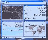
Route Tracer is the application that allows you to trace the Route over the network between two systems, listing all the intermediate routers a connection must pass through to get to its destination. Route Tracer provides the physical geographical locations of network servers and routers. It shows the actual Route path on both the three-dimensional globe and the flat...
Category: Internet / Tools & Utilities
Publisher: MacSeal.COM, License: Shareware, Price: USD $25.00, File Size: 18.2 MB
Platform: Unknown
MyRouteOnline is an easy to use Route planner that that allows you to plan routes from Excel spreadsheet. Excel Add-in that uploads addresses and saves time, fuel and money by helping you Map multiple locations and find the best Route. Online Route planning goes far beyond paper maps or a GPS system, it is the only way to find the optimal Route for your needs,...
Category: Business & Finance / Business Finance
Publisher: MyRouteOnline, License: Freeware, Price: USD $0.00, File Size: 3.1 MB
Platform: Windows
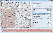
Map&guide base is the ideal solution for anyone who requires a high performance Route planner - whether they work in transport and logistics, as sales professionals or as frequent drivers.
* Map material for all of Europe is constantly and automatically updated
* Fast, seamless navigation around the Map thanks to "speed maps" and a...
Category: Home & Education / Miscellaneous
Publisher: mapandguide, License: Shareware, Price: USD $0.00, File Size: 0
Platform: Windows
Map&guide base is the ideal solution for anyone who requires a high performance Route planner - whether they work in transport and logistics, as sales professionals or as frequent drivers.
Map material for all of Europe is constantly and automatically updated
Fast, seamless navigation around the Map thanks to "speed maps" and a...
Category: Home & Education / Hobbies
Publisher: MAP&GUIDE GmbH, License: Shareware, Price: USD $0.00, File Size: 25.3 MB
Platform: Windows
You can capture the Google Map window and save it as JPG format, and also show the planned Route on Google Map directly.
Main Features:
- Travel Planning
- Travel database saved by calendar
- Travel detail information
- Travel files list
- Software control Function
Category: Home & Education / Miscellaneous
Publisher: GlobalSat Technology Corporation, License: Freeware, Price: USD $0.00, File Size: 68.1 MB
Platform: Windows
You will be able to enjoy many of CompeGPS Lands features such as waypoint and Route creation and edition, full communication between PDA and GPS, use of maps and the moving Map (real-time navigation). CompeGPS Pocket Land allows full communication between GPS and PDA (tracks, waypoints and routes). You will be able to create waypoints and routes, use maps and real-time...
Category: Home & Education
Publisher: CompeGPS TEAM S.L., License: Shareware, Price: USD $76.00, File Size: 3.9 MB
Platform:
ITN Converter is a free and reliable application for travelers.
ITN Converter is a free and reliable application for travelers. If you want to travel to a place that you haven’t explored yet, you can use this software in order to establish your Route.
The program has two main functionalities: to plan routes and to convert. This means that it can help you establish your itinerary and convert it to an appropriate format for...
Category: Multimedia & Design / Digital Media Editors
Publisher: Benichou Software, License: Freeware, Price: USD $0.00, File Size: 904.4 KB
Platform: Windows
Map Calibrator is a surprisingly pleasant freeware for creating Map slices from large bitmap Image files, and doing all kinds of Map calibration work. The application can handle .jpg, .bmp as well as .gif Image files and all that the user needs to do is to fix up couple of points to get the calibrated Image. Even it facilitates provision for converting...
Category: Multimedia & Design / Multimedia App's
Publisher: Megalith, License: Shareware, Price: USD $0.00, File Size: 0
Platform: Windows
GPS Navigator with using a scanned maps and possibility to open a lot of maps together. - you can show a current GPS data (Speed, Direction, Longitude, Latitude, Time, Date, Height); - you can open any of scanned maps (in a "bmp" or "dib" format); - you can calibrate the scanned maps yourself by two calibration points only (left-top and right-bottom); - calibrations are stored...
Category: Home & Education
Publisher: Valeri Vlassov, License: Demo, Price: USD $19.00, File Size: 4.6 MB
Platform: Windows
Super Route Manager is a comprehensive, fully integrated route management system.
Super Route Manager is a comprehensive, fully integrated Route management system. Developed for Windows system using either Microsoft's Access or SQL Server database, a SRM system represents the industry's most scalable package for AMUSEMENT, VENDING, and most any coin-operated Route operations. Whether you have five or five hundred locations, 100 or 10,000...
Category: Business & Finance / Business Finance
Publisher: Premier Data Software and SieCorp, License: Shareware, Price: USD $67.90, File Size: 10.2 MB
Platform: Windows
The Off-Route Data Acquiring software is designed to
download off-Route data from the STD-500/510/3300
instruments into a file on your computer.
Connect the data collector/analyzer to your
workstation.
-Load off-Route points you need.
-Select off-Route points of interest from the list.
-Save selected off-Route points...
Category: Business & Finance / Business Finance
Publisher: Technekon, License: Freeware, Price: USD $0.00, File Size: 5.3 MB
Platform: Windows
The VB Image Map OCX is an ActiveX Control designed to provide your applications with the ability to display interactive images. Hotspots, or specially designated areas on your Image, can be defined that will react to various mouse events. It is easily integrated into your existing applications - just drop the control on a form, assign a background picture, and assign the...
Category: Software Development / Tools & Editors
Publisher: Silverband Software, License: Demo, Price: USD $49.95, File Size: 512.0 KB
Platform: Windows
The five essential benefits:
PLAN ROUTES - Use real colour maps on a PC, Pocket PC or Smartphone to help you find your way. Simply click on the Map to plan your Route and see leg distance, compass bearing, journey length and estimated trip time. You can even visualise your routes in a continuous 3D landscape.
PRINT MAPS - Create and print...
Category: Home & Education / Miscellaneous
Publisher: Memory-Map, Inc., License: Shareware, Price: USD $0.00, File Size: 18.6 MB
Platform: Windows
Live Satellite Maps or Google maps is a web server mapping applications.
Live Satellite Maps or Google maps is a web server mapping applications.Provides scrolling Map images and satellite photos around the earth and even the Route between different places.Since 6 October 2005, live satellite Maps is part of local Google.Google live satellite Map provides the ability to zoom in or zoom out to show the Map.The user can control the...
Category: Home & Education / Science
Publisher: www.satelliteview-of-my-house.com, License: Freeware, Price: USD $0.00, File Size: 643.0 KB
Platform: Windows
OziExplorer3D is an impeccable application for viewing Map images in 3D, along with the options of rotating it in every possible direction, zoom in/out and lots more. The application actually creates grid of heights using the height data that has been obtained and writes it to a file, along with the other required information, loads the file and the Map Image or the...
Category: Multimedia & Design / Multimedia App's
Publisher: Des Newman, License: Shareware, Price: USD $30.00, File Size: 1.9 MB
Platform: Windows
Create Image maps for your website with this easy-to-use tool from Multimedia Australia. Simply select the Image you want to use, choose a shape, then visually draw the Image Map regions. The Image Map coordinates can be copied to the clipboard for insertion into your favourite text editor.
Category: Web Authoring / Web Design Utilities
Publisher: Multimedia Australia, License: Shareware, Price: USD $24.95, File Size: 931.8 KB
Platform: Unknown
CompeGPS Pocket Air is a new software specially designed for Pocket PC mobile devices, with wich you can obtain a new and revolutionary free flight instrument. You will enjoy most of the CompeGPS PC version functions, like the waypoint and routes creation and edition, full GPS and Pocket PC communication, use of digital maps and moving Map (real time navigation), to obtain the...
Category: Home & Education
Publisher: CompeGPS TEAM S.L., License: Shareware, Price: USD $105.00, File Size: 5.2 MB
Platform:


 Freeware
org, uses file and position names that suit to the display of the TomTom Rider, uses file, route and position names that suit to the display of the Map&Guide Motorrad Tourenplaner, remembers language, paths, window size and position. . .
Category: Business & Finance / Conversion Applications
Publisher: Christian Pesch, License: Freeware, Price: USD $0.00, File Size: 6.6 MB
Platform: Windows, Mac, Linux, Solaris, FreeBSD, OpenBSD, Java
BBBike is an information system for cyclists in Berlin and Brandenburg (Germany).
BBBike is an information system for cyclists in Berlin and Brandenburg (Germany).
This software displays a Map with streets, railways, rivers, parks, altitude and other features. BBBike also finds and shows routes between two points. The Route-finder can be customized to match the cyclists preferences (fastest or nicest Route, keep wind direction and hills into...
Category: Home & Education / Hobbies
Publisher: Slaven Rezic, License: Shareware, Price: USD $0.00, File Size: 8.7 MB
Platform: Windows
New Zealand Map Reference Converter (NZMapConv) is software that LINZ provides to convert Map references between the old NZMS260 Map series and the new NZTopo50 Map series.NZMapConv is a Windows programme designed to convert individual coordinates entered manually.
Category: Multimedia & Design / Media Management
Publisher: Land Information New Zealand, License: Freeware, Price: USD $0.00, File Size: 2.4 MB
Platform: Windows
MapCreator 2.0 is a software to create maps and animated maps with a good quality.
MapCreator can be used in presentations because is versatile and can be adequate for any kind of presentation, from travel presentations to professional presentations.
MapCreator is geo-referenced so any Map or portion of the Map will have the exactly portions of latitude and longitude,...
Category: Home & Education / Miscellaneous
Publisher: primap software, License: Freeware, Price: USD $0.00, File Size: 103.3 MB
Platform: Windows
The software will get you a lot of useful information e.
The software will get you a lot of useful information e.g. profile of your trail, Map, itinerary and statistic data.
Cyklotrasy gives you a lot of information, e.g. altitude, latitude, longitude, photos, texts, lengths of distances, nubers of roads, numbers of bike-ways, types of surfaces, hiking and bike marking. You can observe Route total length, superelevation, rise and...
Category: Home & Education / Miscellaneous
Publisher: Eagle Software, License: Shareware, Price: USD $0.00, File Size: 23.5 MB
Platform: Windows


 Commercial
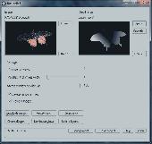
Bas-relief is intended for 2D to 3D conversion using the depth Map. The application opens two images: one is a coloured flat Image, the other is its depth Map, which shows us what areas are closer to us, and what are more distant. The white area is located at the foreground, the black one is at the background. Thereby, the general task is the acceptable depth Map...
Category: Multimedia & Design / Image Editing
Publisher: 3Dmix, License: Commercial, Price: USD $103.00, File Size: 1000 B
Platform: Windows


 Shareware
CoffeeCup Image Mapper has mouseover HTML capability, includes a fully functional Image Map wizard, and enables users to attach parts of an Image to different links. Image Mapper can Map any noninterlaced GIF, interlaced GIF, standard JPEG, and progressive JPEG, as well as the first frame of an animated GIF. Users can choose from three different shape...
Category: Multimedia & Design / Button Creators
Publisher: CoffeeCup Software, License: Shareware, Price: USD $24.00, File Size: 3.8 MB
Platform: Windows


 Shareware
Visual Imagemapper is an Image Map editor; easy to use for the amateur, but still powerful enough for the professional developer. An Image Map is an Image that contains one or more clickable areas, also known as hotspots. Adding hotspots is both quick and easy when using Visual Imagemapper. You no longer have to cut and paste incomprehensible html code between...
Category: Internet / RSS & Web Blog Tools
Publisher: Vicentas, License: Shareware, Price: USD $30.00, File Size: 4.6 MB
Platform: Windows


