Free Downloads: Map To Kmz Kml
Easy way to convert Waypoints from Kmz or Kml to GPX file format with the Kml/Kmz to GPX Converter free.
Easy Steps :
- Save your waypoints in Kmz or Kml format with google earth
- Import that format in the Kml/Kmz to GPX Converter free
- Then select waypoint you want to convert to GPX format
- Export the GPX...
Category: Audio / Rippers & Encoders
Publisher: HotelResortClub.com, License: Freeware, Price: USD $0.00, File Size: 656.6 KB
Platform: Windows
NMEA Converter is a product to convert various types of data NMEA to UDP Converter UDP to NMEA Converter(Reserved) GPS to HDT Converter(Reserved) NMEA to Kml Converter(Reserved) NMEA to Kmz Converter(Reserved) Kml to NMEA Converter(Reserved) Kmz to NMEA Converter(Reserved)
Category: Audio / MP3 Search Tools
Publisher: NMEAsoft, License: Demo, Price: USD $29.00, File Size: 509.0 KB
Platform: Windows
 Shareware
KMLReduce optimizes the size of Kml files by analyzing, reducing, and removing coordinates from polygons contained within the file. This allows you to distribute the Kml file online and use less traffic for users and services accessing the fille. KMLReduce works on Kml files that contian polygon shapes with many coordinates. KMLReduce analyzes the points for each polygon...
Category: Web Authoring / XML/CSS Utilities
Publisher: ksoft, License: Shareware, Price: USD $24.95, File Size: 636.7 KB
Platform: Windows
Demo
Visualize your data in 3D! Quick, easy and inexpensive. Graph Earth enables management, marketing and other business professionals to create stunning visual representations of their data, all without the time and costs associated with a full-featured GIS. Viewable by Everyone! Create one of a kind deliverables and distribute them to the world, recipients need only install Google Earth to view...
Category: Business & Finance / MS Office Addons
Publisher: Deer Creek Marketing LLC, License: Demo, Price: USD $24.95, File Size: 469.0 KB
Platform: Windows
Superoverlay software is a Google Earth application for tiling raster datasets and creating view based regions in Kml or Kmz files.
Also Superoverlay can generate world files for all images in ArcView style (jgw, tfw,...). It helps you put large image overlays into Google Earth (for example alternative maps or aerial photography). GE Sky mode is supported.
Category: Home & Education / Miscellaneous
Publisher: GIS Center, License: Shareware, Price: USD $0.00, File Size: 0
Platform: Windows
Kml Builder makes it easy to create and edit KML files to be viewed in Google Earth.
Kml Builder makes it easy to create and edit Kml files to be viewed in Google Earth.
Places you create with Kml Builder can be emailed to your friends or co-workers and can even be published on the Internet or on Intranets for a broader audience.
Anyone who has Google Earth Desktop installed on their computer can open your created Kml files with just a...
Category: Utilities / Misc. Utilities
Publisher: NorthGates Systems, License: Shareware, Price: USD $0.00, File Size: 0
Platform: Windows

OkCustomMap is a software to produce Garmin Custom Maps.
OkCustomMap is a software to produce Garmin Custom Maps.
Supports many Map formats:
- OkMap
- Ecw
- GeoTiff
- World files
- OziExplorer
- GpsTuner
You can customize:
- The quality of the output JPEG images (0=Bad, 100=Good)
- The Kml transparency (0=Transparent, 255=Opaque)
- The Kml draw order (0=Invisible, 1-49=Under the...
Category: Business & Finance / Applications
Publisher: Gian Paolo Saliola, License: Freeware, Price: USD $0.00, File Size: 3.2 MB
Platform: Windows

MB-GPS2KML converts a GPS log file (in plain NMEA format) to a KML file (placemark file for Google Earth) and opens this file in Google Earth. Velocity, number of satellites and HDOP are interpreted as height, color and size of the icons.
Category: Home & Education
Publisher: Markus Bader, License: Freeware, Price: USD $0.00, File Size: 441.4 KB
Platform: Windows
With GeoIPTC you will be able to read the IPTC city information in pictures and get the corresponding coordinates to your photos from several free services and embed this into the pictures in standard tags in a very professional way. You will also create sets of pictures with all the metadata they contain including geographical tags as Kml or Kmz files for a quick view of the...
Category: Multimedia & Design / Media Catalogers
Publisher: SoftExperience, License: Shareware, Price: USD $112.00, File Size: 7.3 MB
Platform: Windows
With the help of Kml Color Converter you can pick and mix colors and get the respective codes in 7 systems: Kml, RGB, VB, HTM, CMY, CMYK and HSL. You can also adjust the transparency of the resulted color. When you want to change the chosen color, all you have to do is increase/decrease the intensity of the RGB colors by means of the correspondent up/down arrows.
Category: Multimedia & Design / Media Management
Publisher: Ricardo Sgrillo, License: Freeware, Price: USD $0.00, File Size: 1.9 MB
Platform: Windows
The Kml Generator is a useful and reliable utility which enables you to easily analyze GPS log files containing NMEA string data and then generate Google Earth (TM) compatible Kml files. It is a free to use application and has a simple and friendly interface. It has low system requirements too, and works on all windows operating systems.
Category: Software Development / Misc. Programming
Publisher: Jacob Madsen, License: Shareware, Price: USD $0.00, File Size: 0
Platform: Windows
GeoVisu is a program that displays georeferenced data (images, graphics) and downloads data recorded by some GPS devices.
GeoVisu has a "Moving Map" navigation function, which can be used with any NMEA 0183 compatible or Garmin USB GPS device.
Main features:
- Displays georeferenced image formats : GeoTiff, ECW and ECWP, MrSID, OziExplorer...
Category: Multimedia & Design / Graphics Viewers
Publisher: GeoVisu, License: Freeware, Price: USD $0.00, File Size: 1.7 MB
Platform: Windows
Gismaps Viewer is a GIS viewer that can be used for geospatial analysis and map production.
Gismaps Viewer is a GIS viewer that can be used for geospatial analysis and Map production.
The main features are:
- read Shape files using geographic coordinate system
- view satellite images (MrSid, jpeg, bmp and tiff file formats)
- generate thematic maps, queries and labels
- export do Google Earth Kml (shp2kml)
- configure Map...
Category: Multimedia & Design / Graphics Viewers
Publisher: Gismaps Sistemas Ltda., License: Freeware, Price: USD $0.00, File Size: 10.2 MB
Platform: Windows
Freeware
org, uses file and position names that suit to the display of the TomTom Rider, uses file, route and position names that suit to the display of the Map&Guide Motorrad Tourenplaner, remembers language, paths, window size and position. . .
Category: Business & Finance / Conversion Applications
Publisher: Christian Pesch, License: Freeware, Price: USD $0.00, File Size: 6.6 MB
Platform: Windows, Mac, Linux, Solaris, FreeBSD, OpenBSD, Java
Demo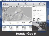
HoudahGeo is a photo geocoding and geotagging tool for Mac. Use HoudahGeo to attach GPS coordinates and location names to your photos. HoudahGeo writes EXIF and XMP geotags to JPEG and RAW image files. This creates a permanent record of where a photo was taken. Just like a GPS-enabled camera. HoudahGeo is the only application that can both write future-proof GPS tags to original images...
Category: Multimedia & Design / Media Catalogers
Publisher: Houdah Software s.à r.l, License: Demo, Price: USD $39.00, File Size: 22.9 MB
Platform: Mac

Geocode digital images with latitude, longitude, altitude, and direction information when collecting GIS field data. RoboGEO stamps this information onto the actual photo or writes it to the EXIF headers, allowing you to permanently geotag and link your photos to the GPS coordinates. All writing to the EXIF and IPTC headers is lossless and all of the existing comments (including the MakerNote...
Category: Multimedia & Design
Publisher: Pretek, Inc., License: Demo, Price: USD $34.95, File Size: 6.4 MB
Platform: Windows

Importation/Exportation: Import/export trails to gpx file. Unlimited number of trails, and TrackPoints. Export to gpx, Excel, PDF, XPS and Kml/Kmz. Data table: Very flexible data table that allows sorting by columns, with inheritance of data, attributes, etc. Presentation on Map: View on Map in accordance with the active trail, which comes from providers of...
Category: Home & Education / Miscellaneous
Publisher: Aplicaciones Topográficas S.L., License: Freeware, Price: USD $0.00, File Size: 27.0 MB
Platform: Windows
This application will measure paths in Google Earth, either saved in Kml Files, or copied from the clipboard. The application uses the haversine formula to measure distances between points on a spherical object. These distances are approximate, but some test calculations I have made, show that they are in line with Google Earth's built in measuring tool calculations. The application...
Category: Home & Education / Miscellaneous
Publisher: Whaleycopter, License: Freeware, Price: USD $0.00, File Size: 457.5 KB
Platform: Windows
EasyAcreage is program for WinXP or Vista program that allows you to calculate area from Kml files exported out of Google Earth. This means you do not even have to leave your house to measure a field anymore. Simply use the free version of Google Earth, mark the area you wish to measure, save it as a Kml file and drag and drop it onto EasyAcreage.
Category: Home & Education / Miscellaneous
Publisher: Wildsoft, License: Shareware, Price: USD $20.00, File Size: 817.1 KB
Platform: Windows
Korti is a Google Earth plugin which allows you to see the unique 3D satellite Map of Korti within your Google Earth application.
Korti provides you a detailed satellite imagery and geographic information about this geographic place.
To have Korti installed on your PC, first install for free Google Earth and then Korti 3D Map plugin. After that, simply double click...
Category: Multimedia & Design / Multimedia App's
Publisher: Maplandia, License: Freeware, Price: USD $0.00, File Size: 309 B
Platform: Windows
Shareware
An add-on for AUTOCAD or BricsCAD, which makes the triangulation of a set of POINT entities, the intersection curves (isolines) between a set of 3DFACE entities and a set of equidistance plans, horizontally or vertically and the volume and center of gravity of a set of bodies or between surfaces composed of 3DFACE entities. You can also load and draw a file of points having the format: Number...
Category: Multimedia & Design / Graphics Viewers
Publisher: Rcad Software, License: Shareware, Price: USD $64.00, EUR59, File Size: 2.5 MB
Platform: Windows
T2K Pro integrates the rich world of GIS datasets and transfers your Geographic information data into Google earth. T2K Pro handles rich data types and access large volumes of geographic data stored in files and databases; T2K PRO handles raster (imagery), Vector Map data and GPS Tracks/ Waypoints/ Routes. Tiles2kml Pro provides a complete suite of conversion tools to easily visualize...
Category: Multimedia & Design / Authoring Tools
Publisher: Tiles2kml, License: Demo, Price: USD $90.00, File Size: 20.9 MB
Platform: Windows
Cool Flash Map Maker is a powerful Flash Map software for developing interactive flash mapping solutions and products for Real Estate, Spacial Statistics, Business Locator Applications, Vector USA Map,World Map, Germany Map,ASIA Map, Canada Map, Europe Map, Australia Map, Austria Map, Africa Map, UK Map, South...
Category: Multimedia & Design / Multimedia App's
Publisher: Go2Share, License: Shareware, Price: USD $29.95, File Size: 17.9 MB
Platform: Windows

OziPhotoTool combines the technology of a GPS receiver and a digital camera to automatically keep a record of where digital photos were taken. It is designed to be used in conjunction with OziExplorer. Most digital cameras have EXIF metadata stored as part of the photo. This includes is the date and time the photo was taken. Many GPS units have 'tracklogs'. The GPS keeps a record of points that...
Category: Utilities
Publisher: OziPhotoTool, License: Shareware, Price: USD $25.00, File Size: 14.3 MB
Platform: Windows
Eye4Software Hydromagic is hydrographic survey software for Windows. It can be used to generare depth maps using a GPS or RTK receiver and an echosounder or fishfinder. After recording the sounding, you can generate DTM's (Digital Terrain Models), depth contours, 3D views and cross-sections. It offers various methods of calculating volumes of bassins, ponds, river sections and lakes....
Category: Home & Education / Mathematics
Publisher: Eye4Software B.V., License: Demo, Price: USD $1549.93, File Size: 83.0 MB
Platform: Windows