Free Downloads: Mapping Marine Gps Coordinates
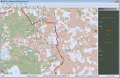
Eye4Software Gps Mapping is a professional Gps Mapping software tool that can be used in numerous applications. Use the software to load, view and edit your maps, display your position realtime and record all your movements.
The software will work with almost any Gps and can be used on any desktop, laptop or needbook computer running Windows XP...
Category: Home & Education / Miscellaneous
Publisher: Eye4Software B.V., License: Shareware, Price: USD $130.61, File Size: 14.6 MB
Platform: Windows
The OSTN02 extension for ArcPad is a FREE tool that automatically transforms Gps data and aligns it with Ordnance Survey (OS) background map. This easy-to-use extension removes the need to manually post-process Gps data by providing’ on the fly’ transformation of WGS84 latitude and longitude into OSTN02 corrected British National Grid coordinate. Data capture using...
Category: Home & Education / Miscellaneous
Publisher: ESRI (UK) Ltd, License: Freeware, Price: USD $0.00, File Size: 8.0 MB
Platform: Windows


 Shareware
Gps Mapping Software for Windows, Loading topographic maps, realtime navigation, track recording, manage Gps devices and more. The software can be used with various map formats including: GeoTiff, BSB Nautical Charts, AutoCad DXF files, ESRI Shapefiles. Using calibration you can also use scanned or downloaded JPG, BMP, GIF, PNG and TIF maps. The software can be used for...
Category: Home & Education / Science
Publisher: Eye4Software B.V., License: Shareware, Price: USD $149.00, EUR99, File Size: 11.1 MB
Platform: Windows


 Shareware
Gps Mapping Software for Windows, Loading topographic maps, manage Gps devices and more. The software can be used with various map formats including: GeoTiff, BSB Nautical Charts, AutoCad DXF files, ESRI Shapefiles. Using calibration you can also use scanned or downloaded JPG, BMP, GIF, PNG and TIF maps. The software can be used for survey, research, track and trace, real...
Category: Home & Education / Science
Publisher: Eye4Software B.V., License: Shareware, Price: USD $75.04, EUR49, File Size: 6.7 MB
Platform: Windows
PolarView NS is a complete user friendly on-board marine navigation system.
PolarView NS is a complete user friendly on-board Marine navigation system. It is available for Apple Mac OS X, Microsoft Windows and Linux operating systems. PolarView NS combines easy Marine passage planning, tides and weather with live Gps navigation and AIS capabilities.
Combining high-quality cartography with extensive instrument support, the applications deliver...
Category: Home & Education / Miscellaneous
Publisher: Polar Navy, License: Shareware, Price: USD $49.99, File Size: 4.0 MB
Platform: Windows
Karto SDK incorporates advanced algorithms for Mapping and autonomous navigation and have a well-defined and easy-to-use API. The SDK provides the following major classes of functionality:
Localization enables a robot to determine its position within its environment using sensor information and any known reference information (e.g., a previously constructed map or known...
Category: Utilities / Misc. Utilities
Publisher: SRI International, License: Demo, Price: USD $0.00, File Size: 15.8 MB
Platform: Windows


 Freeware
With this tool you can add Gps Coordinates to vCards - elektronic business cards - that you have previously exported from e. g. Microsoft Outlook. Therefore the tool uses the address data contained within the vCards and adds the exact Gps position on that basis to the vCard. This way you can use these vCards for example in compatible car navigation systems. Among...
Category: Home & Education / Home Inventory
Publisher: AB-Tools.com, License: Freeware, Price: USD $0.00, File Size: 1.9 MB
Platform: Windows
Gps Egypt brings you the best Gps Mapping and navigation package on the Egyptian market today with over 55,000 km of road coverage. The package offers the best map coverage available in Egypt, in addition to a cutting-edge software package for voice-based routing and navigation.
Category: Internet / Communications
Publisher: GPS Egypt, License: Freeware, Price: USD $0.00, File Size: 135.6 MB
Platform: Windows
The Surface Area Calculator is a tool for easily calculating surface and planimetric areas, as well as volumes.
The extent and shape of the area in question are given in terms of the Coordinates of a number of points throughout the area.
These Coordinates can be specified as either latitude, longitude, and height, as Gps Coordinates (geocentric...
Category: Business & Finance / Calculators
Publisher: Microsearch Corp, License: Shareware, Price: USD $134.00, File Size: 1.2 MB
Platform: Windows
An easy to use Gps downloading utility that lets you download your Gps waypoints easily and export them into a variety of formats useful for editing, display and importing into many different Mapping programs.
Use Lobal to save Gps waypoints as:
- Text Files
- HTML Tables
- Shape Files
- Google Earth KML
- DBase Files.
Category: Utilities / Misc. Utilities
Publisher: Ecological Software Solutions, License: Freeware, Price: USD $0.00, File Size: 2.2 MB
Platform: Windows


 Freeware
GPS Converter will convert GPS coordinates between three different formats: 34. 26965, -116.
76783; N 34° 16. 179', W 116° 46. 07'; and N 34° 16' 10.
Category: Home & Education / Sports
Publisher: ALMSys, Inc., License: Freeware, Price: USD $0.00, File Size: 929.9 KB
Platform: Windows
Marine POI Database Recovery is a free software tool that allows you to recover the POI database if the MapSource data is loaded to your Gps receiver.This file is intended to reload the Point of Interest database that came preloaded in your eTrex Venture, eTrex Mariner, eTrex Legend, eTrex Legend etc.
Category: Utilities / Misc. Utilities
Publisher: Garmin Ltd or its subsidiaries, License: Freeware, Price: USD $0.00, File Size: 3.8 MB
Platform: Windows


 Shareware
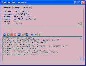
Virtual Gps is a Gps simulator software. You can use it to simulate a Gps receiver unit connected to your system. It's ideal when you need Gps input, but you have no signal or for development purposes. It supports various NMEA sentences, so it can be used with any Gps Mapping software. You can use it using a null-modem cable connected to two physical...
Category: Internet / RSS & Web Blog Tools
Publisher: Zyl Soft, License: Shareware, Price: USD $39.99, File Size: 856.0 KB
Platform: Windows
The Gps Detector software is used to update the Gps detector's database , updating maps , routes and camera locations . The device itself is based on pre-installed Gps Coordinates, the device can indicate various road hazards like: Fixed cameras, Red light speed cameras and bus lane cameras, Usual speed measurement places and dangerous zones.
Category: Business & Finance / Business Finance
Publisher: Euro Noliker Kft., License: Freeware, Price: USD $0.00, File Size: 5.5 MB
Platform: Windows
QuakeMap is a powerful GPS/mapping program for your Windows computer.
QuakeMap is a powerful Gps/Mapping program for your Windows computer. It can be downloaded here for free. The trial mode allows you to use most features indefinitely. When you need to unlock certain powerful features, a License Key can be ordered here. QuakeMap is designed for ease of use. It eatures intuitive user interface, supports most popular Garmin and Magellan receivers,...
Category: Utilities / Misc. Utilities
Publisher: quakemap.com, License: Freeware, Price: USD $0.00, File Size: 821.2 KB
Platform: Windows
Marine Software Suite is a user-friendly Draught Survey, Lashing Calc and Marine Navigator software for Marine Surveyors and Ships Officers. Marine Software Suite is easily operated using either mouse or keyboard. It complies with the latest UNECE standards and MSC Code of Safe Practice for Cargo Stowage and Securing (2003 Edition) (Annex 13) for Draught Surveying...
Category: Desktop Enhancements / Screensavers
Publisher: ATYG Marine Software Inc., License: Shareware, Price: USD $199.00, File Size: 3.5 MB
Platform: Windows, Linux, Mac
The Mapping and GIS License Manager software allows you to manage multiple licenses for the Gps Pathfinder Office software. Using the Gps Pathfinder Office License Administrator software, users of the Gps Pathfinder Office software can choose either a single use or a floating license.
Category: Business & Finance / Business Finance
Publisher: Trimble, License: Freeware, Price: USD $0.00, File Size: 26.8 MB
Platform: Windows
HsGpsDll is a Windows Dynamic Link Library which provides access to any NMEA-183 compliant Gps receiver via a serial communications port.
HsGpsDll is designed for use from Visual C, C++, Visual C Sharp .NET, Visual Basic or other programming languages, capable of calling DLL functions.
HsGpsDll allows a user application to easily read from a Gps device...
Category: Business & Finance / Business Finance
Publisher: Hillstone Software, License: Shareware, Price: USD $270.58, File Size: 700.6 KB
Platform: Windows
TopoFusion is a GPS Mapping program for Windows.
TopoFusion is a Gps Mapping program for Windows. It downloads maps (Topo, Aerial Photo and Satellite) automatically from several public map servers.
It seamlessly displays imagery from Terraserver and the OnEarth Server. Maps are downloaded on demand (as the user pans or zooms around the map) and cached on the user's hard drive for faster (and offline) storage.
Category: Utilities / Misc. Utilities
Publisher: TopoFusion, License: Shareware, Price: USD $69.95, File Size: 7.4 MB
Platform: Windows
Marine life is always an interesting topic for a research.
Marine life is always an interesting topic for a research. Start your own survey with the help of our Free 3D Marine Screensaver. It will show you one day of an underwater inhabitant's life. See how our lobster crawls on a sea bottom about its business and doesn't pay any attention on fish swimming around. Plunge into amazing Marine world with this screensaver!
Category: Desktop Enhancements / Screensavers
Publisher: 3D Savers, License: Freeware, Price: USD $0.00, File Size: 6.9 MB
Platform: Windows
The fast track to GPS success.
The fast track to Gps success. The Linx MDEV-Gps-SR contains everything needed to rapidly evaluate the SR Series Gps modules and implement them in record time. This all-inclusive Master Development System features a pre-assembled development board with an on-board OLED display for standalone testing. The system can also be attached to a PC via USB and operated using the...
Category: Software Development / Misc. Programming
Publisher: Linx Technologies, Inc., License: Freeware, Price: USD $0.00, File Size: 98.5 MB
Platform: Windows
GPS Sway is a simple coordinate conversion program.
Gps Sway is a simple coordinate conversion program. It handles all forms of latitude and longitude (degrees, degrees minutes, degrees minutes seconds) as well as UTM Coordinates and will convert from any form to another. It also handles signs or character direction.
Category: Multimedia & Design / Media Management
Publisher: GPSFileDepot, License: Freeware, Price: USD $0.00, File Size: 154.2 KB
Platform: Windows
OziExplorer is a flamboyant Gps Mapping Software that runs on the PC and works with varieties of Gps receivers such as Garmin, Lowrance, Magellan, Eagle, Brunton, Silva and MLR for the uploading or downloading the waypoints, routes and tracks and most brands of Gps receivers for real time tracking of Gps position.
Using this software, the user...
Category: Internet / Communications
Publisher: Des Newman, License: Shareware, Price: USD $95.00, File Size: 6.8 MB
Platform: Windows
MapToaster Topo New Zealand is New Zealand's only topographical Mapping suite, with options for your computer and Garmin Gps, including:
- all the rich detail of the LINZ topo maps - seamless across NZ. Now includes Topo50 and Topo250 map series.
- 1:50,000 though 1:2 million scale maps on your PC and 1:50,000 on your Gps
- integrated aerial...
Category: Home & Education / Miscellaneous
Publisher: Integrated Mapping Ltd, License: Shareware, Price: USD $0.00, File Size: 38.5 MB
Platform: Windows
CopanMobile for Palm OS is a very functional and easy-to-use geomatics engineering tool for computing and managing plane surveying and Mapping Coordinates. It does numerous coordinate geometry (COGO) calculations, processes and adjusts raw field survey data, computes and adjusts map traverse data, performs map or deed checks, calculates curves, areas and perimeters, performs...
Category: Multimedia & Design / Multimedia App's
Publisher: Underhill Geomatics Ltd., License: Freeware, Price: USD $0.00, File Size: 341.0 KB
Platform: Palm


