Free Downloads: Maps Flights
The only flight planner that allows you to point-and-click on the official Airservices Australia's Maps to plan Flights.
Main Features:
- AirNav VFR is the ultimate Australian PC flight planner for both VFR and IFR pilots
- Plan your Flights on digitised versions of the official Airservices Maps
- AirNav VFR calculates all...
Category: Home & Education / Miscellaneous
Publisher: Sentient Software, License: Shareware, Price: USD $0.00, File Size: 0
Platform: Windows
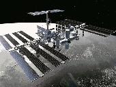
The Space Flights free screensaver will briefly show you off the recent and present events in the history of space Flights. You will see the inhabited space stations and spacecrafts that take astronauts to the orbit. Another important activity in the space is the working outboard the space stations from where the astronauts send you their greetings. Install this screensaver to...
Category: Desktop Enhancements / Screensavers
Publisher: Mega-Screens.com, License: Freeware, Price: USD $0.00, File Size: 5.2 MB
Platform: Windows
Eilat Airport was established by the Israeli Air Force in 1949, at the end of the War of Independence.
In 1964, the runway was extended to 1,500 meters, and a small passenger terminal was built. In 1969, the runway was extended to its current length of 1,900 meters. In 1975, the first charter flight,By Sterling Airways of Denmark, landed in Eilat, and since then international charter...
Category: Business & Finance / Project Management
Publisher: Israeli Scenery Project, License: Freeware, Price: USD $0.00, File Size: 33.3 MB
Platform: Windows
Flights to Jamaica toolbar for Internet Explorer.
Flights to Jamaica toolbar for Internet Explorer. Get updates on airline tickets. Have at your fingertips, access to countless ticket prices in planning your trip to Jamaica.
Category: Home & Education / Miscellaneous
Publisher: Flights to Jamaica, License: Freeware, Price: USD $0.00, File Size: 1.1 MB
Platform: Windows
SkyTrack is Fly UK's flight tracking and logging software.
SkyTrack is Fly UK's flight tracking and logging software.
SkyTrack will retrieve your booked Flights, record flight data and then file the PIREP for you automatically.
The SkyTrack Live Map allows you to view and track all Fly UK Flights currently taking place by pilots using SkyTrack.
You can use SkyTrack to record all your Flights at Fly UK...
Category: Games / Simulations
Publisher: Fly UK, License: Freeware, Price: USD $0.00, File Size: 11.1 MB
Platform: Windows
Can you keep all your passengers happy?
Can you keep all your passengers happy? We wish you a pleasant flight with Far away Flights! Play the game with your mouse. Select items by clicking on them or move Shirley around by clicking on passengers or anywhere else on board.easy controller with a easy install
Category: Games / Arcade
Publisher: Oberon Media, License: Shareware, Price: USD $6.95, File Size: 418.3 KB
Platform: Windows

FSS Google Maps Downloader is a tool that can download the Google Maps images to your PC. This is a clearly free program. There is no spyware or adware. It's absolutely safe to install and to run. The interface is very simple and self explaining. It runs low on system resources consumption and is supported on all Windows versions. It can save them to your hard disk,...
Category: Internet / Download Managers
Publisher: FreeSmartSoft, License: Freeware, Price: USD $0.00, File Size: 874.0 KB
Platform: Windows
The biggest advantage of booking cheap Flights online is that it allows you to compare all the Flights with each other. This comparison helps you to get best deals on tickets as you can see all the prices to a destination on one page. This also helps you maximize your savings as you can avail special-early bird prices that many airlines offer. Online travel websites allow you to...
Category: Business & Finance / Personal Info Managers
Publisher: Cheap Air Tickets, License: Freeware, Price: USD $0.00, File Size: 3.4 MB
Platform: Windows
Diffuse maps represent the absorption of light.
Diffuse Maps represent the absorption of light. Diffuse Maps are what people call "textures". They are the color textures or photographic textures usually applied to 3d models.
ShaderMap creates displacement Maps using the light data stored inside of diffuse Maps. Evenly lit diffuse Maps generally create better quality Maps with ShaderMap.
Category: Home & Education / Miscellaneous
Publisher: Rendering Systems Inc., License: Freeware, Price: USD $0.00, File Size: 4.0 MB
Platform: Windows
NOVA Maps provides appraisers and appraisal users with complete, high-resolution location Maps (also known as “street Maps”) for forms and addenda in seconds. NOVA Maps even automatically places labels for subject properties and comparables.
For just pennies per map and with just a click of the mouse, users have access to the entire United...
Category: Home & Education / Miscellaneous
Publisher: Day One, License: Demo, Price: USD $0.00, File Size: 5.7 MB
Platform: Windows
 Shareware
Google Hybrid Maps Downloader is a tool that can automatically download the google hybrid Maps images to your PC. It can download the small tiles and save them to your hard disk. After downloading, you can view the Maps offline by its tool Maps Viewer, or you can combine the small images into one big map image. If you want to make a map of your city by yourself, it...
Category: Internet / Download Managers
Publisher: allmapsoft.com, License: Shareware, Price: USD $29.99, File Size: 30.6 MB
Platform: Windows
Shareware
Google Maps Terrain Downloader is a tool that can automatically download the google terrain Maps images to your PC. It can download the small tiles and save them to your hard disk. After downloading, you can view the Maps offline by its tool Maps Viewer, or you can combine the small images into one big map image. If you want to make a map of your city by yourself, it...
Category: Internet / Download Managers
Publisher: allmapsoft.com, License: Shareware, Price: USD $29.99, File Size: 305.3 MB
Platform: Windows
InvisibleHand automatically gets the lowest price when you shop online or search for flights.
InvisibleHand automatically gets the lowest price when you shop online or search for Flights. InvisibleHand shows a discreet notification when a better price is available on a product or flight you're shopping for. Covers over 580 retailers in the US, UK & Germany.
Category: Internet / Web Search Utilities
Publisher: InvisibleHand, License: Shareware, Price: USD $0.00, File Size: 91.8 KB
Platform: Windows
think! Bubble Maps is a Windows tool for creating bubble Maps and capturing your thought. Using simple mouse click, drags and typing, your thoughts get put to paper (virtual), quickly and effectively.
The key feature of think! Bubble Maps is speed which makes it an excellent tool for live capture. You can use this program during meetings, workshops, and seminars.
Category: Multimedia & Design / Multimedia App's
Publisher: Lowrie Associates Ltd, License: Shareware, Price: USD $41.90, File Size: 5.9 MB
Platform: Windows
MapComp is a powerful and free Windows Software for drawing images of linkage Maps and to compare linkage Maps and indicate common markers.
MapInspect can display, print and save images, and has no limit to the number of Maps it can compare (but only neighbouring Maps are compared). Maps can be flipped within MapINspect, an the on-screen order of...
Category: Multimedia & Design / Multimedia App's
Publisher: MapInspect, License: Freeware, Price: USD $0.00, File Size: 616.7 KB
Platform: Windows
A flight simulator addon for virtual airlines to manage pilot reports, financing and fleet.
A flight simulator addon for virtual airlines to manage pilot reports, financing and fleet.
Main features:
Complete flight following acars system
- View weather and airport information from departure and arrival airports
- Full VA fleet and schedule search
- Fly dispatched, booked, or any route in your schedule
- Passengers feedback for...
Category: Games / Simulations
Publisher: VAFINANCIALS, License: Shareware, Price: USD $0.00, File Size: 8.6 MB
Platform: Windows
This software development kit (SDK) provides the binaries and programming reference for the Bing Maps Silverlight Control. You can use this control to build your own web sites that use Bing Maps.
The Bing Maps Silverlight Control combines the power of Silverlight and Bing Maps to provide an enhanced mapping experience. Developers can use the Bing...
Category: Utilities / Misc. Utilities
Publisher: Microsoft, License: Freeware, Price: USD $0.00, File Size: 3.8 MB
Platform: Windows

CompeGPS Pocket Air is a new software specially designed for Pocket PC mobile devices, with wich you can obtain a new and revolutionary free flight instrument. You will enjoy most of the CompeGPS PC version functions, like the waypoint and routes creation and edition, full GPS and Pocket PC communication, use of digital Maps and moving map (real time navigation), to obtain the...
Category: Home & Education
Publisher: CompeGPS TEAM S.L., License: Shareware, Price: USD $105.00, File Size: 5.2 MB
Platform:
SensAct -SENSORS CONVERSION Maps AND ACTUATORS COMMAND Maps
This software pack contents the sensors conversion Maps and the actuators command Maps like motorized throttles, gasoline injectors corrections, ...
It is mandatory to install it to select the type of sensor and actuators that are equiping the ECUs, because these Maps are no longer...
Category: Business & Finance / Applications
Publisher: Skynam, License: Freeware, Price: USD $0.00, File Size: 3.4 MB
Platform: Windows
Welcome to Newcastle Airport. First opened in 1935 as a grass airfield with a few buildings and a single hanger, today Newcastle is a hub for Flybe, Easyjet, Jet2 and Eastern airways. It also has Flights by British airways, KLM, Air France and other European operators and long haul Flights by Emirates, Thompson and Thomas Cook. This scenery Includes detailed images of the real...
Category: Games / Simulations
Publisher: UK2000 Scenery, License: Shareware, Price: USD $24.81, File Size: 96.4 MB
Platform: Windows
PlanetGIS Explorer is a free viewer for PlanetGIS maps and GIS exchange files.
PlanetGIS Explorer is a free viewer for PlanetGIS Maps and GIS exchange files. PlanetGIS Explorer allows you to navigate through Maps, query map elements and view attribute information from linked database tables. Also PlanetGIS Explorer allows you to customize the appearance of Maps for purposes of creating hardcopy printouts, but does not allow you to save any changes to...
Category: Multimedia & Design / Graphics Viewers
Publisher: Planet GIS, License: Freeware, Price: USD $0.00, File Size: 5.4 MB
Platform: Windows
A desktop application used for online reservation and to view the Flights and trains availabilty
Add Yatra.com to your desktop. Install this powerful little application and you can access from at any time. No need for a browser or the wait to load a page. Just click and book.
Take Yatra Desktop Buddy for a spin to see just how useful it can be for you!
Category: Desktop Enhancements / Shell & Desktop Managers
Publisher: Yatra Online Pvt. Ltd., License: Freeware, Price: USD $0.00, File Size: 1.4 MB
Platform: Windows
Shareware
FPS Maps for WPF is a brand new component with a set of built-in country Maps. There are 15 Inbuilt Countries. FPS Maps for WPF contains samples of how to work with it and customize. Maps navigation can be performed via Navigation bar which supports Themes and mouse. You can pan with mouse or zoom in/out with mouse scroll. More options will be added in future...
Category: Software Development / Components & Libraries
Publisher: FPS Components, License: Shareware, Price: USD $199.00, File Size: 1.1 MB
Platform: Windows
What we conceived with gates.to/fsnet is a platform that you can think of as an evolution of network flying just like chat is an evolution in communication compared to the email system.If you look at multi-players Flights as the 'email' what you would like to have in a 'chat' system? The gates.to answer is to let you share your cockpit with another pilot and cooperate on it!Thanks to...
Category: Games / Simulations
Publisher: gates.to, License: Shareware, Price: USD $5.99, File Size: 1.4 MB
Platform: Windows
With yalips maps you get 4 products in 1.
With yalips Maps you get 4 products in 1. You are more productive, more creative and perform better on your job when using visual software tools. With the resulting visualizations you can communicate more effectively and convincingly to your collegues, your boss, your customer or the chairman of the board. Therefore many companies spent a lot of money on such tools. Unfortunately, most...
Category: Business & Finance / Project Management
Publisher: yalips Software, License: Shareware, Price: USD $80.00, File Size: 29.6 MB
Platform: Windows