Free Downloads: Marine Chart Maps
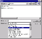
The Chart Catalogue is designed for the preparation of orders for the purchase of TX–97 format charts from Transas Marine.
The catalogue window consists of three parts:
- Information panel containing the Chart catalogues;
- Chart panel with the outlines of selected charts overlaid on the map of the world;
- Utility's...
Category: Home & Education / Miscellaneous
Publisher: Transas Marine (UK) Ltd., License: Freeware, Price: USD $0.00, File Size: 7.9 MB
Platform: Windows
Whether you're exploring new coastline or cruising your favorite bay, BlueChart Pacific contains the most detailed Marine cartography around. These electronic nautical Maps give you peace of mind when navigating offshore. Detailed coverage of New Caledonia, Includes MSQ data (Maritime Safety Queensland), Chart-specific information, including Chart name, number,...
Category: Home & Education / Miscellaneous
Publisher: Garmin Ltd or its subsidiaries, License: Shareware, Price: USD $0.00, File Size: 54.4 MB
Platform: Windows
A photoshop plugin which allows you to read NOAA Marine charts.NOAA Marine charts are the standard raster charts and have the file extension of *.bsb and *.kap.Once a Chart is imported into Photoshop you can:- Print the Chart.- Paste charts together to cover a larger area.- Create and print your own custom charts to cover the area you want.- Edit Charts.- Print a...
Category: Multimedia & Design / Image Editing
Publisher: Apocgraphy, License: Shareware, Price: USD $20.00, File Size: 20.5 KB
Platform: Unknown
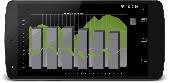
TeeChart Charting Library for Xamarin.Android offers full set of 60+ Chart styles in 2D and 3D, Maps and gauges, 50+ financial and statistical indicators and a full set of Chart tools components for additional functionality. The TeeChart for Xamarin.Android license provides support for Android mobile platform and includes a renewable one-year subscription service that...
Category: Software Development / Components & Libraries
Publisher: Steema Software, License: Shareware, Price: USD $339.00, File Size: 15.4 MB
Platform: Mac
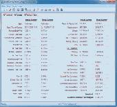
Marine Software Suite is a user-friendly Draught Survey, Lashing Calc and Marine Navigator software for Marine Surveyors and Ships Officers. Marine Software Suite is easily operated using either mouse or keyboard. It complies with the latest UNECE standards and MSC Code of Safe Practice for Cargo Stowage and Securing (2003 Edition) (Annex 13) for Draught Surveying...
Category: Desktop Enhancements / Screensavers
Publisher: ATYG Marine Software Inc., License: Shareware, Price: USD $199.00, File Size: 3.5 MB
Platform: Windows, Linux, Mac
Marine life is always an interesting topic for a research.
Marine life is always an interesting topic for a research. Start your own survey with the help of our Free 3D Marine Screensaver. It will show you one day of an underwater inhabitant's life. See how our lobster crawls on a sea bottom about its business and doesn't pay any attention on fish swimming around. Plunge into amazing Marine world with this screensaver!
Category: Desktop Enhancements / Screensavers
Publisher: 3D Savers, License: Freeware, Price: USD $0.00, File Size: 6.9 MB
Platform: Windows
TeeChart Charting component for Xamarin.iOS offers 50+ Chart types in 2D and 3D, 50+ financial and statistical indicators, gauges and Maps with customizable tools for data visualization in the mobile applications. It supports Mac iOS platform: iPhone and iPad devices. The TeeChart for Xamarin.iOS license includes a renewable one-year subscription service that entitles...
Category: Software Development / Components & Libraries
Publisher: Steema Software, License: Shareware, Price: USD $339.00, File Size: 6.7 MB
Platform: Mac
ENCX UDE is ideal for NOAA ENC charts, to introduce marine chart displays into your system.
ENCX UDE is ideal for NOAA ENC charts, to introduce Marine Chart displays into your system. The technology is mature with a considerable pedigree in the industry, including hydrographic offices, navies and major oil companies. It is extremely fast and benefits from 16 years experience of the development of high performance navigation systems.
It is extremely accurate...
Category: Business & Finance / Business Finance
Publisher: CherSoft Ltd., License: Freeware, Price: USD $0.00, File Size: 42.7 MB
Platform: Windows
Pie chart symbols for use as location markers on maps.
Pie Chart symbols for use as location markers on Maps. There are three full sets of pies in the font. One is mapped to the upper-case letters A-U, and one to the lower case a-u . The third set is mapped to the number keys: the unshifted keys ` 1 2 3 4 5 6 7 8 9 0 represent 0%, 10%, 20%, 30%, 40%, 50%, 60%, 70%, 80%, 90%, and 100%, and their shifted counterparts ~ ! @ # $ % ^ &...
Category: Multimedia & Design / Multimedia App's
Publisher: Curtis Clark, License: Freeware, Price: USD $0.00, File Size: 12.5 KB
Platform: Windows
Draft Survey and Lashing calculations
Marine Software Bundle is a user-friendly Draught Survey calculation program for Ships' Officers and Marine Surveyors. It is easily operated using either Keyboard or Mouse. Marine Software Bundle complies with the latest UN ECE standards for Draught Surveying and can print to all standard printer types.
Course and Distance...
Category: Business & Finance / MS Office Addons
Publisher: ATYG Marine Software Inc., License: Shareware, Price: USD $99.95, File Size: 5.4 MB
Platform: Windows
Draft Survey and Lashing calculations
Marine Software Bundle is a user-friendly Draught Survey calculation program for Ships' Officers and Marine Surveyors. It is easily operated using either Keyboard or Mouse. Marine Software Bundle complies with the latest UN ECE standards for Draught Surveying and can print to all standard printer types.
Course...
Category: Business & Finance / MS Office Addons
Publisher: ATYG Marine Software Inc., License: Shareware, Price: USD $0.00, File Size: 7.7 MB
Platform: Windows
Nokia Map Manager is a program that allows you to manage and transfer GPS maps to mobile phone.
Nokia Map Manager is a program that allows you to manage and transfer GPS Maps to mobile phone. The Map Manager is for the 6110 Navigator only. The program is provided with scan function to search Maps on the computer and DVD. Nokia Map Manager is an additional application and is used together with Nokia PC Suite 6.86 and later versions.
Nokia Map Manager helps you to manage...
Category: Internet / Communications
Publisher: Nokia, License: Freeware, Price: USD $0.00, File Size: 0
Platform: Windows
Space Marine is an exciting action game, with lots of weapons and mission for you to discover.
Space Marine is an exciting action game, with lots of weapons and mission for you to discover. You have to eliminate your enemies , developing your character and increasing your skill levels, confronting enemies that become harder to kill. Space Marine features a fluid combat system that allows players to seamlessly switch from ranged to melee weapons without interrupting the flow...
Category: Games / Action
Publisher: THQ, License: Shareware, Price: USD $79.99, File Size: 2.0 GB
Platform: Windows

Draft Survey and Lashing calculations
Marine Software Bundle is a user-friendly Draught Survey calculation program for Ships' Officers and Marine Surveyors. It is easily operated using either Keyboard or Mouse. Marine Software Bundle complies with the latest UN ECE standards for Draught Surveying and can print to all standard printer types.
Course and Distance...
Category: Business & Finance / MS Office Addons
Publisher: ATYG Marine Software Inc., License: Shareware, Price: USD $99.95, File Size: 5.4 MB
Platform: Windows
Marine and her friends have six days to find the four remaining warriors and make it to the showdown!
With such tight schedule and dramatic events piling up, Marine's nerves are all over the place.
But Jeanne the tiny fairy is back! And this alone helps even the balance!
Category: Games / Adventure & RPG
Publisher: Aldorlea Games, License: Shareware, Price: USD $13.99, File Size: 149.7 MB
Platform: Windows
ROCKTEC Marine is a technical calculation program to be used for calculation of surface temperature, insulation thicknesses and heat loss for technical installation i.e. pipes or boilers on board ships and off shore installations. The calculations are based on our product range within Marine & offshore.
Category: Business & Finance / Calculators
Publisher: Rockwool A/S, License: Freeware, Price: USD $0.00, File Size: 3.5 MB
Platform: Windows
Living Marine Aquarium 2 is an animated screensaver that turns your screen into an aquarium.
Living Marine Aquarium 2 is an animated screensaver that turns your screen into an aquarium. When your computer becomes idle, this screensaver displays a colorful and relaxing scene with Marine plants, fish and other underwater creatures, and with a coral reef in the background. All the while you hear the sound of bubbles coming from your speakers.
You can access its...
Category: Desktop Enhancements / Screensavers
Publisher: W3i, LLC, License: Freeware, Price: USD $0.00, File Size: 1.6 MB
Platform: Windows
Draft Survey and Lashing calculationsMarine Software Bundle is a user-friendly Draught Survey calculation program for Ships' Officers and Marine Surveyors. It is easily operated using either Keyboard or Mouse. Marine Software Bundle complies with the latest UN ECE standards for Draught Surveying and can print to all standard printer types. Course and Distance calculations...
Category: Business & Finance / MS Office Addons
Publisher: ATYG Marine Software Inc., License: Shareware, Price: USD $49.99, File Size: 3.8 MB
Platform: Windows
Whether you're exploring new coastline or cruising your favorite bay, BlueChart Atlantic contains the most detailed Marine cartography around. These electronic nautical Maps give you peace of mind when navigating offshore.
The BlueChart Atlantic CD-ROM includes coverage for several offshore regions — select one of these regions to view and download charts with...
Category: Home & Education / Miscellaneous
Publisher: Garmin Ltd or its subsidiaries, License: Shareware, Price: USD $0.00, File Size: 0
Platform: Windows
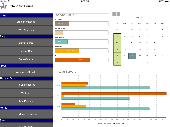
Create spectacular charts in your ASP.NET projects with this high-quality yet cost-effective 2D/3D Chart component. Features extensive ASP.NET support including Chart streaming, image Maps and response, server-side events with postback, persistent states, script injection, browser detection and automatic temporary file cleanup. It provides all the Chart types and...
Category: Software Development
Publisher: Xceed Software Inc., License: Demo, Price: USD $399.95, File Size: 62.4 MB
Platform: Windows

FSS Google Maps Downloader is a tool that can download the Google Maps images to your PC. This is a clearly free program. There is no spyware or adware. It's absolutely safe to install and to run. The interface is very simple and self explaining. It runs low on system resources consumption and is supported on all Windows versions. It can save them to your hard disk,...
Category: Internet / Download Managers
Publisher: FreeSmartSoft, License: Freeware, Price: USD $0.00, File Size: 874.0 KB
Platform: Windows
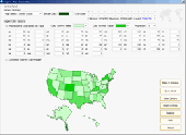
Region Map Generator is a tool to make region map with self-definition color. The original Maps in the software are blank political region ones for different countries or areas. You can color any region with whatever color as you like. By this software, you can easily make lively Maps. These Maps can be used as data analysis charts, teaching materials, business...
Category: Business & Finance / Applications
Publisher: cciyy, License: Shareware, Price: USD $36.95, File Size: 1.3 MB
Platform: Windows
 Freeware
Free standalone software DataPult Desktop creates heat Maps from your data quickly and efficiently. Key features: Direct data import from MS Excel with one click. The ability to create animated Maps of data over several years. Interactive Maps and diagrams. 39 map colorings for making heat Maps. Intelligent identification of input...
Category: Business & Finance / MS Office Addons
Publisher: DataPult, License: Freeware, Price: USD $0.00, File Size: 21.0 MB
Platform: Windows
MarineUpdater is a Windows-based PC application which works in conjunction with a Garmin USB card reader, a Garmin data card, and an Internet connection to generate software update cards for your fixed-mount Garmin Marine products. Products which support MarineUpdater will program a data card with information about your Garmin Marine product and other Garmin Marine products...
Category: Home & Education / Miscellaneous
Publisher: Garmin Ltd or its subsidiaries, License: Freeware, Price: USD $0.00, File Size: 2.0 MB
Platform: Windows
Feature Summary: -Default support for BlackBerry v7.1 OS -50 Chart styles (in 2D and 3D plus multiple combinations) including Gauges -38 mathematical functions -100% sourcecode available as purchase option -20 Chart Tool components for additional functionality, like dragging series marks, annotation objects, cursors and manual trend lines, coloring bands, etc...
Category: Software Development / Components & Libraries
Publisher: Steema Software, License: Commercial, Price: USD $259.00, File Size: 8.2 MB
Platform: Windows,