Free Downloads: Nad27
License: All | Free
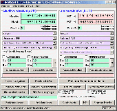
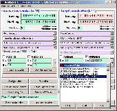
CoordTrans converts geographic coordinates between different coordinate systems.
CoordTrans converts geographic coordinates between different coordinate systems.
CoordTrans is very easy to use, and full of Wizards to help you with more complex tasks.
Convert between UTM, WGS84 and Nad27 / NAD83, and more... almost all projections and datums on Earth are supported. See complete list..
You can convert single coordinates, or...
Category: Business & Finance / Business Finance
Publisher: Franson, License: Shareware, Price: USD $49.00, File Size: 6.5 MB
Platform: Windows

TRANSDAT geosoftware executes coordinate transformations and geodetic datum shifts between many coordinate and reference systems of America, Australasia, Europe, Germany special and world-wide, with high precision and high speed: 1.The current and historical coordinate and reference systems of all countries of the European Union (EU) including the eastern extensions and the systems of non-EU...
Category: Home & Education / Science
Publisher: Killet Software Ing.-GbR, License: Shareware, Price: USD $170.00, EUR160, File Size: 4.4 MB
Platform: Windows
 Shareware
Java toolkit to add coordinate conversion functionality to your Java applications and applets. The toolkit offers functionality to perform map grid and datum transformations: latitude and longitude can be converted to various map grids, like Transverse Mercator (TM), Oblique Mercator, Mercator, Oblique Stereographic, Polar Stereographic, Cassini, Albers Equal Area Conal, Gauss Kruger or...
Category: Software Development / Components & Libraries
Publisher: Eye4Software B.V., License: Shareware, Price: USD $199.00, EUR179, File Size: 155.5 KB
Platform: Unknown
TRANSDAT Geosoftware executes coordinate transformations and geodetic datum shifts between lots of coordinate and reference systems of Germany, Europe, America, Australia and world wide in high quality and with high performance: 1. The German Coordinate and Reference Systems of the old and new Federal Countries including the 40 Prussian Soldner Land Registers and Soldner Berlin and Munic. 2....
Category: Business & Finance / Applications
Publisher: Killet Softwareentwicklung GbR, License: Shareware, Price: USD $230.00, File Size: 2.6 MB
Platform: Windows
Shareware
GPS SDK to add GPS and coordinate conversion functionality to your software and scripts). All NMEA0183 protocol versions are supported and can be filtered by NMEA sentence type and talker ID. Garmin USB PVT support. Information on GPS status can also be retrieved: GPS fix quality, satellites used in fix, satellites in view, satellite azimuth, elevation and signal strengths. The toolkit also...
Category: Software Development
Publisher: Eye4Software B.V., License: Shareware, Price: USD $99.00, EUR79, File Size: 2.3 MB
Platform: Windows
In the Dynamic Link Library GeoDLL geodesic functions like coordinate transformation, datum changes, meridian strip changes, user defined coordinate and reference systems, distance calculation, maps functions, Digital Elevation Models and more geodesic functions are contained to bind them into own applications. WINDOWS operating system allows building of function libraries intended for use by...
Category: Software Development
Publisher: Killet Softwareentwicklung GbR, License: Shareware, Price: USD $290.00, File Size: 999.9 KB
Platform: Windows

TRANSDATpro can prove a helpful tool for professionals, providing them with the possibility to perform coordinate transformations fast and easy by use of the coordinate reference systems of their choice. TRANSDATpro performs Coordinate Transformations fast and with high accuracy. The coordinate conversion software supports worldwide thousands of Coordinate Systems, geodetic Reference Systems...
Category: Home & Education / Science
Publisher: Killet GeoSoftware Ing.-GbR, License: Shareware, Price: USD $270.00, EUR240, File Size: 5.3 MB
Platform: Windows
License: All | Free