Free Downloads: Outdoor Activities Gps Map Data Europe
GPS Tuner was first launched in 2003.
Gps Tuner was first launched in 2003. Success followed introduction shortly. Over the years it became a best-selling favourite Gps software among off-roaders as a reliable, versatile feature-packed application suiting the needs of Outdoor enthusiasts and professional off-road users alike. After five years of continuous development of previous Gps Tuner versions...
Category: Web Authoring / Web Design Utilities
Publisher: GPS Tuner Ltd., License: Freeware, Price: USD $0.00, File Size: 4.5 MB
Platform: Windows
Trimble Adventure Planner software is a PC-based trip planning, mapping and trip journaling application for lovers of hiking, biking, walking, fishing, running, geocaching and other Outdoor Activities.
Adventure Planner can be used as a standalone product or with the Trimble Outdoors phone application. Is it NOT intended to be used with the AllSport Gps...
Category: Home & Education / Miscellaneous
Publisher: Trimble Navigation Ltd., License: Freeware, Price: USD $0.00, File Size: 8.6 MB
Platform: Windows
Have a Gps and a laptop? Use this to find your way. Make patterns or a trail to share with others. When the application starts, you may pick your area of operations - be it North America, South America, Europe and Asia, or Australia. Your quadrant is determined by where you are in relation to the Equator and the Prime Meridian. Tracking of your position is automatically enabled...
Category: Home & Education / Miscellaneous
Publisher: LogicAll Solutions, LLC, License: Freeware, Price: USD $0.00, File Size: 4.6 MB
Platform: Windows
The OSTN02 extension for ArcPad is a FREE tool that automatically transforms Gps Data and aligns it with Ordnance Survey (OS) background Map. This easy-to-use extension removes the need to manually post-process Gps Data by providing’ on the fly’ transformation of WGS84 latitude and longitude into OSTN02 corrected British National Grid coordinate....
Category: Home & Education / Miscellaneous
Publisher: ESRI (UK) Ltd, License: Freeware, Price: USD $0.00, File Size: 8.0 MB
Platform: Windows
Map of Africa is one of the many maps created for GPS TrackMaker.
Map of Africa is one of the many maps created for Gps TrackMaker. You are able to download the installation package from the TrackMaker website. In order to preview the contents of this package, you need to install Gps TrackMaker.
Using the above mentioned application, you will be able to see the Map of Africa. Just click on the "Open Temporary...
Category: Home & Education / Miscellaneous
Publisher: Geo Studio Technology, License: Freeware, Price: USD $0.00, File Size: 18.3 MB
Platform: Windows
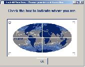
Have a Gps and a laptop? Use this to find your way. Make patterns or a trail to share with others. When the application starts, you may pick your area of operations - be it North America, South America, Europe and Asia, or Australia. Your quadrant is determined by where you are in relation to the Equator and the Prime Meridian. Tracking of your position is automatically enabled...
Category: Home & Education / Miscellaneous
Publisher: LogicAll Solutions, LLC, License: Freeware, Price: USD $0.00, File Size: 4.6 MB
Platform: Windows
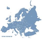
Europe Flash Map Locator for websites, presentations and more.
Europe Flash Map Locator for websites, presentations and more. Easy adjustment.
Variants of using a Map locator:
- Real-Estate websites
- Quick access to contact organization Data, having affiliated network in Europe
With this fully-clickable Map you will be able to improve navigation and provide visitors with a better and faster means of...
Category: Web Authoring / Web Design Utilities
Publisher: Fla-shop.com Inc., License: Demo, Price: USD $69.00, File Size: 111.0 KB
Platform: Windows, Mac

Overview Gps Simulator is software that generates a virtual Gps Data Used to develop and simulation of Gps applications -Save testing and development time -No location restriction or work everywhere -No Gps device needed Feature Easy routing Selectable Map(7EA Map) Support speed control Support 10EA NMEA protocol messages(GGA,...
Category: Desktop Enhancements / Shell & Desktop Managers
Publisher: NMEAsoft, License: Demo, Price: USD $150.00, File Size: 3.3 MB
Platform: Windows
The Gps Map will help you give you with turn by turn directions to your destination using a POI, city point and/or longitude and latitude.It has the ability to preplan driving destinations before getting into your car. Compatible with ALL Garmin Gps units. Don't pay more than US$10 per day when you already own a Garmin, this is the most comprehensive Gps...
Category: Home & Education / Miscellaneous
Publisher: GPSTravelMaps.com, License: Shareware, Price: USD $0.00, File Size: 0
Platform: Windows
RouteBuddy is the only modern, advanced digital map application for Windows and Mac OS X.
RouteBuddy is the only modern, advanced digital Map application for Windows and Mac OS X. It doesn't matter on which platform you wish to use the application as it sports a universal toolbar and comparable features throughout.
- High resolution Road, Topo and Satellite maps can be viewed in the same application using our state-of-the-art animated layer technology.
...
Category: Home & Education / Miscellaneous
Publisher: RouteBuddy Ltd, License: Shareware, Price: USD $59.99, File Size: 121.5 MB
Platform: Windows
Northwest Trails is a mapset of trails designed for upload to any map-enabled Garmin GPS receiver.
Northwest Trails is a mapset of trails designed for upload to any Map-enabled Garmin Gps receiver. It is more than just a mapset, though; it is also a community effort initiated to record and collect Gps Data for trails in the Northwest (Washington, Idaho, Oregon, Montana, Wyoming, Alaska, British Columbia and Alberta) and provide that Data for general public...
Category: Internet / Misc. Plugins
Publisher: Jon F. Stanley, License: Freeware, Price: USD $0.00, File Size: 31.7 MB
Platform: Windows

Gps Navigator with using a scanned maps and possibility to open a lot of maps together. - you can show a current Gps Data (Speed, Direction, Longitude, Latitude, Time, Date, Height); - you can open any of scanned maps (in a "bmp" or "dib" format); - you can calibrate the scanned maps yourself by two calibration points only (left-top and right-bottom); -...
Category: Home & Education
Publisher: Valeri Vlassov, License: Demo, Price: USD $19.00, File Size: 4.6 MB
Platform: Windows
Nokia Map Manager is a program that allows you to manage and transfer GPS maps to mobile phone.
Nokia Map Manager is a program that allows you to manage and transfer Gps maps to mobile phone. The Map Manager is for the 6110 Navigator only. The program is provided with scan function to search maps on the computer and DVD. Nokia Map Manager is an additional application and is used together with Nokia PC Suite 6.86 and later versions.
Nokia Map...
Category: Internet / Communications
Publisher: Nokia, License: Freeware, Price: USD $0.00, File Size: 0
Platform: Windows
GPS Send Map is a Windows interface program which uses (sendmap.
Gps Send Map is a Windows interface program which uses (sendmap.exe) to load the IMG maps to the Gps.This program works well and setup is easy, although there seams to be minor issues in some windows OS.The Gps acted as usual and my maps appeared on the screen as usual. NICE.
Category: Security & Privacy / Other
Publisher: DougsBrat, License: Freeware, Price: USD $0.00, File Size: 1.5 MB
Platform: Windows
Centennia is a Map-based guide to the history of Europe and the Middle East from the beginning of the 11th century to the present. It is a dynamic, animated historical atlas including over 9,000 border changes. A good feature is the Map controls that evolves the Map forward or backward in time bringing the static Map to life.
Category: Home & Education / Miscellaneous
Publisher: Centennia Software, License: Shareware, Price: USD $79.00, File Size: 3.3 MB
Platform: Windows
Karto SDK incorporates advanced algorithms for mapping and autonomous navigation and have a well-defined and easy-to-use API. The SDK provides the following major classes of functionality:
Localization enables a robot to determine its position within its environment using sensor information and any known reference information (e.g., a previously constructed Map or known...
Category: Utilities / Misc. Utilities
Publisher: SRI International, License: Demo, Price: USD $0.00, File Size: 15.8 MB
Platform: Windows
 Shareware
Gps Mapping Software for Windows, Loading topographic maps, realtime navigation, track recording, manage Gps devices and more. The software can be used with various Map formats including: GeoTiff, BSB Nautical Charts, AutoCad DXF files, ESRI Shapefiles. Using calibration you can also use scanned or downloaded JPG, BMP, GIF, PNG and TIF maps. The software can be used for...
Category: Home & Education / Science
Publisher: Eye4Software B.V., License: Shareware, Price: USD $149.00, EUR99, File Size: 11.1 MB
Platform: Windows
OziExplorer is a flamboyant Gps Mapping Software that runs on the PC and works with varieties of Gps receivers such as Garmin, Lowrance, Magellan, Eagle, Brunton, Silva and MLR for the uploading or downloading the waypoints, routes and tracks and most brands of Gps receivers for real time tracking of Gps position.
Using this software, the user can use...
Category: Internet / Communications
Publisher: Des Newman, License: Shareware, Price: USD $95.00, File Size: 6.8 MB
Platform: Windows
Want to brush up on the names and locations of the 40 or so countries of the new Europe?
Want to brush up on the names and locations of the 40 or so countries of the new Europe? This program from the Family Games Web Center will help you. European Geography Tutor presents a scrolling Map of Europe along with a list of countries. As your mouse pointer passes over the Map, the country under the pointer highlights, along with its entry in the list. Simply...
Category: Home & Education / Genealogy
Publisher: AHA! Software Inc., License: Freeware, Price: USD $0.00, File Size: 508.0 KB
Platform: Windows
Europe Flash map Silver (with FLA source) 1.
Europe Flash Map Silver (with FLA source) 1.0for web sites, interactive applications, presentations, and more.With this fully-clickable Map you will be able to improve navigation and provide visitors with better and quicker access to information as well as improve the way you present the information. The Map can be easily customizable. In just a few minutes you can...
Category: Web Authoring / Flash Utilities
Publisher: Fla-shop.com Inc., License: Demo, Price: USD $69.00, File Size: 140.0 KB
Platform: Windows
Cardinal Points is a free map and compass training program used to teach navigation skills.
Cardinal Points is a free Map and compass training program used to teach navigation skills. Using an expansive 360 degree panorama and interactive compass, this unique desktop application guides you through key navigational techniques; the closest thing to really being out there. Map and compass navigation is not a dying art: Gps is undeniably useful, but nothing beats the...
Category: Desktop Enhancements / Shell & Desktop Managers
Publisher: YonYonson, License: Freeware, Price: USD $0.00, File Size: 256.0 KB
Platform: Windows
Golden SpotsMap of Europe for websites, presentations and more.
Golden SpotsMap of Europe for websites, presentations and more. The Map contains detailed maps of each state. Easy adjustment.Variants of using a Map locator:- Real-Estate websites- Quick access to contact organization Data, having affiliated network in USAWith this fully-clickable Map you will be able to improve navigation and provide visitors with a better...
Category: Web Authoring / Flash Utilities
Publisher: Fla-shop.com Inc., License: Demo, Price: USD $149.00, File Size: 470.0 KB
Platform: Windows, Mac
Shareware
Toolkit to add Gps functionality to your software and scripts (Gps SDK). All NMEA0183 protocol versions are supported and can be filtered by NMEA sentence type and talker ID. Information on Gps status can also be retrieved: Gps fix quality, satellites used in fix, satellites in view, satellite azimuth, elevation and signal strengths. The toolkit also offers...
Category: Software Development / ActiveX
Publisher: Eye4Software B.V., License: Shareware, Price: USD $150.81, File Size: 1.6 MB
Platform: Windows
Whether you are surfing at the beaches, climbing mountains and volcanos, or trekking through the rainforest, this Map will help you orient yourself the whole time you are exploring Costa Rica. A local, scale Gps Map of the entire country of Costa Rica in Central America with many features you would not normally have in your Gps.
In addition to roads and...
Category: Internet / Misc. Plugins
Publisher: GPSTravelMaps.com, License: Shareware, Price: USD $0.00, File Size: 0
Platform: Windows
Flash Map of Europe.Suitable for Real-Estate, Dealer Maps, Branch Offices Locators.With this fully-clickable Map you will be able to improve navigation and provide visitors with better and quicker access to information as well as improve the way you present the information. The Map can be used "as is" however it is also easily customizable. In just a few...
Category: Web Authoring / Flash Utilities
Publisher: Fla-shop.com Inc., License: Demo, Price: USD $69.00, File Size: 117.0 KB
Platform: Windows