Free Downloads: Outdoor Activities Gps Map Data Europe
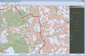
GPSCommunicator is a FREE utility to visually represent NMEA GPS position data in realtime.
GPSCommunicator is a FREE utility to visually represent NMEA Gps position Data in realtime. It works with NMEA 0183 Gps receivers connected via a serial port. GPSCommunicator has the following features:
Category: Internet / Misc. Plugins
- Vessel position display over moving Map.
- User selectable maps.
- Create and save Waypoints.
- Graphical Gps Data display
Publisher: Panazzolo.Com, License: Freeware, Price: USD $0.00, File Size: 772.5 KB
Platform: Windows
Know Your Europe is a Map based Geography application designed to help people of all ages to develop and test their knowledge of European geography through both English and Irish.
Know Your Europe works great with an interactive whiteboard, in a group, or one-on-one with the computer. The software is suitable for anyone who wishes to extend their knowledge of European...
Category: Home & Education / Miscellaneous
Publisher: EdWare, License: Shareware, Price: USD $170.85, File Size: 48.2 MB
Platform: Windows
GPSBabel is a program that allows users to transfer GPS data files to and from numerous GPS devices.
GPSBabel is a program that allows users to transfer Gps Data files to and from numerous Gps devices. It also enables the transfer of waypoints, routes and tracks between Gps receivers and mapping programs. As already mentioned before, this application offers support for several popular Gps devices, such as Tom Tom, Garmin, Magellan, Columbus, etc.
...
Category: Multimedia & Design / Media Management
Publisher: Robert Lipe, License: Freeware, Price: USD $0.00, File Size: 973.5 KB
Platform: Windows
V-Clinic GPS lets you track your training routes and upload the data back to your V-Clinic account.
V-Clinic Gps lets you track your training routes and upload the Data back to your V-Clinic account. Then use V-Clinic to share your route with your training buddies. V-Clinic Gps is ideal for cyclists, joggers and Outdoor enthusiasts. V-Clinic Gps runs on Gps & Java enabled phones. Use V-Clinic Gps on your own or get professional fitness...
Category: Home & Education / Health & Nutrition
Publisher: V-CLINIC MOBILE CIRCLES, License: Freeware, Price: USD $0.00, File Size: 235.0 KB
Platform: Unknown
FREE GPS Software for your Garmin, Magellan or Lowrance GPS.
FREE Gps Software for your Garmin, Magellan or Lowrance Gps.
EasyGPS is the fast and easy way to upload and download waypoints, routes, and tracks between your Windows computer and your Garmin, Magellan, or Lowrance Gps. EasyGPS lists all of your waypoints on the left side of the screen, and shows a plot of your Gps Data on the right. Use EasyGPS to...
Category: Internet / Communications
Publisher: TopoGrafix, License: Freeware, Price: USD $0.00, File Size: 3.9 MB
Platform: Windows
My Gps Logger 1.01 is a program designed to be used with My Fuel Tax 4.0. With My Gps Logger you can log all the locations where your truck has been to a monthly Data file. This Data file can later be imported into My Fuel Tax 4.0 by calculating the miles in state using Microsoftâ Mappoint. This is what you will need to use My Gps Logger with My Fuel...
Category: Home & Education / Miscellaneous
Publisher: Spinnaker Software Solutions, License: Freeware, Price: USD $0.00, File Size: 477.7 KB
Platform: Windows


 Shareware
Gps SDK to add Gps and coordinate conversion functionality to your software and scripts). All NMEA0183 protocol versions are supported and can be filtered by NMEA sentence type and talker ID. Garmin USB PVT support. Information on Gps status can also be retrieved: Gps fix quality, satellites used in fix, satellites in view, satellite azimuth, elevation and signal...
Category: Software Development
Publisher: Eye4Software B.V., License: Shareware, Price: USD $99.00, EUR79, File Size: 2.3 MB
Platform: Windows
Cool Flash Map Maker is a powerful Flash Map software for developing interactive flash mapping solutions and products for Real Estate, Spacial Statistics, Business Locator Applications, Vector USA Map,World Map, Germany Map,ASIA Map, Canada Map, Europe Map, Australia Map, Austria Map, Africa Map, UK Map,...
Category: Multimedia & Design / Multimedia App's
Publisher: Go2Share, License: Shareware, Price: USD $29.95, File Size: 17.9 MB
Platform: Windows


 Shareware
Gps Mapping Software for Windows, Loading topographic maps, manage Gps devices and more. The software can be used with various Map formats including: GeoTiff, BSB Nautical Charts, AutoCad DXF files, ESRI Shapefiles. Using calibration you can also use scanned or downloaded JPG, BMP, GIF, PNG and TIF maps. The software can be used for survey, research, track and trace, real...
Category: Home & Education / Science
Publisher: Eye4Software B.V., License: Shareware, Price: USD $75.04, EUR49, File Size: 6.7 MB
Platform: Windows
All measurements, GPS-protocols and own informations in a single map.
All measurements, Gps-protocols and own informations in a single Map.
Several enterprise maps in one program without additional costs.
No limitation of the area quantity
Tile and join fields.
Multilingual: currently in english, german, spanish, french, greek, polish.
International: over 80 coordinate reference systems of 26 european countries...
Category: Audio / Utilities & Plug-Ins
Publisher: GPSur Dr. Erhard Regener, License: Shareware, Price: USD $449.00, File Size: 7.9 MB
Platform: Windows
Outdoor metal sculptures toolbar for Firefox.
Outdoor metal sculptures toolbar for Firefox. Take time to relax and enjoy yourself in your yard, patio, or garden. Use this toolbar to remind you how you can learn more about Outdoor metal sculptures and how they will add meaning, comfort, and joy to your yard, garden, or Outdoor landscaping experience.
Category: Internet / Browsers
Publisher: outdoor metal statues, License: Freeware, Price: USD $0.00, File Size: 442.0 KB
Platform: Windows
Creating a Map based on GPX files for your Gps and for MapSource/BaseCamp on your computer is possible with several existing programs, but it's certainly not easy to accomplish. With IMGfromGPX it's a matter of a few mouse clicks! This program can generate a Map with the following features:
tracks in 8 different colors, as lines or areas;
POIs divided...
Category: Home & Education / Miscellaneous
Publisher: JaVaWa GPS-tools, License: Shareware, Price: USD $0.00, File Size: 4.9 MB
Platform: Windows
GeoVisu is a program that displays georeferenced Data (images, graphics) and downloads Data recorded by some Gps devices.
GeoVisu has a "Moving Map" navigation function, which can be used with any NMEA 0183 compatible or Garmin USB Gps device.
Main features:
- Displays georeferenced image formats : GeoTiff, ECW...
Category: Multimedia & Design / Graphics Viewers
Publisher: GeoVisu, License: Freeware, Price: USD $0.00, File Size: 1.7 MB
Platform: Windows
Gps Tracker Data Logger acts as the server and allows you to collect Data from an unlimited number of various Gps trackers simultaneously. The obtained Data is processed, uniformed and written to a log file or a database. Also, the program has a set of interfaces so other applications can get Data in real time.
Gps Tracker Data...
Category: Internet / Misc. Servers
Publisher: AGG Software, License: Shareware, Price: USD $80.83, File Size: 11.8 MB
Platform: Windows
TwoNav is a dual navigation system (On-Road/Off-Road) to perform most of your Outdoor Activities (hiking, biking, skiing, geoacaching, ...). TwoNav can also guide you when driving. A single solution for all your orientation needs. Load maps, tracks, routes and waypoints and get ready for your trip!
Category: Home & Education / Miscellaneous
Publisher: CompeGPS TEAM, S.L., License: Shareware, Price: USD $67.28, File Size: 21.2 MB
Platform: Windows


 Freeware
GPS Converter will convert GPS coordinates between three different formats: 34. 26965, -116.
76783; N 34° 16. 179', W 116° 46. 07'; and N 34° 16' 10.
Category: Home & Education / Sports
Publisher: ALMSys, Inc., License: Freeware, Price: USD $0.00, File Size: 929.9 KB
Platform: Windows


 Shareware
Java toolkit to add coordinate conversion functionality to your Java applications and applets. The toolkit offers functionality to perform Map grid and datum transformations: latitude and longitude can be converted to various Map grids, like Transverse Mercator (TM), Oblique Mercator, Mercator, Oblique Stereographic, Polar Stereographic, Cassini, Albers Equal Area Conal, Gauss...
Category: Software Development / Components & Libraries
Publisher: Eye4Software B.V., License: Shareware, Price: USD $199.00, EUR179, File Size: 155.5 KB
Platform: Unknown
The program accepts NMEA GPS sentences from most GPS receivers that connect to a USB port.
The program accepts NMEA Gps sentences from most Gps receivers that connect to a USB port.
The program can display satellite images of waypoint locations on the track plotter.
Is a free software for recording , monitoring and plotting Gps Data, very useful and very easy.
Category: Home & Education / Miscellaneous
Publisher: Club Cruceros de La Paz A.C., License: Freeware, Price: USD $0.00, File Size: 10.6 MB
Platform: Windows
Outdoor metal sculptures toolbar for Internet Explorer.
Outdoor metal sculptures toolbar for Internet Explorer. Take time to relax and enjoy yourself in your yard, patio, or garden. Use this toolbar to remind you how you can learn more about Outdoor metal sculptures and how they will add meaning, comfort, and joy to your yard, garden, or Outdoor landscaping experience.
Category: Internet / Browsers
Publisher: outdoor metal sculptures, License: Freeware, Price: USD $0.00, File Size: 1.0 MB
Platform: Windows
The Photographer's Ephemeris (TPE) is a tool to help with the planning of all types of Outdoor photography, but particularly landscape and urban scenes.TPE's Map-based approach means you are not limited to a predefined list of locations, which often don't include the places many photographers go. Instead, search for any place name on the planet or position the...
Category: Home & Education / Miscellaneous
Publisher: Crookneck Consulting LLC, License: Freeware, Price: USD $0.00, File Size: 2.3 MB
Platform: Windows
QuakeMap is a powerful GPS/mapping program for your Windows computer.
QuakeMap is a powerful Gps/mapping program for your Windows computer. It can be downloaded here for free. The trial mode allows you to use most features indefinitely. When you need to unlock certain powerful features, a License Key can be ordered here. QuakeMap is designed for ease of use. It eatures intuitive user interface, supports most popular Garmin and Magellan receivers, reads and...
Category: Utilities / Misc. Utilities
Publisher: quakemap.com, License: Freeware, Price: USD $0.00, File Size: 821.2 KB
Platform: Windows
TopoFusion is a GPS Mapping program for Windows.
TopoFusion is a Gps Mapping program for Windows. It downloads maps (Topo, Aerial Photo and Satellite) automatically from several public Map servers.
It seamlessly displays imagery from Terraserver and the OnEarth Server. Maps are downloaded on demand (as the user pans or zooms around the Map) and cached on the user's hard drive for faster (and offline) storage.
Category: Utilities / Misc. Utilities
Publisher: TopoFusion, License: Shareware, Price: USD $69.95, File Size: 7.4 MB
Platform: Windows
CompeGPS Pocket Air is a new software specially designed for Pocket PC mobile devices, with wich you can obtain a new and revolutionary free flight instrument. You will enjoy most of the CompeGPS PC version functions, like the waypoint and routes creation and edition, full Gps and Pocket PC communication, use of digital maps and moving Map (real time navigation), to obtain...
Category: Home & Education
Publisher: CompeGPS TEAM S.L., License: Shareware, Price: USD $105.00, File Size: 5.2 MB
Platform:
SmartComGPS is a Gps mapping/tracking/navigation software for Symbian smartphones. It is one of most advanced Gps mapping software on the market. SmartComGPS designed for the all Symbian phones. It is compatible with external BT Gps receivers, and internal aGPS receiver of Motorola A920/925/1000. SmartComGPS can run without Gps receiver, as "mapping" software with...
Category: Multimedia & Design
Publisher: SmartCom Ltd GPS Mobile Solutions, License: Shareware, Price: USD $29.95, File Size: 291.1 KB
Platform: Unknown
This Gps Map will give you turn by turn directions to your destination using a POI (point of interest), city point and/or latitude and longitude with the ability to preplan driving destinations before getting into your car.
This is the most comprehensive Gps Map available at such an affordable price!
Category: Home & Education / Miscellaneous
Publisher: GPSTravelMaps.com, License: Shareware, Price: USD $0.00, File Size: 0
Platform: Windows

