Free Downloads: Print Large Maps
MapComp is a powerful and free Windows Software for drawing images of linkage Maps and to compare linkage Maps and indicate common markers.
MapInspect can display, Print and save images, and has no limit to the number of Maps it can compare (but only neighbouring Maps are compared). Maps can be flipped within MapINspect, an the on-screen...
Category: Multimedia & Design / Multimedia App's
Publisher: MapInspect, License: Freeware, Price: USD $0.00, File Size: 616.7 KB
Platform: Windows
With MapAuthor you can create, Print and save desktop Maps, using data that you obtain from commercial sources or perhaps your in-hous GIS department as shapefiles (shapefiles are a very common GIS exchange format.) You can also produce internet-based Maps based on Google Maps, for use on your web site.
MapAuthor allows you to link your own data to...
Category: Internet / Misc. Plugins
Publisher: MapAuthor.com, License: Freeware, Price: USD $0.00, File Size: 6.3 MB
Platform: Windows
Download, View, and Print Maps with the MrSID Viewer.
Download, View, and Print Maps with the MrSID Viewer.
To download and view Maps offline you need a special viewer. Maps are stored in MrSID format. The MRSID Viewer is a freeware tool. This library provides access to the MrSID viewer developed by LizardTech.
NOTE:
LizardTech dropped the link for that stand-alone viewer download...
Category: Multimedia & Design / Graphics Viewers
Publisher: Lizardtech, License: Freeware, Price: USD $0.00, File Size: 2.0 MB
Platform: Windows
Fractal Mapper is a high-powered mapping system that lets gamers create a wide variety of of Maps - dungeons, continents, cities, and more! With it's easy to use interface, powerful features, and unique capabilities, making high quality Maps with Fractal Mapper is a breeze!
Main features:
- Fractal based drawing tools for realistic coastlines, rivers, and...
Category: Games / Tools & Editors
Publisher: NBOS Software, License: Shareware, Price: USD $0.00, File Size: 39.4 MB
Platform: Windows
 Freeware
Arm Map Explorer recreates all the functionalities of Google Maps on your desktop while expanding them with new extras. Map Explorer lets you locate and view any place on the planet using dynamic interactive Maps. These Maps are draggable, which means there is no need for you to click and wait for graphics to reload each time you want to view adjacent parts of a map....
Category: Internet / Flash Tools
Publisher: ArmCode, License: Freeware, Price: USD $0.00, File Size: 5.5 MB
Platform: Windows

FSS Google Maps Downloader is a tool that can download the Google Maps images to your PC. This is a clearly free program. There is no spyware or adware. It's absolutely safe to install and to run. The interface is very simple and self explaining. It runs low on system resources consumption and is supported on all Windows versions. It can save them to your hard disk,...
Category: Internet / Download Managers
Publisher: FreeSmartSoft, License: Freeware, Price: USD $0.00, File Size: 874.0 KB
Platform: Windows
MapMage™ is a random dungeon generator for role-playing games such as Advanced Dungeons and Dragons™ or AD&D™ by Wizards of the Coast. MapMage will instantly generate Maps of re-creatable and expandable dungeons for your players, complete with Room Descriptions, Items, Sounds, Smells and Traps. You can produce partial Maps to give to players, add your own...
Category: Software Development / Misc. Programming
Publisher: VIO Systems Limited, License: Shareware, Price: USD $24.99, File Size: 1.5 MB
Platform: Windows
Need to print at home and work?
Need to Print at home and work? Sharing Maps with friends? All you need is the free CC3 Viewer! Based on version FastCAD , the viewer is compatible with all versions of Campaign Cartographer (CC2 and up).
It is updated the viewer to be compatible with Maps created in Campaign Cartographer 3, including bitmap symbols and sheet effects.
The CC3...
Category: Home & Education / Miscellaneous
Publisher: ProFantasy Software Ltd, License: Freeware, Price: USD $0.00, File Size: 57.0 MB
Platform: Windows
Diffuse maps represent the absorption of light.
Diffuse Maps represent the absorption of light. Diffuse Maps are what people call "textures". They are the color textures or photographic textures usually applied to 3d models.
ShaderMap creates displacement Maps using the light data stored inside of diffuse Maps. Evenly lit diffuse Maps generally create better quality Maps with ShaderMap.
Category: Home & Education / Miscellaneous
Publisher: Rendering Systems Inc., License: Freeware, Price: USD $0.00, File Size: 4.0 MB
Platform: Windows
Terrain Tools - Create maps quickly and easily!
Terrain Tools - Create Maps quickly and easily!
Terrain Tools is the ideal tool for outdoor recreationists, real-estate professionals, farmers, ecologists, archaeologists and others who need to create basic Maps, calculate areas, lengths, bearings and distances.
Overlay GPS tracks on scanned images such as USGS or Canadian NTS topos. Import and export...
Category: Business & Finance / Applications
Publisher: Softree, License: Shareware, Price: USD $124.00, File Size: 15.0 MB
Platform: Windows
NOVA Maps provides appraisers and appraisal users with complete, high-resolution location Maps (also known as “street Maps”) for forms and addenda in seconds. NOVA Maps even automatically places labels for subject properties and comparables.
For just pennies per map and with just a click of the mouse, users have access to the entire United...
Category: Home & Education / Miscellaneous
Publisher: Day One, License: Demo, Price: USD $0.00, File Size: 5.7 MB
Platform: Windows
Shareware
Google Hybrid Maps Downloader is a tool that can automatically download the google hybrid Maps images to your PC. It can download the small tiles and save them to your hard disk. After downloading, you can view the Maps offline by its tool Maps Viewer, or you can combine the small images into one big map image. If you want to make a map of your city by yourself, it...
Category: Internet / Download Managers
Publisher: allmapsoft.com, License: Shareware, Price: USD $29.99, File Size: 30.6 MB
Platform: Windows
Shareware
Google Maps Terrain Downloader is a tool that can automatically download the google terrain Maps images to your PC. It can download the small tiles and save them to your hard disk. After downloading, you can view the Maps offline by its tool Maps Viewer, or you can combine the small images into one big map image. If you want to make a map of your city by yourself, it...
Category: Internet / Download Managers
Publisher: allmapsoft.com, License: Shareware, Price: USD $29.99, File Size: 305.3 MB
Platform: Windows
ArcReader is a free, easy-to-use desktop mapping application that allows users to view, explore, and Print Maps and globes. Anyone with ArcReader can view high-quality interactive Maps authored by a high-level ArcGIS Desktop product and published with the ArcGIS Publisher extension.
ArcReader is a free and easy-to-use application that allows users to view and...
Category: Desktop Enhancements / Shell & Desktop Managers
Publisher: Environmental System Research Institute, Inc., License: Freeware, Price: USD $0.00, File Size: 499.2 MB
Platform: Windows
think! Bubble Maps is a Windows tool for creating bubble Maps and capturing your thought. Using simple mouse click, drags and typing, your thoughts get put to paper (virtual), quickly and effectively.
The key feature of think! Bubble Maps is speed which makes it an excellent tool for live capture. You can use this program during meetings, workshops, and seminars.
Category: Multimedia & Design / Multimedia App's
Publisher: Lowrie Associates Ltd, License: Shareware, Price: USD $41.90, File Size: 5.9 MB
Platform: Windows
Print.Works is an add-in application that extends printing capabilities of SolidWorks. It enables users to Print drawings of any scale regardless of the size of available printers.
This add-in allows you to split drawings that are meant for Large sheet formats into sections that can be printed on smaller sheets. It also helps combine multiple drawings for...
Category: Multimedia & Design / Image Editing
Publisher: AMC Bridge LLC., License: Freeware, Price: USD $0.00, File Size: 6.0 MB
Platform: Windows
Euratlas Periodis Expert is a database and a historical atlas of Europe with editing functions.
Euratlas Periodis Expert is a database and a historical atlas of Europe with editing functions. It describes the political status of Europe, North Africa and Near East at fixed intervals, from year 1 until year 2000.
Stress is put on the precise drawing of territories at one exact instant defined by fixed length intervals, that is the first day of each centennial year.
...
Category: Home & Education / Miscellaneous
Publisher: Euratlas, License: Shareware, Price: USD $77.80, File Size: 33.2 MB
Platform: Windows
Arrange web pages on a virtual desktop to start the analysis. Create webpage screenshots. .
Category: Web Authoring / HTML Color Pickers
Publisher: FastWebTools, License: Shareware, Price: USD $99.95, File Size: 24.9 MB
Platform: Windows
PowerMapper allows information architects, usability analysts and web developers to create graphical site Maps with one click, providing site visualization and simple navigation. Maps show thumbnails of web pages and can be tailored using 11 different styles then printed or copied into another application. Key Features: Mapping - create Maps of any site on the World...
Category: Internet
Publisher: Electrum, License: Shareware, Price: USD $349.00, File Size: 1.3 MB
Platform: Windows
You will either mess up your work place with huge Maps and travel guides or just switch on to Schmap Player to guide you for your travel.
This amazing travel guide with elaborated Maps and destinations can be downloaded and used for free. The main interface of this application comprises the guide menu with: European guides, US guides, Canadian guides, Australian guides, and...
Category: Internet / Web Search Utilities
Publisher: Schmap, Inc., License: Freeware, Price: USD $0.00, File Size: 2.0 MB
Platform: Windows
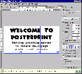
PosterPrint is a Desktop printing system to create multipage posters and banners. Did you ever need to Print out a Large poster or banner but you couldn't make it big enough on your standard printer? It is possible now! PosterPrint can take a document created by any Windows application, zoom and Print it for you on several standard sheets of paper using any available...
Category: Utilities
Publisher: GrandUtils, License: Shareware, Price: USD $20.00, File Size: 429.9 KB
Platform: Windows
This software development kit (SDK) provides the binaries and programming reference for the Bing Maps Silverlight Control. You can use this control to build your own web sites that use Bing Maps.
The Bing Maps Silverlight Control combines the power of Silverlight and Bing Maps to provide an enhanced mapping experience. Developers can use the Bing...
Category: Utilities / Misc. Utilities
Publisher: Microsoft, License: Freeware, Price: USD $0.00, File Size: 3.8 MB
Platform: Windows
PowerMapper allows information architects, usability analysts and web developers to create graphical site Maps with one click, providing site visualization and simple navigation. Maps show thumbnails of web pages and can be tailored using 7 different styles then printed or copied into another application. Key Features: Mapping - create Maps of any site on the World...
Category: Internet
Publisher: Electrum, License: Shareware, Price: USD $149.00, File Size: 1.3 MB
Platform: Windows
A series of astronomical props for use with Poser software.
A series of astronomical props for use with Poser software. They allow you to quickly add real 3D planet-style objects directly inside Poser to give your scenes some extra dimension! This product has been optimized for low system requirements in order to keep rendering times to a minimum. The "Core Edition" will provide you with the most common objects needed to add planets, moons and...
Category: Multimedia & Design / Multimedia App's
Publisher: Cybia, License: Demo, Price: USD $12.00, File Size: 388.0 KB
Platform: Windows
SensAct -SENSORS CONVERSION Maps AND ACTUATORS COMMAND Maps
This software pack contents the sensors conversion Maps and the actuators command Maps like motorized throttles, gasoline injectors corrections, ...
It is mandatory to install it to select the type of sensor and actuators that are equiping the ECUs, because these Maps are no longer...
Category: Business & Finance / Applications
Publisher: Skynam, License: Freeware, Price: USD $0.00, File Size: 3.4 MB
Platform: Windows